Pretty sure this will be the Q&A topic. Subject to change.
4 Likes
2 Likes
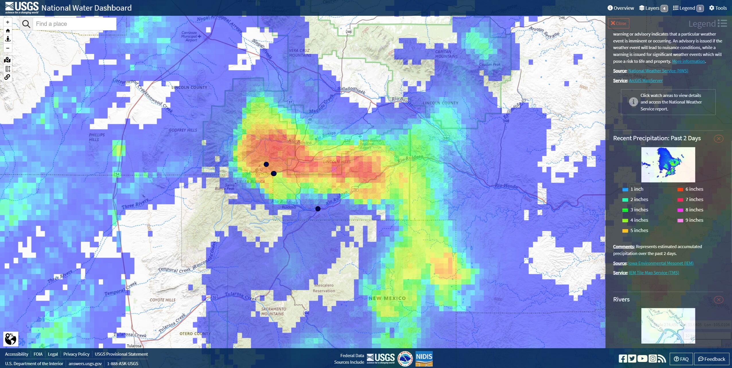
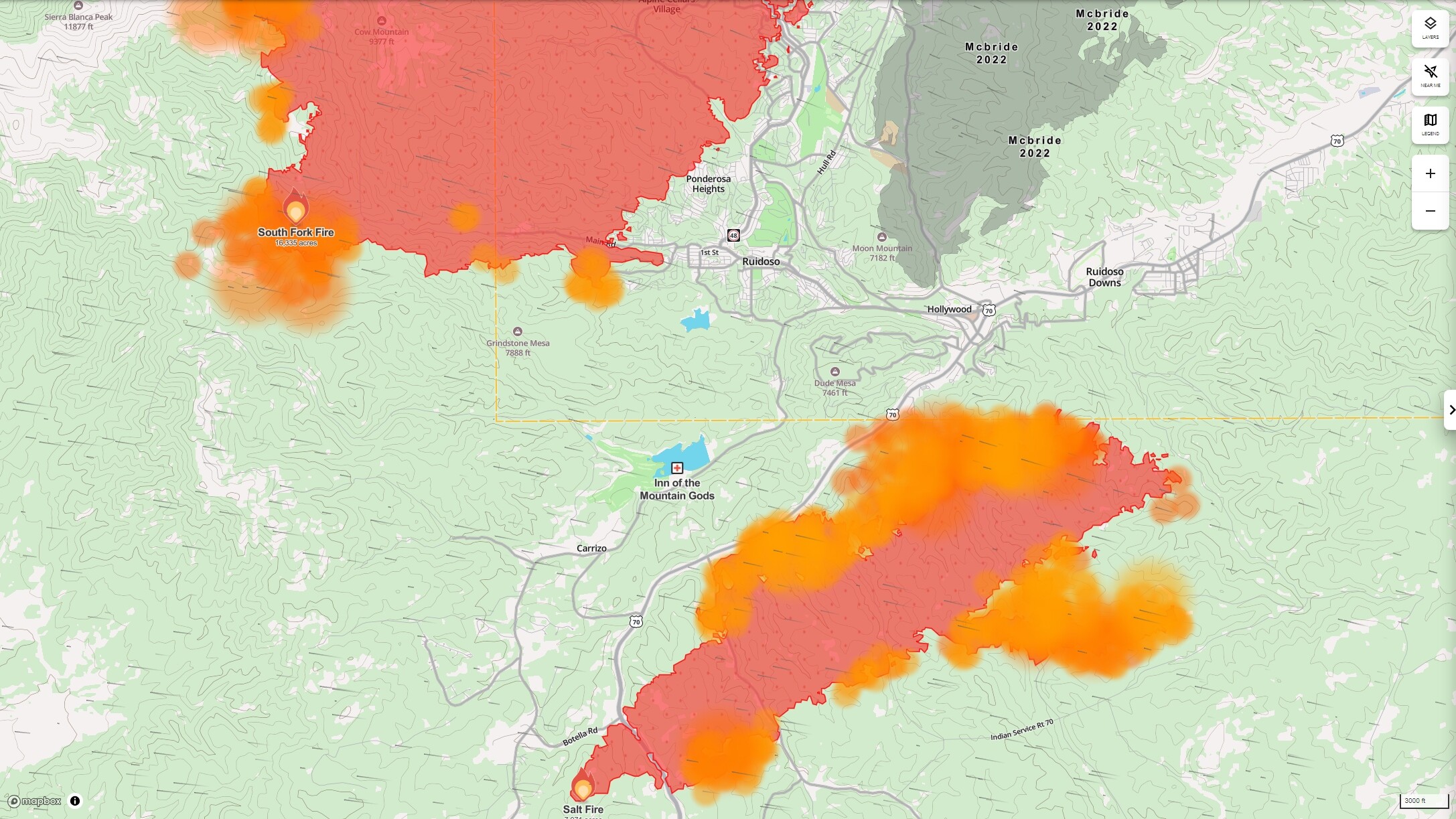
6, 7 and 8 inches in the last 2 days from a convection cell that landed on the eastern side. Numbers like that would trigger watches and warnings almost anywhere, especially around a fresh scar. Unfortunately, the edges of the fire outside the rain cell are still throwing lots of heat according to these maps.
Rank speculation, but looking at this, moisture driven right to left gets funneled in by the Capitan Mountains and squeezed out like a sponge on the ridges running north by northwest of Sierra Blanca Peak. Not sure if particulate smoke was a factor in the excessive precip, or not.
Similar to what was happening in Matalija and Wheeler Springs in Ventura County, and Fashion Valley in San Diego, this winter. Sometimes, the rain only falls on one side of the mountain. 
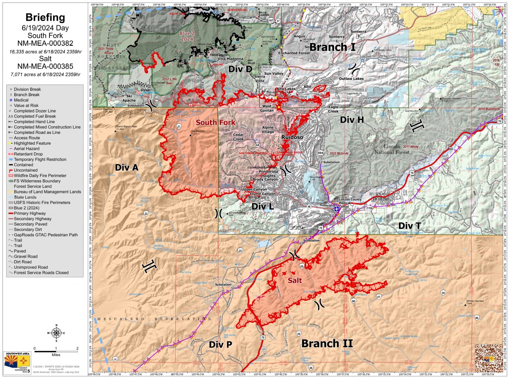
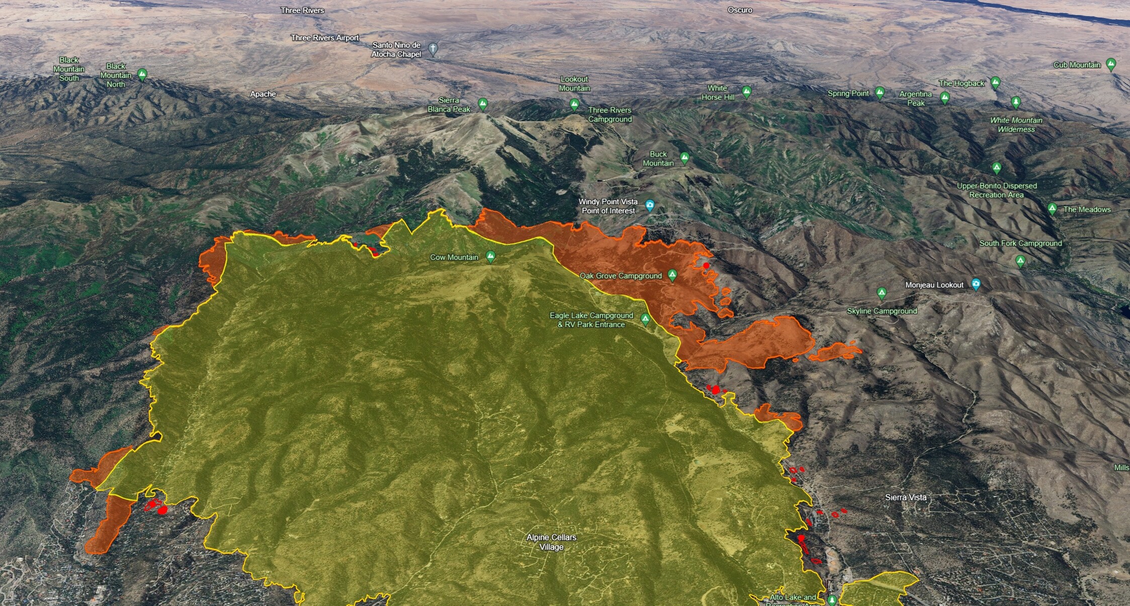
Looking downwind at Div A with this morning’s IR.
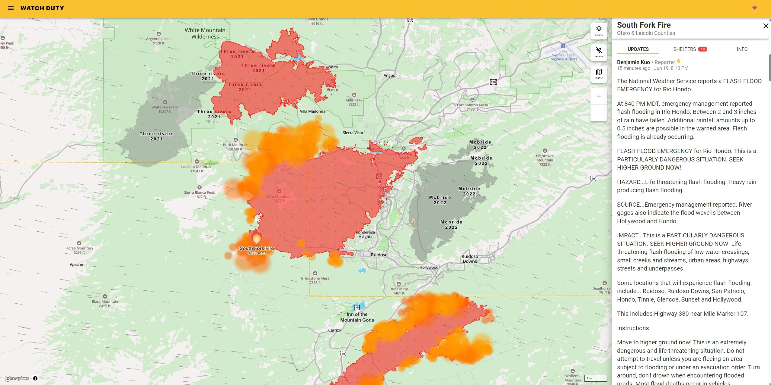
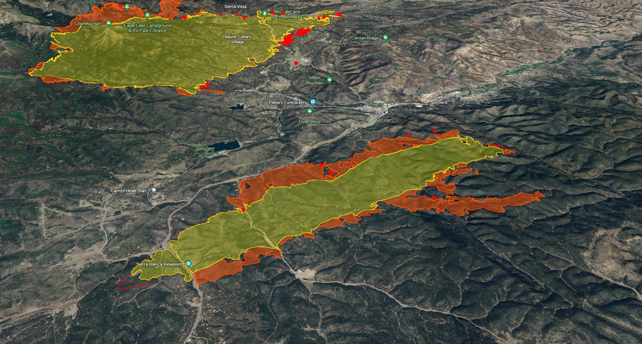
South of Ruidoso. Looking north at the Salt Fire and this morning’s IR. They got maybe an inch or so on some parts of the fire.
I’ve never been to this part of New Mexico, but there’s gonna be some work there this year. Inn Of The Mountain Gods, Dude Mesa, Hollywood. I hope that community gets back on its feet without further loss of life and property.
6 Likes
4 Likes
3 Likes
4 Likes
2 Likes