NWS SF Bay Area: As the trough moves eastward
high pressure will build at the surface in its wake over the
PacNW. This is a classic scenario for offshore flow over the Bay
Area - surface high pressure building over the PacNW/Great Basin
and lower pressure over the Central Coast. Offshore flow gradients
from WMC-SFO are easily greater than 10mb with some models **
** suggesting over 15mb this weekend.
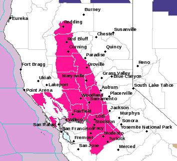
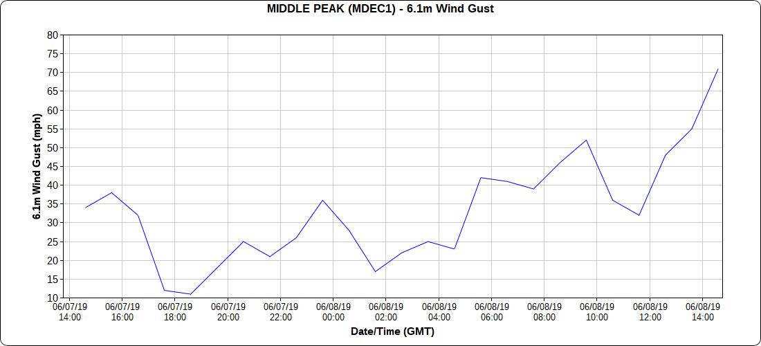
Simply put, NE winds will
develop Friday night and last through the weekend. The intensity
of the winds will ebb and flow, but the peak still appears to be
Friday night with gusts up to 60 mph over the higher peaks of the
N and E Bay. The offshore flow will do several things: mix out the
marine layer completely, lower relative humidity day and night,
warm temperatures day and night and lastly heighten fire weather
concerns. The current forecast handles this scenario rather well
with an initial warm up on Saturday, but then triple digit heat
arrives across the interior for Sunday and Monday. The current
forecast is definitely on the warmer side of model solutions and
see no reason to not agree. To put this in context, meteorologists
look at how anomalous model solutions are for certain situations
to gage severity. In this situation, the European ensemble
indicates temperatures will be 7-8 standard deviations above
normal for Monday or very anomalous. Interior portions of the N
and E Bay Area will be 100-105 or on the extreme end of the
envelope. There will be some minor relief each night, which will
keep some of the severity in check. Slight cooldown begins on
Tuesday with increase onshore flow.