North Ops Weather-2019

North Ops Lightning Summary 8/10/2019 @ 0820

  • 1,887 lightning strikes in North Ops in the last 24hrs
  • NWS Red Flag Warning remains for much of Modoc and Siskiyou County for abundant lightning on dry fuels. This warning is in effect from 1100 this morning to 2200 this evening.
  • Attached is a kmz-file of the last 24hr Lighting strikes

Klamath National Forest

  • 13 fires total fires, all staffed fires are under 1 acre
  • 3 fires unstaffed with crews responding

Shasta Trinity National Forest

  • 3 fires, 2 under 1 acre and staffed
  • 1 fire crews en-route

BLM Northern California District

  • 2 fires, under 1 acre and contained

All other Forests reported 0 new Lightning fires.

CALFIRE

  • TGU: 1 fire at 1.9 acres, contained
  • SHU: 2 fires under 0.5 acres, both contained
  • SKU: 2 fires at 0.1 acres, both contained
  • MEU: 1 fire at 0.1 acres, contained
4 Likes

SHF dropping a couple jumpers on single tree smokers west of Big Bend in I believe the Squaw Creek drainage.

MNF has someone sitting on Ball Rock above Paskenta on R5 Tac4 watching for smokers. They’re expecting a recon up around 1300 today.

LNF Air Attack 06 launched for the McDonald fire, just east of the base of McDonald Peak, NE of Termo.

AA240 just launched for SHU/TGU recon, 11am.

4 Likes

MDF and LNF dispatching to multiple starts in both forests.

2 Likes

NOD has had 5 fires since wensday all started by lightning. Lots of strikes today

EGW

Everything Got Wet, Northern Cali into OR and Wa.

That many down strikes there’s going to be some sleepers waking up with a drying trend starting. Next few days could be interesting.

3 Likes

I agree. You would think.

2 Likes

Looking hot:

I don’t think they are the hardest, if you look at the history there were more dangerous storms which where there!
Regards, 9Apps Vidmate APK

1 Like

RFW up for SKU/KNF for Weds.

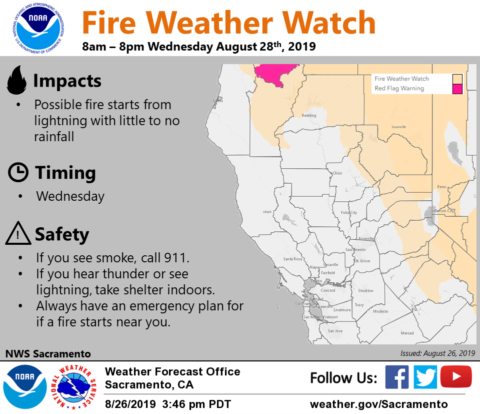
URGENT - FIRE WEATHER MESSAGE
National Weather Service Medford OR
1245 PM PDT Sun Aug 25 2019

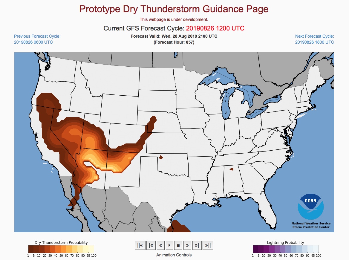
.A disturbance will move up from the south Wednesday morning. This
system is expected to tap into some moisture from what is
currently tropical depression Ivo. The combination of increasing
moisture, instability and trigger could bring abundant lightning
on dry fuels starting late Wednesday morning into Wednesday
evening. There is a chance thunderstorms could produce little or no
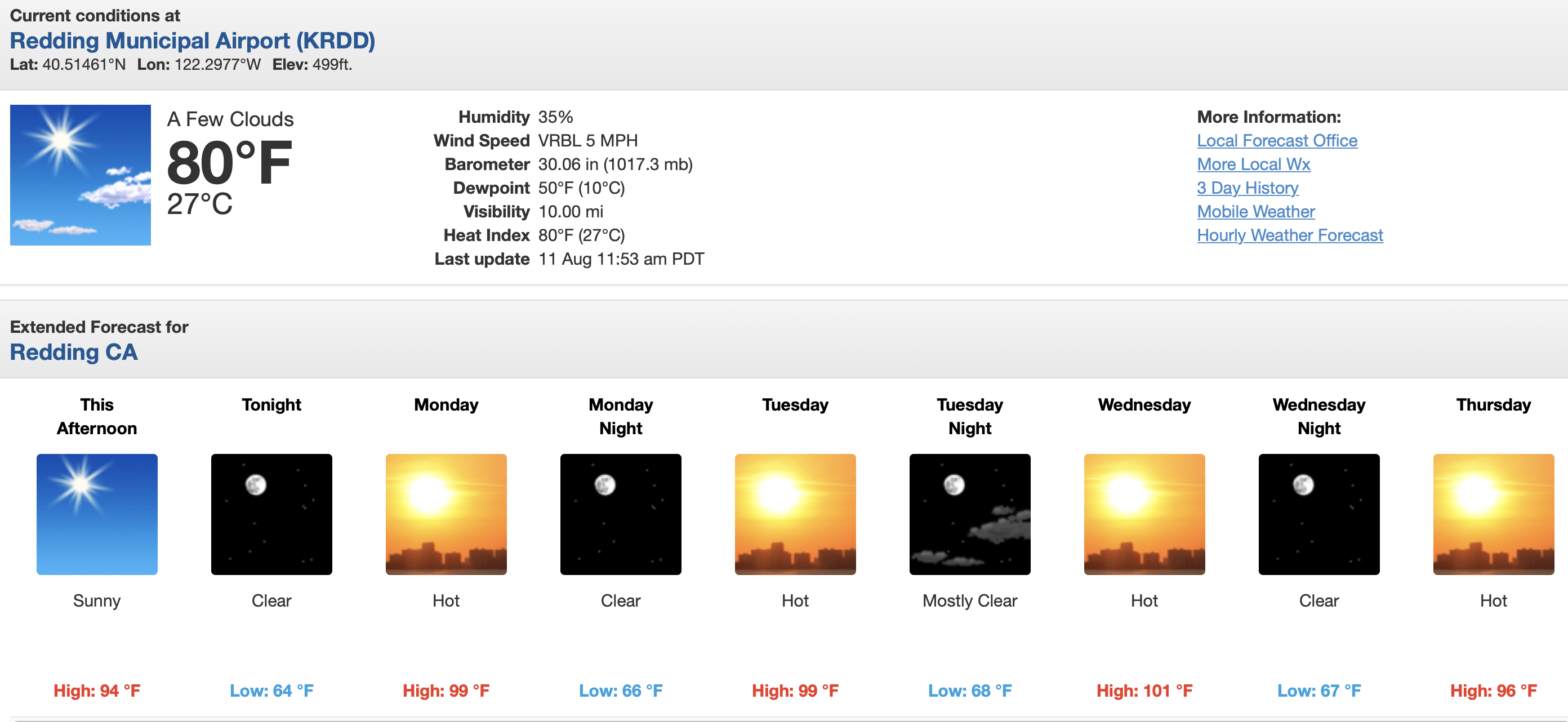
rainfall. This will follow two days of hot temperatures with
triple digit readings for interior west side valleys Tuesday and
Wednesday.

7 Likes

FIRE WEATHER WATCH IN EFFECT FROM WEDNESDAY MORNING THROUGH WEDNESDAY EVENING FOR ABUNDANT LIGHTNING ON DRY FUELS FOR FIRE WEATHER ZONES 280…281…284…616…617…619…620…621… 622…623…624 AND 625

https://www.wrh.noaa.gov/eccda/fw_alerts_each_eccda.php?ecczone=ECC005

4 Likes

NWS - Sacramento has issued a Fire Weather Watch for lightning, which is in effect from Wednesday
morning through Wednesday evening.

4 Likes
  • Affected area: We have highest confidence in scattered
    thunderstorm coverage in portions Fire Weather Zone 281 mainly
    north and west of Yreka in the warning area. The fire weather
    watch will affect the rest of the area.

https://forecast.weather.gov/wwamap/wwatxtget.php?cwa=mfr&wwa=red%20flag%20warning

Klamath going to get lit up.

2 Likes

Ahhh, the annual “lightning event”… let’s see

1 Like

May it rain like there is no tomorrow with these storms and put an end to the foaming!

3 Likes

Takes me back to ‘87… (I was 2 years old then) But I’ve heard the other, more experienced folks talk about it!

2 Likes

2008 was also significant. Might go to one more fire before the career change.

4 Likes

That’s perfect! Just come up and play with us!

1 Like

Everyone I talk to, more science, met types who know nor cal say this one is for real. Just passing this along. I for one will believe it when/if I see it.

7 Likes