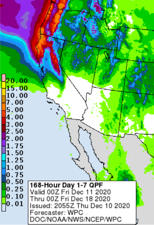
Forecast models advertise significant precipitation for North Ops during the next 10 days, reaffirming that fire season is over for North Ops.


Forecast models advertise significant precipitation for North Ops during the next 10 days, reaffirming that fire season is over for North Ops.

looks good for the North, and that is great…hopes it comes true. down South it may be a bit dryer…hopefully you can come up with some Southernly moisture…Farmers Almanack does not look good for the South…Hope for great results for the North…they have taken a beating this year so far…think positive…
Just a hair over .75 here in Twain Harte. It was a good soaking rain. In early October we got 1.75 in a storm. Drove over Hwy 88 and not much snow over the passes that was last Monday. Kid was on four acres on the STF on Wednesday. So with the up coming storm tomorrow and the one we just had hopefully the storm door will stay open. Damn, we need it!!!
Forecast models are advertising deep layered troughing across at least Central and Northern CA at the end of the month. In fact, a rare surface low may develop off of the coast of Nothern CA which would potentially bring a significant amount of precipitation. Irregardless if this feature comes to fruition, there is a solid chance of banding features with atmospheric river characteristics at least north of the Bay Area.
The CPC has noted this with above average precipitation favored during the next 10 days.