This might do it:
8 Likes
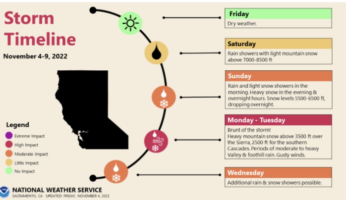
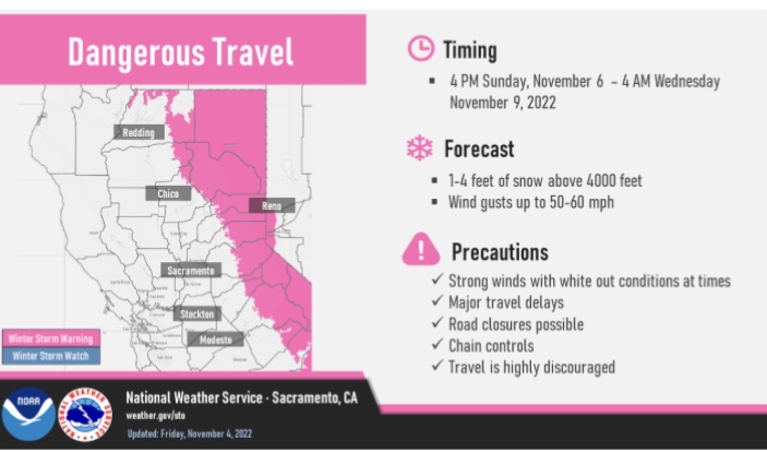

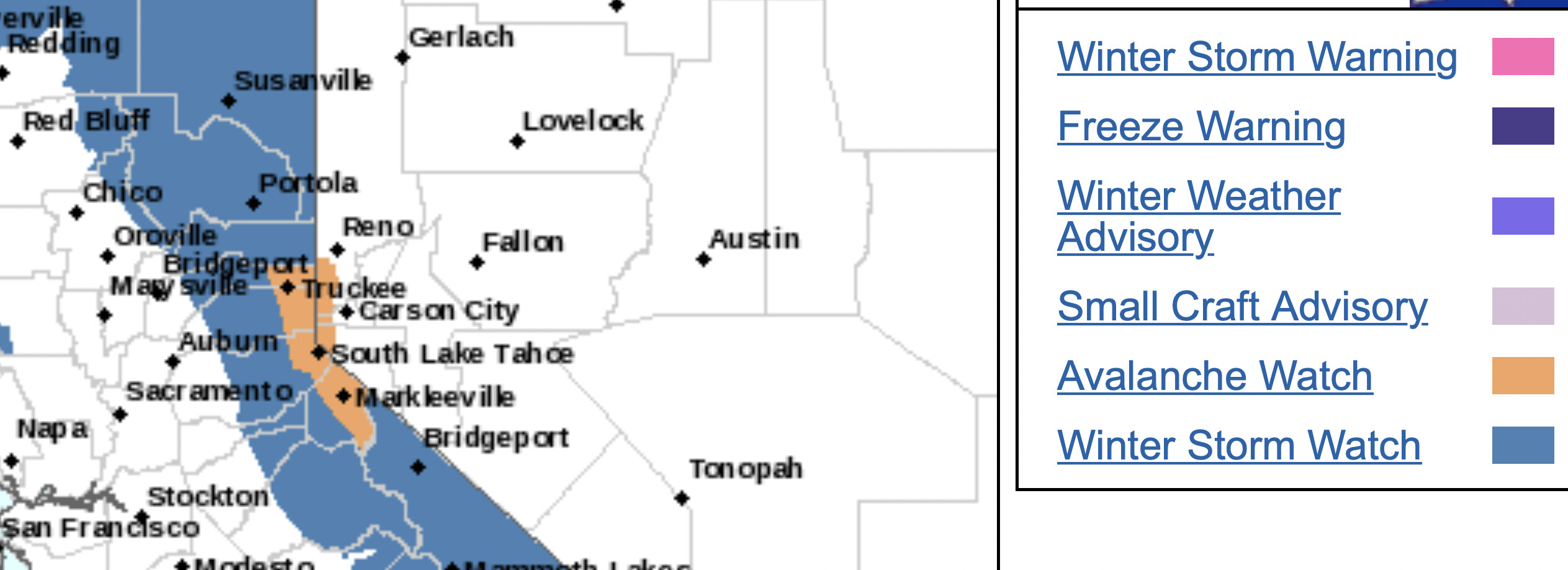
Sierra Avalanche Center in Truckee: A winter storm and gale winds loading substantial amounts of new snow onto a weak existing snowpack may result in widespread avalanche activity in the mountains. Large avalanches could occur in a variety of areas.
Thu 1900 to Fri 1900 hours:
6 Likes
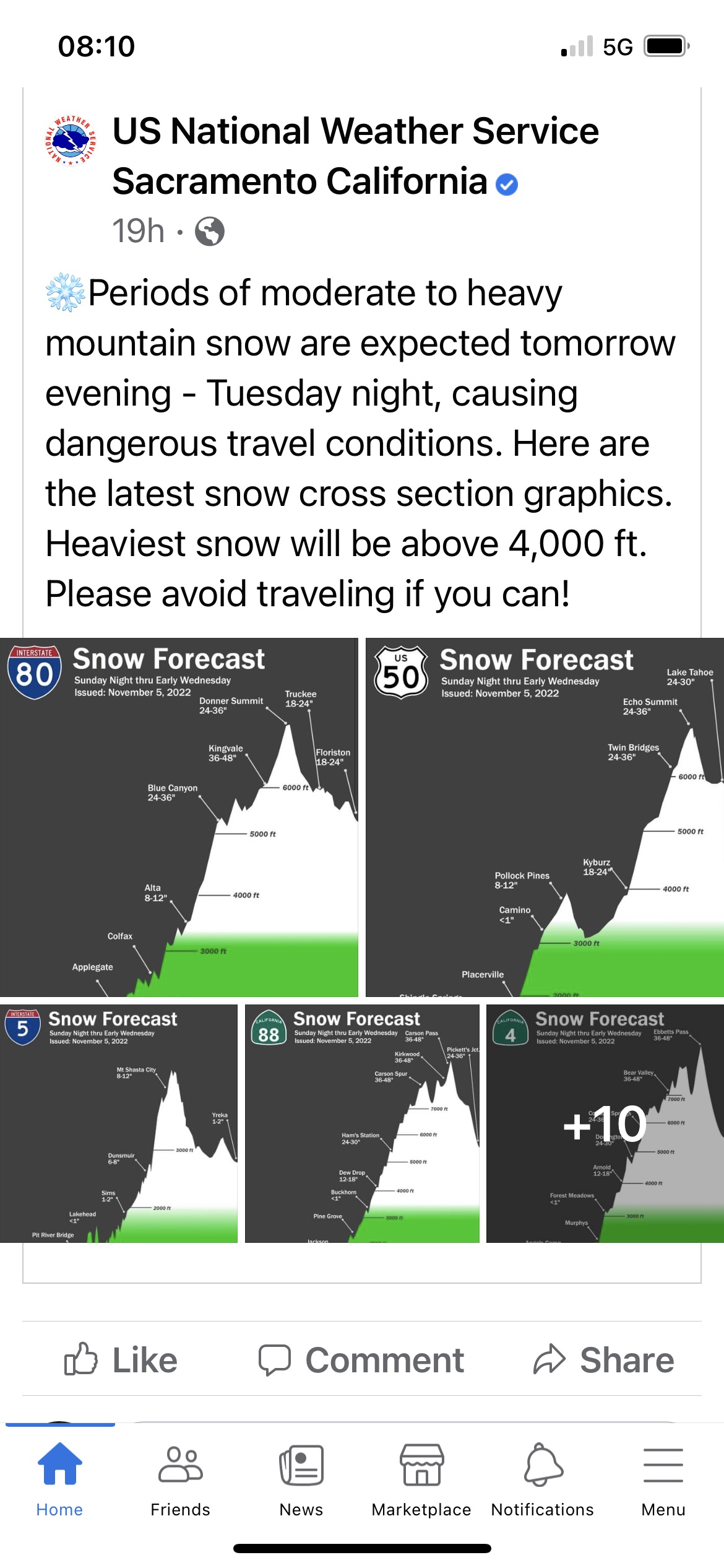
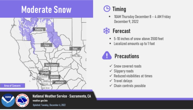
Last two storms I have received a total of 4’’ of rain in Sonora. The first storm I did get a dusting of snow at 2200’. Sad things is this last storm was a lot warmer and below 6000 feet it washed a lot of snow away. Season total is around 7" of rain so far.
3 Likes
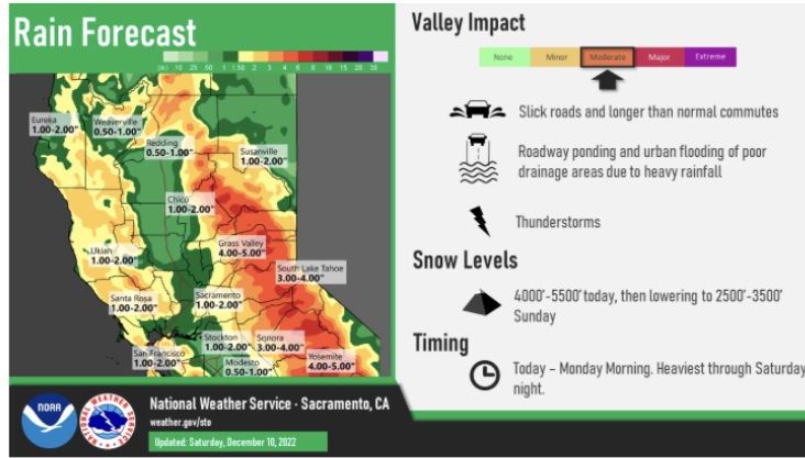
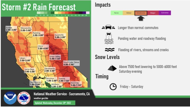
NWS SF: 2:20 pm The latest AR guidance continues to classify this system as a weak Atmospheric River. The total rainfall expected is 1.0-3.0" in the North Bay, 1.0-3.0" in the San Francisco and East Bay area, 1-1.5" for interior Monterey and San Benito, and 2.0-3.0" for Big Sur, with coastal mountains and higher elevations potentially getting up to 4.0-5.0". The latest WPC excessive rainfall outlook shows that the coastal areas will have a marginal risk for flooding on Saturday. Therefore, a hydrological outlook was issued for the entire forecast area.
3 Likes
NWS SF 2pm: Having watched these types of systems for years, models seem to struggle with warm frontal rain processes along the coastal ranges, especially near the triple point. Looking at ensemble members during this warm frontal period for STS, the range of potential varies widely. As such, don’t be surprised if the warm front and its reinforcing push over perform what models and the official forecast indicate. As of today there is not reason to deviate from the WPC provided QPF. Tomorrow may be more telling and we may have to work with WPC to adjust upward for the Thursday/Friday time frame. Pulse 3 will follow pulse two nearly seamlessly, but with one big exception. Rain rates. As this Pineapple Express launches its moisture toward the Bay Area, rain rates will go up. That said, the plume of highest moisture will be narrow and intense. Models have varied by numerous miles as to where the head of this stream will initially take aim. Some have it in Mendocino County, while others impact San Mateo County. Once the head of this hits the coast, it will likely stall for a short time before the cold front as a whole sinks southward. On the bright side, this system does not look to pack the winds like the post Christmas storm did.
7 Likes
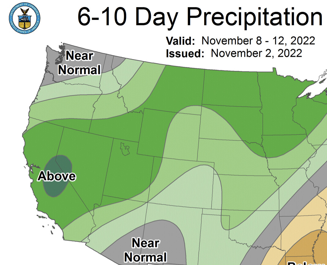
That’s a lot of rain for a couple days. We need the snowpack in the high country.
2 Likes