North Ops Weather - 2022
5 Likes

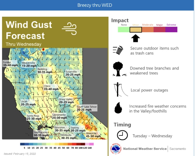
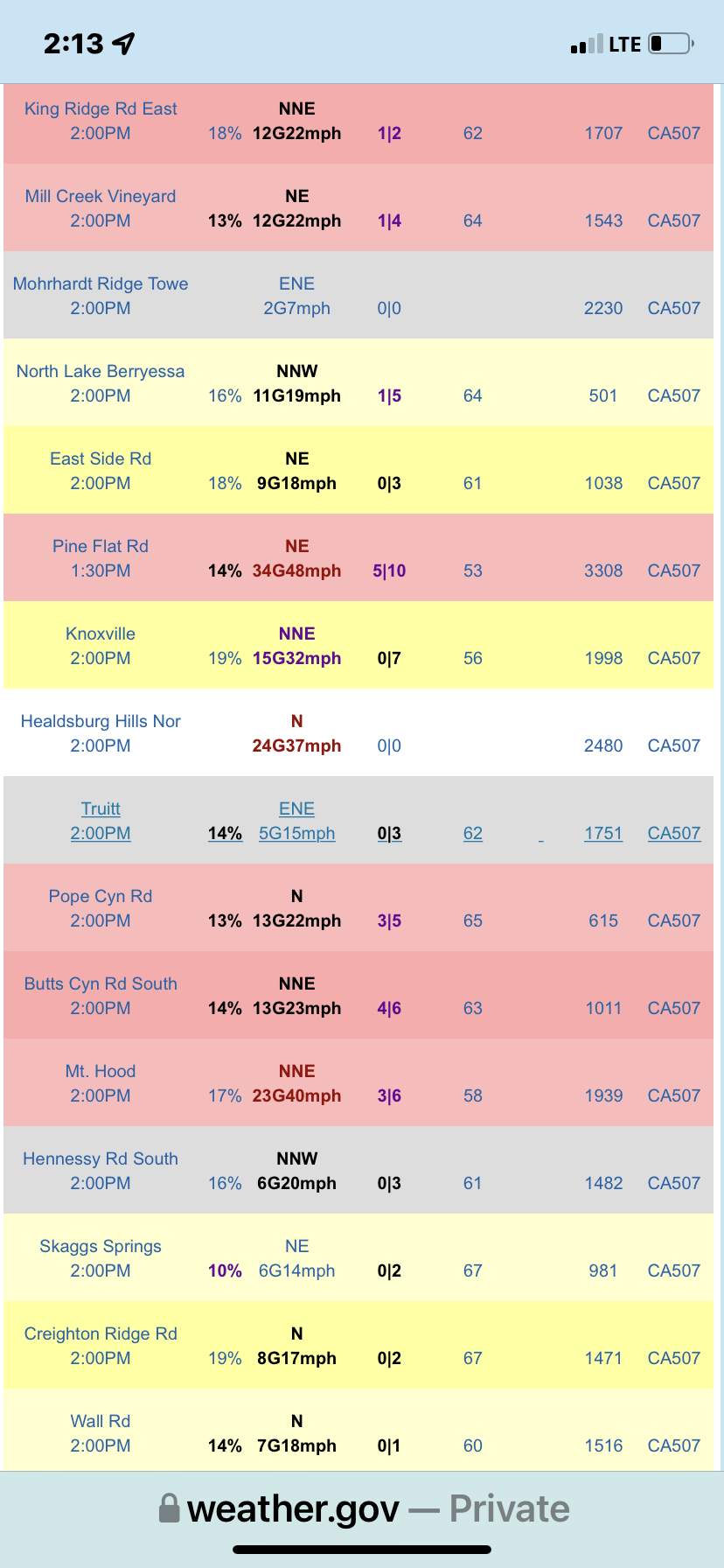
NWS SF: A x-section of the North Bay Mts early Wednesday shows all the ingredients needed for mountain wave development. The last mountain wave to develop, or at least be modeled, was roughly 10 days ago. The end result of that offshore flow pulse/wave were 90mph winds near Healdsburg Hills. Not saying that same thing will happen again, but its possible and something that well be watching closely in the coming days. To add additional support for strong winds are the HREF winds at over 60 mph and the ECMWF EFI once again highlighting how unusual winds like this are for early February. If the guidance keeps trending this way Wind Advisories will likely be needed and possibly another High Wind Warning for the hills. As of now, Tuesday and Wednesday seem to be the windiest days.
5 Likes


NWS SF - Wednesday
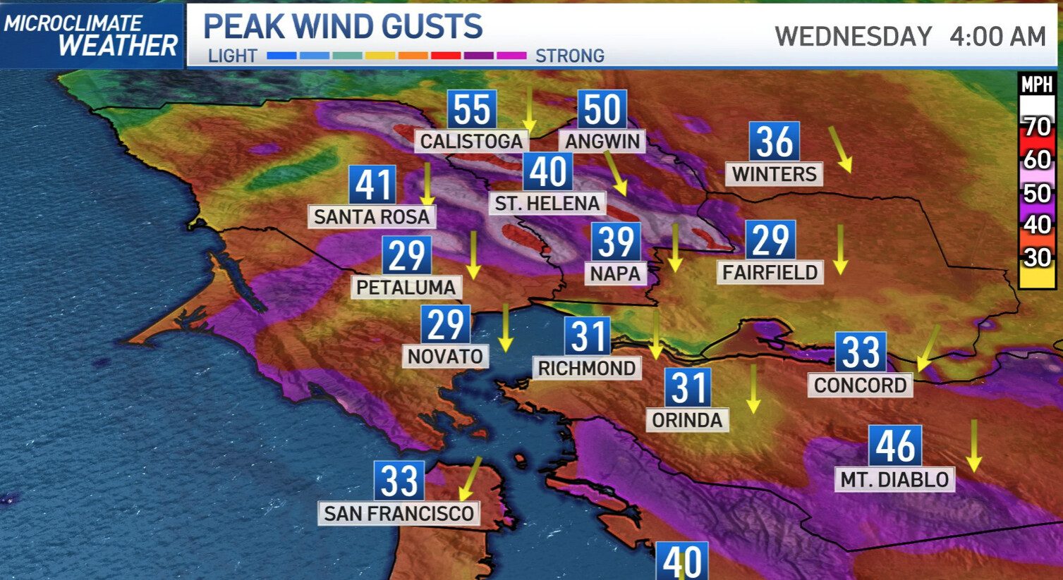
So while we may be in a bit of a lull, indications are that this should change today due to a few factors. First, the shortwave impulse now dropping into SoCal should pull farther away from the area. As this occurs surface high pressure will strengthen over the Great Basin. This should enhance the low-level pressure gradient across the Sierra (WMC-SFO gradient increases to ~-10 mb) and result in a renewed burst of winds later this morning and into this afternoon. This event should focus over the Bay Area, with peak wind gusts largely dictated by elevation. The strongest winds are likely above 2,500 ft where gusts may reach 60 to 70+ mph. Gusts of 45-60 mph are possible down to about 1000 ft, with areas between 500 and 1,000 ft seeing gusts to around 45 mph. Some of the valley floors may be gusty as well, with peak winds likely closer to 30 mph.
Fire weather concerns remain elevated given the combination of gusty winds, low humidity, and drying fuels. As previously noted, fuel charts and ERC values are approaching record dry values. However live fuel components remain high and plants are breaking dormancy.
2 Likes
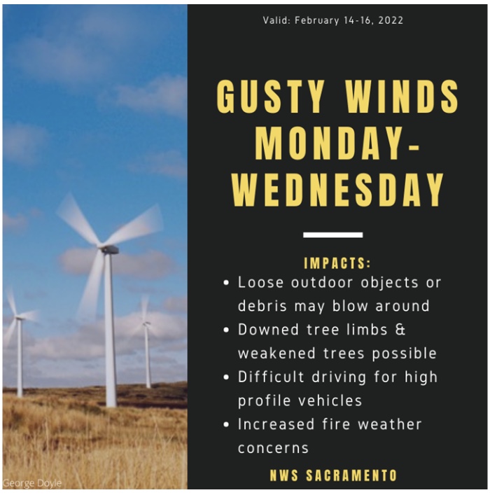
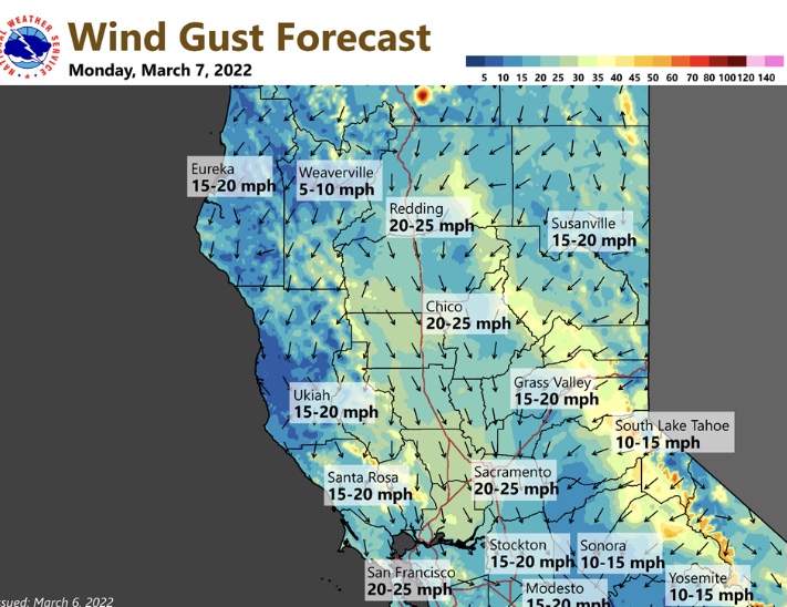
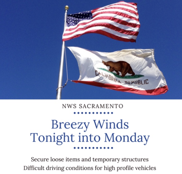

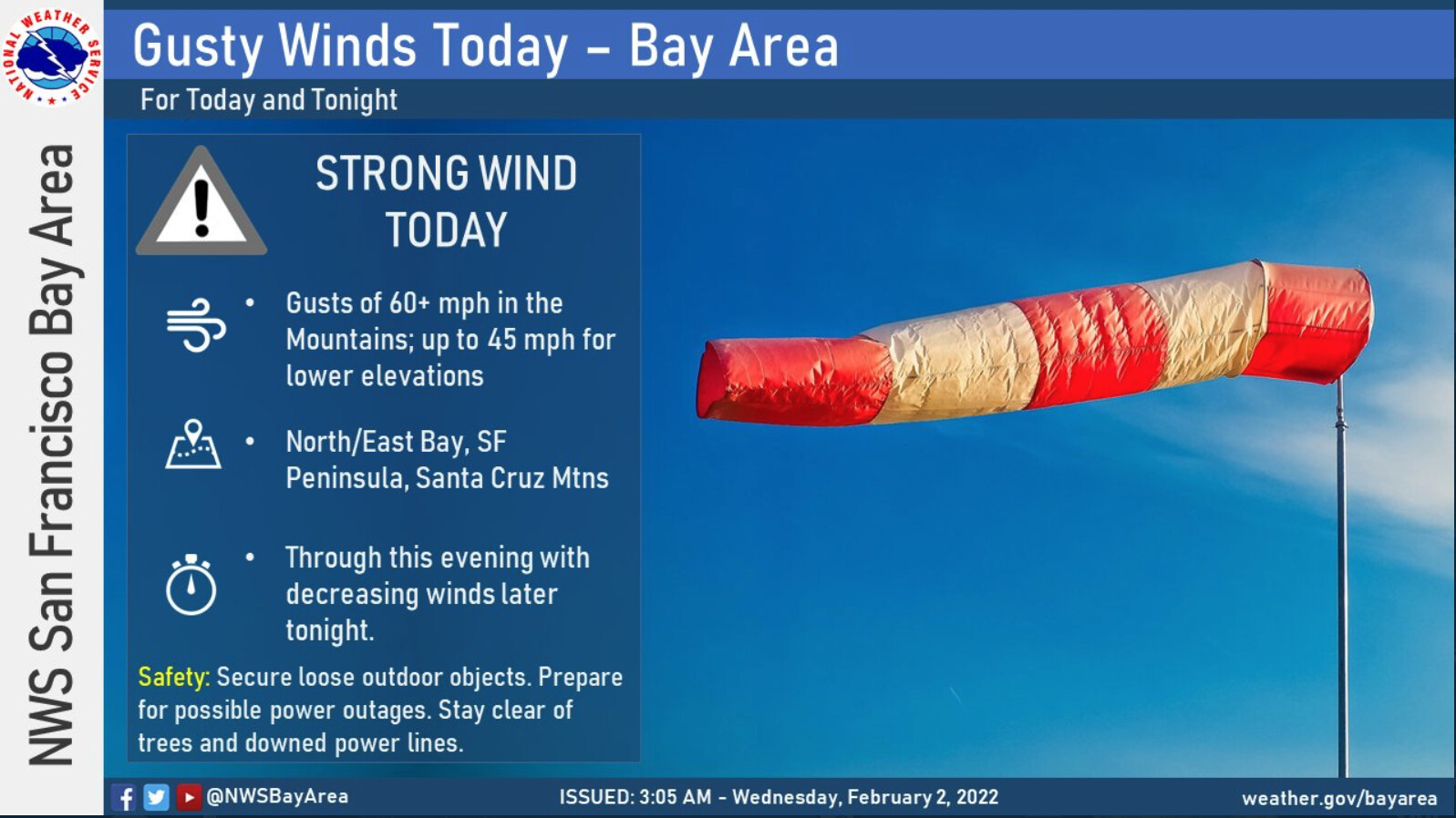
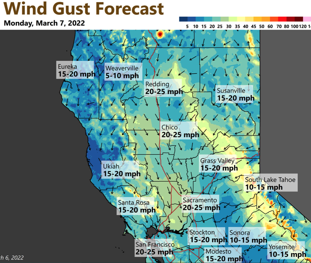
Breezy winds are expected across #NorCal today. Be sure to secure loose objects and use caution driving in and around high profile vehicles. Breezy winds are possible on Thursday as well.
2 Likes
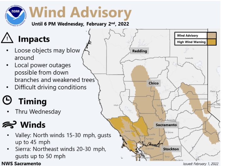
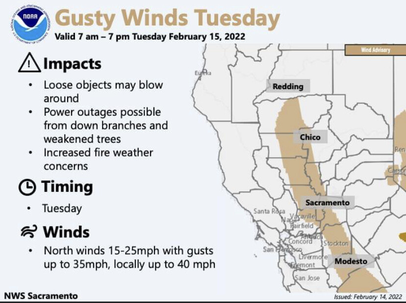
NWS SF: 925 mb winds look to peak between 35 and 40 kt just offshore by late afternoon, with some downward momentum transport into the lowest 1-2 kft per proximity soundings along the coast. Therefore look for breezy N-NW winds later today along the coast and bays with surface gusts around 25-40 mph. However by tonight winds should strengthen in the North Bay Hills and Mountains with gusts increasing into the 45 to 55 mph range. Winds should also increase for the East Bay Hills late tonight towards Thursday morning. Therefore issued a Wind Advisory for these areas for tonight through the first portion of Thursday. Its possible that the coastal North Bay may also flirt with Wind Advisory criteria for a time early this evening, but confidence is lower for this area. However its a possible area for later inclusion if newer data supports stronger winds.

Hill prescribed burn on the lower Klamath preserve quietly had a pyrocumulus event while winds pushed it but stayed within the 600 acre plan.
4 Likes
Not looking good at all for a water year. New Malenos Reservoir is in pretty sad shape for this time of year water level wise.
3 Likes
The Sierra Nevada snowpack has declined to an average of 58% of normal for this time of year. Continued dry and warm weather will cause this to fall through the end of this week.
The ECMWF indicates a potential statewide heatwave 7 days ahead, with temperatures 10-20 degrees above normal. All three global model ensemble means show this anomalous ridge, and thus I am forecasting with high probability further desecration of the snowpack and water resources through the 25th.
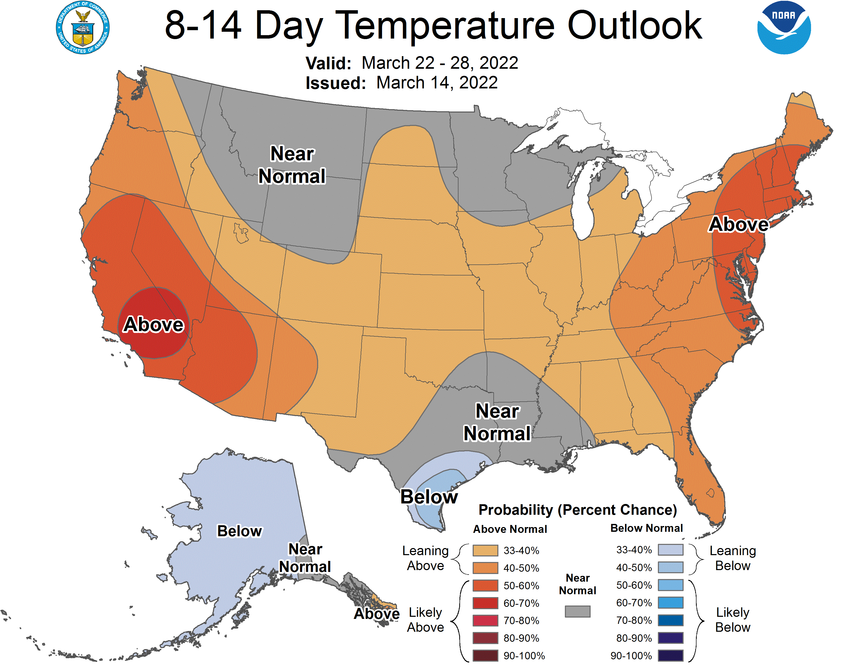
The CPC gives a high chance of above normal temperatures in both the short term and long term outlook.
6 Likes
Although it seems like a cliche… I do believe we could see a record year again in the west, and especially California.
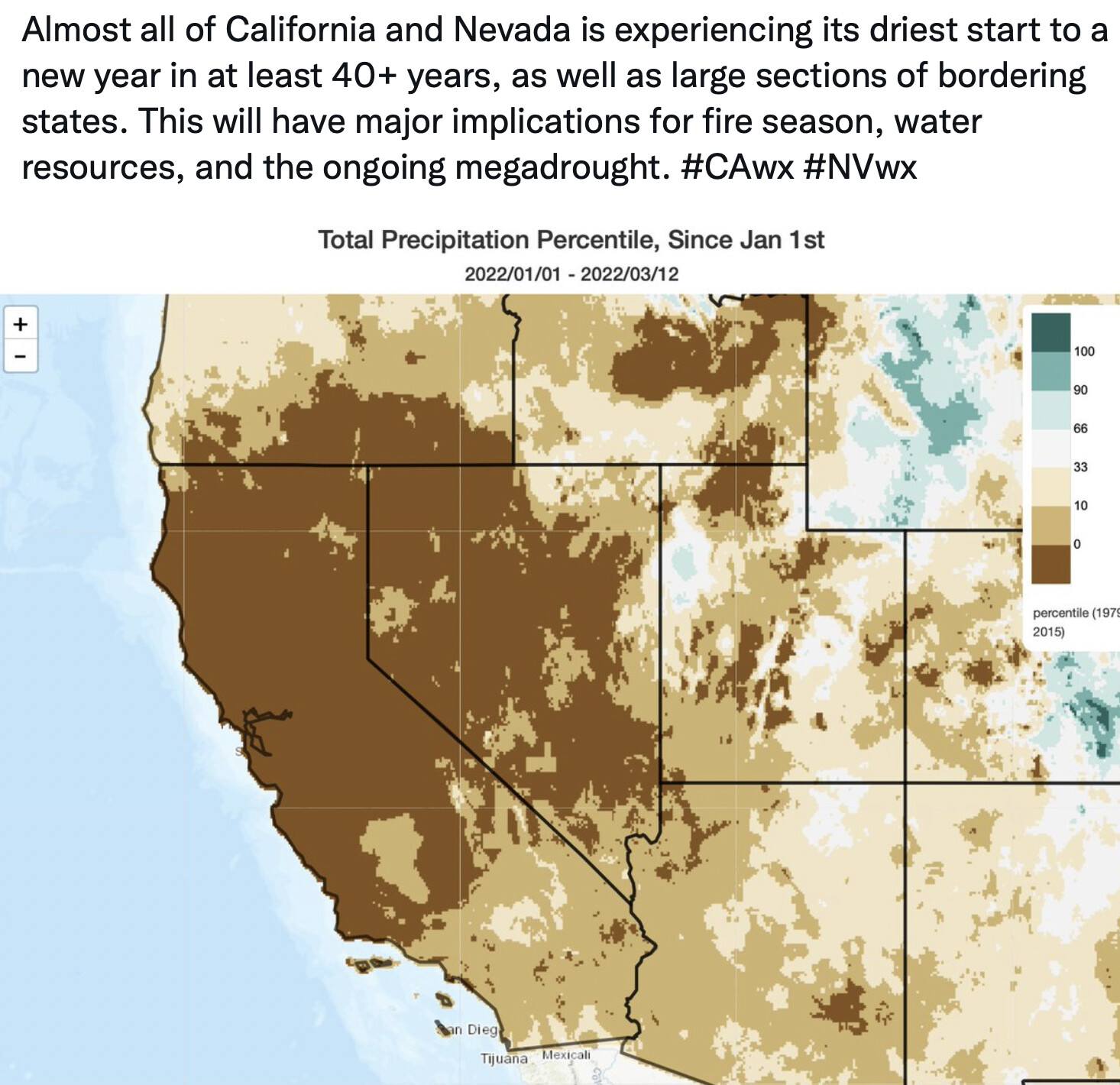
We just ended the driest January-February period over the last 127 years. This when paired with the dry year last year and since 2000-- really only 5 wet years( 05/06, 10,11, 17 and 19) we are seeing the long termed impacts of drought. Tree mortality in the Ponderosa and Grey Pines is really starting to show in the lower foothills and Mother Lode.
The Evaporative Drought Demand Index will really shed light on where the greatest impacts are on soil moisture.
We can hope for some short termed relief in April… but the one thing we are lacking is a solid grass crop… and any late season rain will just enhance that.
I do think it could be a rough year up and down the state… and potentially a really rough year for the areas that were impacted by the low snow event in late December. Yuba, Sierra, Nevada, Placer and El Dorado counties could see some enhanced risk due to the snow kill and dead and down from the low snow.
7 Likes