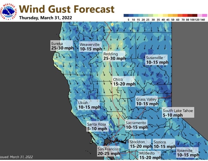
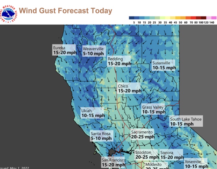
NWS SF 11am: Saturday shows light rain for most locations. Showers end by Saturday night with clear and cool weather Sunday morning. Turningand mild by Sunday afternoon. Strong high pressure builds next week with record warmth possible Tuesday and Wednesday.

2 Likes
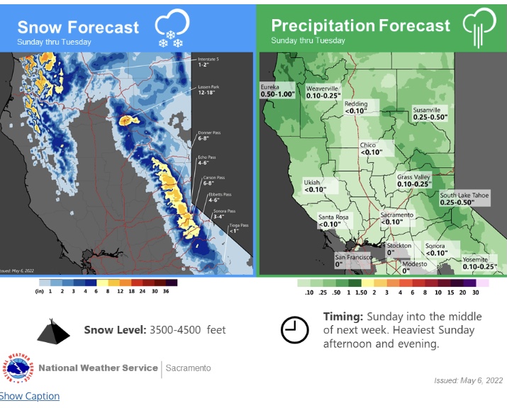
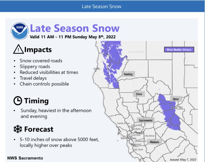
The Sierra Nevada snowpack has declined to an average of 39% of normal for this time of year after the last two weeks of dry weather.
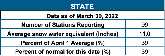
Once again, the ECMWF indicates a potential statewide heatwave 5-7 days ahead and thus I am forecasting the snowpack to fall significantly again. This heatwave could be even more significant and longer duration.
We will need an April Hail Mary for snowfall.
5 Likes
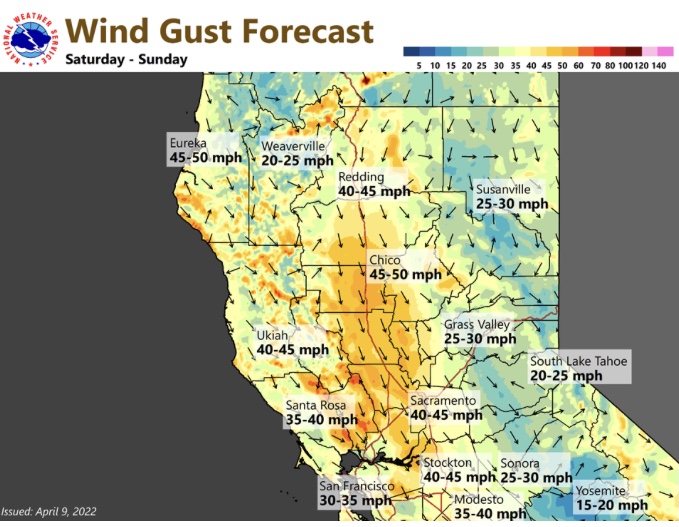
This is less than ideal. My unscientific hypothesis, considering the warmth, lack of rain, persistently strong winds and insanely low RH values, April will burn like June, June like August and so on an so forth.
8 Likes
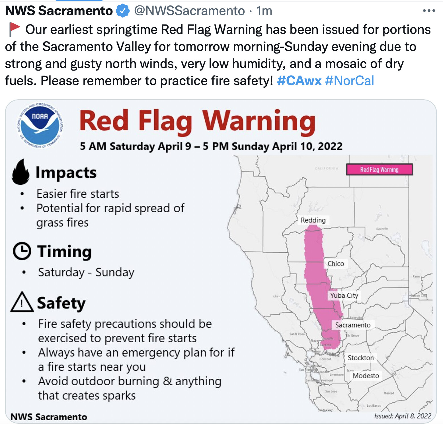
How are people perceiving conditions on the ground across the red flag area? The webcams seem to be showing things still being pretty green around the lower foothills. Is NWS jumping the gun with this RFW?
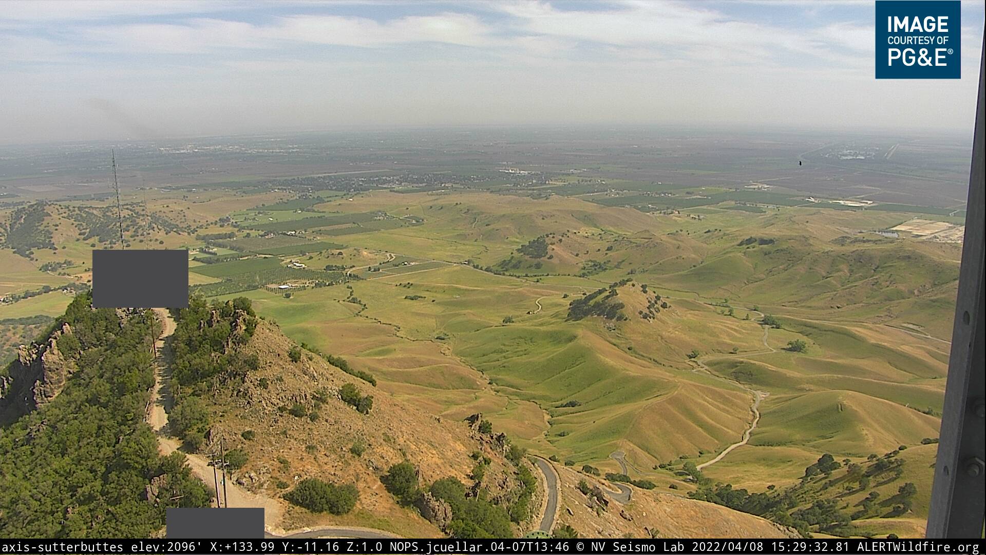
Sutter Buttes
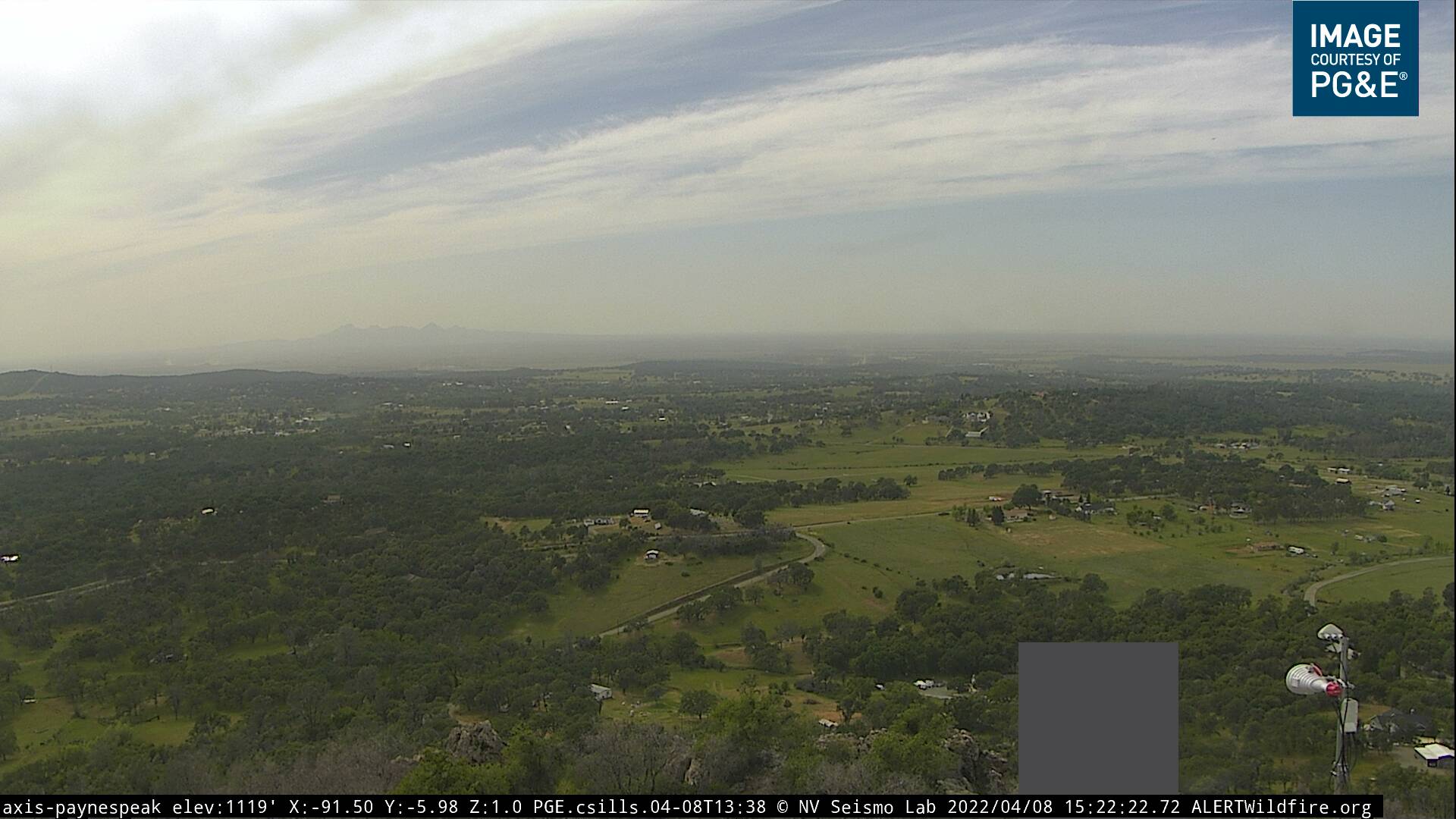
Payne’s Peak
4 Likes
Maybe more than usual due to the large fires that have popped in March in the south and central coast on non red flag days with significant winds and low RH.
We burned 150 acres on the coast in early Feb on a no red flag but high winds and low RH. Moved enough to warrent structure protection resources and consumed the model 2-3 brush very clean. Just saying CYA maybe a little.
3 Likes
I think it has more to do with the 100hr & 1000hr FM. The fires I’ve been on since Jan have ripped in the decedent brush and timber models. But if they hit a grass or shrub (1hr & 10hr) were able to catch and slowdown. The greenness of the grass has led to complacency in some aspects that the “fuels aren’t ready” when in reality the heavy fuels will rip and carry fire spread.
16 Likes
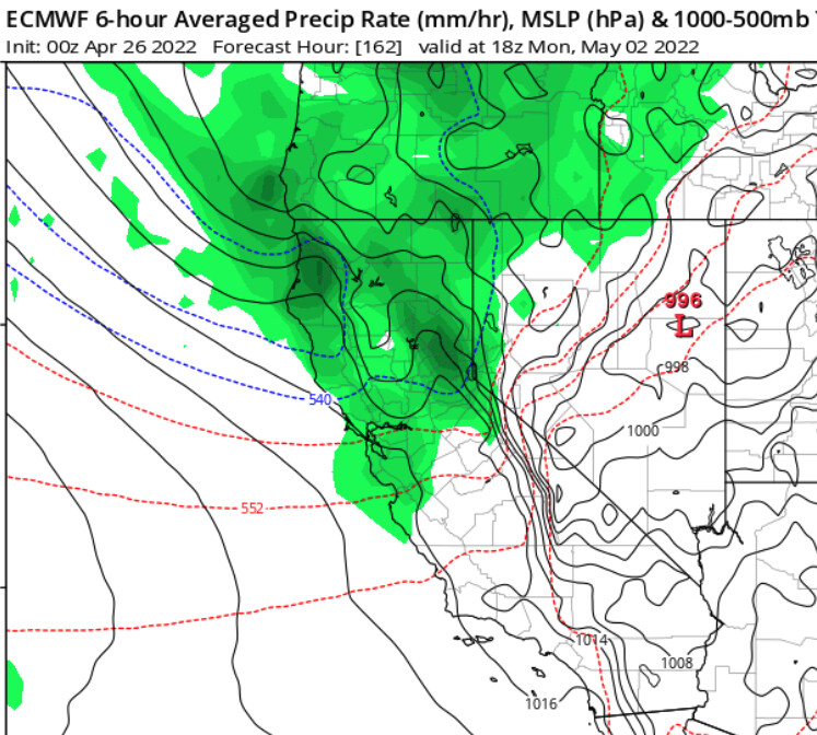
KTVU Tuesday: EURO model brings light rain back in on Monday the 2nd. Other forecast models wait until later next week but pattern looking active out to May 10th.
3 Likes
Conditions should stay very mild through the next few weeks. A long wave trough over the northern US is going to stick around. This nuisance trough is going to promote offshore flow on the backside of shortwaves. As surface troughing continues to dominate the central US, cold air advection continues through mid month in the Great Basin.
This will promote offshore flow at times, which is untimely at this juncture. In fact, there is a high risk for a cold snap event in the middle of the country in mid May, as the aleutian low oscillates into Canada.
2 Likes
Never too early to get the scare tactics going
4 Likes
For what means?
1 Like