NWS SF: The warming trend might be delayed until Thursday. The upper low with its colder airmass may move slowly out of our region such that we wont see a notable warming trend until Thursday. The forecast is still on track for temperatures to be back to seasonable levels by Friday. Then the weekend highs will go above normal by about 5 to 15 degrees and the forecast calls for widespread max temps in the 80s with inland areas potentially reaching the low 90s! Stay tuned to see how the building high pressure ridge impacts the upcoming drier and warmer trend in the extended forecast.
7 Likes
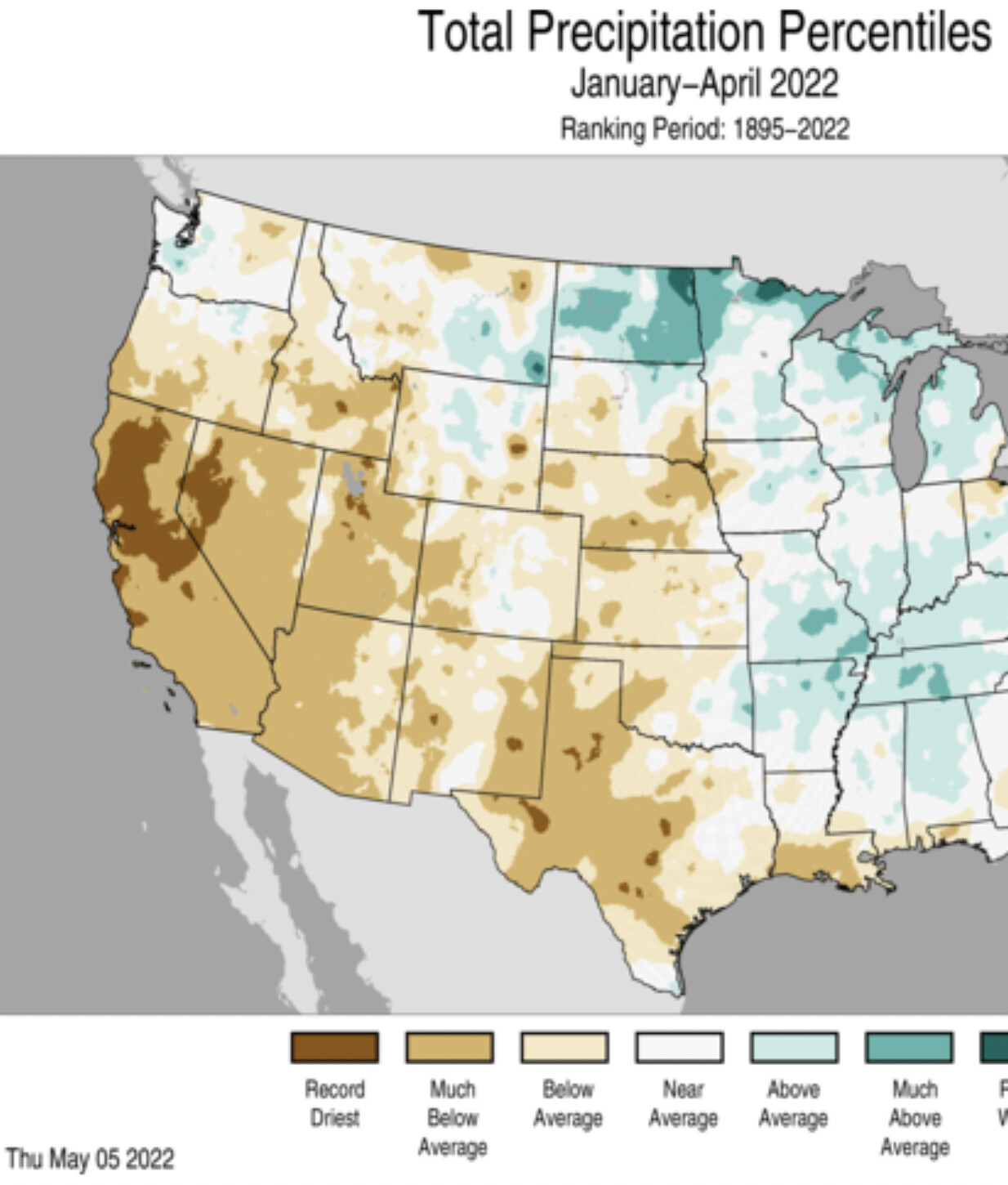
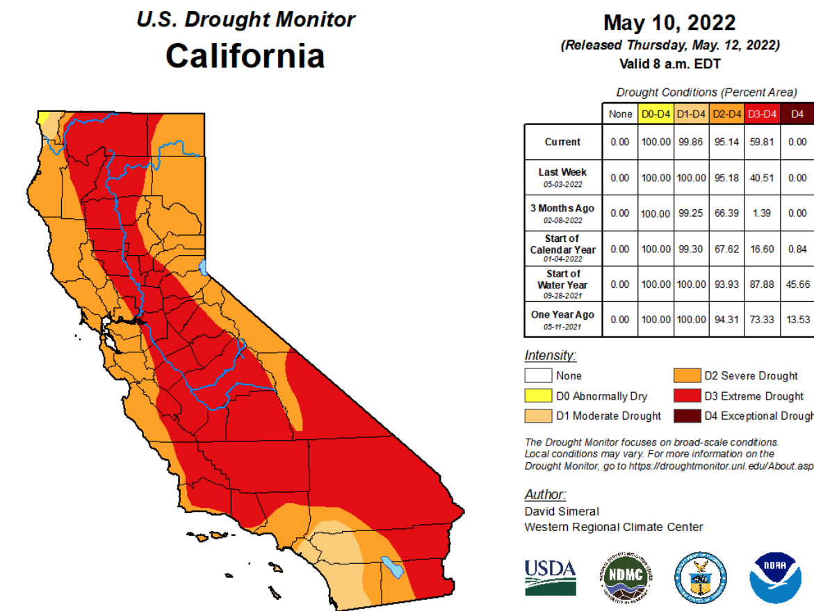
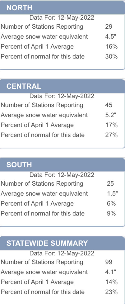
California continues on pace for the driest start to a calendar year while now approaching the more typical driest and warmest time of year.
6 Likes
Apologies for my absence. I will do some work on the general weather outlook going forward this year in the next couple of days.
12 Likes
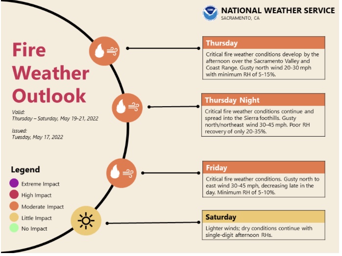
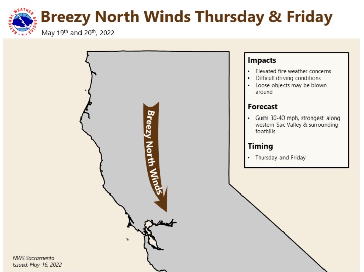
NWS SF Tuesday: Breezy winds are likely each afternoon and evening; becoming particularly gusty and turning offshore for Wednesday into Thursday. Elevated fire weather concerns are anticipated for mid to late week as humidity values plummet.
Deep layer ridging will flex poleward across the eastern Pacific while downstream troughing drops through the Pacific Northwest and northern Great Basin. This will maintain robust northerly flow across the area with a tendency for winds to become more offshore and gusty.
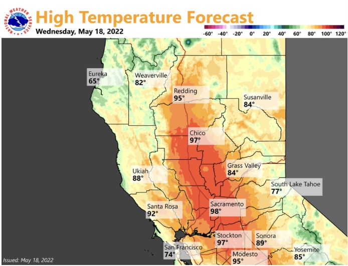
This pattern change will result in: 1) warmer temperatures as highs for inland areas climb well into the 80s to lower 90s. 2) stronger winds as gusts in the hills may reach or exceed 45 mph; and 3) enhanced fire weather concerns as very low humidity values combine with warm temperatures and gusty winds. As previously mentioned fuels aren`t fully in fire season yet but they are getting there. Otherwise look for plentiful sunshine outside of some coastal clouds at times.
6 Likes
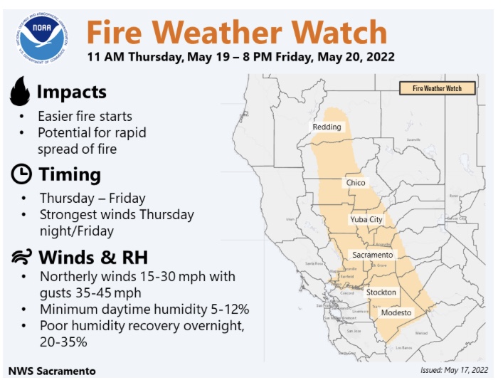
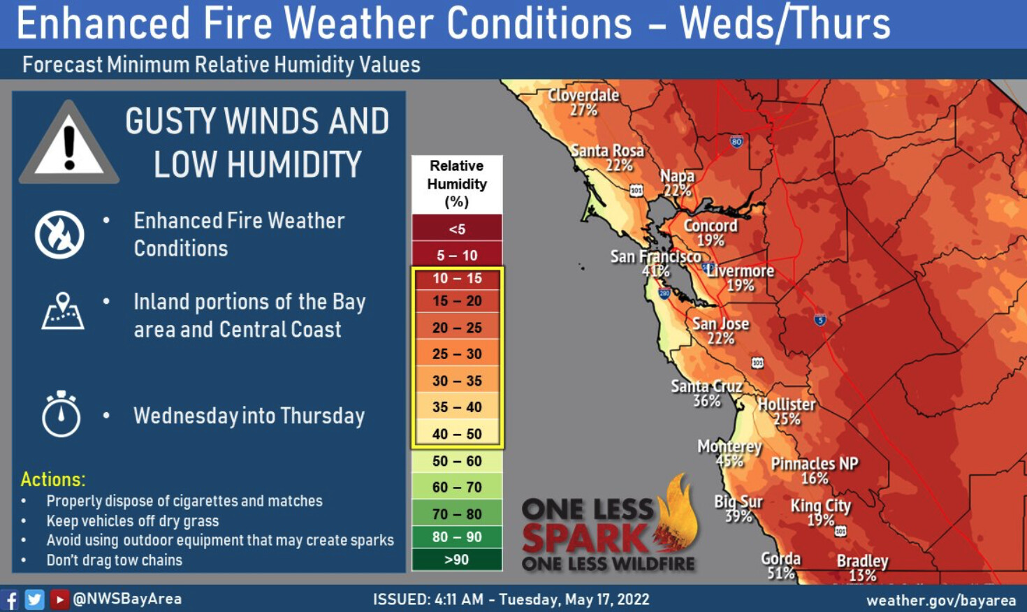
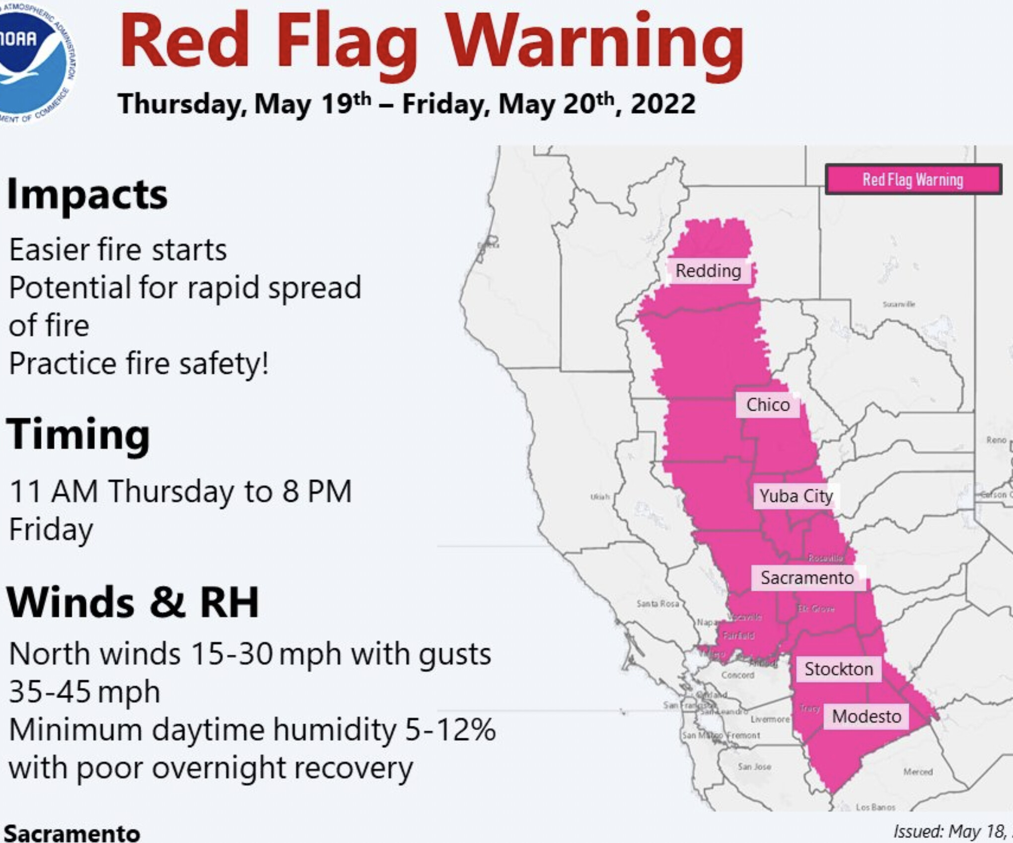
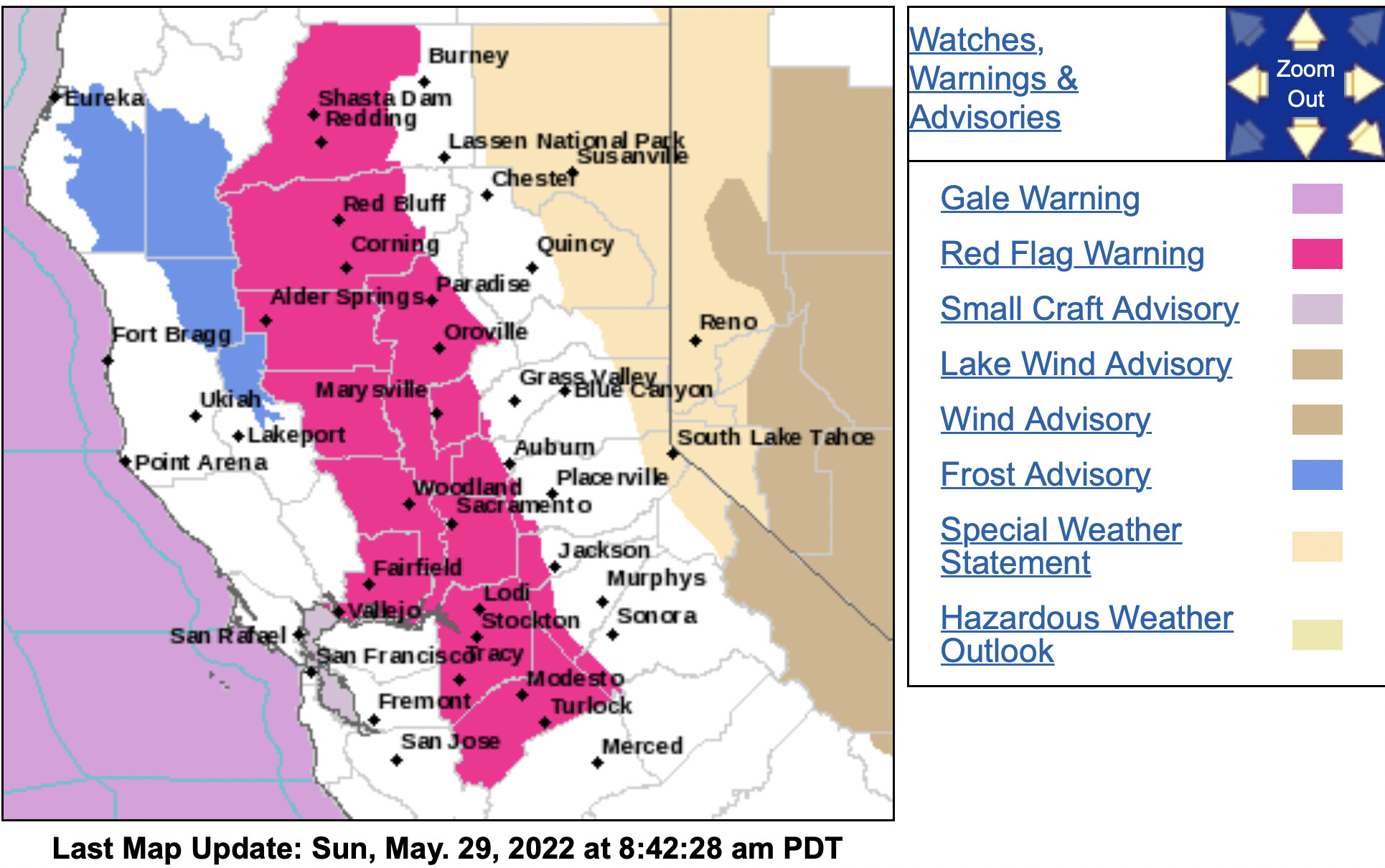
NWS Sac 1047 AM Wed
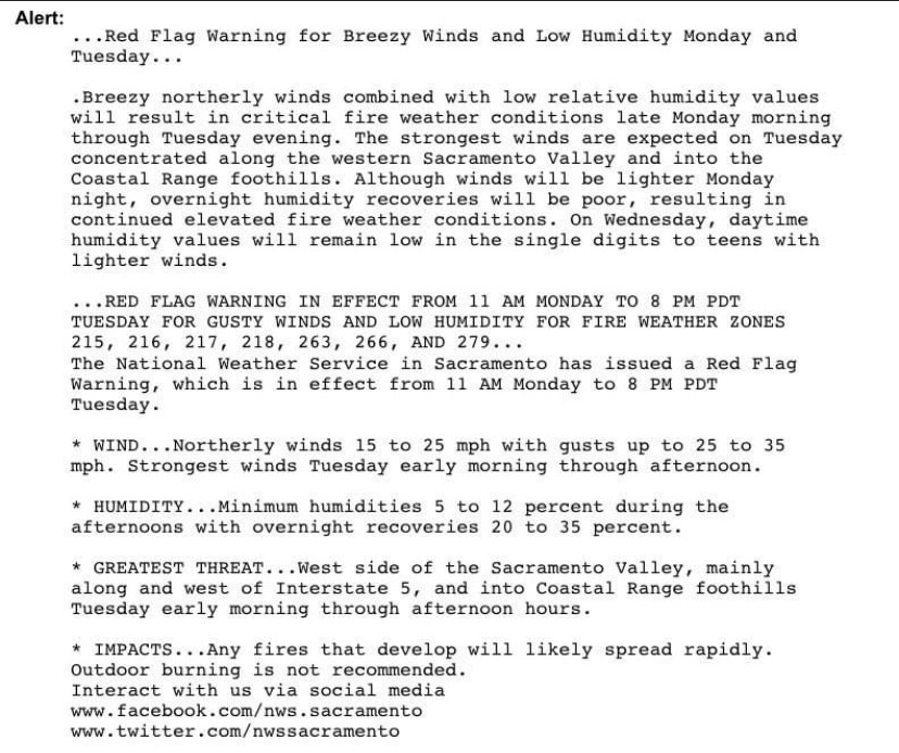
…Red Flag Warning for Gusty Winds and Low Humidity Thursday and
Friday…
.A weather system passing to our northeast will bring gusty north
and east winds to interior northern California. Winds will be
increasing Thursday morning and will be strongest Thursday night
through Friday morning. The strongest winds will be over the west
side of the Sacramento Valley and the Coastal Range Foothills.
Gusty winds along with drying fuels will lead to critical fire
weather conditions. Lighter winds are expected on Saturday, but
humidity values will remain in the single digits and teens.
WIND…Northerly winds 15 to 30 mph with gusts 35 to 45 mph,
** locally higher.**
-
HUMIDITY…Minimum humidities 5 to 12 percent during the
afternoons with overnight recoveries 20 to 35 percent. -
GREATEST THREAT…West side of the Sacramento Valley mainly
along and west of Interstate 5 and 505 and into the Coastal
Range Foothills below 2500 feet.
Strongest winds Thursday night through Friday morning.
7 Likes
3 Likes
This verified. My computer is down so haven’t been able to do much work. I also promised to do a blog style page and will work on it. Bear with me.
6 Likes
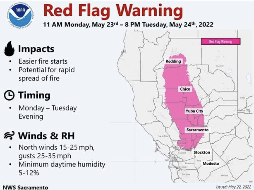
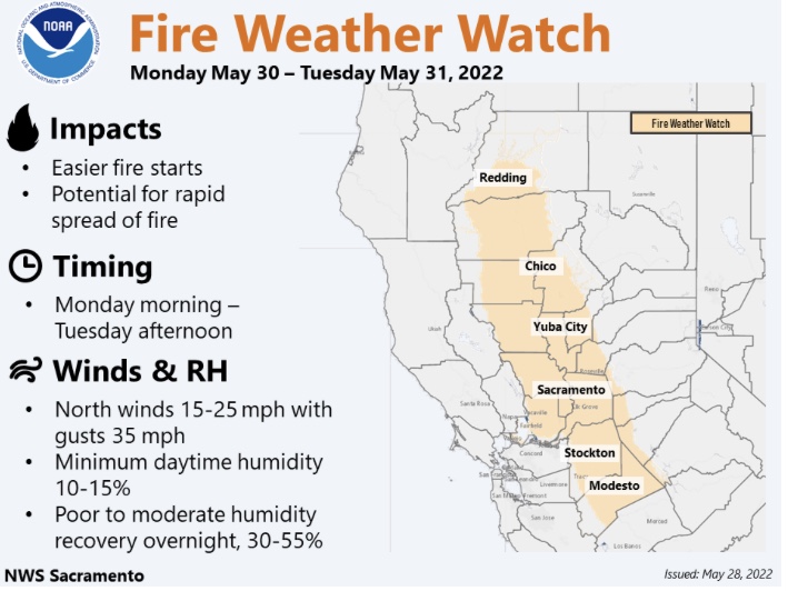
NWS Sacramento has issued a Red Flag
Warning for gusty winds and low humidity, which is in effect from
11 AM Monday to 8 PM PDT Tuesday.
-
Winds…Northerly wind 15 to 25 mph with gusts up to 35 mph.
Strongest wind expected Monday. -
Humidity…Minimum humidities 5 to 15 percent with overnight
recoveries 30 to 55 percent. -
Greatest Threat…West side of the Sacramento Valley, mainly
along and west of Interstate 5.
6 Likes
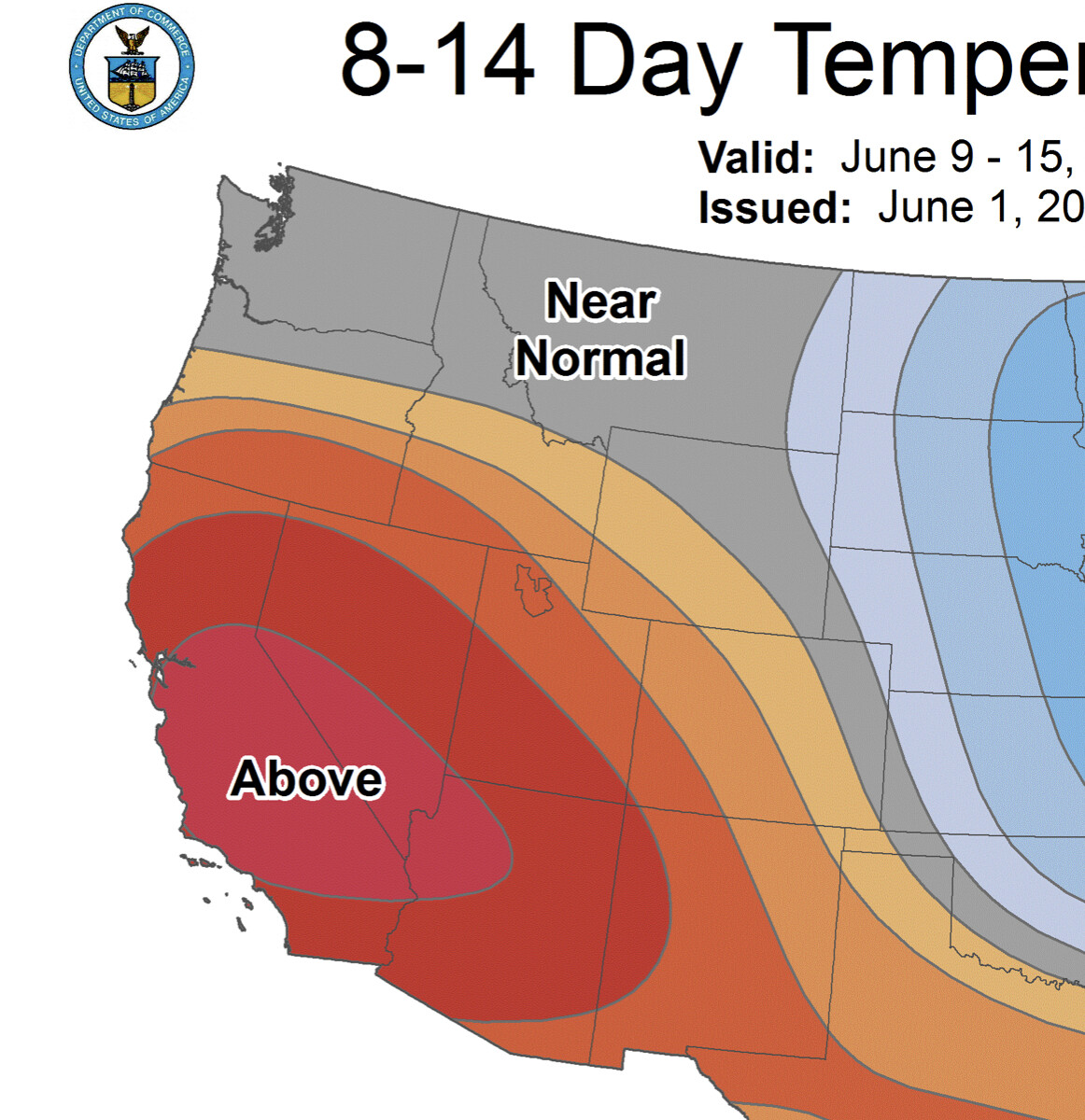
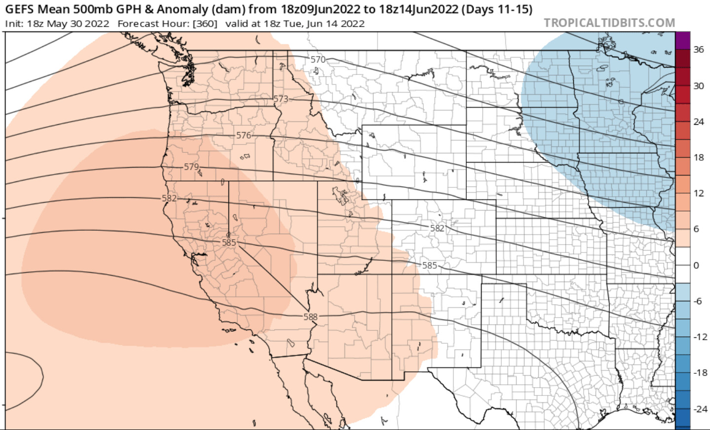
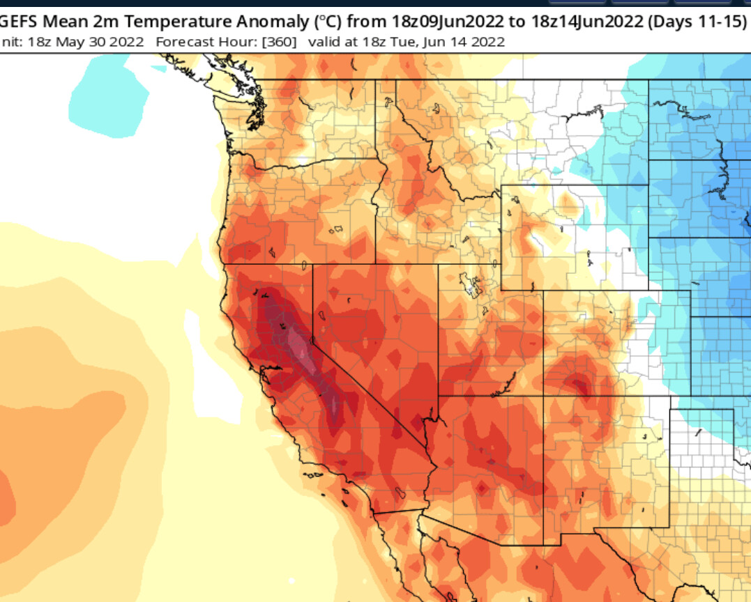
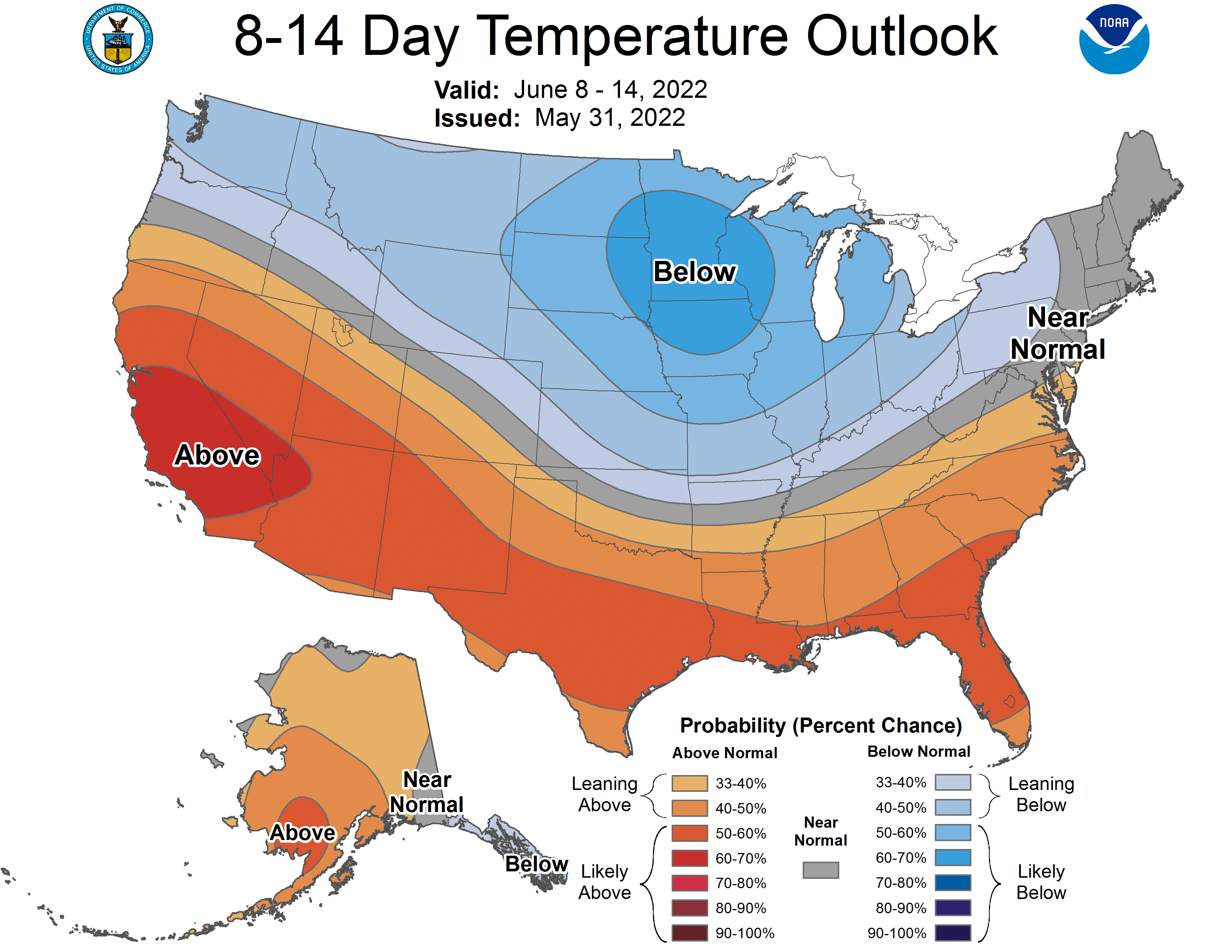
A heat wave could occur around June 8th- June 14th. The GFS builds a subtropical ridge into the SW US around June 8th and it amplifies for the next few days after. At this same point, a strong upper level high pressure system develops off the Western US as a couple of surface low pressure systems may develop and help amplify the ridge as they move downstream into Canada.
There is disagreement on the exact placement of these features. It is too far out to concretely forecast. If the GFS verifies there could be strong surface high pressure in the Great Basin with very strong upper level ridging aloft, temperatures would likely reach widespread triple digits.
This event would likely kick off receptive fire spread in brush and timber at higher elevations.
Update 5/31:
15 Likes