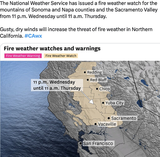
RFW now up.
Lots of lightning from Yosemite Valley - Susanville… pretty good show here in Verdi. So far dry.
Historically average fire weather for this time of year. My time in BTU in the late 90’s was this weather pattern.
Upgraded to Red Flag Warning
https://forecast.weather.gov/wwamap/wwatxtget.php?cwa=STO&wwa=red%20flag%20warning
Northerly winds will be strongest between 11 pm tonight through 11
am Thursday, but breezy northerly winds will linger through the
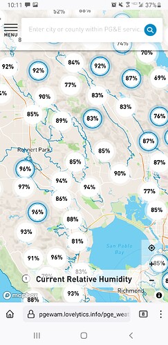
afternoon Thursday. Humidities will begin to drop late tonight
into early morning hours. Low humidities in the 25 to 35 percent
range are expected by Thursday morning.
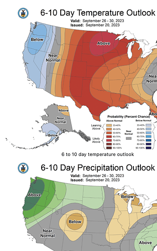
The models have been hinting at this for a couple of days now. With a “Train of storms”. Time will tell, but the 1st part of Oct looks wet.
Red packets coming If that weather pattern holds and you can officially call this season a dud.
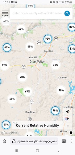
Red packet humidity…
Rather wet, especially in the nothern portion of the state.
First atmospheric river of the (hydrologic) year looks like it will be hitting 9/24
GEFS_LandfallTool_150_coast_current.png (1473×630) (ucsd.edu)
Central Sierras seems to be the only potential fire danger left this fall.
I traveled over the Grapevine yesterday then up the 15 from San Berdu and saw plenty of Chia Pet green grass shouldering the roads and some slopes.
Latest Sunday North Ops weather:
-
Wetting rain (0.25" to 1.5" and locally higher) across N. Coast, NW Mtns & northern portions of Mid Coast-Mendocino PSAs beginning mid-day Mon and spreading eastward through the
day. -
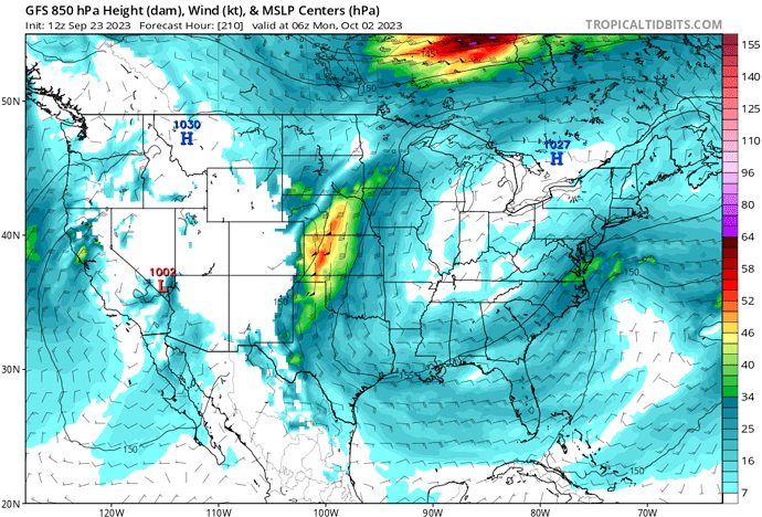
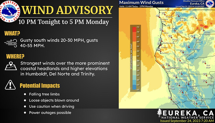
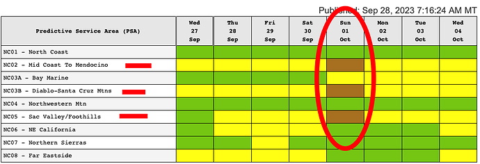
Slightly higher confidence in classic offshore wind pattern setting up during first few days of October. At this time focused areas of gusty winds and low rh is Mid Coast Mendocino and Diablo Santa Cruz PSAs.
