Happy New Year 2023
3 Likes
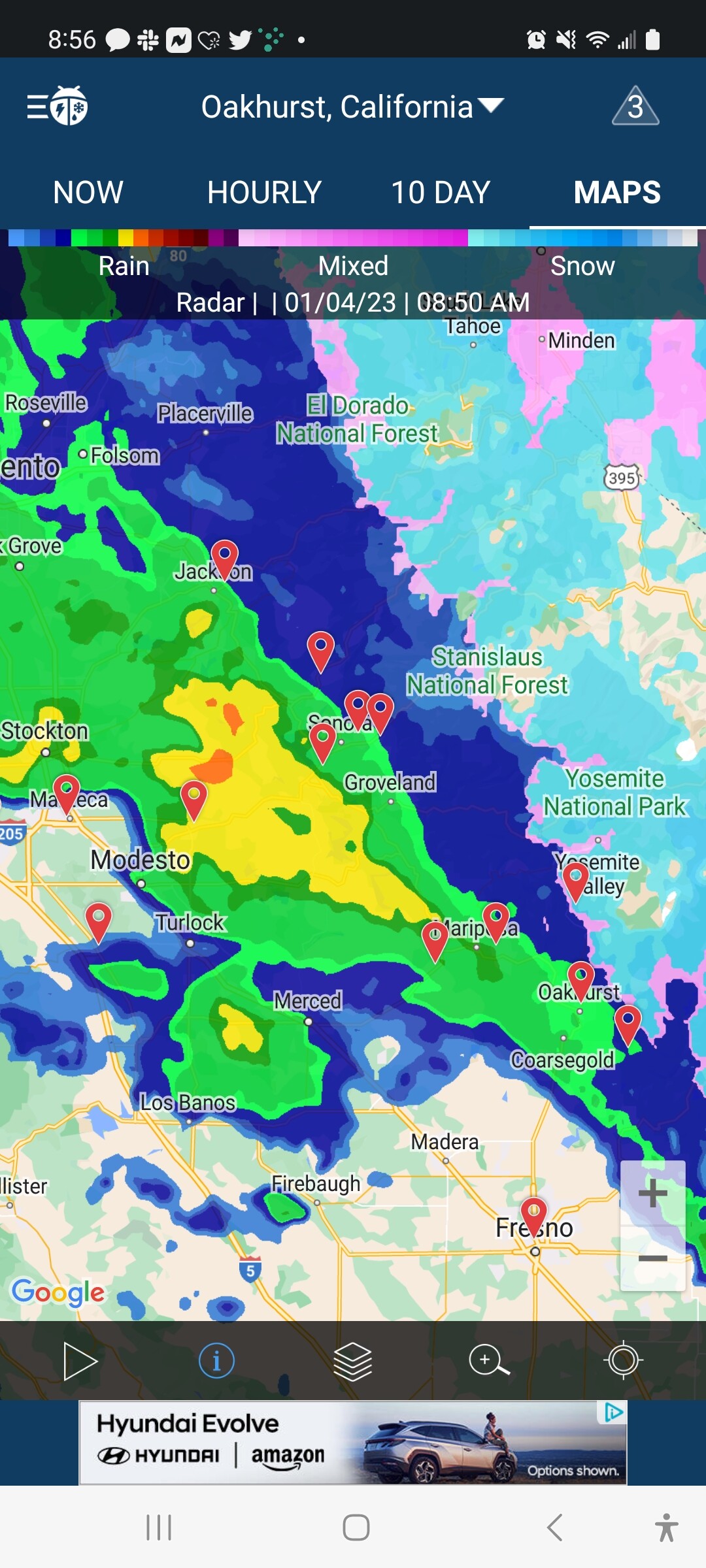
The Motherlode a freaking mess with all that rain. We received 5.50" in the last storm. Bringing us to 15.25 for the year at our house in Sonora. On Friday my kid got 5.35 at Twain Harte in 24 hours.
4 Likes
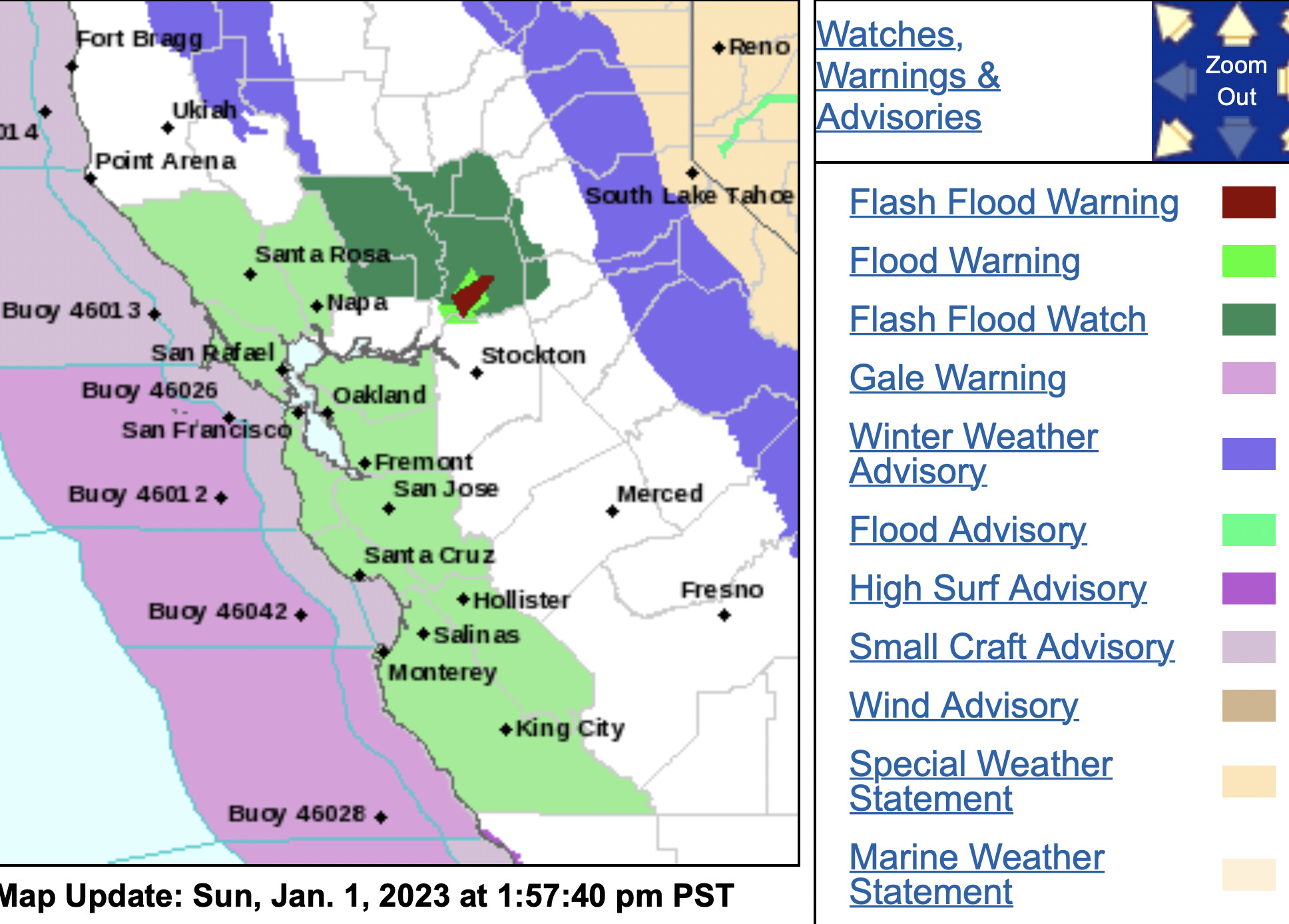
NWS SF 1:30pm
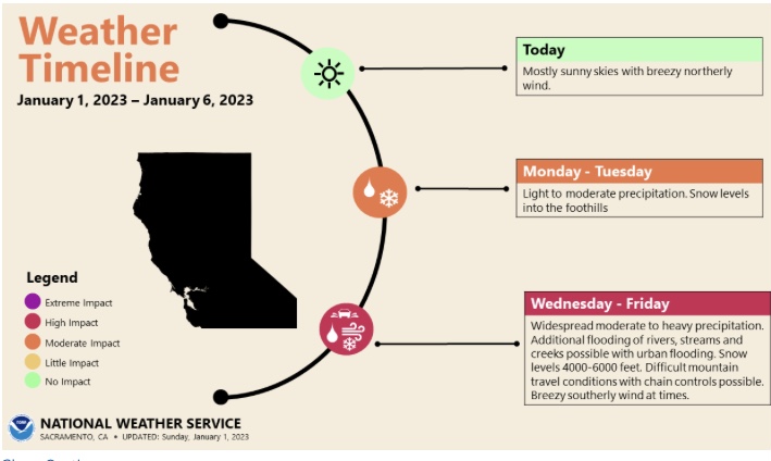
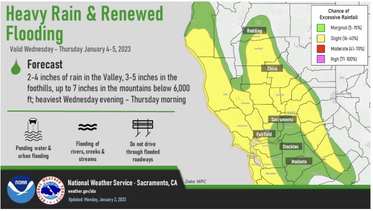
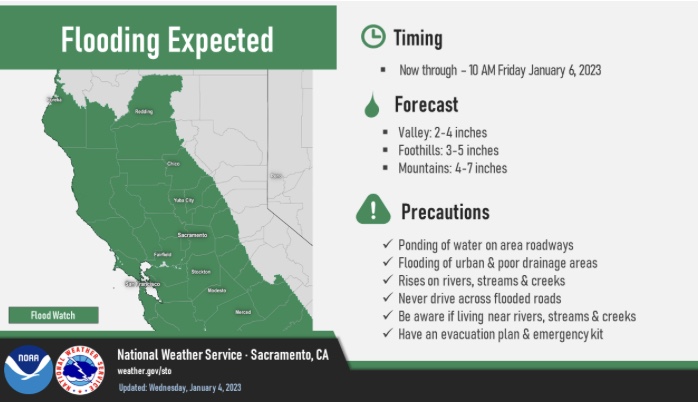
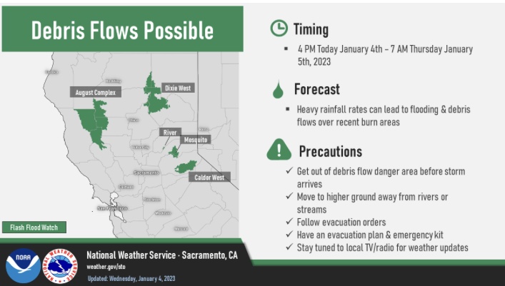
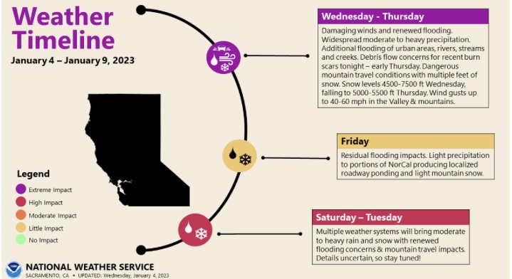
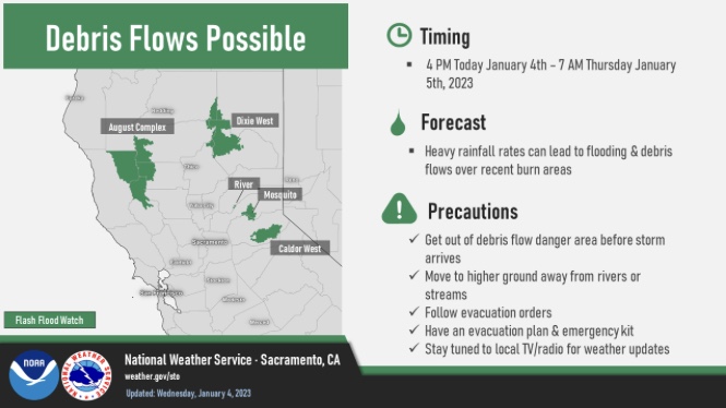
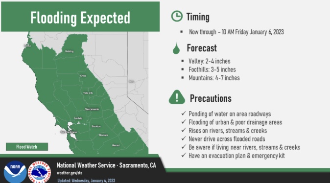
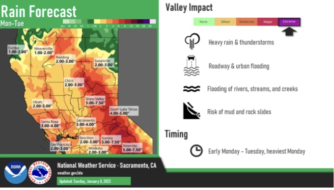
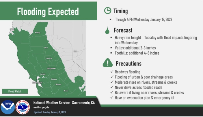
An atmospheric river, similar in strength or stronger than the New Years Eve storm will spread heavy rain across the region as early as Wednesday through Thursday. Early forecasts show widespread 2-4 inch rainfall totals in the lower elevations with 3-6 inches in the hills while the wettest peaks of the North Bay, Mt Tamalpais, Santa Cruz Mountains and Santa Lucia Range could see 8-10 inch rain amounts with this atmospheric river. Given the saturated soils and recent rains we can expect rapid responses on smaller creeks with quick rises on the mainstem rivers Wednesday through Friday. This system will result in an increased risk of mudslides and debris flows across the region and especially over recent wildfire burn areas.
-
WHERE…Entire forecast area from Napa and Sonoma counties south through Monterey and San Benito counties. Latest model guidance suggests the North Bay Mountains, the coastal slopes of the Santa Cruz Mountains and Santa Lucia Mountains above Big Sur will most likely receive the greatest amounts of precipitation.
-
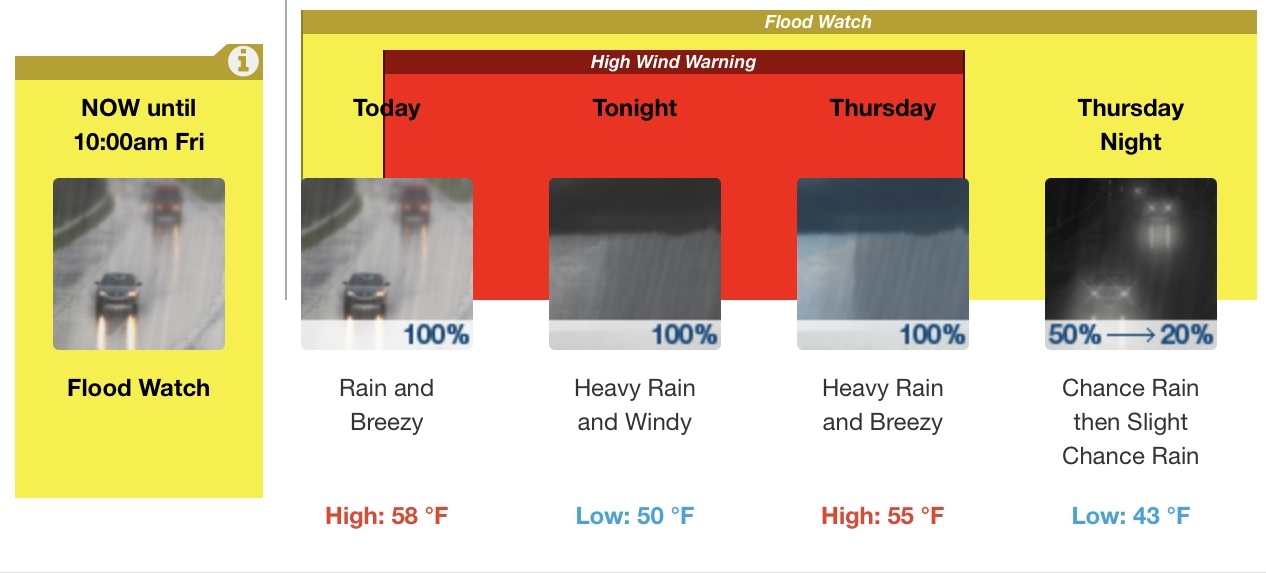
WHEN…Wednesday through Thursday will see the heaviest rain with flood impacts likely lingering into Friday. Long range models suggest more rain chances next weekend and through mid-month.
3 Likes
2 Likes

Flash Flood Watch
3 Likes
I’ll be livestreaming on The Lookout YouTube at 7pm about the geography of the Sacramento River flood protection system. We’ll look at the system of levees and weirs on the Sacramento River built to keep floodwaters out of urbanized areas. #castorms #cawx https://www.youtube.com/c/TheLookout1
5 Likes
3 Likes
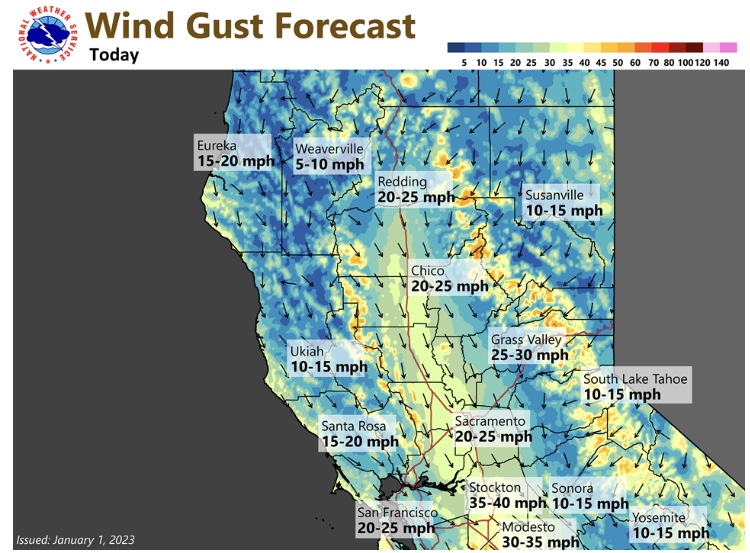
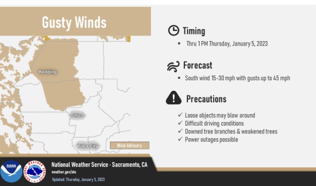
Blowing at my house in Sonora 15 to 20 with guest to 40mph with rain.
2 Likes
I’m up on a ridge above the NW side of Sonora. We catch a lot of wind here.
4 Likes
A rather rare occasion in NorCal. A USAF Hurricane Hunter has just landed at Mather at 1515 hours. 995309 (Lockheed Martin WC-130J Weatherbird) took off from Gulfport, MS about 6 hours ago.
7 Likes
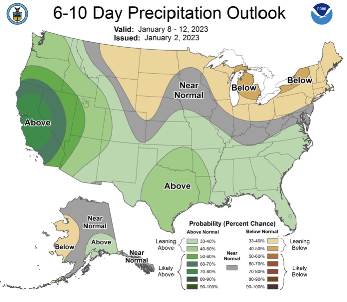
Over the next 7 days, several waves of energy are set to create atmospheric river conditions in the West. WPC’s QPF product shows widespread 5+" rain accumulations over 7 days! With each upcoming event, highly saturated soils create concern for flash flooding across the region.
4 Likes
3 Likes
WET!!!..and more WET…ground is maxed out and reservoirs are rising.
3 Likes
Millerton rose 32,580 acre feet since 11:15am yesterday that would have been closer to 50,000 acre feet if reclamation didn’t start releasing water Friday. Made for a wet day recovering docks today.
3 Likes