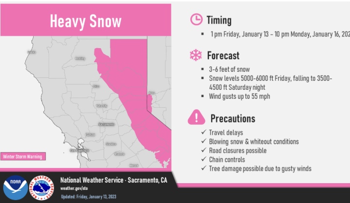
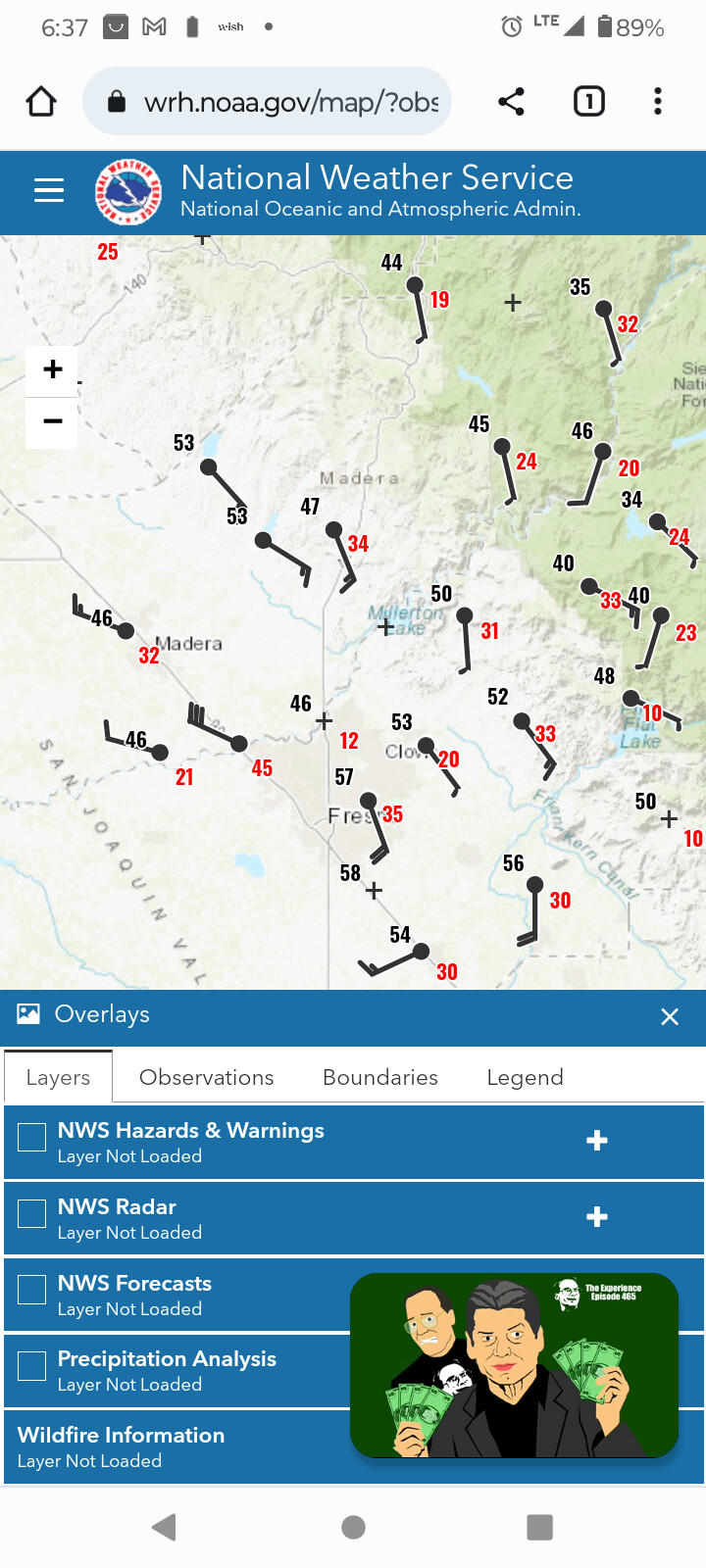
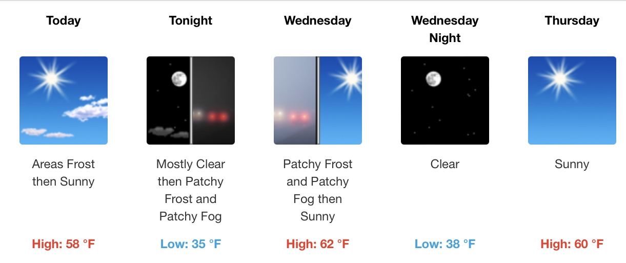
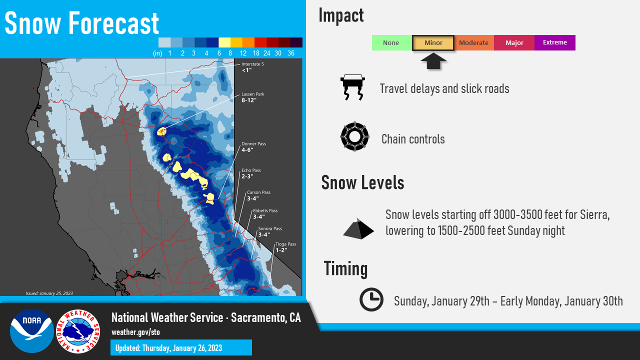
Copy that, I heard Lake Don Pedro was going to raise 30 plus feet by the end of the week with all the inflows going into it. It would not surprise me Pedro has a good size water shed. New Melones is on the rise a lot of the islands that were showing are now under water. Glad we are getting rain and snow now lets space it out with some sun.
4 Likes
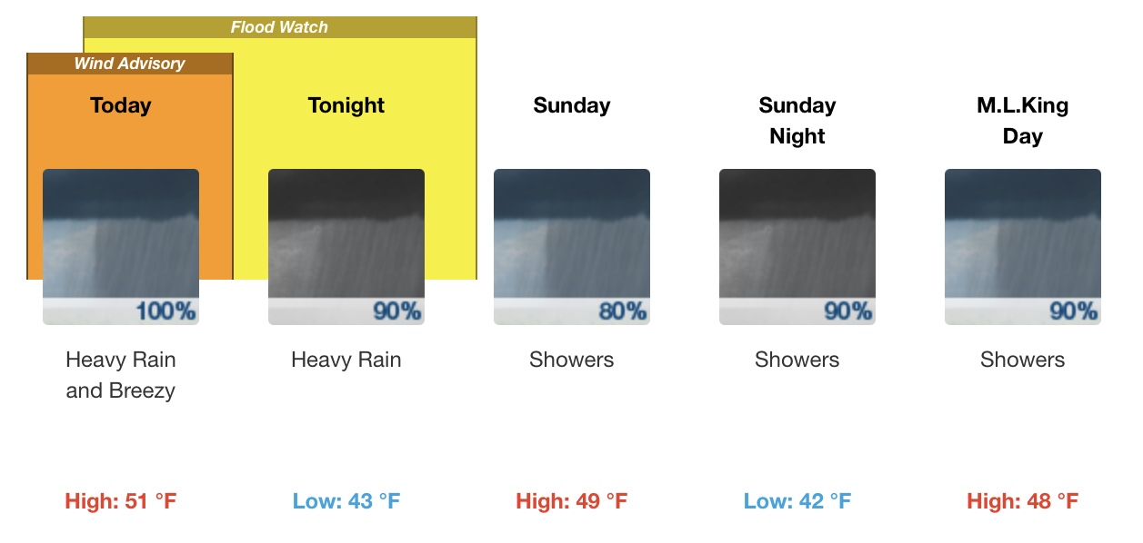
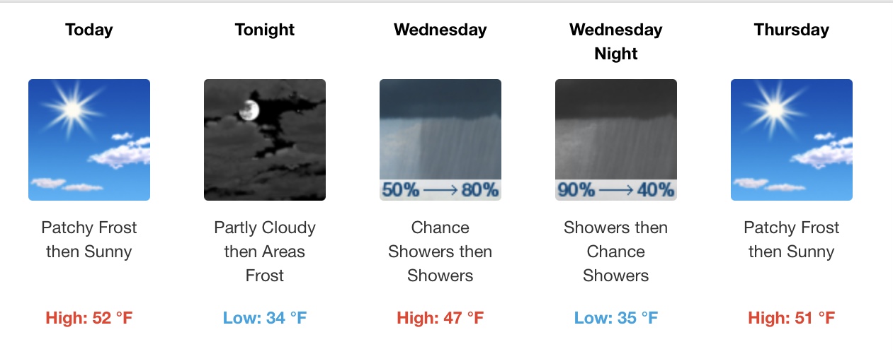
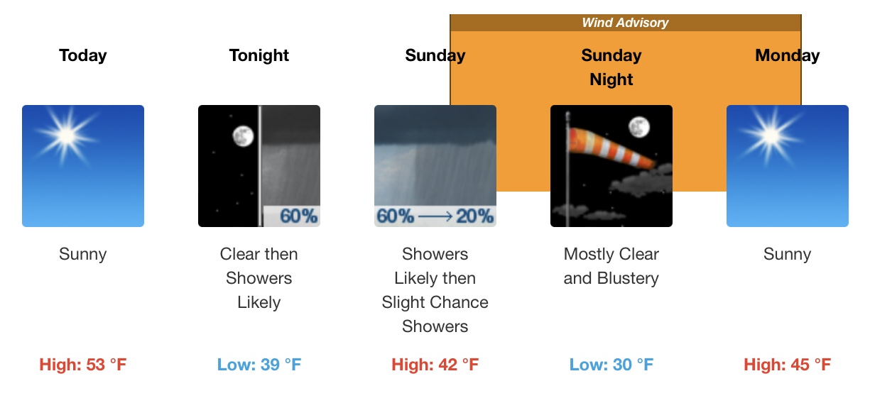
No sun… But maybe a little bit of drying spells although it’s kinda raining up here in Soulsbyville right now… Lol
5 Likes
Russian???
1 Like
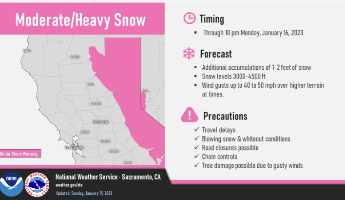
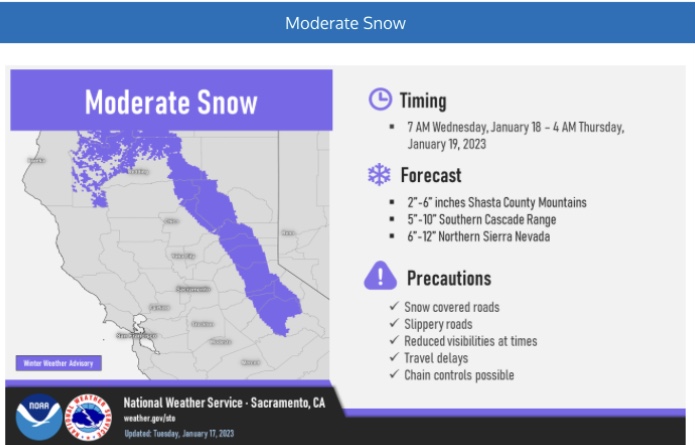
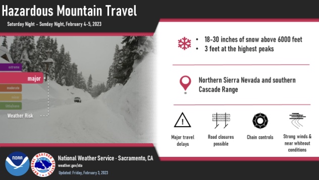
Couple inches of snow in Twain Harte this morning at 3648’. Earlier in the week at 6600’ it was raining at Dodge Ridge Ski Resort. Hopefully this will bring the base up at the lower elevations.
4 Likes
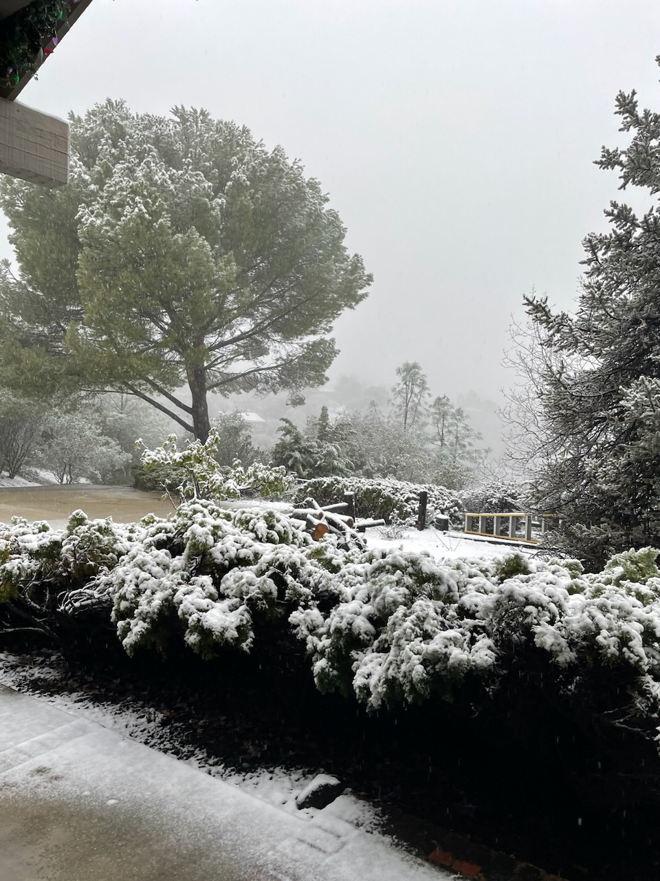
Been dumping here in Soulsbyville since about 7am
For some reason I can’t upload pictures here anymore
4 Likes

Sonoma County - Alexander Valley - Russian River
Post Wildfire Debris Flow Hazard Assessment
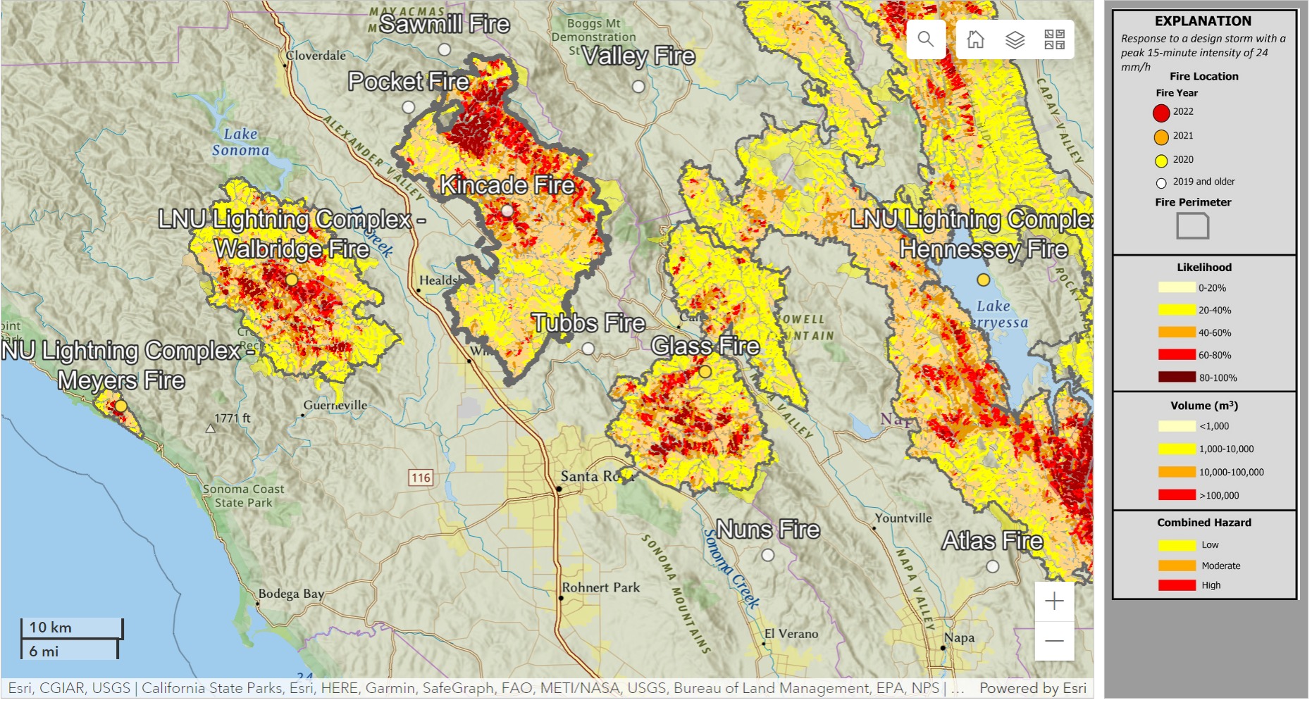
The watershed, per se, breaks near Santa Rosa, meaning that there is some ‘normal’ waterflow that goes west, rather than south. Sonoma has gotten pretty scorched in the last 5 years, extending back through the 2020 LNU Complex Fires (part of the lightning siege of 2020) to the Kincade Fire of 2019. Hazards abound. These fires probably contributed in big ways to the flood watches and warnings that persisted here after watches were lifted in the Central Valley to the east.
3 Likes
The burned areas are almost totally regrown with heavy grass and brush crops. Older burns like Kincade have a lot of dead and down which helps slow runoff and trap sediment. Many of the areas burned with low-moderate severity in the first place. It’s not a given that the burns had any measurable effect on the recent flooding.
5 Likes
Thanks for your observations. Perceptions can often run counter to intuitions. It seems clear the big yellow indicates less severe hazard, re: Kincade. I’m sure your competent, but I look at Alexander and Napa valleys and it continues to strike me that there just ain’t no place else for the stormwater to go. I think keeping the watches up was wise.
If you happen to do a work examining the fireshed, or the fireshed around Carmel Valley, I think there is a lot of interest in that type of study tour for the vegetation types and consequential issues.
2016 Soberanes Fire (still a factor in the Santa Lucia Range?)
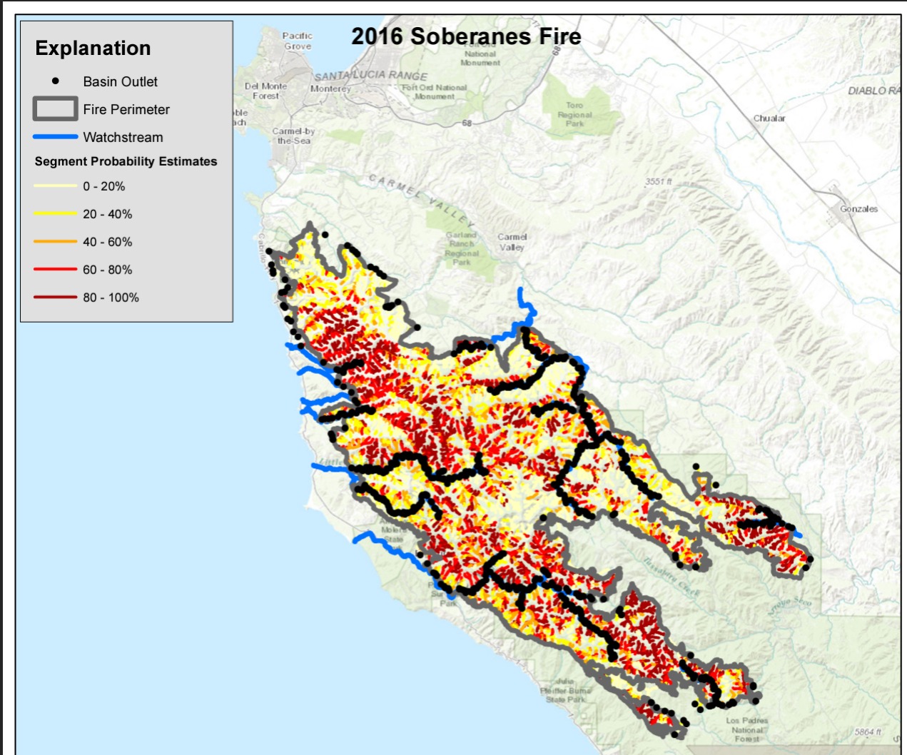
A quick look at reported landslides and the absence of footprint display in the nominal PWFDF display suggests that this fireshed is no longer ‘in the black’. Some people call this area ‘remote’, but we should know better. It’s not a long drive, its the roads.
New landslide discovered along Hwy 1 blocking road (ksby.com)
2 Likes
6 Likes