State ID: NV
3 letter designator: EFKX
Fire name: Conner
Location: Pine View Estates, 2 Miles South of Gardnerville
Reported acres: 100
Rate of spread: Moderate
Report on Conditions: Wind-driven
Structure threat: 2 homes involved, evacuations in place, FMAG
Resources: NV-EFK, NV-TDO, CA-EFD, CA-ANT, CA-SLT, CA-LAV, NV-CCF, NV-LYO, NV-STO, NV-TMF, NV-RFD, NV-NLT, NDF, BLM-CCD / Unified Command between East Fork FPD & BLM-Carson City District
Hazards:
Weather: West to southwest winds with gusts up to 30 mph this morning and up to 45 mph are expected this afternoon. Winds shift to the north late tonight behind a cold front. Overnight recoveries were poor below 20% with min RH this afternoon around 10%. However, overnight recoveries improve tonight. Temperature…49-53…Max 70-75. RH…15-19% ..Min 8-11%.
Radio channels: Douglas County VALLEY FIRE, BLM-CCD, NDF
Scanner link:
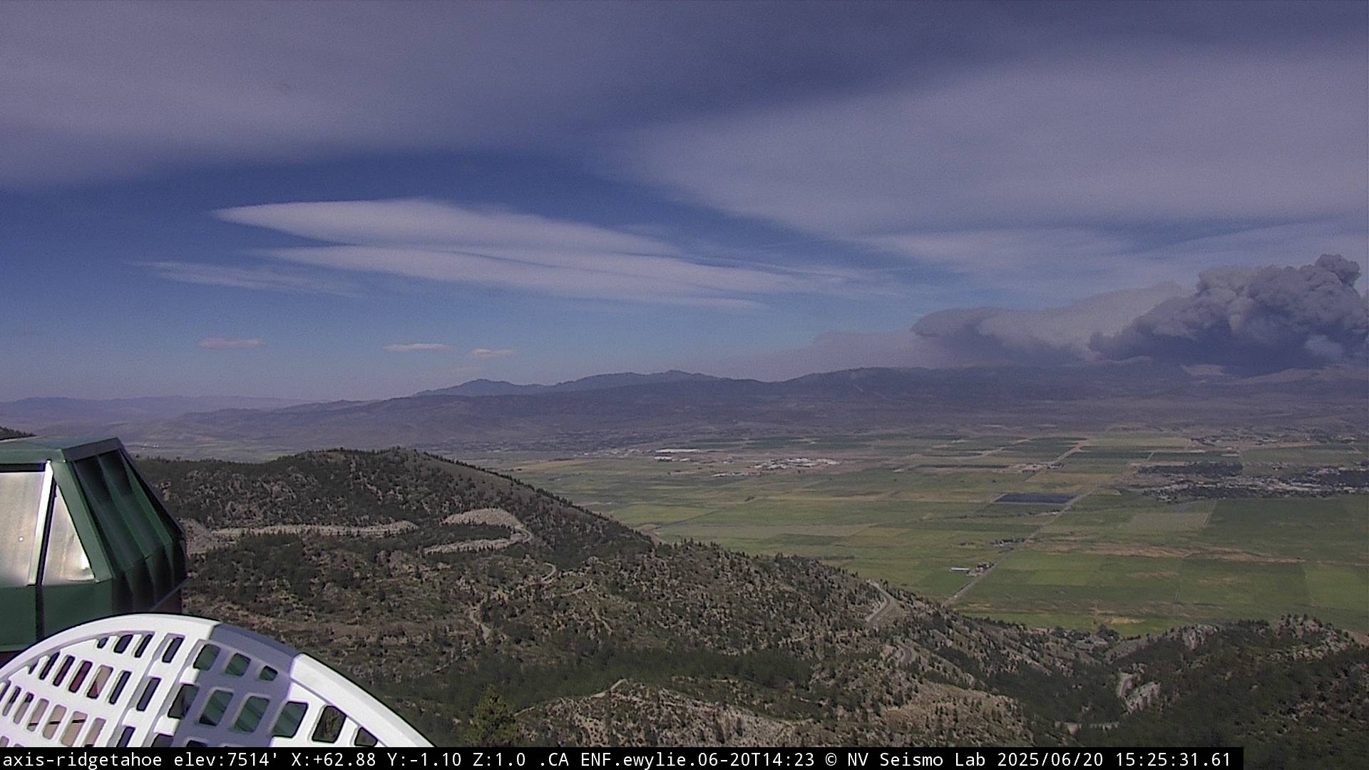
Webcam link: ALERTWest - Minden
Agency Website:
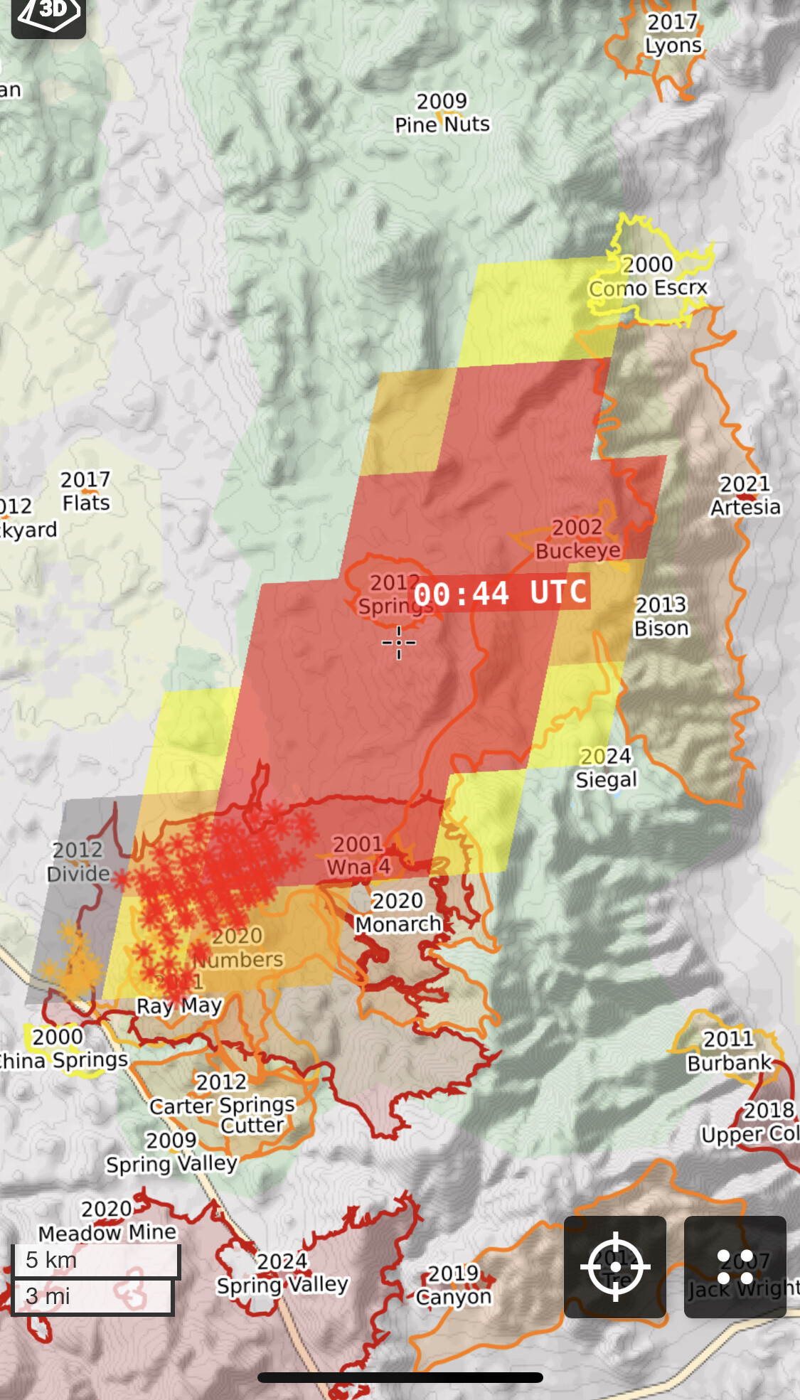
200 acres partially within the perimeter of the Numbers Fire (2020). Aircraft ordered.
300 acres into Juniper. Request for Three Type 3 Engines to Pine Nut Road and Out-R-Way.
T01 and CF T88 & T89 assigned
Reloading out of Stead
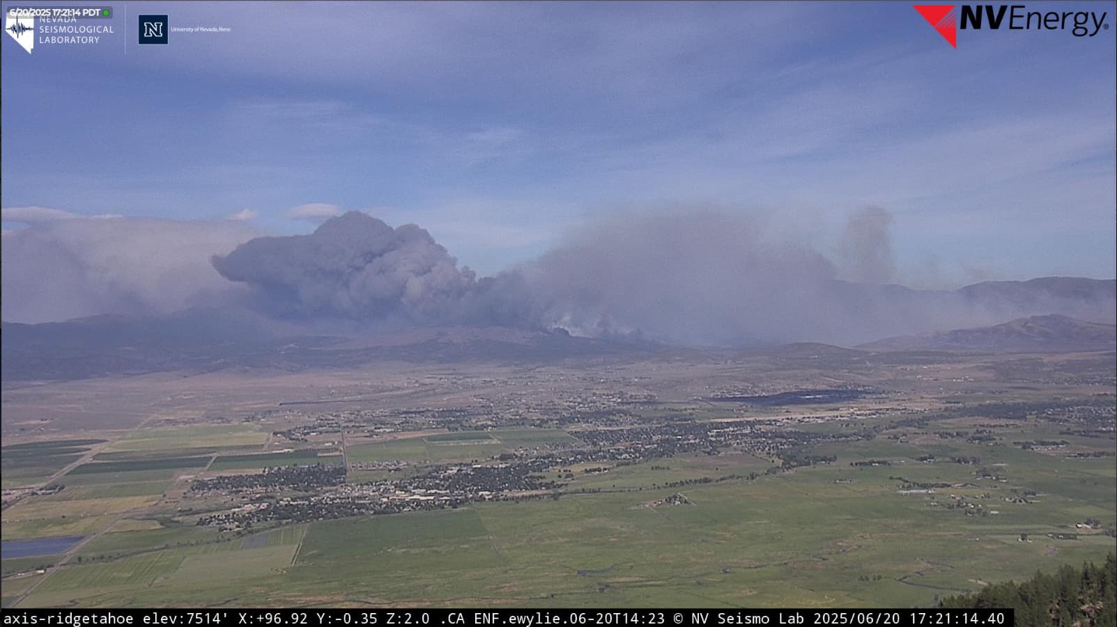
Per Air Attack, now estimate 950-1000 acres. Left flank looks good. Still active burning on right flank. 3 helicopters, numerous SEATS, air tankers working it.
Correction, Per IC, incident size is 2000-2500 acres. Great Basin Type 3 IMT ordered. In-briefing tonight at 1800 hours.
Not sure how bad winds are in Gardnerville, but big Waste Management cans getting blown around in Reno.
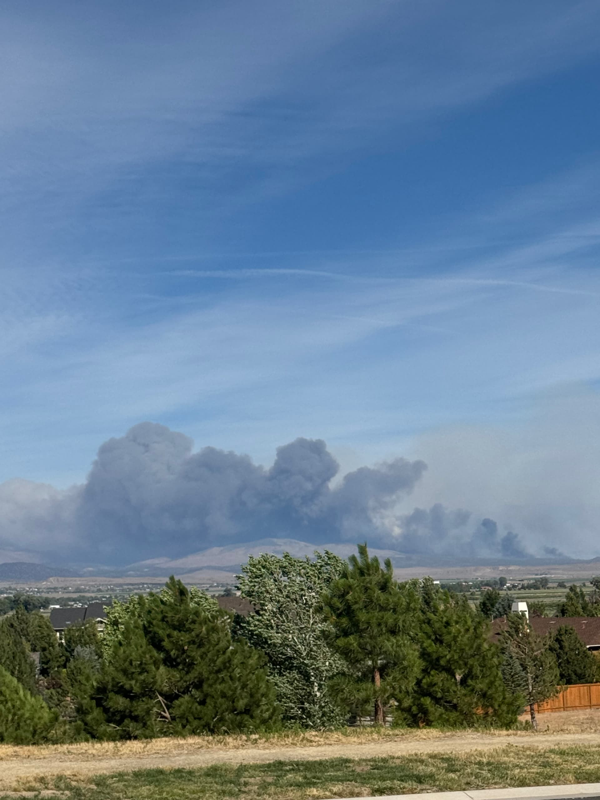
Couple other camera views:
I think the fire is now largely in the Bison Fire (24,000 Acres 2013) scare.
It might be loosing a tiny bit of its significant intensity but it might also speed up in the lighter fuels.
Calfire n461df out of porterville is mapping the fire.
13,900 acres
I am not familiar with the area. What is burning there? That is a lot of dense black smoke.
Juniper, Sage Brush and Grass plus with the ROS and wind anything else that was out in front of it.
Here is a streetview from nearby, appears a lot of juniper trees, they can put off black smoke pretty good.