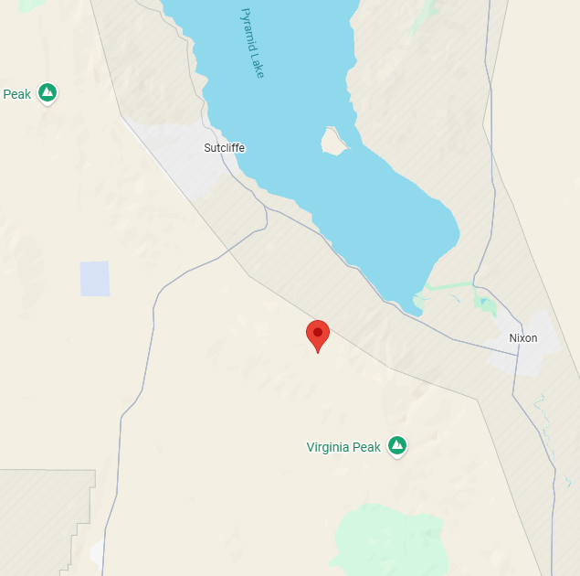
New fire out closer to Pyramid lake (east of Bug, and east of Freds Mt incidents), has tankers dropping on it now. Not sure if its fresh start or ember-cast from yesterday evening’s winds on the Bug/Freds fires? (Below coordinates are from Wildcad)
3 Likes
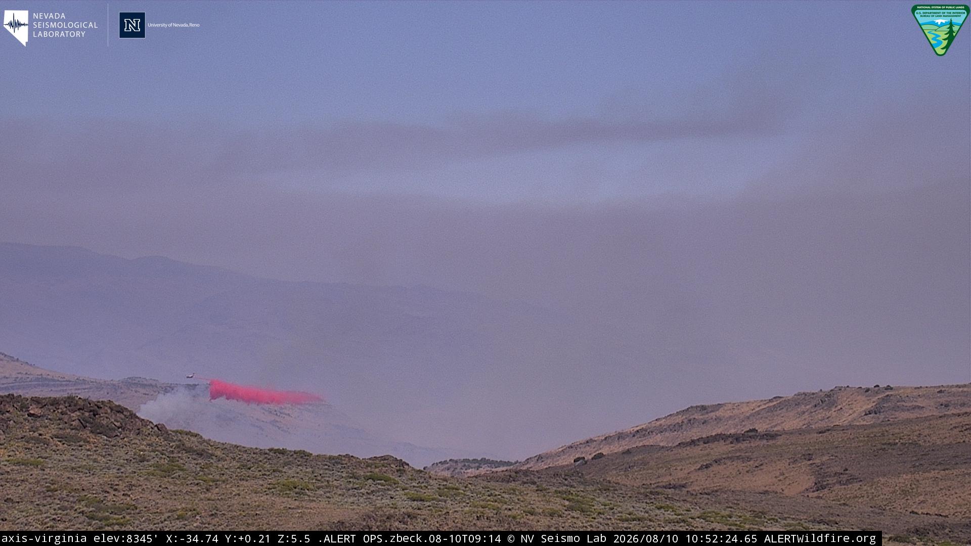
Wildcad now listing this at 1000 acres.
1 Like
Now reported at 20,075 acres per the perimeter uploaded to the National Interagency Fire Center (NIFC). Evac warning area expanded significantly overnight. Virginia Peak camera is offline this morning as well.
1 Like
I’m on duty in Cali but live in Fernely. I see the evacuation zone creeping towards Wadesworth. I would assume it would take a lot for this thing to hop hwy 80 and actually get into Fernely correct?
1 Like
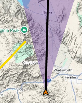
Looking at perimeter map, it looks to generally be north of Virginia Peak, so it has a long way to go to get down to Wadsworth/Fernley. There’s a few ranges to get over and back down, or if it gets down to the hwy 447 corridor on the east side, it would no longer be as terrain driven. Winds are “supposed” to moderate after today, although potential scattered thunderstorms may be on tap as a wildcard. You might want to keep an eye on Eagle Peak cam, which is just south of I80 and West of Fernley area - currently looking north.
1 Like
Thank you for the information! Yea I’ve been watching the cameras while on duty. Was hoping cal fire would send some more resources so I could possibly go. But we have fires going on here..told the wife not to worry to much because of how much it would take to cross the 80. But I just wanted to ask to double check
1 Like
Reach 85 on top of virginia peak
1 Like

1 Like
Tell them to plug the Virginia Peak camera back in while they’re there. 
2 Likes
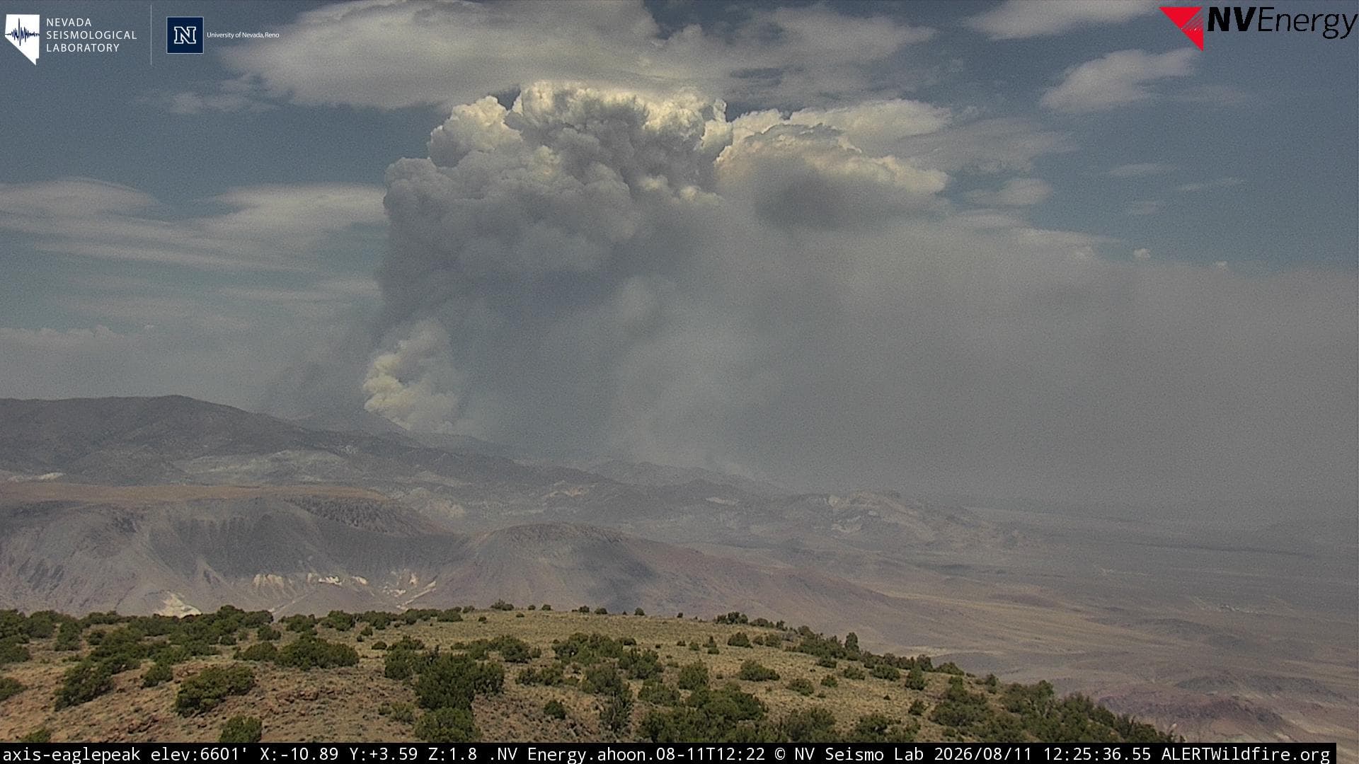
I haven’t driven out there towards pyramid lake since I’ve moved to Fernely. How’s the vegetation out there? Because I know some areas in Fernely vegetation is very sparse. By the looks of the column building I would guess not much fire history in that are?
1 Like
I haven’t been out there for a few years, but it seems like it’s pretty sparse down by the highways in the flatlands. As you get higher up, there’s more brush, sage, and pinion - but a lot of those hills look pretty sparse from the distance (as I recall…).
1 Like
Two DC10’s T910 & 912 dropping on Stallion fire, along w/ C130 and others. Full airshow. Also, the tribe has shut down Pyramid Lake to boating and super scoopers are using the lake for water fills. They seem to be dropping on the north side of Bug fire.
2 Likes
Sounds like Bug, Fred Mountain, and Stallion incidents are now combined and will be managed by Southwest Area Incident Management Team 1, which assumed command this morning.
3 Likes
Did they change evacuation orders? Wadesworth isn’t under evacuation anymore per the watch duty app?
2 Likes
Yeah, the wadsworth thing was a get ready notice, they seem to have dropped that section. They’re still showing 0% containment, but based on the smoke production now vs. this morning, it seems that may be conservative. Not sure if its really zero, or they just haven’t made the evening assessment yet. Anyway, based on the perimeter map there’s a section that’s right up against the Lake so that ought to be good for a couple of %%'s. 
1 Like
Stallion Fire reported at 33,426.4 aces and 0% by incident command this morning. Not a lot of smoke showing there yet on the webcams, winds are relatively calm this morning. There are four super-scoopers flying Stallion right now.
4 Likes