State ID: NV
3 letter designator: MFX
Fire name: Petrilla
Location: 170 Cheyenne Way, Reno, NV
Reported acres:
Rate of spread:
Report on Conditions:
Structure threat:
Resources: AA-0CP B312 B3362 B411 BC 13 H-405 T-839
Hazards:
Weather:
Radio channels:
Scanner link:
Webcam link: ALERTWildfire | Tahoe
Agency Website:
3 Likes
Rough estimated map for discussion and reference. Not for tactical decision making. Rough acreage estimate 110-125 acres rapid rate of spread, info not from incident only remote estimates.
Additionally fire is headed directly for this cam. ALERTWildfire | Tahoe
ALERTWildfire | Tahoe RENO CAM
2 Likes
Estimated map update to 175-200 acres. Again for reference and discussion not for tactical use or PIO.
Updated map @1514hrs (300-325acres) https://caltopo.com/p/057A
2 Likes
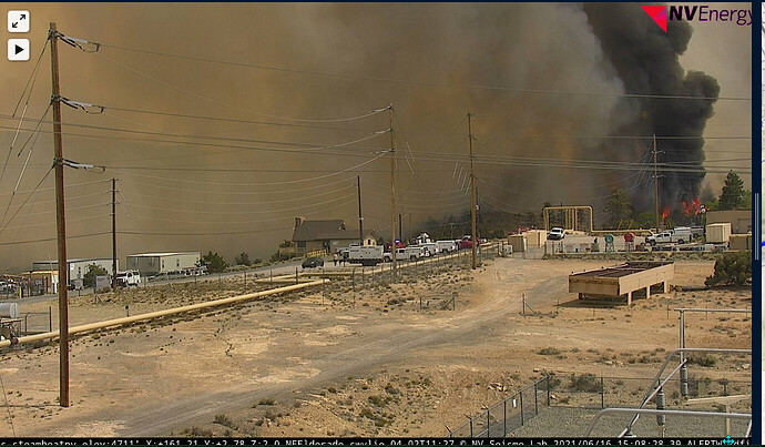
View from the Ormat Steam Plant.
14505 S Virginia St, Reno, NV 89511
Looking South at the head of the fire.
5 Likes
Fire has jumped 580 and is burning actively on east and west sides of the hwy. Very rough map acreage 425-450acres
4 Likes
Tankers currently on the fire 839, 861, 828, and 850.
4 Likes
Live Video
2 Likes
Forward progress stopped.
5 Likes
