
Reports are coming in that we lost three of the OR-CA lines.
2 Likes
The intertie has been burned through by this fire for quite some time now but maybe smoke production is a factor that led to it being shut down, or aircraft or ground safety, who knows.
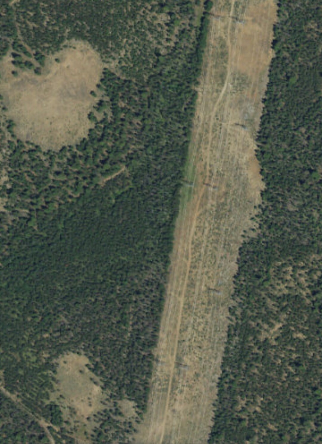
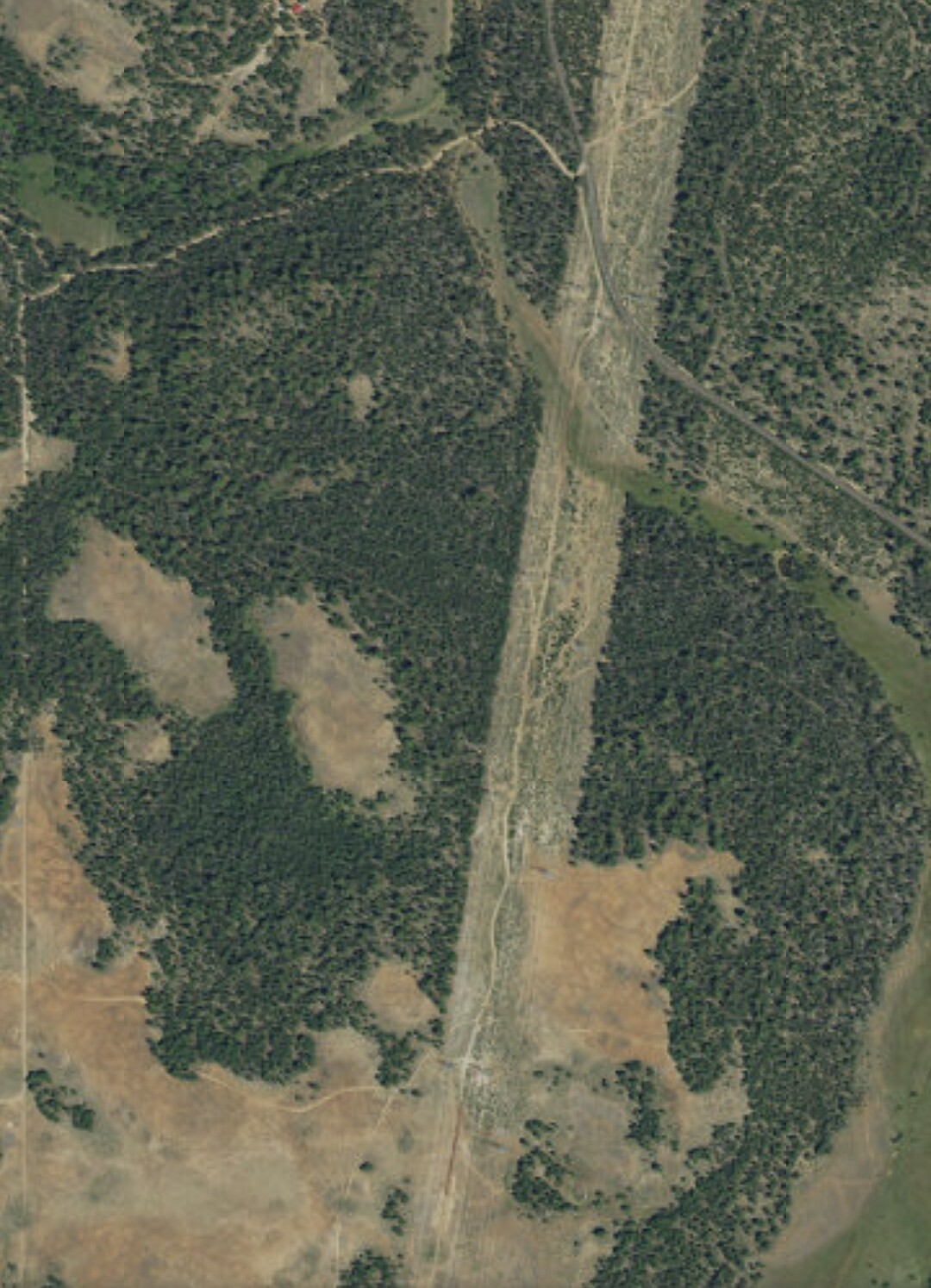
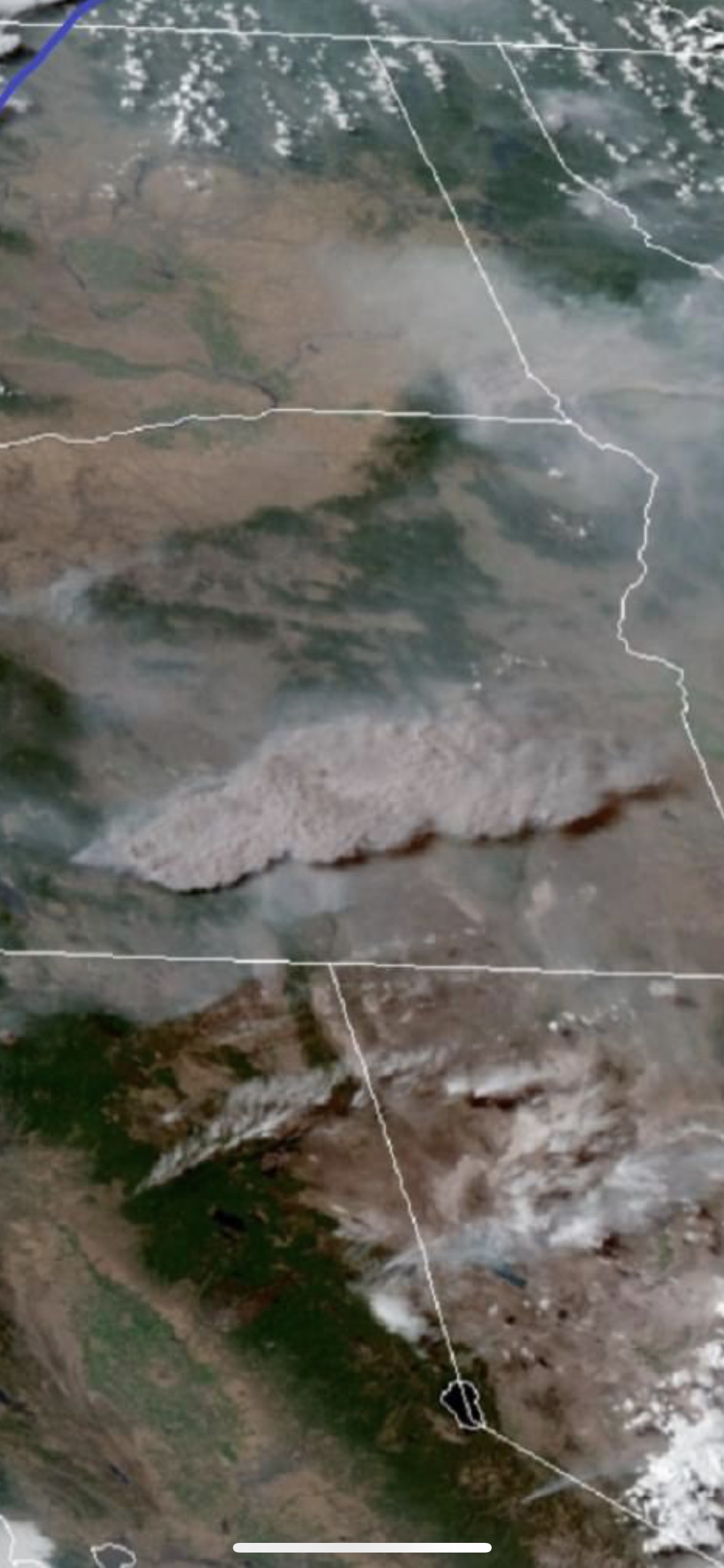
Three 500 kV lines run co-located through the area of the burn; a fourth one goes over and up the I-5 corridor through Oregon. Shown as Malin-Summer Lake in this graphic. A fifth is the pacific HVDC line which runs from the Columbia River to Southern California by way of western Nevada.
Here is a map of the power grid along with a shot of the clear cut that shows how the lines pass through the burn area.

6 Likes
Type 1 Team ordered. Allen
1 Like
I did see in another place that it was thick smoke that tripped the lines out, as expected.
It happened in Dutch Flat some years ago as well The loss of power took out the nearby AAB pumps.
I worked a fire in this area and under these lines years ago, and the power company was out there in among the burning stumps, crawling all over their equipment to inspect quickly and thoroughly, because they apparently wanted very badly to turn it back on.
5 Likes
CA-OES Strike Team 6848C (Type III) enroute per Facebook
Rancho Santa Fe Fire Protection District
Carlsbad Fire
Escondido Fire
Oceanside Fire
San Marcos Fire
https://www.facebook.com/275055138890/posts/10158839586033891/
3 Likes
CA-OES 1890C en route also
Anaheim Fire
Orange City fire
Fullerton fire
Long Beach fire
Laguna Beach fire
5 Likes
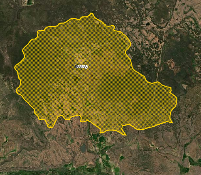
Size update 0% containment with 143,607 acres burned. Fire has crossed into Lake County. Predicting explosive growth potential today.
4 Likes
When those lines are down it’s a million dollars an hour loss
2 Likes
OSFM mobilized additional structural task forces Klamath County. They are from Clackamas, Lane, Marion, Multnomah, & Washington Counties.
In total, 11 Oregon task forces and four California Governor’s Office of Emergency Services strike teams have been mobilized
5 Likes
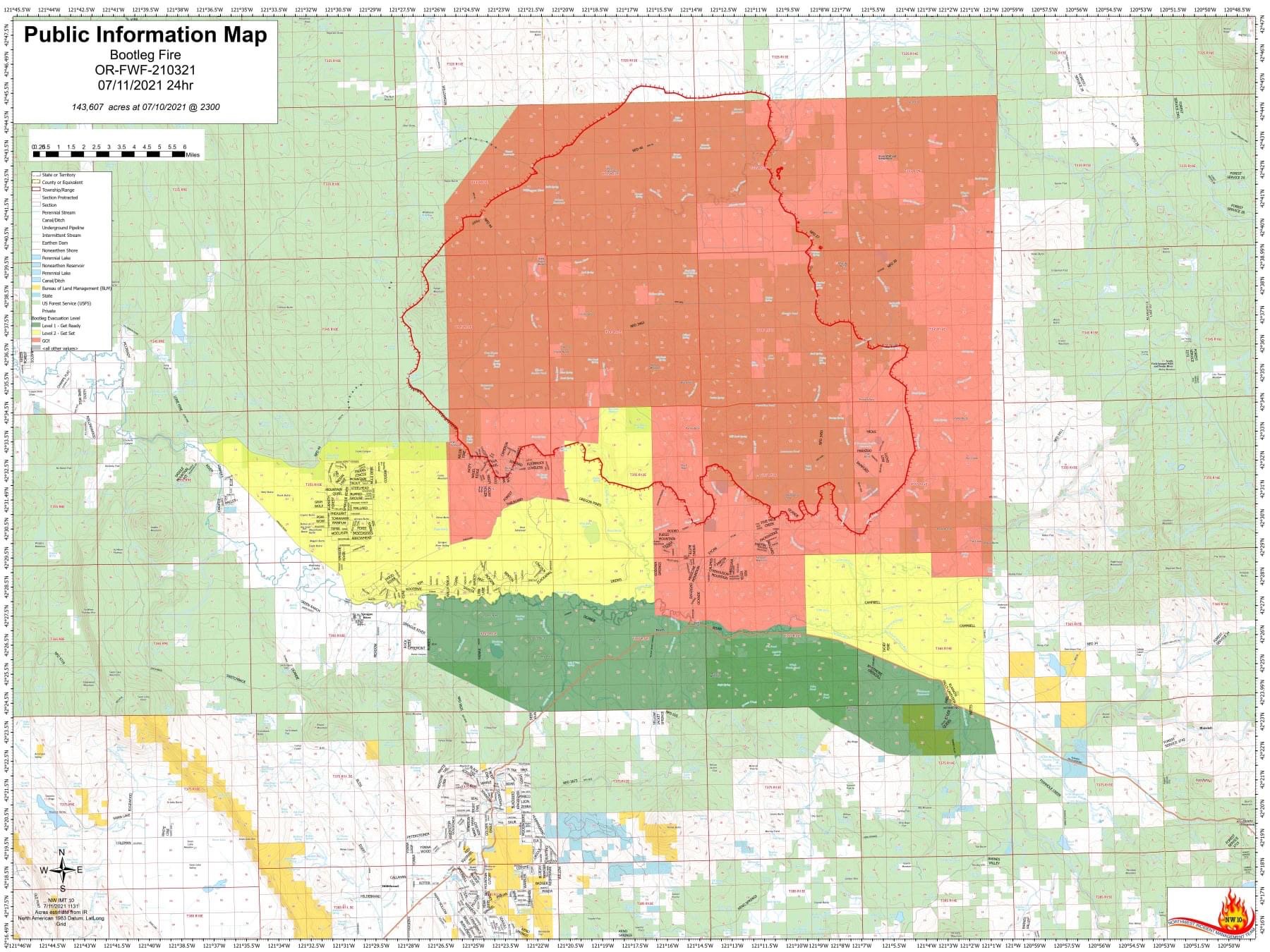
Bootleg. OR-FWF-210321. IMT1, ODF Team 1 (Hessel), NW Team 10 (Lawson) & OSFM Green Team (Lighty). 15 mi NW of Beatty, OR. Start 7/6. Full Suppression. Cause: Unknown. 153,479 acres (+3,472). 0% containment. Extreme fire behavior. Timber and brush. Evacuations in effect. Road closures.IMT1, PNW Team 2 (Allen) is mobilizing with inbrief scheduled for today,7/12 at 1200.
2 Likes
DOES ANYONE HAVE AN IAP OR WHERE TO FIND ONE???
2 Likes
Still working on IAP
2 Likes
The fire has, for the most part, burned past the heavily-timbered portions of the powerline corridor.

7 Likes
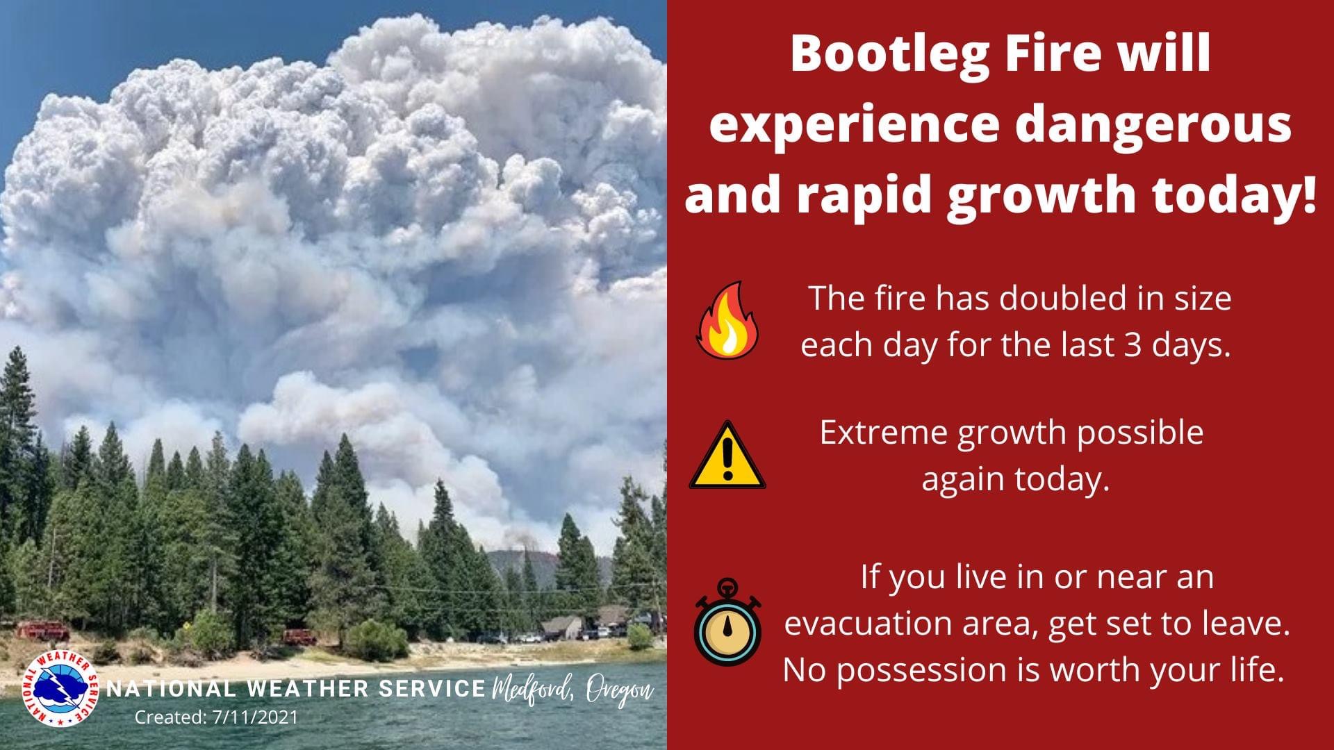
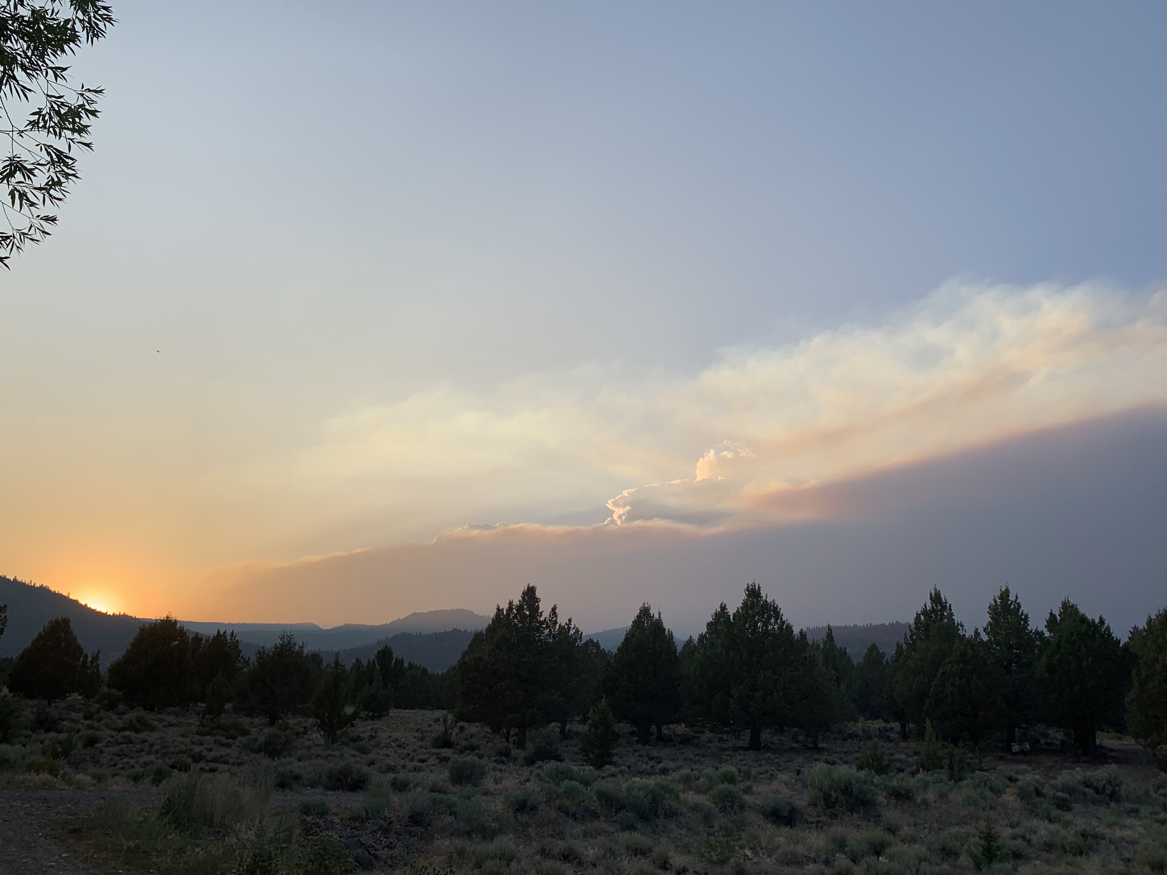
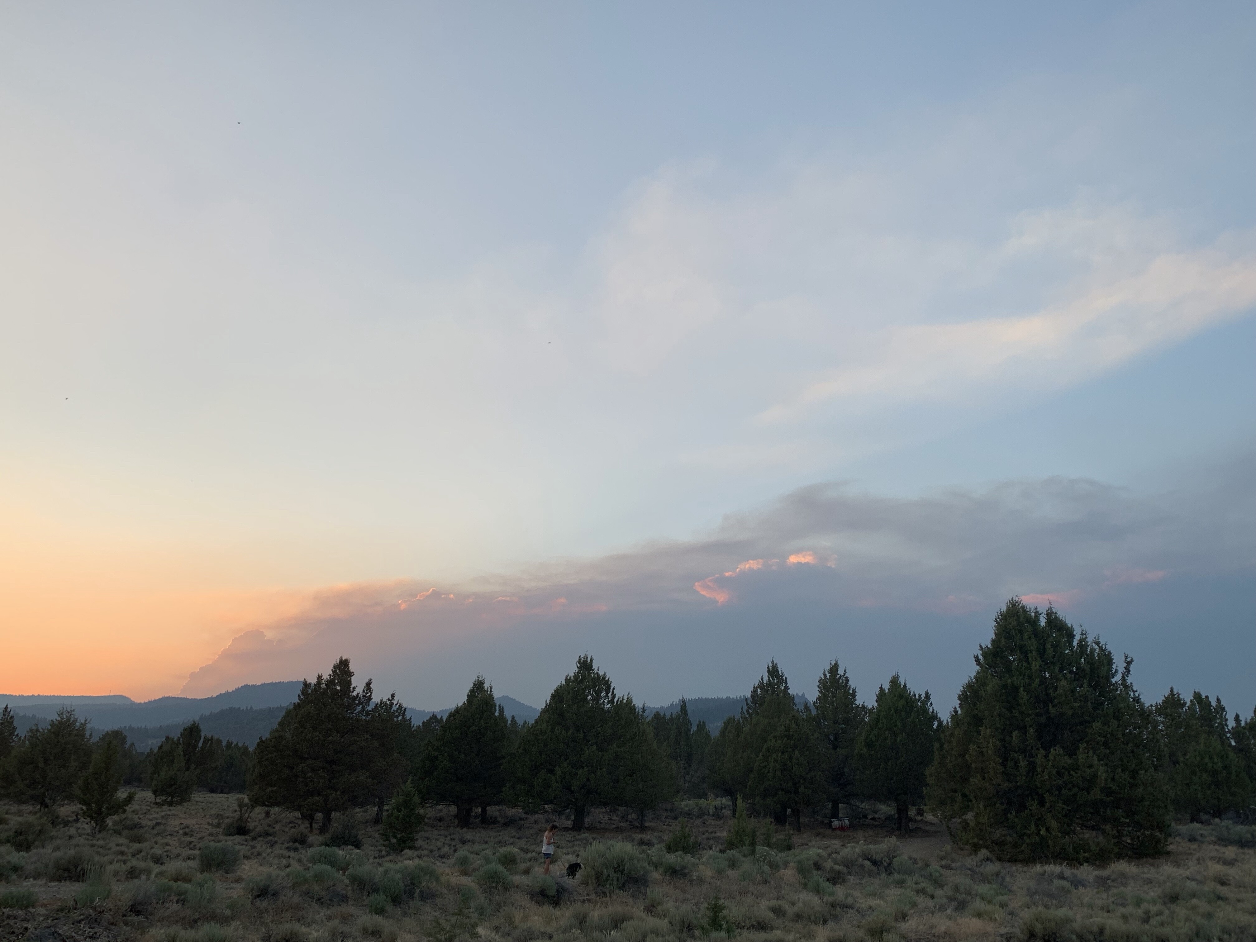
Looks like the Bootleg is making an evening run… these pictures are from near Lakeview on 7/12 at 1930. ~37 miles away. Look behind the evening smoke for tonight’s column…
1 Like
The Lake County Sheriff’s Office is issuing level 1, 2 and 3 evacuation notices.
Level 3 (Go Now):
South of the Sycan River, south of Forest Roads 3239 and 28, and the Gearhart Wilderness west of Forest Road 3372 in Lake County.
Level 2 (Get Set):
Sycan Marsh area, Chocktoot Creek Drainage area, west of Forest Road 28 and east of Forest Road 3372, north of Forest Road 34, and through the area that includes Corral Creek Campground and Mitchell Monument.
Level 1 (Be Ready):
From the northeast at the Lake County line, through the Yamsay Mountain Recreation Area, extending east to the south of Thompson Reservoir to Winter Rim Recreation Area, then south near the Forest Boundary, then following Chewaucan Road south to Forest Road 34.
2 Likes
201,700 acres per the IR. The column was visible from Eagle Lake near Susanville, CA yesterday at sunset.
4 Likes