CA-OES 1890C en route also
Anaheim Fire
Orange City fire
Fullerton fire
Long Beach fire
Laguna Beach fire
CA-OES 1890C en route also
Anaheim Fire
Orange City fire
Fullerton fire
Long Beach fire
Laguna Beach fire
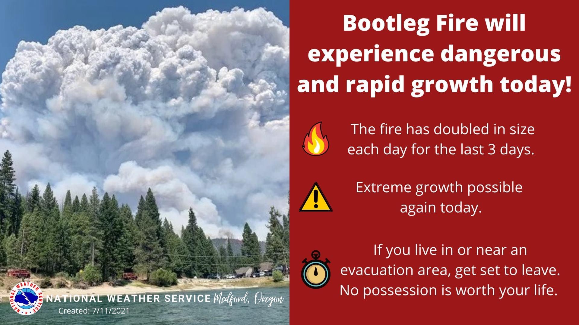
Size update 0% containment with 143,607 acres burned. Fire has crossed into Lake County. Predicting explosive growth potential today.
When those lines are down it’s a million dollars an hour loss
OSFM mobilized additional structural task forces Klamath County. They are from Clackamas, Lane, Marion, Multnomah, & Washington Counties.
In total, 11 Oregon task forces and four California Governor’s Office of Emergency Services strike teams have been mobilized
Bootleg. OR-FWF-210321. IMT1, ODF Team 1 (Hessel), NW Team 10 (Lawson) & OSFM Green Team (Lighty). 15 mi NW of Beatty, OR. Start 7/6. Full Suppression. Cause: Unknown. 153,479 acres (+3,472). 0% containment. Extreme fire behavior. Timber and brush. Evacuations in effect. Road closures.IMT1, PNW Team 2 (Allen) is mobilizing with inbrief scheduled for today,7/12 at 1200.
DOES ANYONE HAVE AN IAP OR WHERE TO FIND ONE???
Still working on IAP
The fire has, for the most part, burned past the heavily-timbered portions of the powerline corridor.
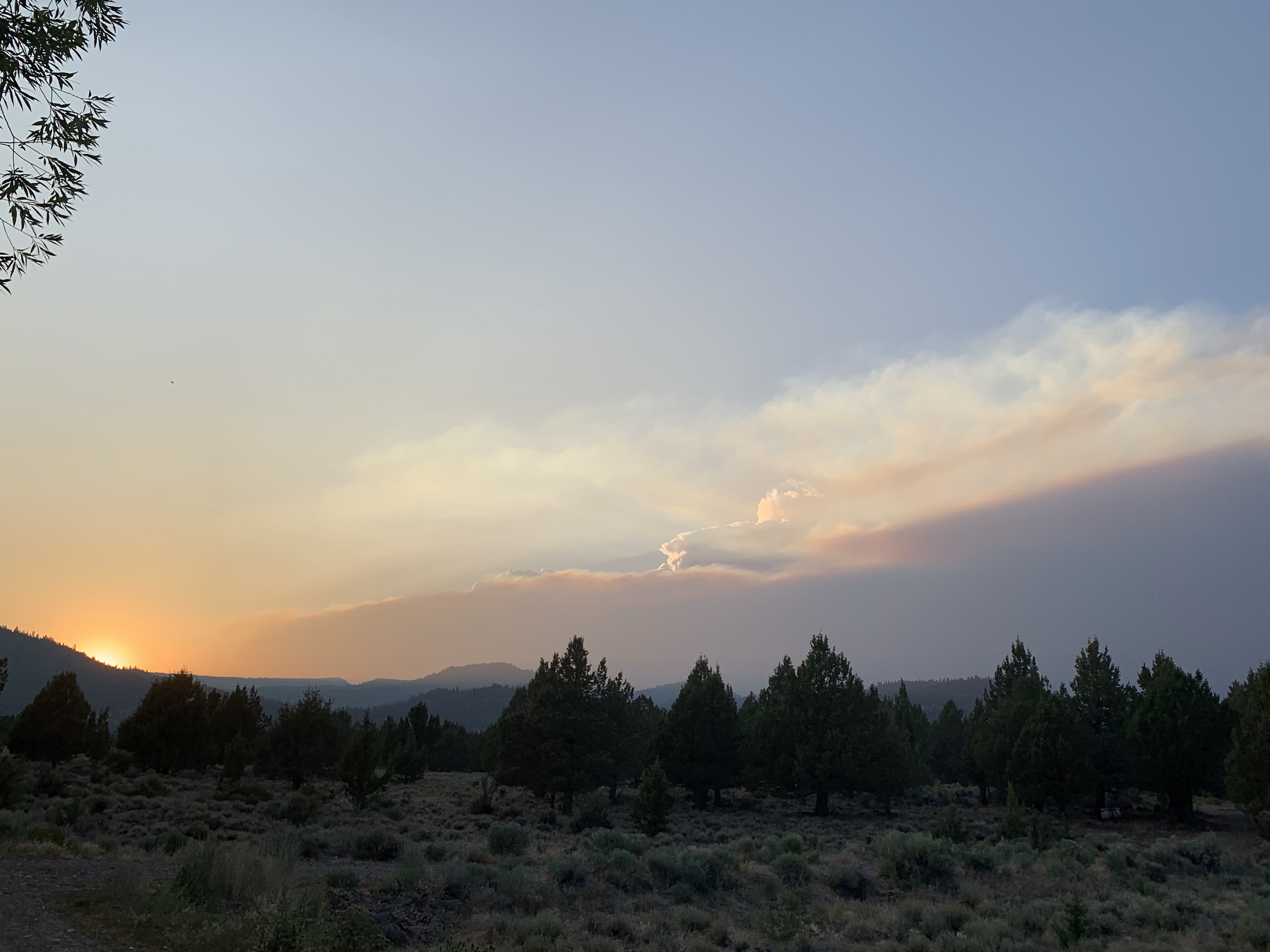
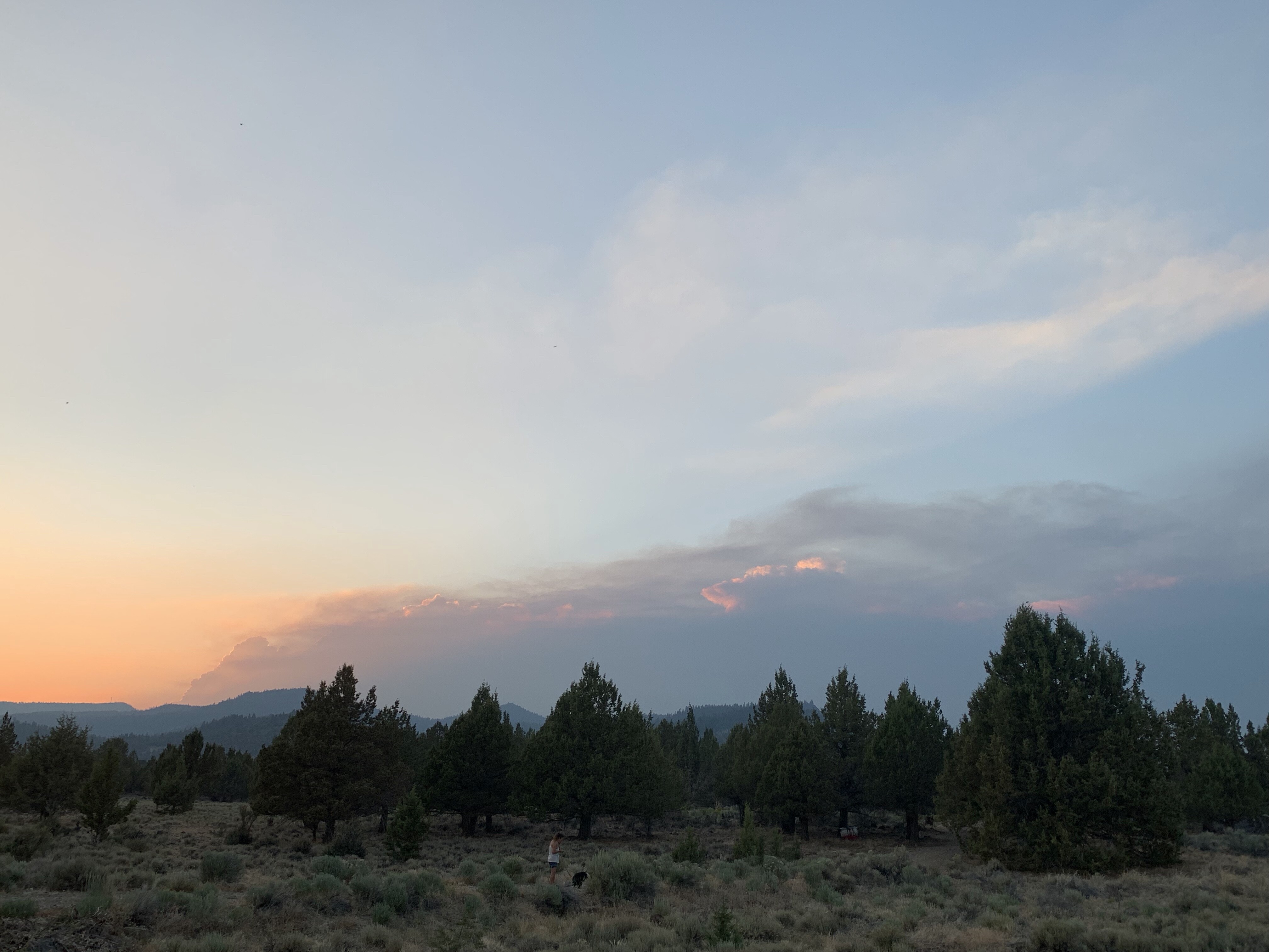
Looks like the Bootleg is making an evening run… these pictures are from near Lakeview on 7/12 at 1930. ~37 miles away. Look behind the evening smoke for tonight’s column…
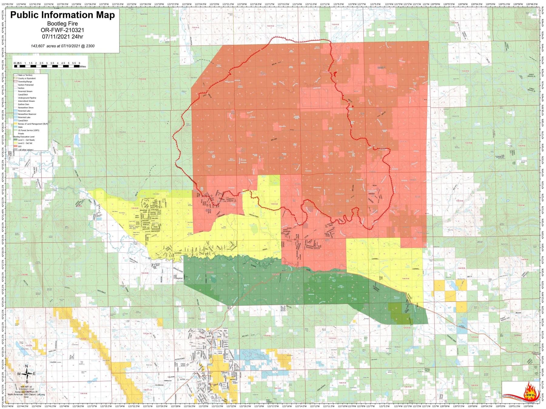
The Lake County Sheriff’s Office is issuing level 1, 2 and 3 evacuation notices.
Level 3 (Go Now):
South of the Sycan River, south of Forest Roads 3239 and 28, and the Gearhart Wilderness west of Forest Road 3372 in Lake County.
Level 2 (Get Set):
Sycan Marsh area, Chocktoot Creek Drainage area, west of Forest Road 28 and east of Forest Road 3372, north of Forest Road 34, and through the area that includes Corral Creek Campground and Mitchell Monument.
Level 1 (Be Ready):
From the northeast at the Lake County line, through the Yamsay Mountain Recreation Area, extending east to the south of Thompson Reservoir to Winter Rim Recreation Area, then south near the Forest Boundary, then following Chewaucan Road south to Forest Road 34.
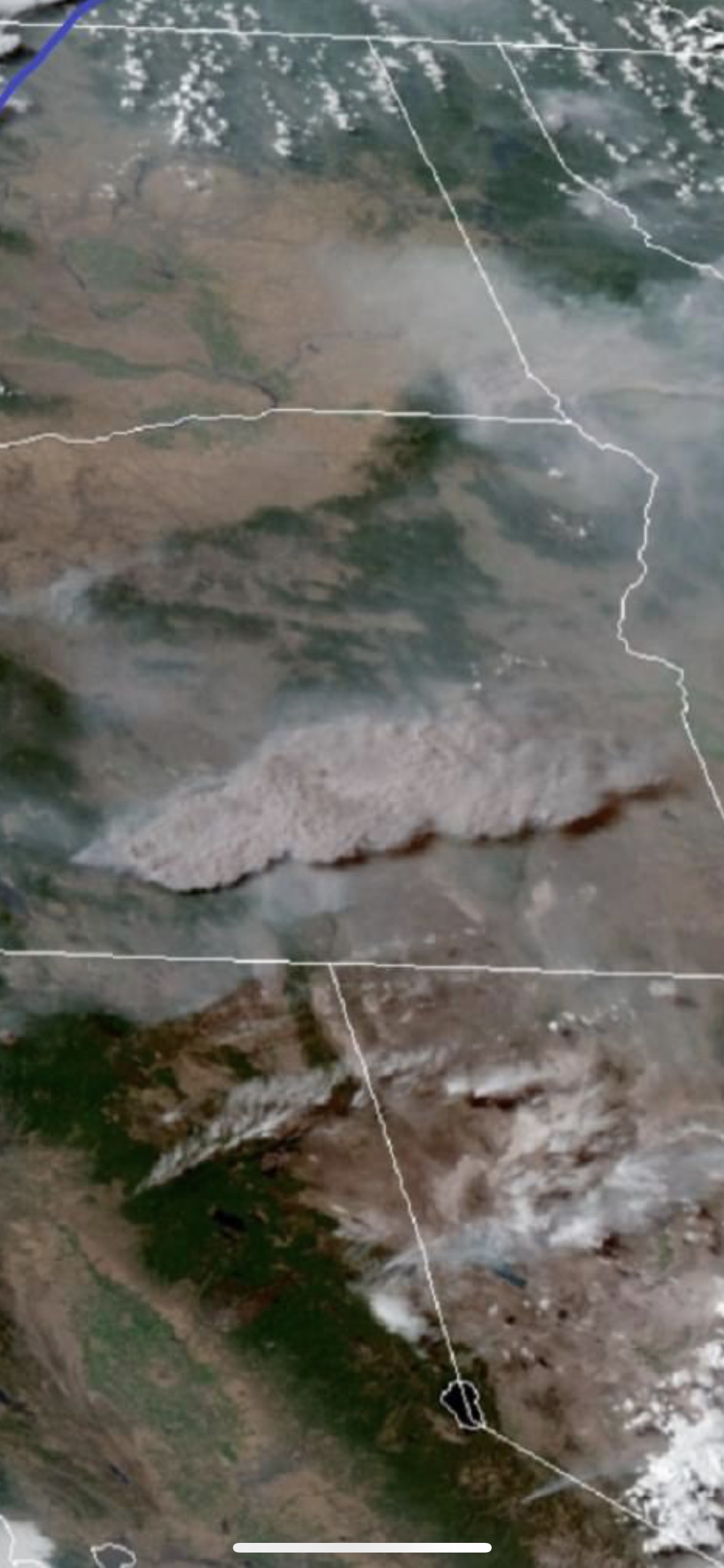
201,700 acres per the IR. The column was visible from Eagle Lake near Susanville, CA yesterday at sunset.
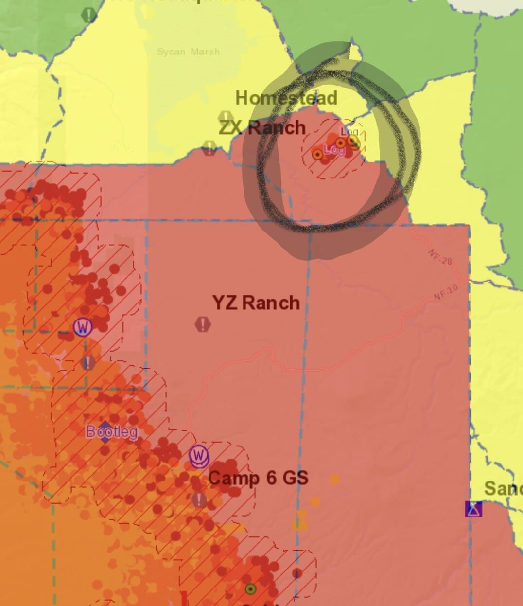
Looks like either a spot or new incident approximately 15 miles NE of the main fire. Approx 120 acres as of 2100 last night.
That fire north of bootleg is the log fire. Estimated at 2800 acres. Post to follow
Log incident created: Log
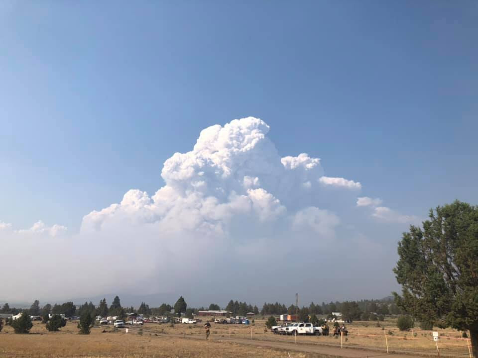
Cool view from my brother’s jet today at approx 1600hrs looking from over the Crater Lake area.

Don’t see that everyday