New evacuation orders for Lake county.
LAKE COUNTY EVACUATION UPDATES
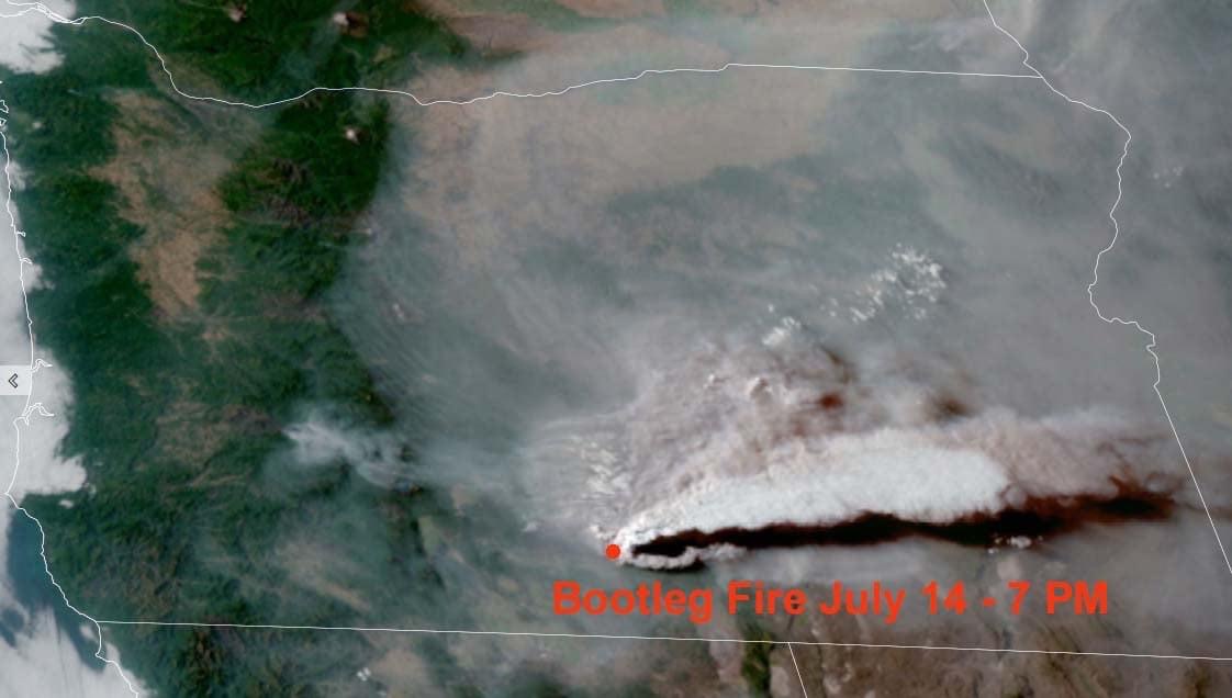
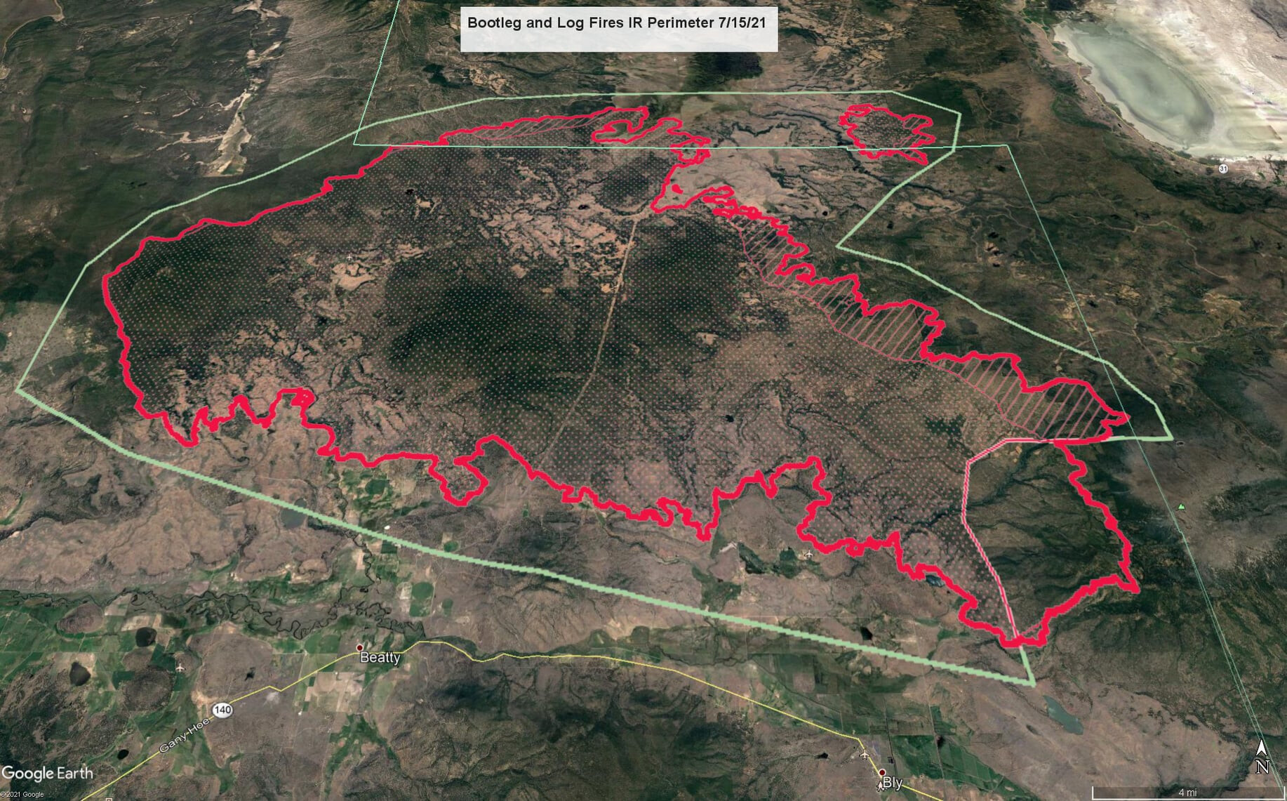
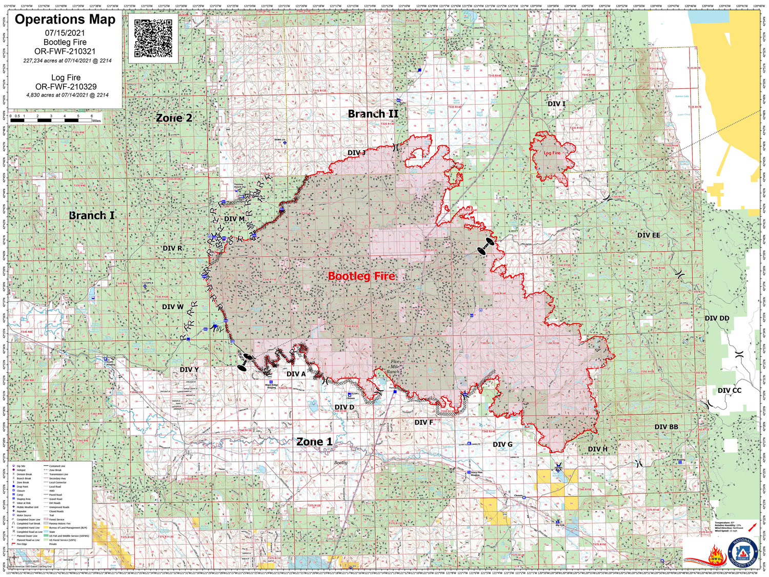
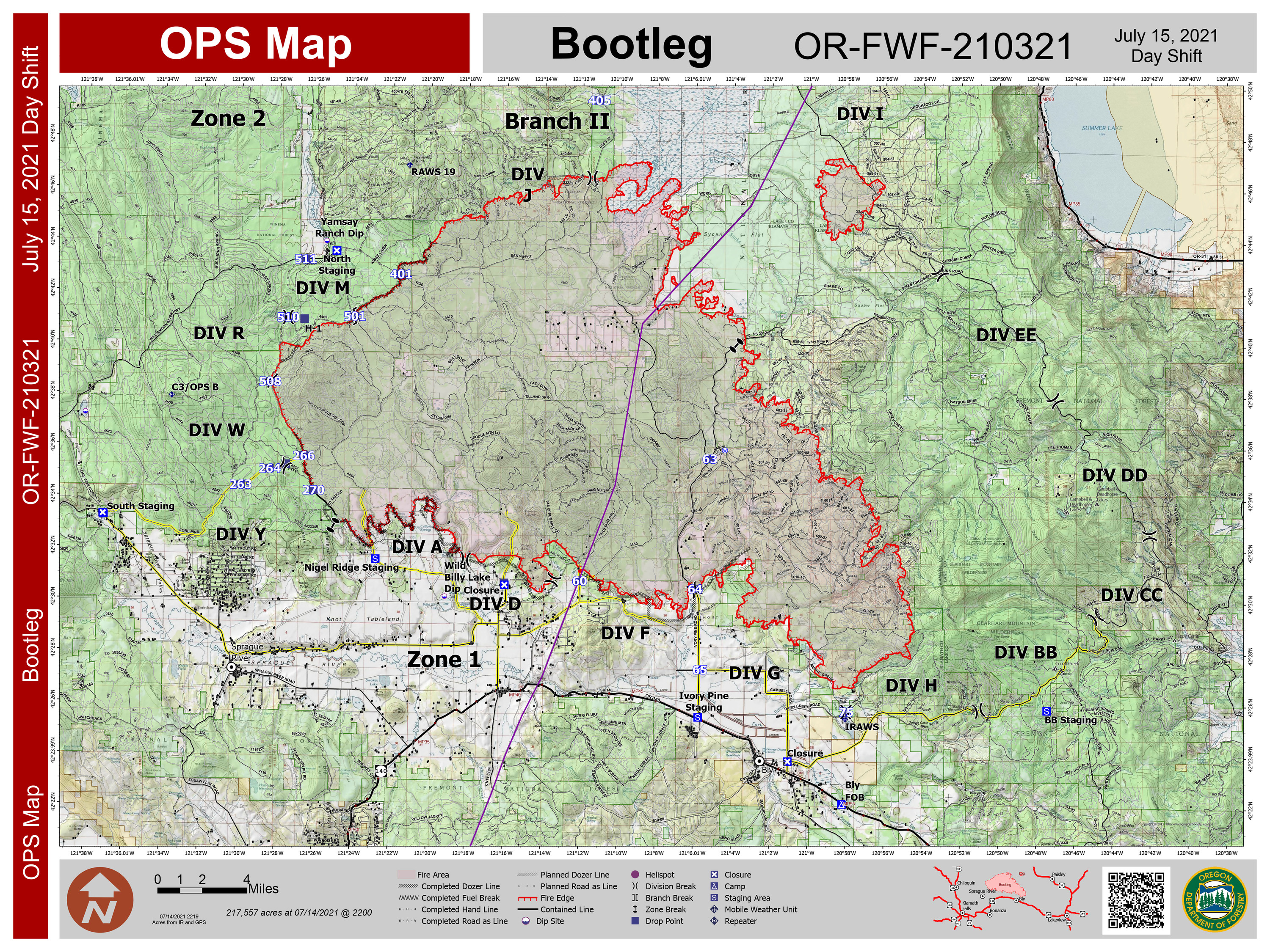
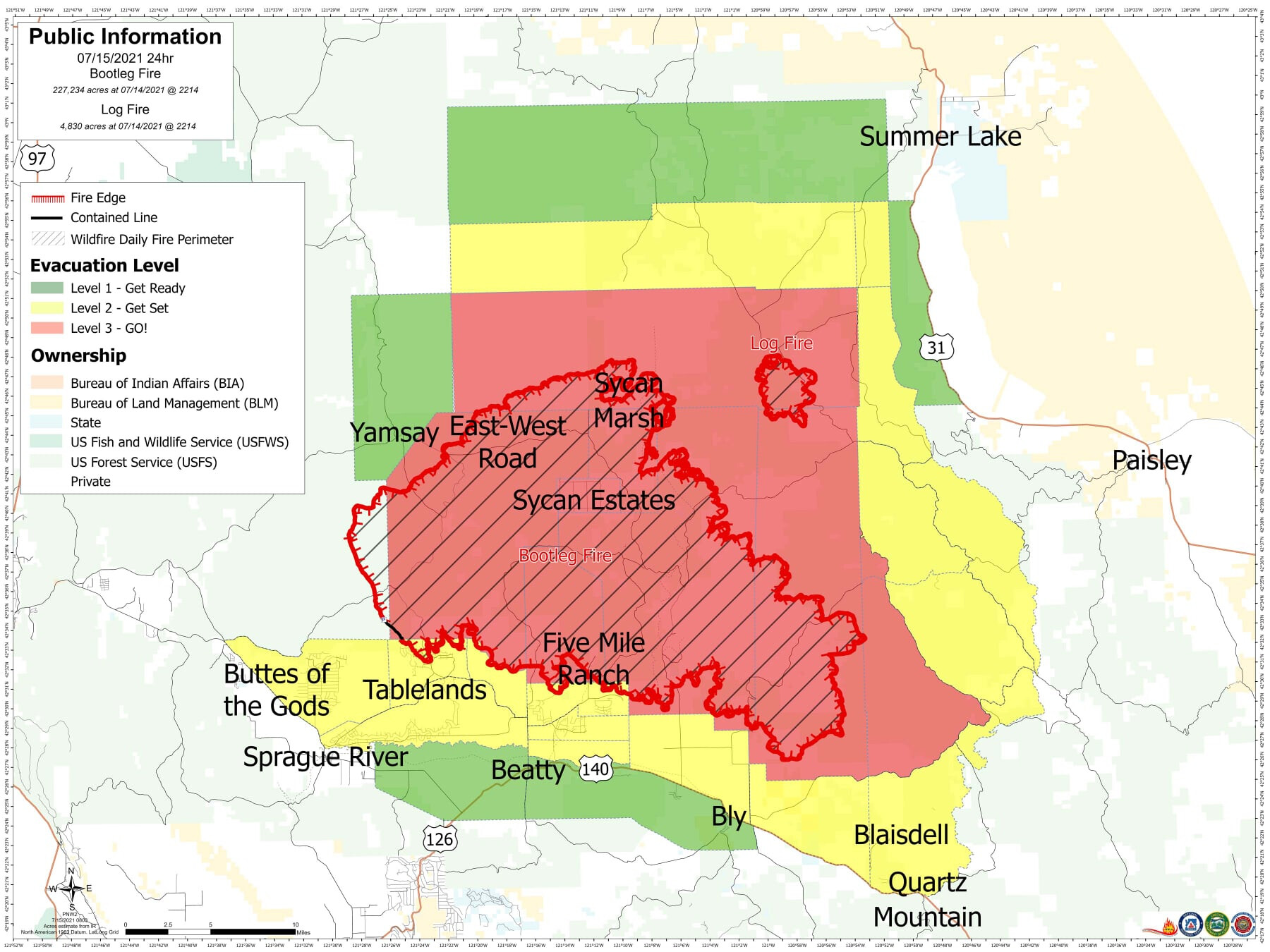
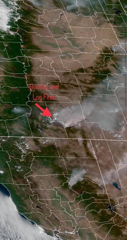
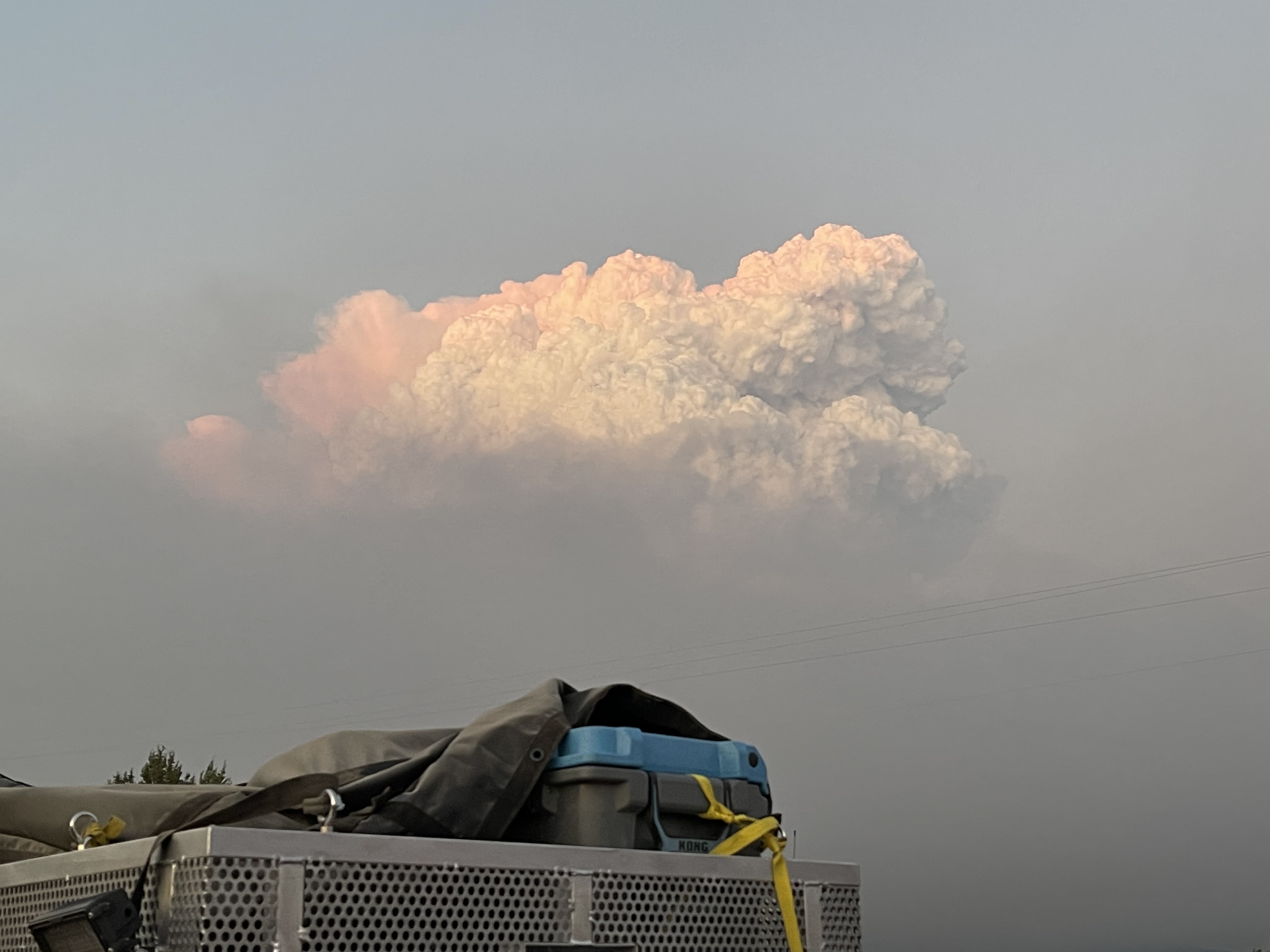
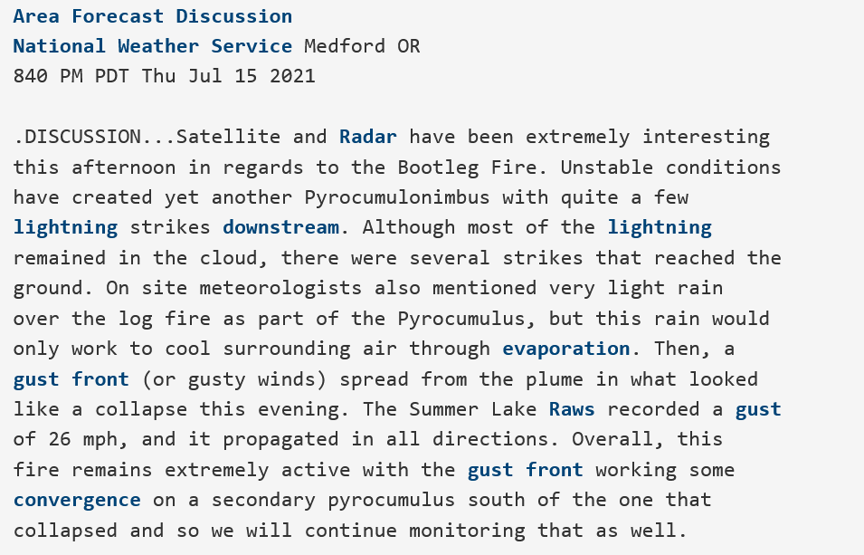
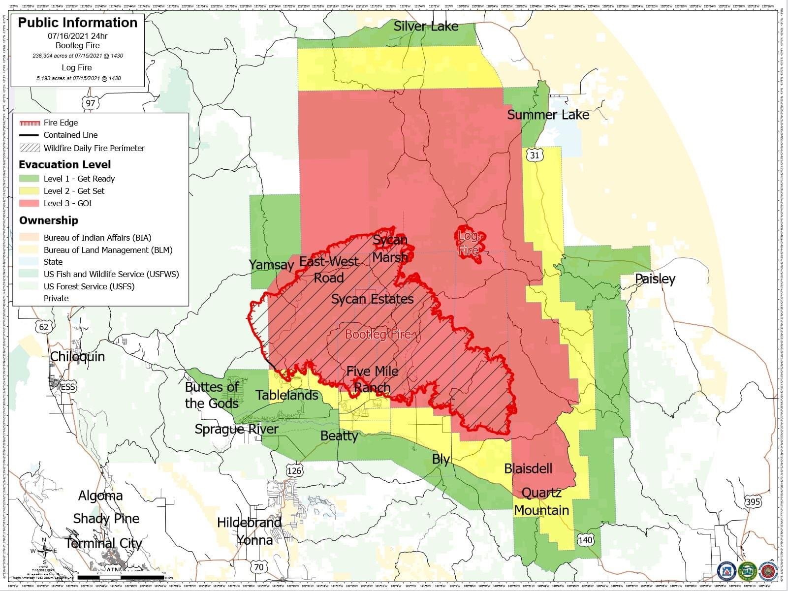
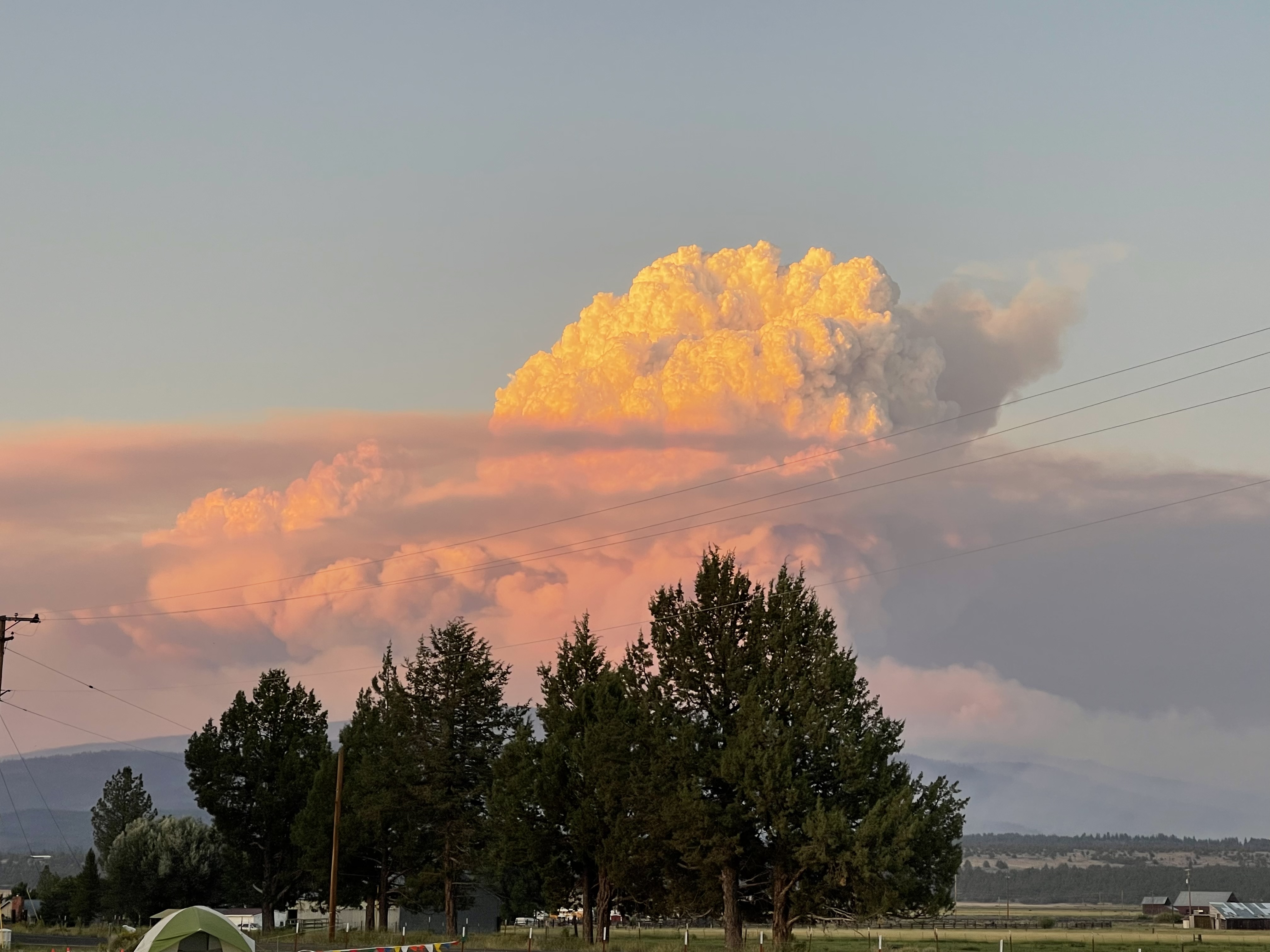
Lakeview, OR – Lake County Emergency Manager Evacuation Updates. Due to increased fire activity on the Log Fire, which is NE of the Bootleg Fire, evacuation zones near Summer Lake are increasing. Also, due to increased fire activity on Bootleg Fire, evacuation zones near the Gearhart Wilderness and the town of Paisley are also increasing. See the link below for an interactive fire map.
Effective Immediately:
Level 3 (Go Now)
• County line on Hwy 140 east to Quartz Mt, following the FS RD 3660 to Corral Crk, north to FS Rd 34, to Deadhorse and Campbell Lakes, Bald Butte to the north of Winter Rim, to Picture Rock Pass, east over Hager Mt, county line at Coffee Pot Spring.
Level 2 (Get Set)
• From county line near Mitchell Monument south to Hwy 140, running along Hwy 140 east to Quartz Mountain and northeast to Dairy Creek CG, then north to Government Harvey Junction, north on FS 29 Rd to Hwy 31 again encompassing the west shore of Summer Lake and stopping 2 miles short of ODFW headquarters on Hwy 31, then west across Thompson Reservoir to the County line.
Level 1 (Be Ready)
• West of Hwy 140.
Level 1 – Be Ready Residents should be aware of the danger that exists in their area, monitor emergency services websites and local media outlets for information.
This is the time for preparation and precautionary movement of persons with special needs, mobile property, and (under certain circumstances) pets and livestock.
If conditions worsen, emergency services personnel will make every attempt to contact you. You may be contacted via the emergency notifications system.
Evacuation shelters are located at the following locations: Klamath County Fairgrounds, La Pine Middle School, and a shelter will be available later tonight at the Daly Middle School Auditorium (220 South H ST)
Area residents and Forest visitors are asked to avoid the fire area and related roads while suppression activities continue. Anyone driving in the area should watch for increased traffic and vehicles associated with wildland firefighting.
https://kcgis.maps.arcgis.com/apps/webappviewer/index.html?id=4bfb02b41eb7473ca95b04c3cbd1da21