State ID: OR
3 letter designator: LAD
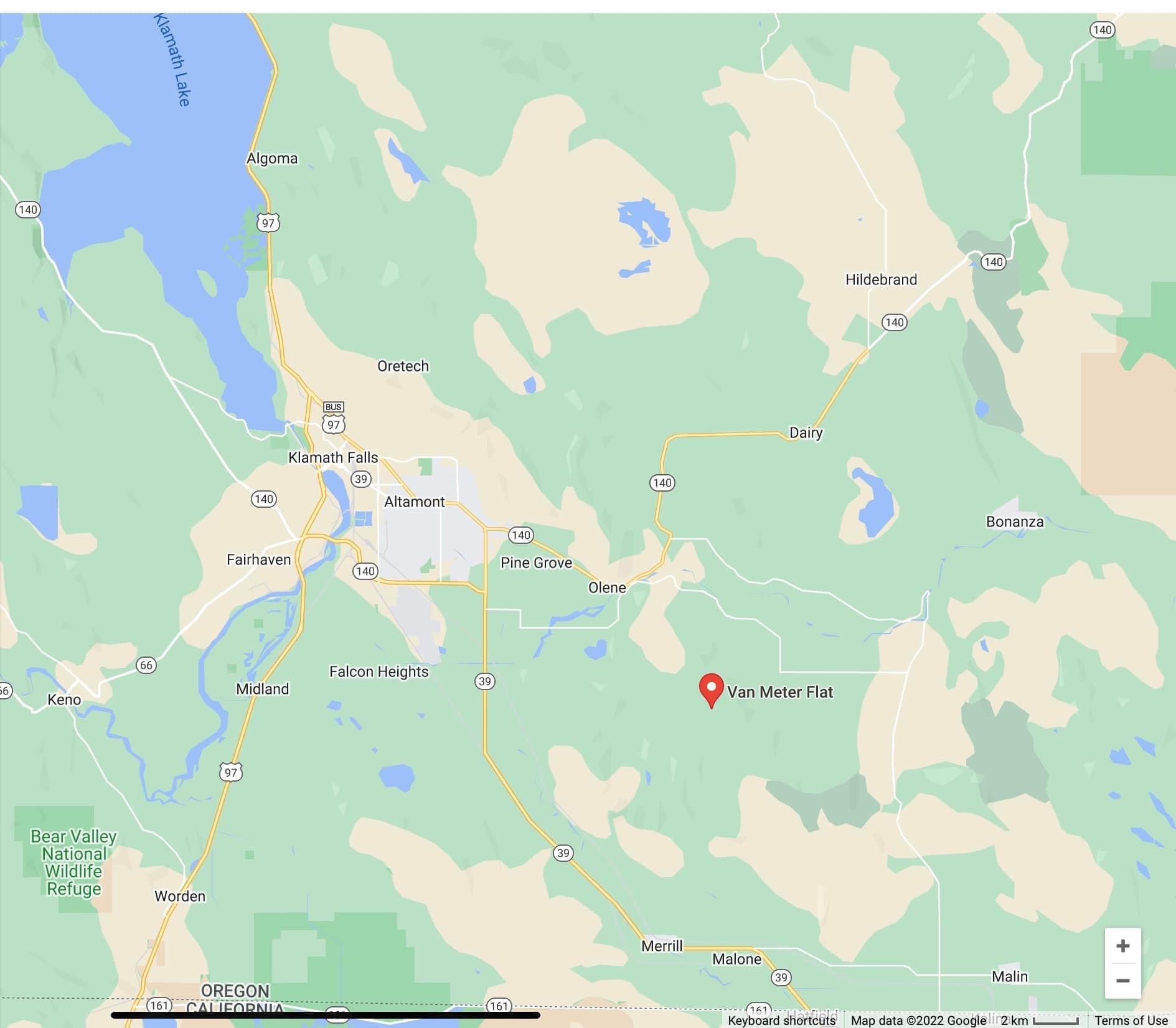
Fire name: Van Meter
Location: 20 miles Southeast of Klamath Falls
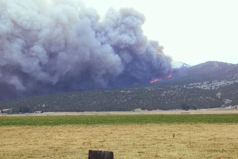
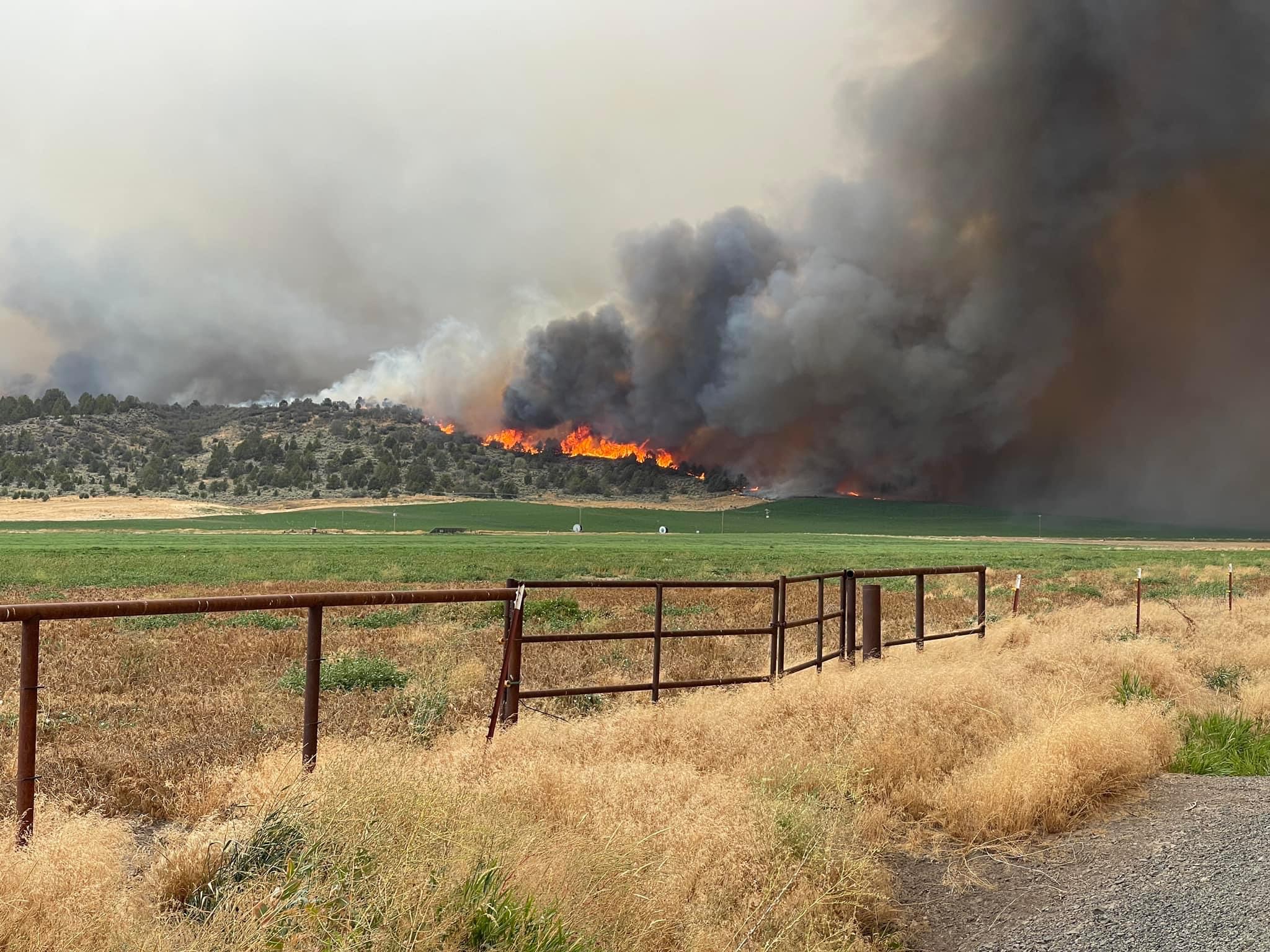
Reported acres: 800-1000
Rate of spread: Rapid
Report on Conditions: RROS in grass, brush and timber
Structure threat: multiple structures threatened
Resources:
Hazards:
Weather: Temp 91°, RH 15%, Winds 16mph
Radio channels:
Scanner link: Klamath County Public Safety
Webcam link: ALERT Wildfire
Agency Website:
2 Likes
Two task forces en route immediate need from Central Oregon and Rogue Valley through OSFM
Evacuations have been issued:
-Level 3 (Go): Crystal Springs Rd east of Hill Rd. So. Poe Valley Rd from Crystal Springs Rd to Weber Rd.
- Level 1 (Ready): Harpold Rd west to Hill Rd and north of Taylor Rd, just north of the town Merrill.
2 Likes
Lead 63 and multiple SEATs over the fire
Two LAT en route to the fire also
2 Likes
ODF Team 3 on alert
4 Likes
Update as of 11:30PM
Size : 1,500 - 2,000 acres (estimated)
Containment : n/a
Structures Threatened : 260
Structures Destroyed : 5
Three structural task forces on scene from Jackson, Deschutes, and Lake counties
ODF Team 3 to take the fire mid afternoon today (9/8).
2 Likes
Type 1 team en route to take fire at 1800 today. Not sure what team.
Fire is estimated at 3500 acres.
3 Likes
New evacuations have been ordered:
LEVEL 3 (GO NOW) evacuation for the Dodds Hollow area north of the town of Merrill. This includes all addresses on Patricia Ln, Dodds Hollow Rd, and Pope Rd, north of Taylor Rd.
LEVEL 2 (BE READY)-Crystal Springs Rd E of Hill Rd to S. Poe Valley Rd and S. Poe Valley Rd to Weber Rd. This area was previously a LEVEL 3. LOCAL TRAFFIC ONLY!
2 Likes
1 Like