This thing got out of hand really quickly, I was there and seen what poor tactics and strategies on the north end that lead to the slop across burnt creek.
@Thatguyoutwest do you have an IAP you can attach or have any information about their plan to defend Huntington?
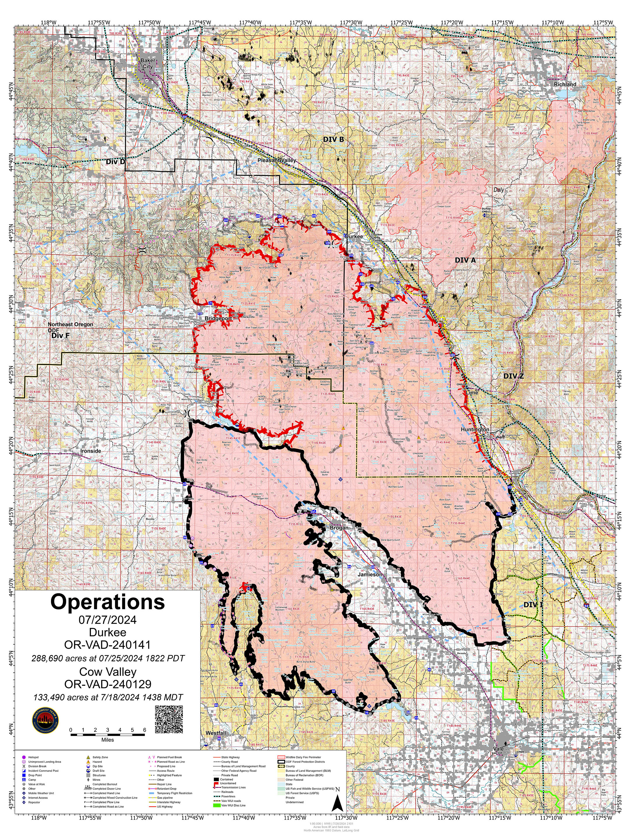
OR-VAD-240141. Unified Command. CIMT NW Team 6/OSFM Green Team. 1 mile W of Durkee, OR. Start 7/17. Full Suppression. Cause: Lightning. 173,759 acres (+28,202). 0% containment. Brush, grass and timber. Extreme fire behavior with wind driven runs, running and short-range spotting. Evacuations in effect. Structures threatened. Road closures.
Cow Valley. OR-VAD-240129. CIMT NW Team 6. 9 miles SE of Ironside, OR. Start 7/11. Full Suppression. Cause: Undetermined. 133,490 acres (+0). 78% containment. Brush and grass. Minimal fire behavior.