State ID: OR
3 letter designator:ODF
Fire name: North River Road
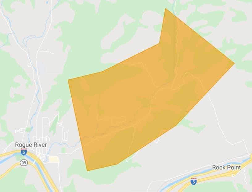
Location: 4300 North River Road
Reported acres: 5 Acres
Rate of spread: Moderate
Report on Conditions: Burning uphill with 7-10mph winds
Structure threat: Yes
Resources: 6601, 6651, 6663, 7401, 7367, 7741, BC 4, ODF, aircraft on order
Hazards:
Weather: Temp 90, Winds 7-10
Radio channels: North County, Tac 3
Scanner link: Jackson County - North County Fire Live Audio Feed
Webcam link: Your Custom Cameras Page | TripCheck - Oregon Traveler Information
Agency Website:
5 Likes
Helicopter 9KB on scene
4 Likes
2nd alarm requested from structural agencies. Units toned- 7308, 7512, 7542, 7541, 7442, 7708, 7741
Helicopter 480 on scene
4 Likes
Additional air resources en route. 43T and 11H
3 Likes
Grants Pass engine 7309 and DC 7352 en route. ODF Ordering additional air resources.
4 Likes
Third alarm assigned. Haven’t heard resources yet.
Staging location in Rogue River. Assigned tac 6 for structure protection.
3 Likes
Updated acreage per ODF, 10 acres not spreading rapidly.
3 Likes
Per AA 11H fire size 30-50 acres
2 Likes

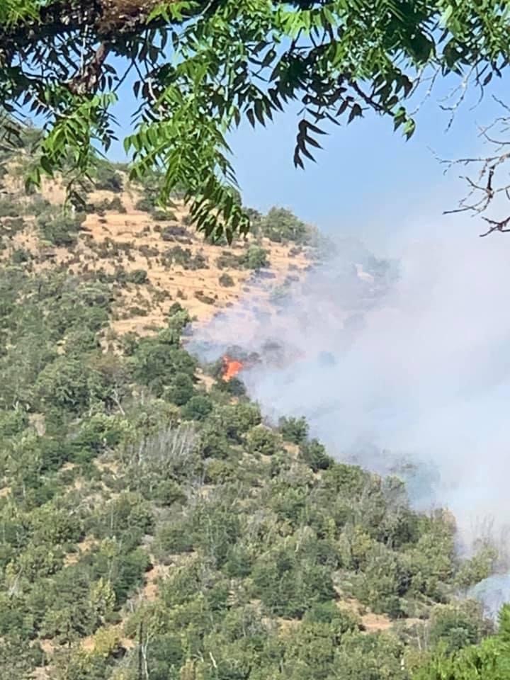
Fire is now estimated to be 40 acres, and crews are holding it despite the wind. The perimeter is 20% lined at this time. Spot fires driven by wind are adding an additional challenge for crews, along with steep terrain, dense brush and limited access.
Additional resources have been ordered for the evening. Medford Fire Department, BLM Oregon & Washington and U.S. Forest Service- Rogue River-Siskiyou National Forest are on scene as well.
2 Likes
Air resources are returning due to night fall.
Structural resources are being demobilized
1 Like
A Level 1 BE READY evacuation notice has been issued for the 1000-3000 blocks of Wards Creek Road, Rogue River and surrounding area due to the N. River Fire.
1 Like
Releasing structural units.
ODF staffing the fire through the night
2 Likes
Overnight progress on the Fire, firefighters were able to line 100% of the perimeter, and begin mop-up operations.
The fire is currently 5% contained, however crews assigned to the incident today will continue to further mop-up efforts while holding the lines. Firefighters were able to GPS map the fire overnight as well, and determined it’s 60 acres in size. The majority of the fire is burning on Bureau of Land Management lands, including the Mountain of the Rogue biking trails; they are currently closed to the public for safety concerns and wildfire operations along the trails.
Additional resources arrived on scene Sunday morning for a change in shift at 8:00 a.m., including three 20-person crews and three contract engines. A type two and type three helicopter are assigned to the fire today and will be doing bucket drops on particularly difficult areas. Forecasted triple digit temperatures are posing a risk for increased fire activity
5 Likes