State ID: OR
3 letter designator: OCF
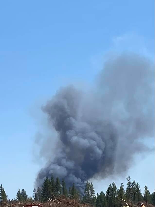
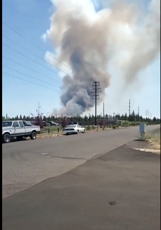
Fire name: DARLENE FIRE
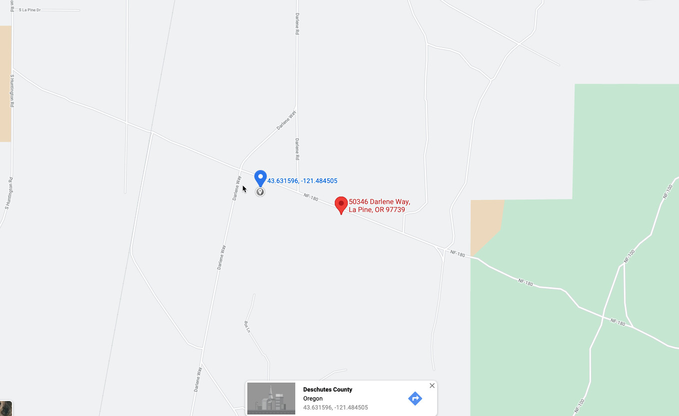
Location: Darlene Road, La Pine, Oregon
Reported acres: 10
Rate of spread:
Report on Conditions:
Structure threat: Yes
Resources: 9502 BC51 C301 D230 D231 D91 E332 E635 E637 E696 E9560 H-407MC OPS32 PT31 T-804
Hazards:
Weather:
Radio channels:
Scanner link: Deschutes and Crook County Fire / EMS
Webcam link:
Agency Website:
3 Likes
Evacuation Level 3 orders being issued, trying to work on area now
3 Likes
Online scanner is down
3 Likes
Engine 231 requested from Sun River Fire
3 Likes
La Pine second alarm on arrival, missed what units this pulled in.
3 Likes
Level three from DCSO-
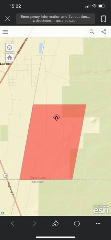
Current LEVEL 3 Evacuation map. West side is at the railroad tracks. South to the Deschutes/Klamath border (almost to 31). The North end doesn’t really have anything to mark it with, but about halfway down Darlene. East up the mountain.

3 Likes
Size 100 acres. Direct attack continuing. Not in unified command with La Pine fire at this point. Multiple structures threatened with evacuations in place.
3 Likes

Bend fire being toned- Engine 231 and 313
3 Likes
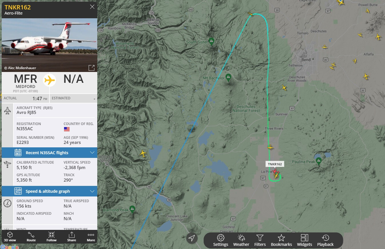
500 acres VLAT requested. All tankers load and return
3 Likes
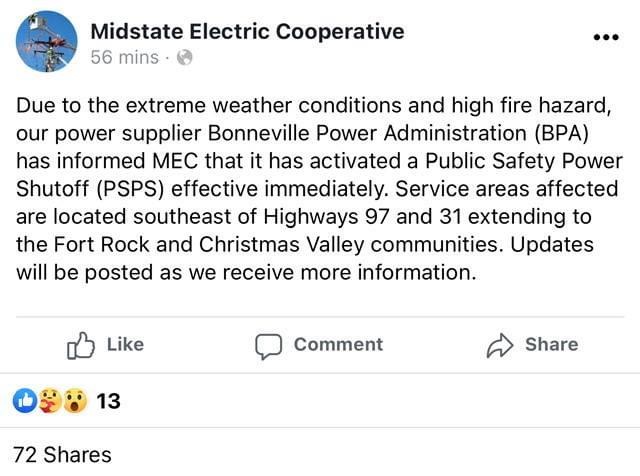
Power being shut off.
4 Likes
Request for task forces. Not sure who is left to fill those.
3 Likes
600 acres. Trying to hold fire west of power lines and north of 31.
3 Likes
Extreme weather conditions? I don’t think it even hit 90 degrees in LaPine today and hardly any wind… 