State ID: OR
3 letter designator:
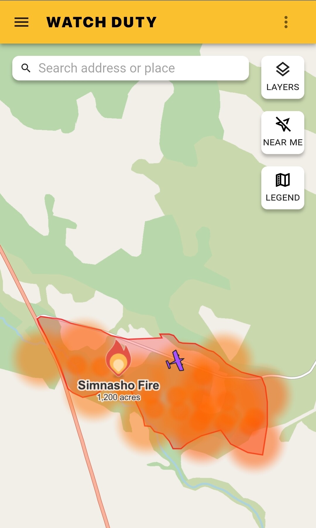
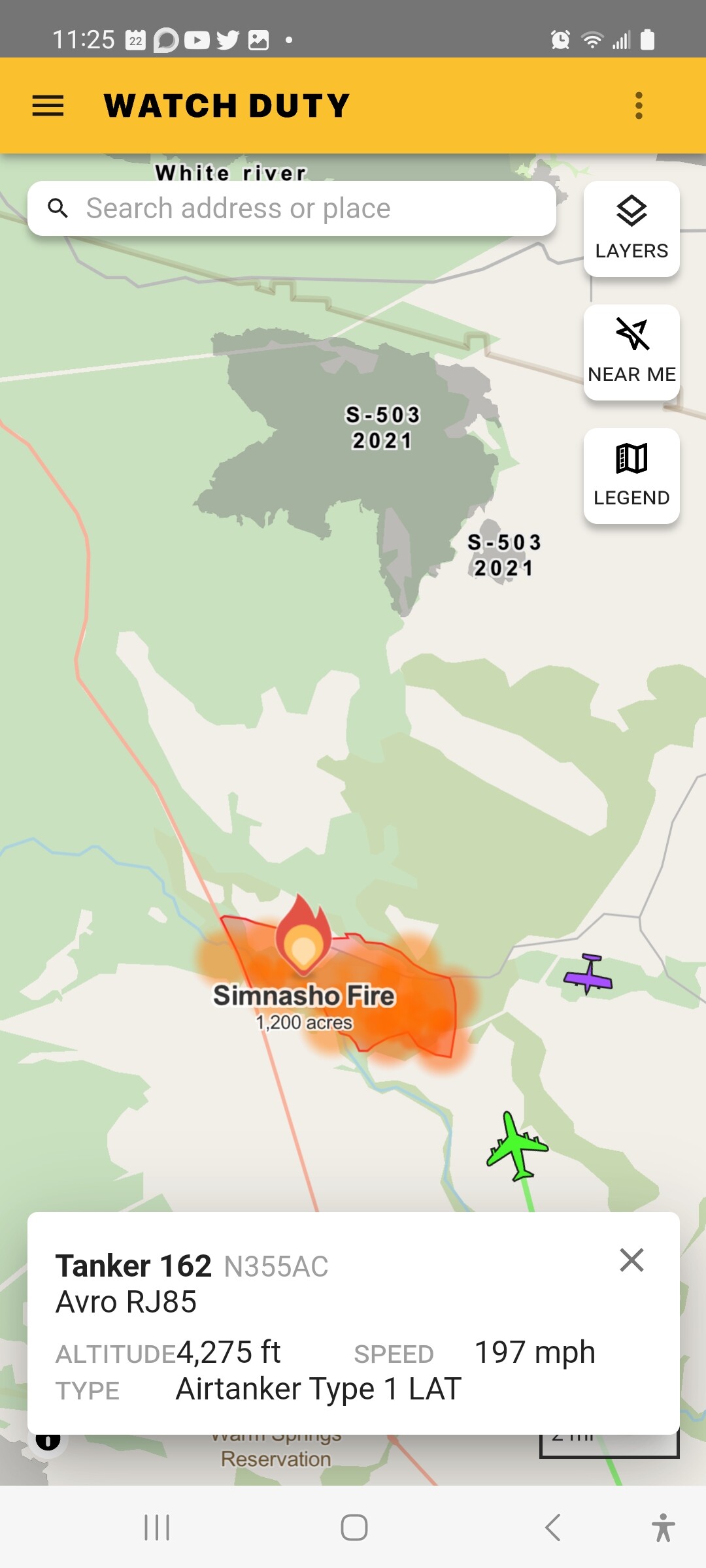
Fire name: SIMNASHO
Location: Hwy 9 east of US-26, west of Simnasho, Wasco Co
Reported acres: 1200
Rate of spread:
Report on Conditions:
Structure threat:
Resources: https://share.watchduty.org/i/7565
Redirecting...
Redirecting...
Hazards:
Weather:
Radio channels:
Scanner link: n/a
Webcam link:
Agency Website:
2 Likes
7/22/23 Saturday July 22, Simnasho Fire Update:
- The Incident Commander for this fire Gary Sampson.
- The fire started on Friday July 21st around 600pm. Cause is still unknown.
- Current acres is at 1200.
- Fire crews worked throughout the night to get a rough line around the fire limiting it to East of Hwy 26, South of Hwy 9, West of Hwy 450, and North of the Warm Springs river.
- The goal today to keep it within boundaries and limit growth in the SE corner near timbered areas as the wind comes in from the North and West.
- Aditional resources have been called in from around the region to assist Warm Springs crews including engines and hand crews.
- Burning is occurring mostly in tall seasonal grasses and bushes with a mix of Junipers and Pines. Luckily it’s reported that the fire swept mostly through the underbrush and grasses when in the mature pine grounds.
- Weather is a factor today with high temperatures in the upper 80s and mid 90s and winds from the West.
- Traffic is limited on Hwy 9 and 3 to local residents and fire crews.
Thank you all firefighters for working all night!
Photos credit to Francis Kentura evening IC.
3 Likes
4 Likes
HeliTanker 63AC off Fresno enroute support Oregon fires.
3 Likes
do you know the number I need to find them on flight radar? tail number I think? thanks!
1 Like
Helitanker N163AC. It’s a S64. Erickson
3 Likes