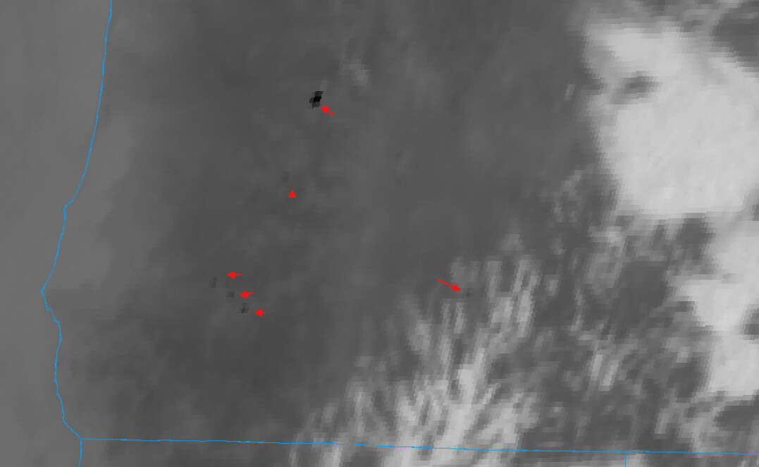
Multiple starts on ODF and BLM lands north of Grants Pass. So far 22 starts called in.
Ranging in size 1/10th-1.5 acres.
Multiple starts on ODF and BLM lands north of Grants Pass. So far 22 starts called in.
Ranging in size 1/10th-1.5 acres.
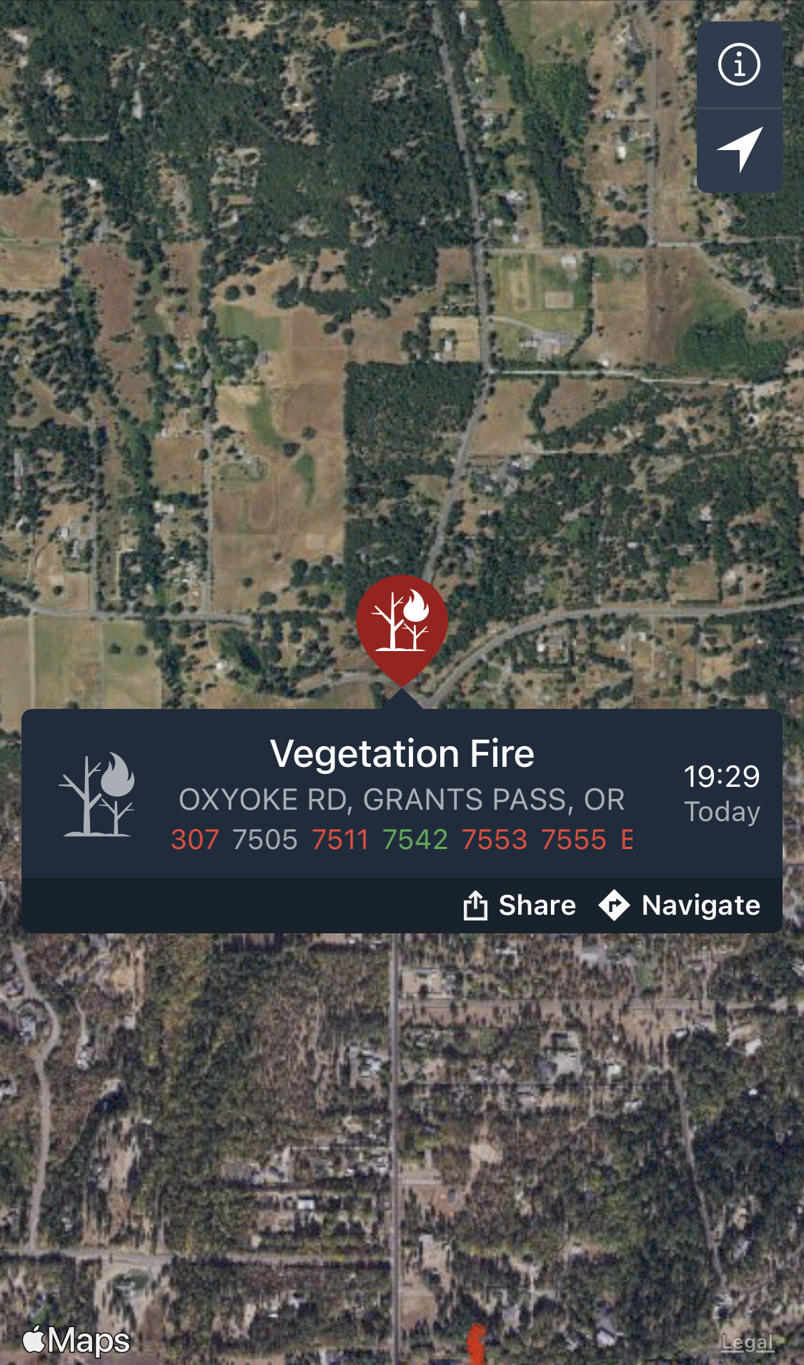
Start near Three Pines and Oxyoke 1/2 acre units on scene
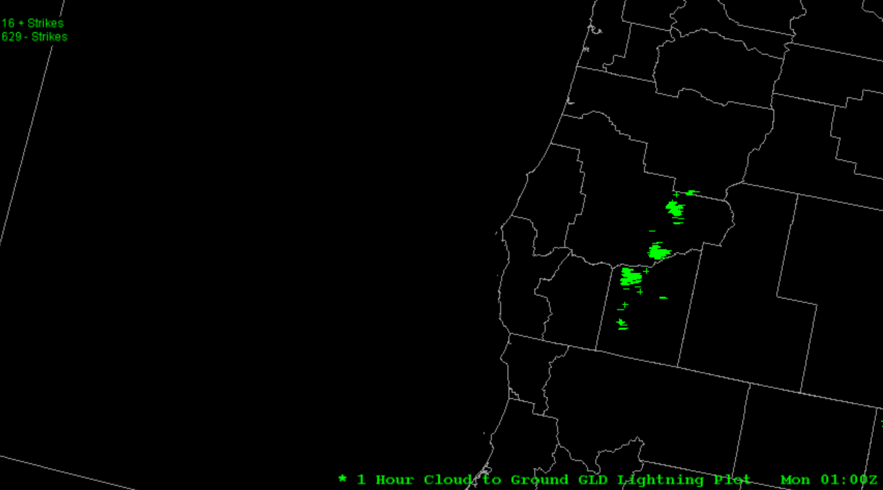
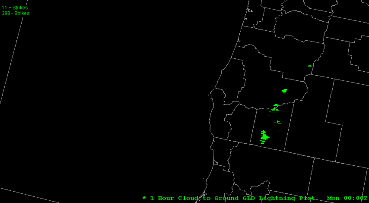
Would love to see the total lightning tally if anyone has it.
In Douglas county-
DFPA News Release: Lightning Update: 1:00 AM Monday Update
Thunderstorms moved across the Douglas District Sunday evening, resulting in numerous down strikes and several confirmed fires across the district, with most of the lightning activity occurred east of I-5. Aviation resources were unable to fly Sunday evening due to the active storm cells in the area but will be utilized first thing Monday morning to complete a district reconnaissance flight in addition to bucket work as needed. Additional resources, including hand crews, engines, water tenders, overhead personnel, and aviation resources have been ordered to assist with suppression efforts Monday morning. At this time, no structures are threatened by any of the known lightning fires. Below is a status of each fire:
O’Shea Creek Fire: Located 3 miles east of Canyonville. Estimated to be 5 – 10 acres in size. Ground resources, including a bulldozer, are engaged on the incident, and will be working overnight to construct containment lines around the fire. Fire spread was reported to be slowing after nightfall.
Poole Creek Fire: Located 8 miles west of Tiller. Currently estimated to be 5 acres in size. Crews are engaged on the fire and will continue working on the incident overnight.
Hill Fire: Located 3 miles southeast of Canyonville. Currently 2 acres in size. Crews are engaged on the incident and will continue working on the fire overnight.
Sweat Creek Fire: Located 4 miles east of Canyonville. Currently 3/4 acre in size. Crews are engaged on the incident and have containment lines around half of the fire.
Buck Shot Fire: Located 9 miles southeast of Glide. The fire burned 1 acre. Crews have completed containment lines around the fire are mopping up hot spots.
Packard Creek Fire: Located 6 miles southeast of Canyonville. The fire burned a 1/4 acre. A bulldozer was used to open an old road that accessed the top of the fire. Crews have containment lines around half of the fire.
Turkey Creek Fire: Located 5 miles southeast of Canyonville. The fire burned 1/10th of an acre. Crews have completed containment lines around the fire.
Galesville Boat Ramp Fire: Located 8 miles southeast of Canyonville, between Upper Cow Creek Road and Galesville Reservoir. The fire burned 1/100th of an acre and has been contained.
Update from ODF-
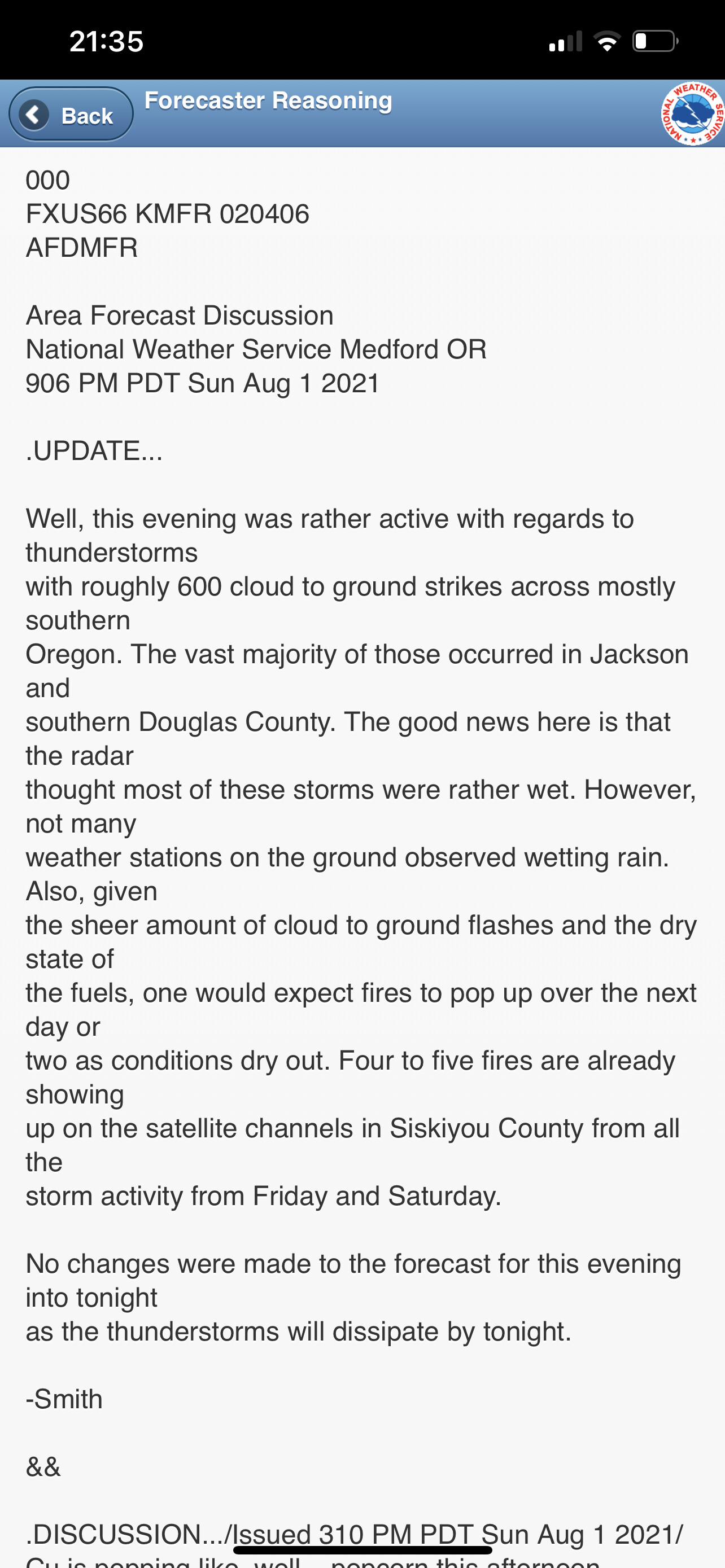
𝘼𝙁𝙏𝙀𝙍 𝙏𝙃𝙀 𝙎𝙏𝙊𝙍𝙈: An estimated 50 fires have been reported following thunderstorms that passed though the Oregon Department of Forestry (ODF) Southwest Oregon District on Sunday afternoon. Firefighters, dispatchers and detection specialists worked through the night to locate and extinguish fires. Approximately 50 fires were reported from Sunday afternoon into Monday morning; of those, 35 fires were confirmed as active. Of those 35, 20 have been put out, and 15 are in various stages of response; the majority are 100% lined and are currently in mop-up operations.
Private contract resources have been brought on to bolster firefighters, tree fallers and water tenders on active fires. This will also free up our district resources to respond to new fire starts as they are discovered throughout the day.
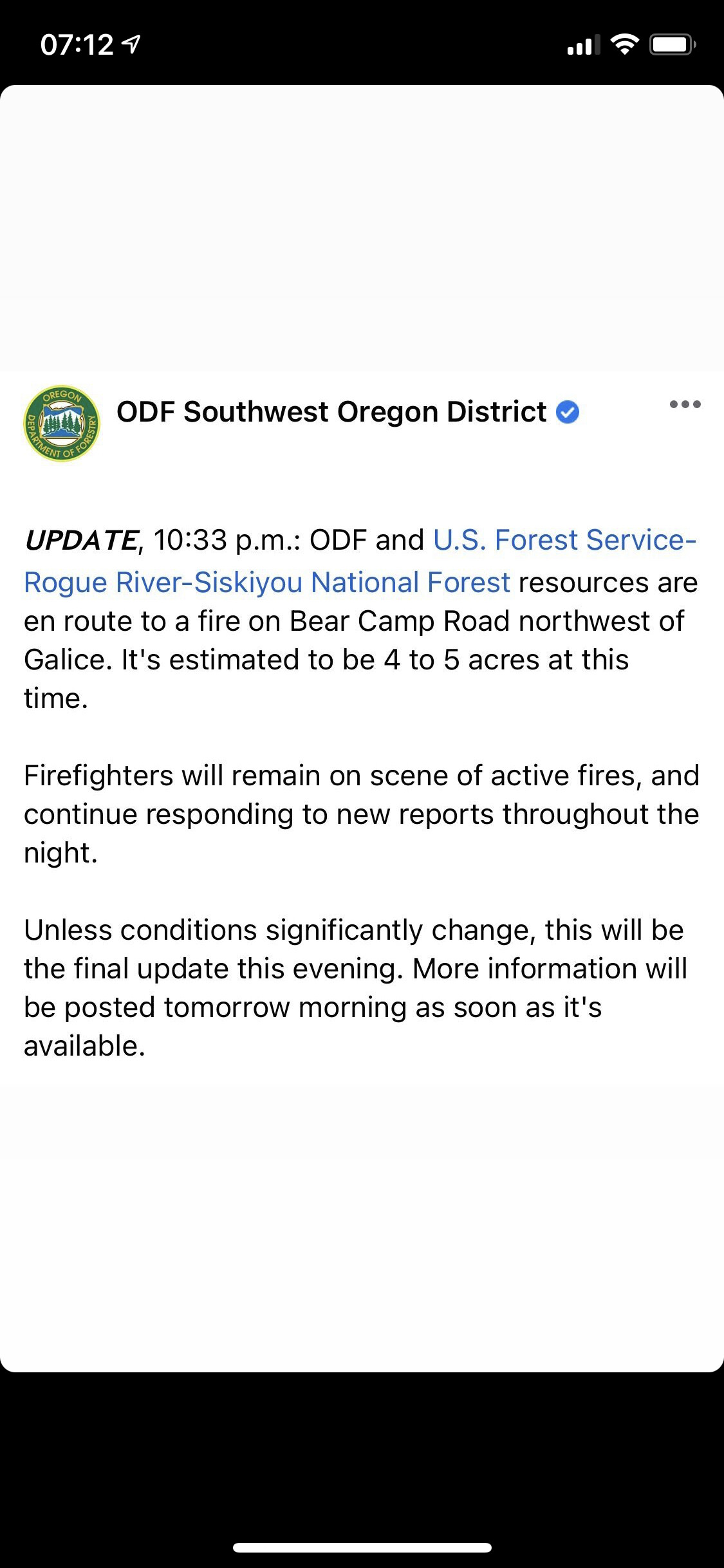
On the Medford unit, the two largest fires are both estimated to be 3.5 acres each. The North Fork Anderson Creek Fire, located on Anderson Butte outside of Talent is 100% lined and 5% contained; Jackson County Fire District #5 IAFF Local 2596 responded alongside our firefighters on this incident. The Buck Rock Fire (pictured) , located 5 miles north of Trail, is 30% lined and 5% contained. On the Grants Pass unit, the largest fire our resources responded to is the Bear Camp Road Fire; it’s estimated to be 4-5 acres. This fire is burning on U.S. Forest Service- Rogue River-Siskiyou National Forest land, however, ODF responded as mutual aid due to close proximity to our protected area. The second largest incident in Josephine County is the Placer Road Fire located southwest of King Mountain at 1.5 acres. It is 100% lined and mopped up at this time. In the same area, the Oxyoke Fire near Hugo was extinguished as well; it was caught by ODF and Rural Metro Fire - Josephine County resources overnight at just over half an acre. This is the only fire that was burning near homes.
At this time, there are currently no homes threatened, despite the large amount of fires burning on the landscape. A reconnaissance flight was sent out at 8:30 a.m. to fly over current incidents and look for new reports of smoke; new fires will likely emerge throughout the day as temperatures heat up. Residents in areas where lightning struck should report any smoke by calling 911.
Fire season updates are available online on our website, www.swofire.com, our Facebook ODF Southwest Oregon District and our Twitter account, @swofire. #fireseason2021 #swofire2021
Team on order for Douglas County, working on who
ODF Team 1 will be en route to Douglas Forest Protection association (ODF Unit).