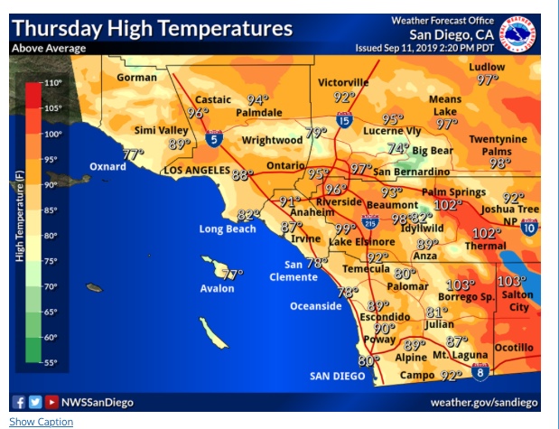
SoCal heating up…
2 Likes
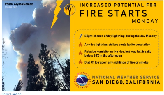
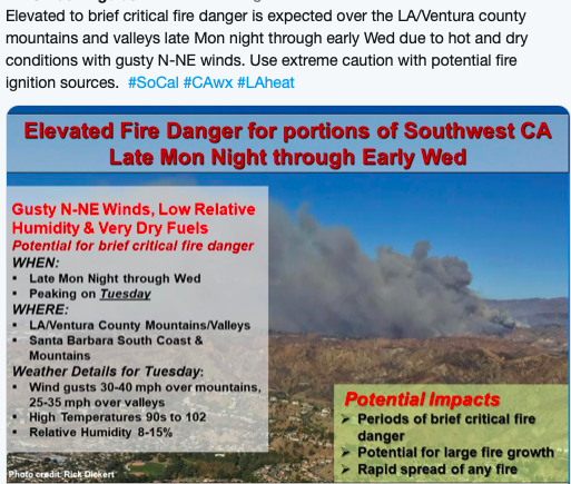
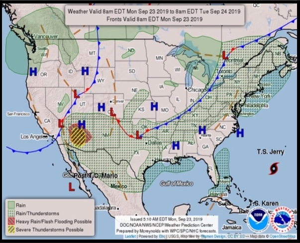
Fire Weather Forecast
1 Like
From NWS LA;
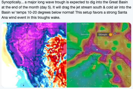
And then this possibly around the 28th. We will see if the models keep this in the runs this week.
NWS Satellite view:
https://www.goes.noaa.gov/dml/west/nhem/weus/rb.html
San Diego Area Forecast:
https://www.weather.gov/sgx/
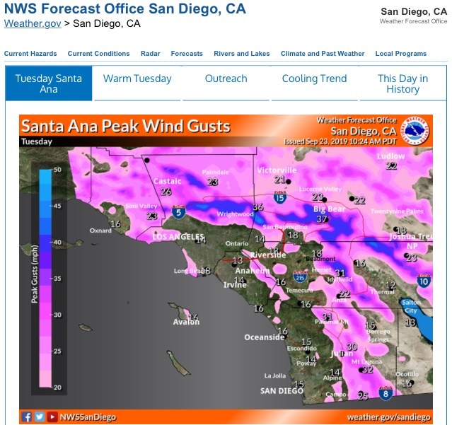
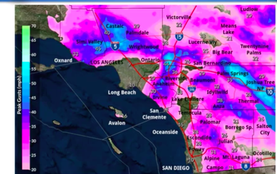
First moderate to strong Offshore wind event likely next Thursday and Friday. Gust up to 50 mph in the usual spots. Chart showing potential wind speeds below.
3 Likes
Latest GFS model has backed way off on this already to a very weak event. Time will tell…
1 Like
The new 06Z model run shows an eye brow raising off shore event within the next week or so. It looks like we will have on and off east winds for almost 2 weeks. Strength to still be determined. But worth keeping an eye on.
1 Like
I saw a model run for the 16-18th of the month…way out in lala land…but it showed a huge high pressure ridge over the Great Basin with strong offshore flow and temps over 100 at the coast. That was Thursday, has probably already changed.
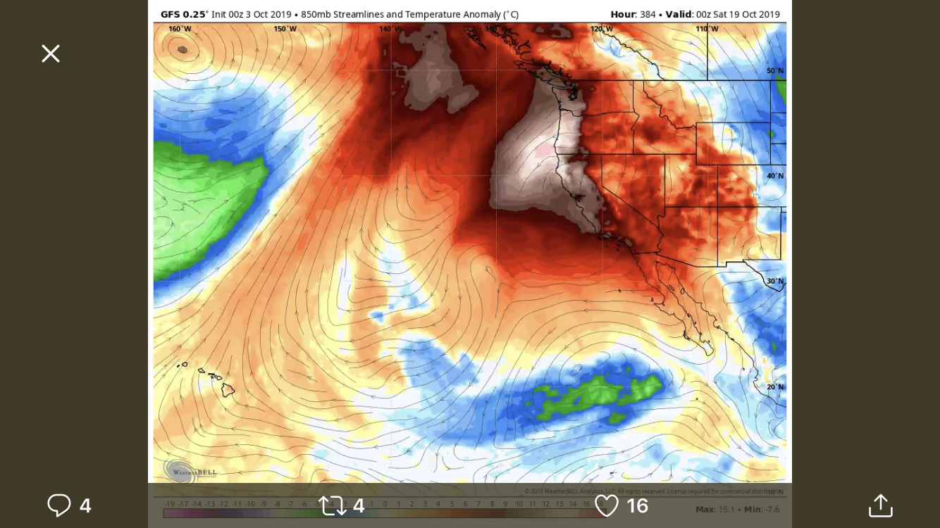
Time will tell, let’s see how much cold air and advection drop into the Great Basin. At the very least it will be breezy and dry. I’m sure models will change one way or the other as this gets closer. That is the image I saw.
Some temps I heard being discussed after looking at this model were actually closer to 110’ than 100’. I know it’s happened before but that would be in the rare category
Here is the 12z Euro, although like you said the GFS does not agree.
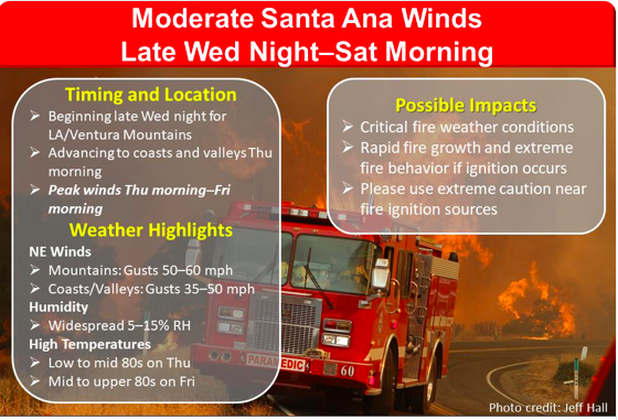
From tonight AFD from NWS San Diego;
Confidence is increasing for a moderate Santa Ana wind event perhaps developing late Wednesday night, with a peak Thursday night into Friday, then lingering offshore flow through Saturday morning. Peak gusts could exceed 50 mph in the foothills and mountains of eastern Ventura and western Los Angeles Counties. Given the extended period of warm and dry conditions preceding this event, critical fire weather conditions and large fire growth will be a significant concern.
1 Like
Cold dry high pressure coming to Great Basin this Thursday-Sunday after front passage. Overnite lows down into the teens, RH low 20’s.
https://www.weather.gov/forecastmaps
The Santa Ana wind event for Thursday through Saturday is looking on track. Models are showing a -8 pressure gradient from LAX-DAG. this will produce advisory level winds in excess of 50 MPH with single digit RH. This will provide critical fire weather for 2-3 days.
1 Like
From NWS LA/Oxnard Office.
2 Likes
That’s a great photo🤭
5 Likes
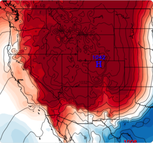
Great Basin High very dry and strong @ 30.40 in (1028 mb) with Coldfront coming Thursday. Freeze warnings in place with lows into the teens.
https://www.weather.gov/forecastmaps