
SoCal staying dry, warm and windy thru the end of October.
1 Like
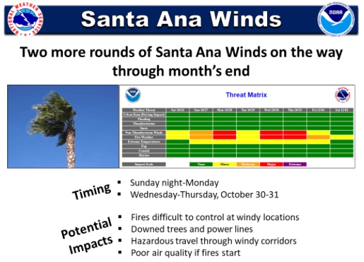
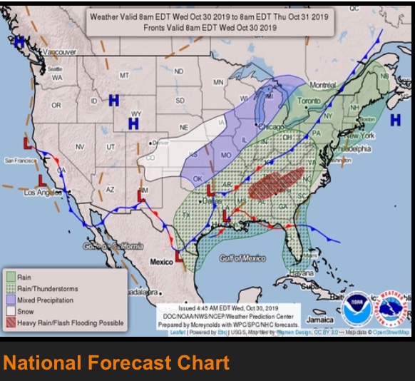
Santa Ana’s building this week
1 Like
For Wednesday into Halloween night gradients range from -9.1 (GFS [low res]) to -10.9 (NAM [High res])
A trifecta of key elements expected. Cold air advection, strong gradients, and upper level support.
This could be a widespread high wind warning level wind event
2 Likes
-10.9 is pretty strong . We just may see the sawti go to purple with the combine RHs…
2 Likes
That could be slightly over done, but even near -9-10 with cold air advection and upper level support shown in the models, I agree. NWS saying possibly the strongest event this year. We don’t see many purple days on the SAWTI.
2 Likes
Newhall Pass seeing gusts to 40mph currently RH 15%
3 Likes
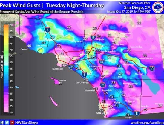
So Cal is in for a serious Rip Tue-Thur. Latest from NWS LA.
The next Santa Ana wind event remains on target for Tuesday night through Thursday. This event has all the ingredients for a rare and strong event, with one of the strongest offshore surface pressure gradients on record (LAX-DAG peaking at -9.0 to -11.0 mb), upper level support (50-60 KT up to 7000 feet), and ample cold air (temperatures in the teens in the Antelope Valley). Peak winds gusts over Los Angeles and Ventura Counties should fall in the 50 to 70 mph range, but there is a good chance for some gusts around 80 mph during the Wednesday peak. These winds will result in a significant threat for large fast-moving fires and wind damage (like downed trees, power lines, and broken signs or overhangs). Power outages are likely…"
4 Likes
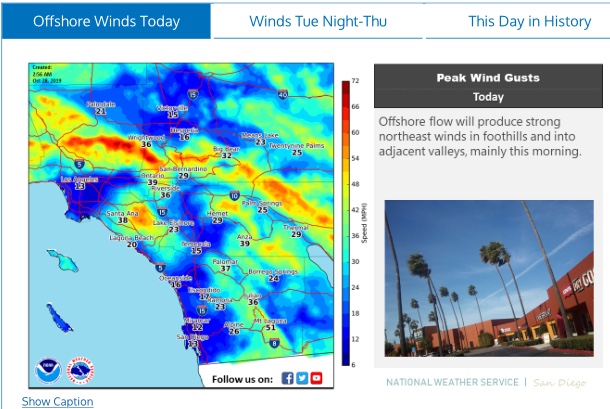
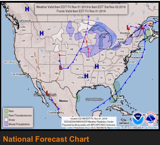
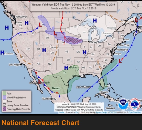
NWS National Map
3 Likes
The Weather folks are saying no precipitation in sight for the first 10 days of November in Ca. See what happens.
1 Like
Heard mumbling of heavy wind forecast coming up? Anything more concrete and timeline etc?
1 Like
.FIRE WEATHER…14/204 PM.
Elevated fire weather conditions are anticipated from Friday
afternoon through Saturday across the area as north to northeast
flow develops. Gusty north to northeast winds are expected across
San Luis Obispo and Santa Barbara counties Friday afternoon and
Friday night with gusts between 30 and 40 mph across the mountains
and foothills. Early Saturday morning, the winds will shift to
the northeast and increase across Ventura and Los Angeles counties
with gusts between 30 and 40 MPH for these areas. With relative
humidity dropping into the teens and 20s, elevated fire weather
conditions will be likely through Saturday.
For Saturday night through Monday, the offshore flow will increase
with gradients peaking Sunday morning, setting the stage for a
moderate Santa Ana wind event. The upper level and thermal support
is not great, but LAX-DAG gradients are forecast between -4.0
and -5.0 mb . So, should be enough there to generate moderate
Santa Ana winds across Ventura and Los Angeles counties with gusts
35-50 MPH on Sunday then somewhat weaker winds Sunday night and
Monday. Near-record warmth is expected Sunday/Monday along with
relative humidity in the teens and single digits. With fuels at
historically critical levels, widespread critical fire weather
conditions will be possible Sunday and Monday. So, a Fire Weather
Watch will need to be considered by future shifts.
CSR staffing now, dozers, crews early up aircraft
2 Likes
Tied into up coming weather is LFM moisture is near critical and after this wind event may well fall below critical.
https://www.fire.lacounty.gov/forestry-division/fire-weather-report/
1 Like
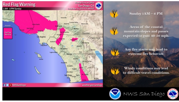
Red Flag Warning on Sunday
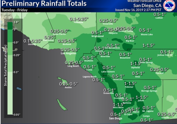
Rains coming? Tuesday - Friday
1 Like
Send some of that North!!!
4 Likes