
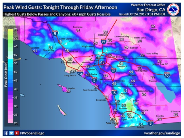
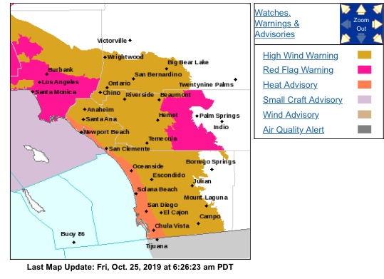
Reading the fire weather forecast as of 0530 this morning. Down to 4 percent RH, just up to 70 MPH, and 80 degree temps. Stay vigilant.
1 Like
Can u post ur weather report please.
You should be able to google it for the LA Mtn. Area. Hopefully this works for you.
https://www.wrh.noaa.gov/fire2/?latitude=33.93&longitude=-118.23&latlon=Go&wfo=mfr&interface=fwzones
Heads on swivel for LA and Ventura Counties.
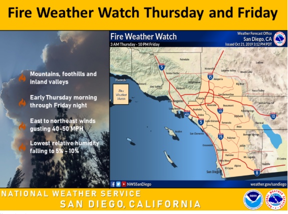
FRIDAY…
Sky/weather…Mostly sunny.
Max temperature…79-89.
24 hr trend…Up 3.
Min humidity…2-7 percent.
24 hr trend…Down 3.
20-foot winds…Northeast 15-30 mph with gusts to 45 mph becoming
10-20 mph with gusts to 30
1 Like
GOES imagery loop:
https://www.star.nesdis.noaa.gov/goes/sector_band.php?sat=G17§or=psw&band=GEOCOLOR&length=12
So dry a lizzard has to pack a canteen.
6 Likes
Thanks for the post…something we can all chuckle about…
RH yesterday in Camarillo a whopping 3%
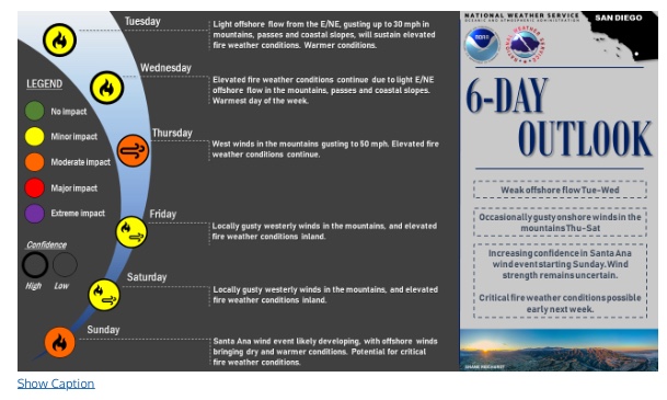
The rest of this week NWS outlook. Santa Ana building again Sunday.
4 Likes
Link to the south ops webcast. SoCal fire season is here.
5 Likes
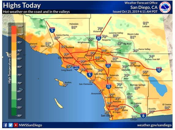
Warming up Tuesday

Redflag continues thru Friday:
1 Like
Redflag - Low RH - Heatwave
https://www.weather.gov/sgx/
SDG&E Current Wx:
https://weather.sdgeweather.com
1 Like
October 30-31 Forecast
Possible Strong Santa Ana Wind Event With Critical Conditions
- Moderate confidence in low minimum humidities 5-10% with some offshore flow.
- Drastic differences in wind speed projections.
Peak LAX-DAG gradient anywhere from -4.0 to -11.0 mb.
*Chance for the strongest offshore wind event of the season
4 Likes