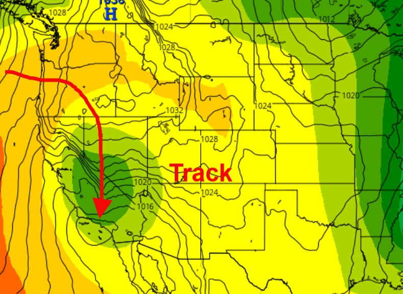
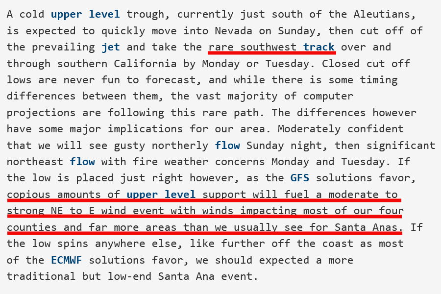
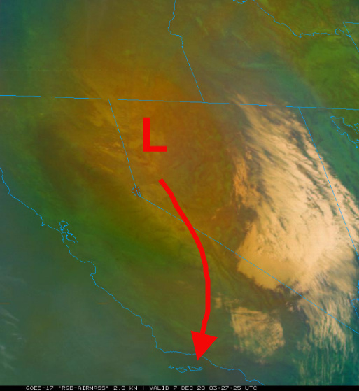
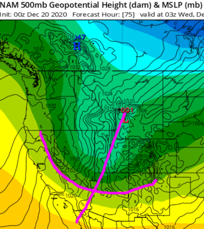
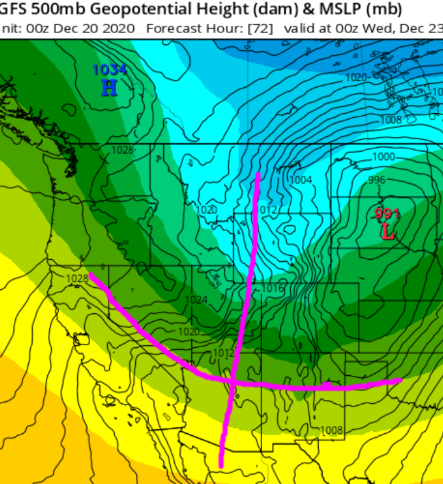
Attention is now turning to the next Santa Ana wind event, on Monday and Tuesday. Forecast models show a low pressure system moving into the Omega Block that has established itself across the Western US. As the low pressure system splits off from the main flow on Sunday, it nose dives from Oregon down the spine of the Sierra Nevada and amplifies in strength as it moves directly across Southern CA Monday.
This low pressure system is deepening, however it is encountering an extremely dry airmass with no moisture to work with, and thus precipitation should not be expected. Forecast models do show some snow showers near the Nevada/CA border, although.
The track of the low pressure system is rather unique in that it will drag a surface high pressure system across the Great Basin, but also an extremely strong surface high over the San Joaquin Valley and a very strong gradient sets up between LAX-BFL (Bakersfield).
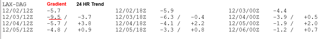
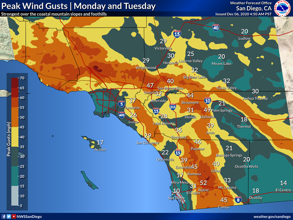
The GFS, which is the only model in range for automatic gradient tabulation currently shows a peak gradient at -7.5 (LAX-BFL) from the North and -5.9 (LAX-DAG) from the East. This sets up a moderate-strong Santa Ana wind event as the vortex moves just offshore Southern California.
These gradients do not sound as strong as the -8 we peaked at for this current event, but understand that the average gradients between gradients from the north and the east is very important.
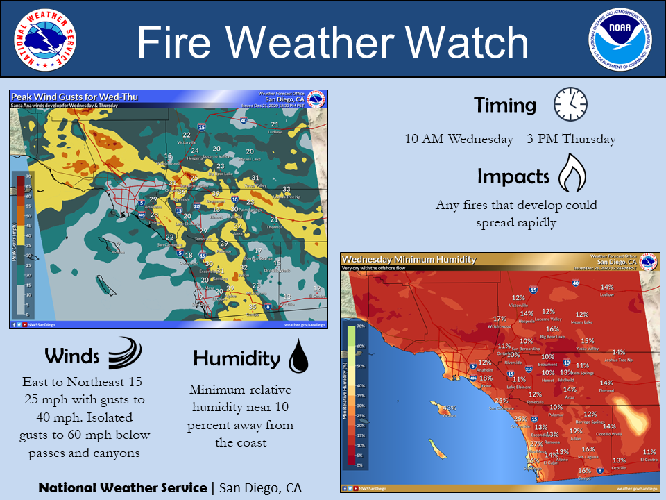
At the peak of the wind event this morning, gradients peaked at -1 from the north (LAX-BFL) and -8 from the east (LAX-DAG) for an average of -4.5 between the two. If something like the GFS were to verify -7.5 + -5.9= an average offshore gradient of -6.7 a strong NE wind event is likely in the areas that are more favorable for NE winds.
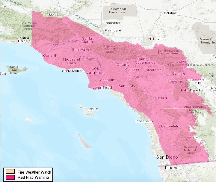
Since the low pressure system just offshore is driving the gradient rather than heating of the land surface, this wind event will likely be more widespread. South Ops predictive services has added high risk days for Monday and Tuesday.
As the low pressure system moves offshore of San Diego on Tuesday, the winds will likely be more out of the east favoring that region’s terrain again for at least moderate winds.
As a side note to keep everyone entertained and on toes. Forecast models show a strong inside slider picking up the cut off low offshore. A strong Santa Ana wind event could occur at that point as well… but that is way down the line.
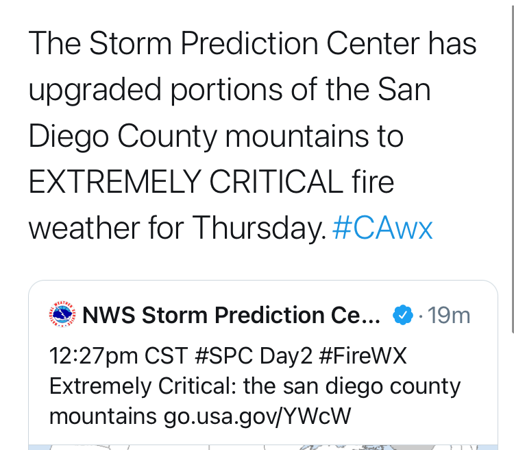
NWS confirmation today:


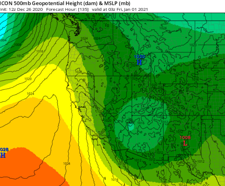
 A low pressure system, with a blast of cold continental air swings down the western side of it on New Years into the second. This would set up either a backdoor cold front and/or Santa Ana wind event with excellent upper level support. Ridging builds in from the pacific through the first few days of 2021 and rising heights will leads to continued offshore gradient trends.