John Fischer just shared this website with me. Unlike the NWS pages which calculate RFW criteria based on winds and RH, this tool incorporates current fuel moistures. As such, it is not showing any major fire potential with the current system.
https://fsapps.nwcg.gov/psp/sawti
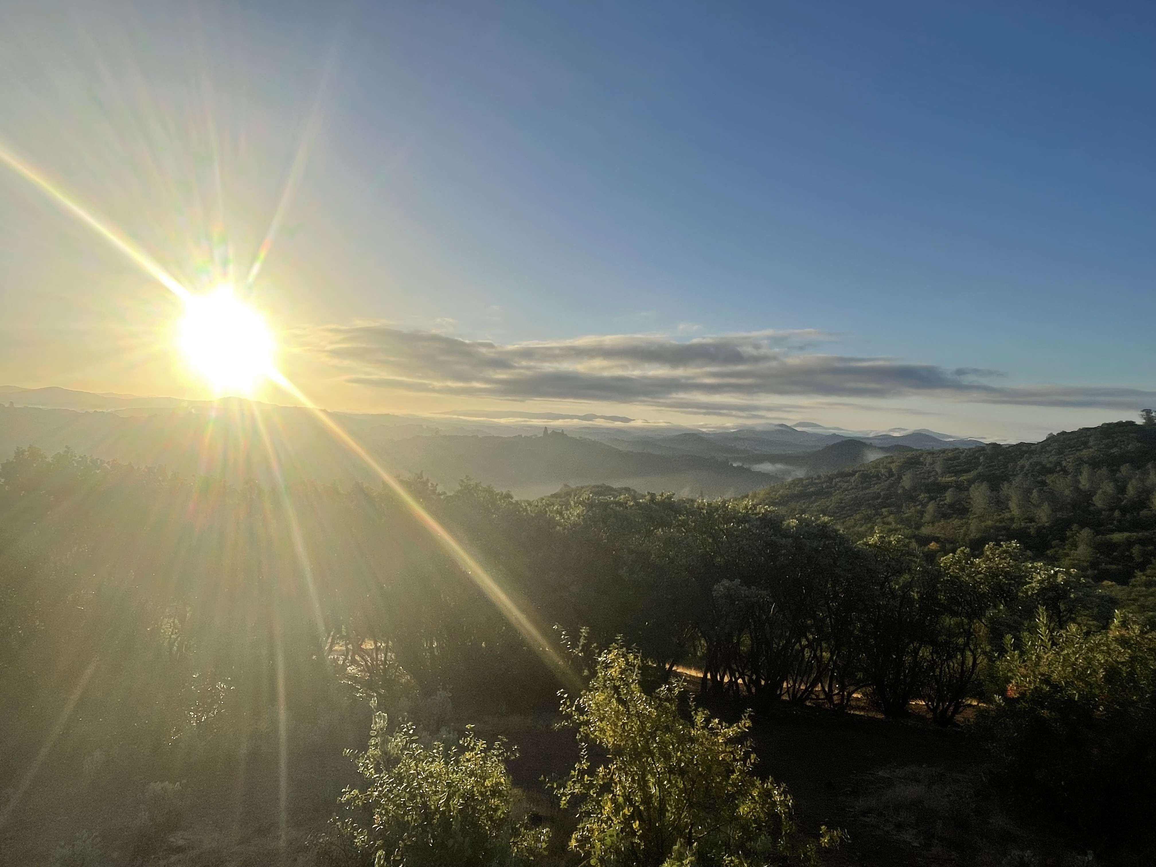
Great morning for a hike. The Bonus is a great sunrise. Temp 48, No wind, RH 23 leaf litter and grass crunchy this morning. Control burns all over the place helps make for a great pic when the sun rises.
Maybe next week some showers in the forecast for Twain Harte/Sonora area.
SoCal Peak Winds

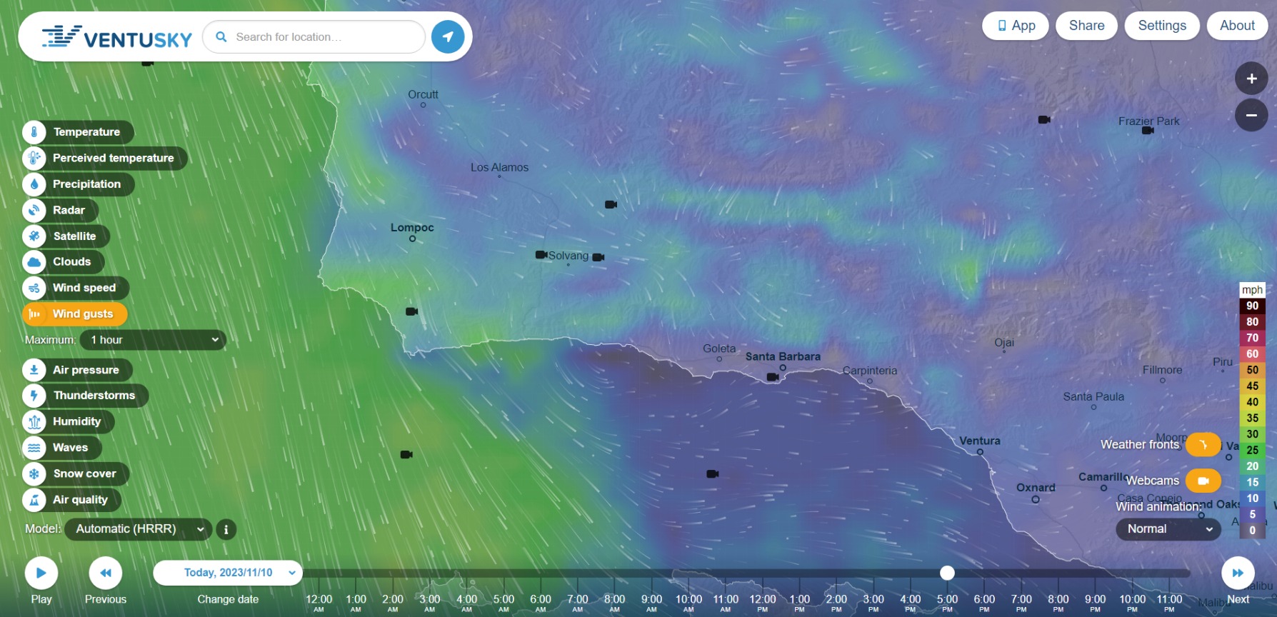
Potentially moderate Sundowner wind event Tuesday into Wednesday.
WRF-NAM peaks LAX-BFL gradients at -5.6 with solid upper level support and cold air advection. Global models balk at the strength at the moment, this event will transition to a Santa Ana wind event Wednesday into Friday.
Perhaps the model strength is limited by equally strong northerly and easterly gradients.
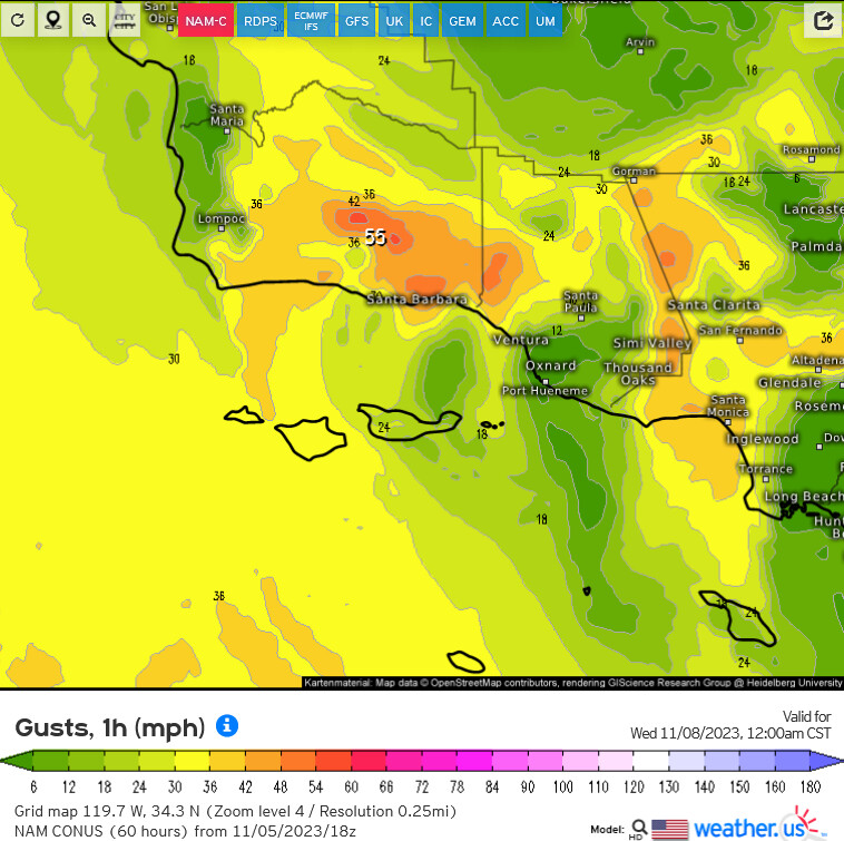
The European & GFS have been all over the place the last 48-72 with each model run. But each model run keeps backing off slightly each time. If I had to bet, it’s a inside slider looking at the central sierras and the forecasted winds.
Just got my friendly SCE phone call saying they may shut the power off Wed & Thursday
Sundowners. This will be more an evening blow, continuing through the day Wednesday, intensifying again in the evening, unlike the last event that was more intense in the morning hours.
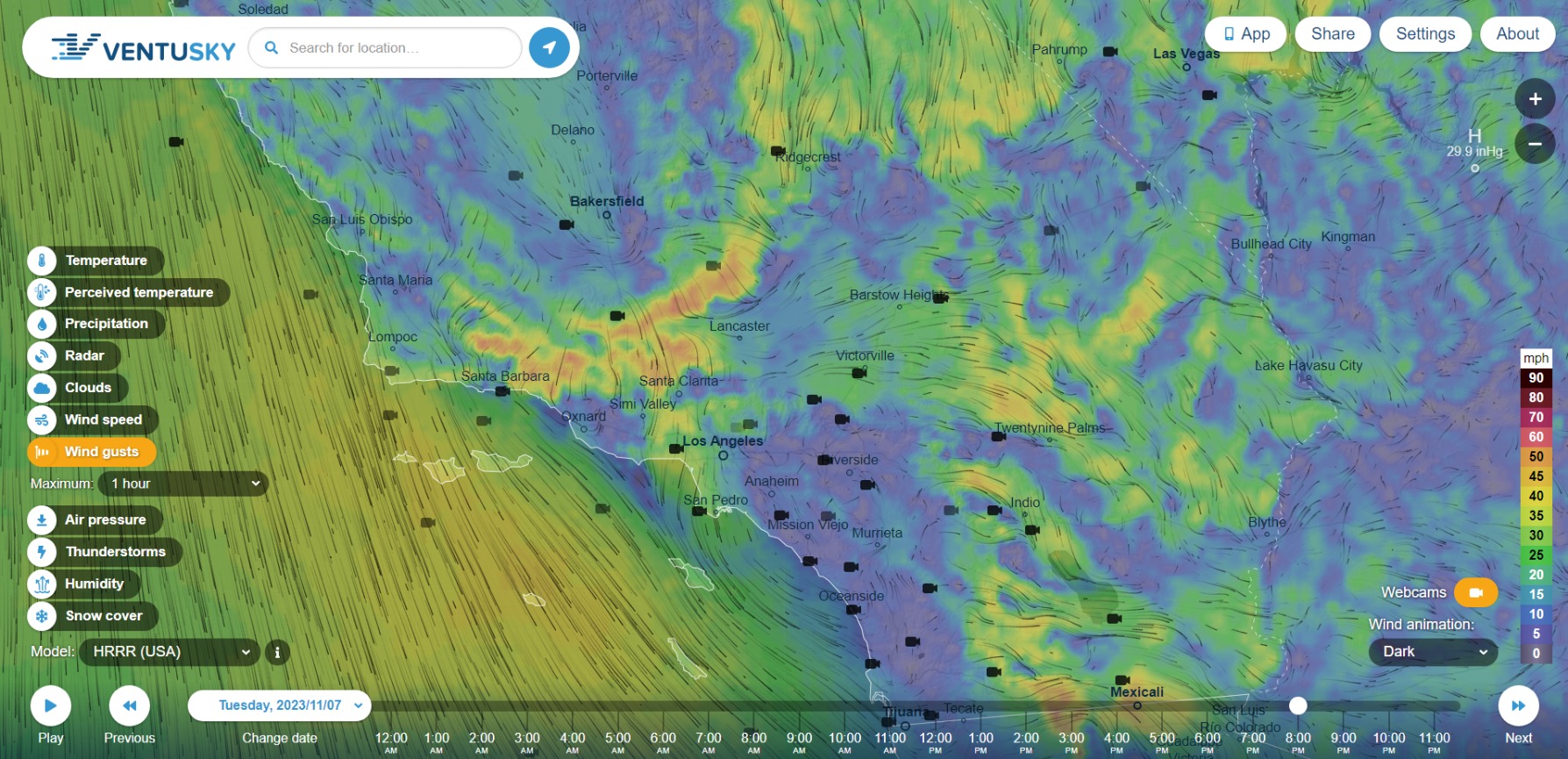
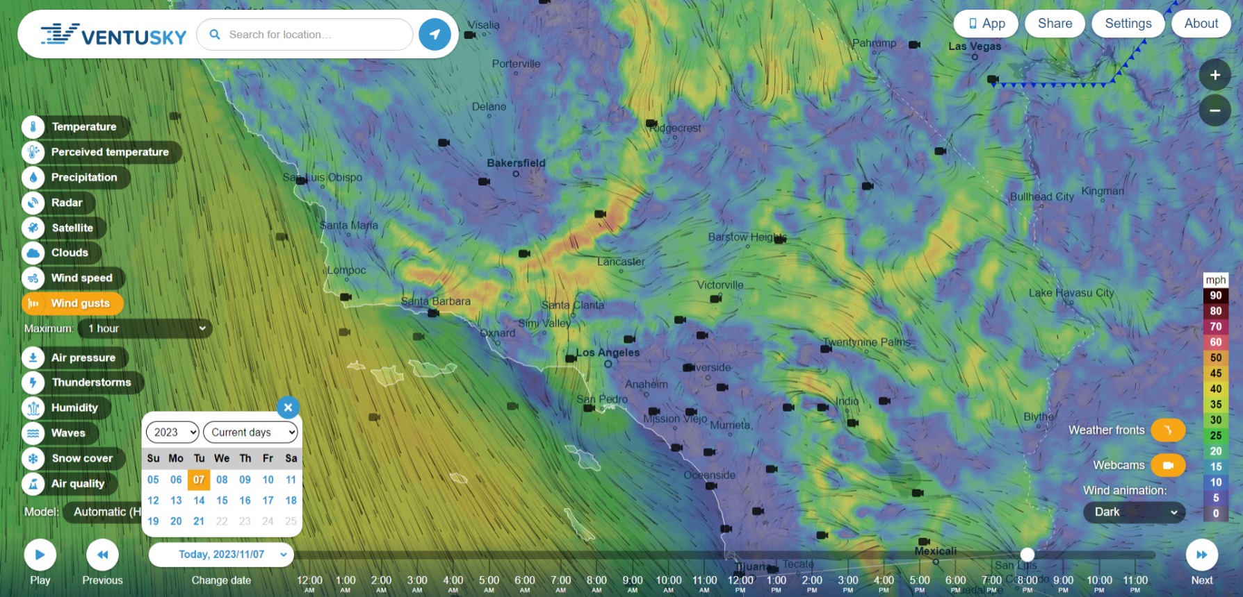
Ventusky HRRR for TUE Nov 7 8pm (sunset is at 5pm).
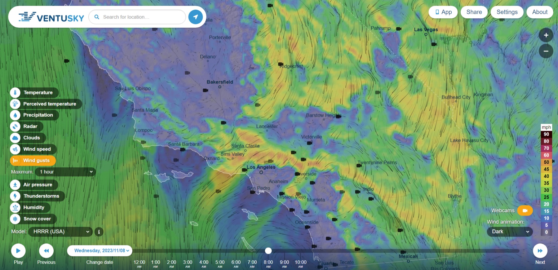
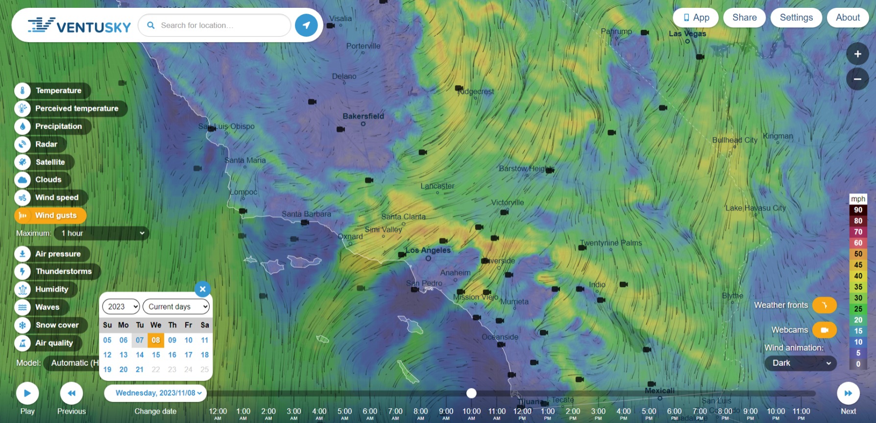
Ventusky HRRR for WED Nov 8 8pm (sunset is at 5pm).
In addition, coastal and mountain temperatures are swinging up to 40 degrees F between the day and the night, which, to my layman’s eye, indicates that the marine layer may be in retreat during the event. Humidity may drop down into the low 20s, or below (Oxnard, Santa Clarita, Mission Viejo), in the affected areas (not a bad time to check the cables and clamps).
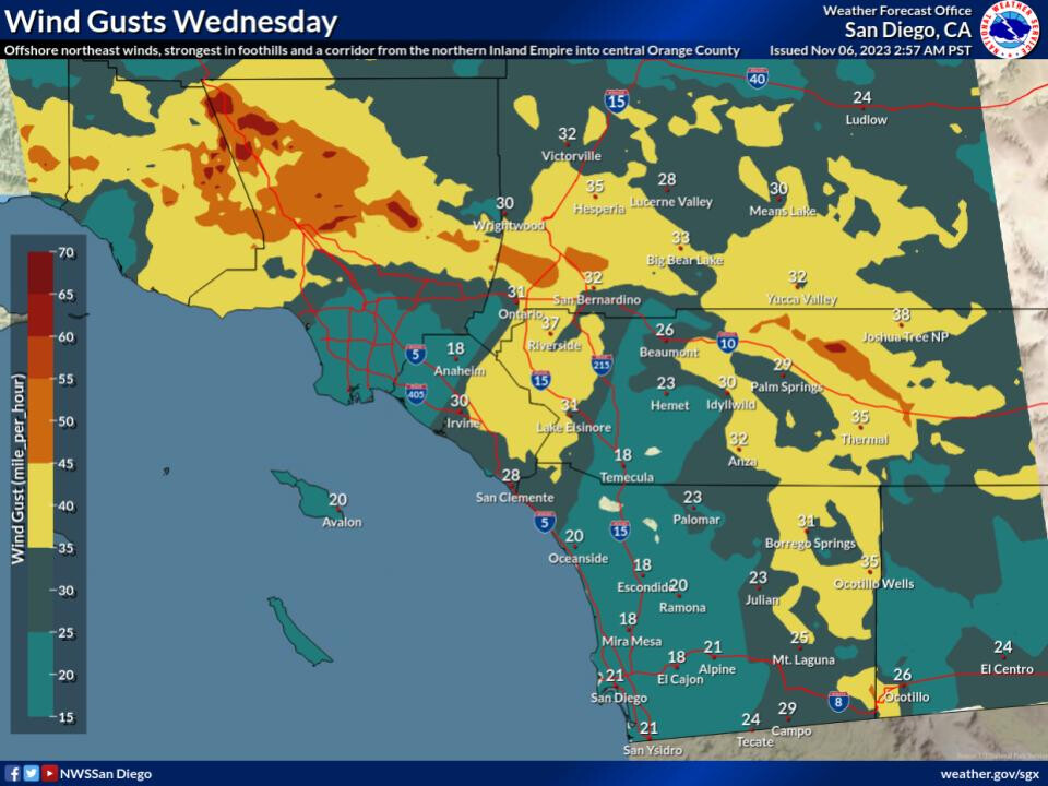
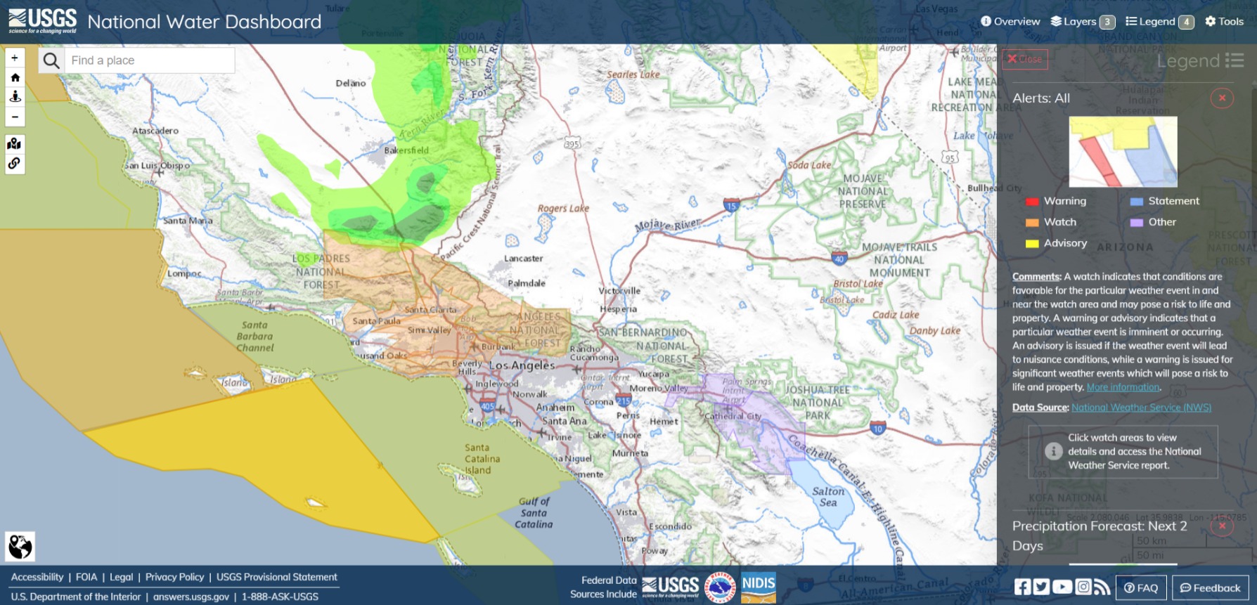
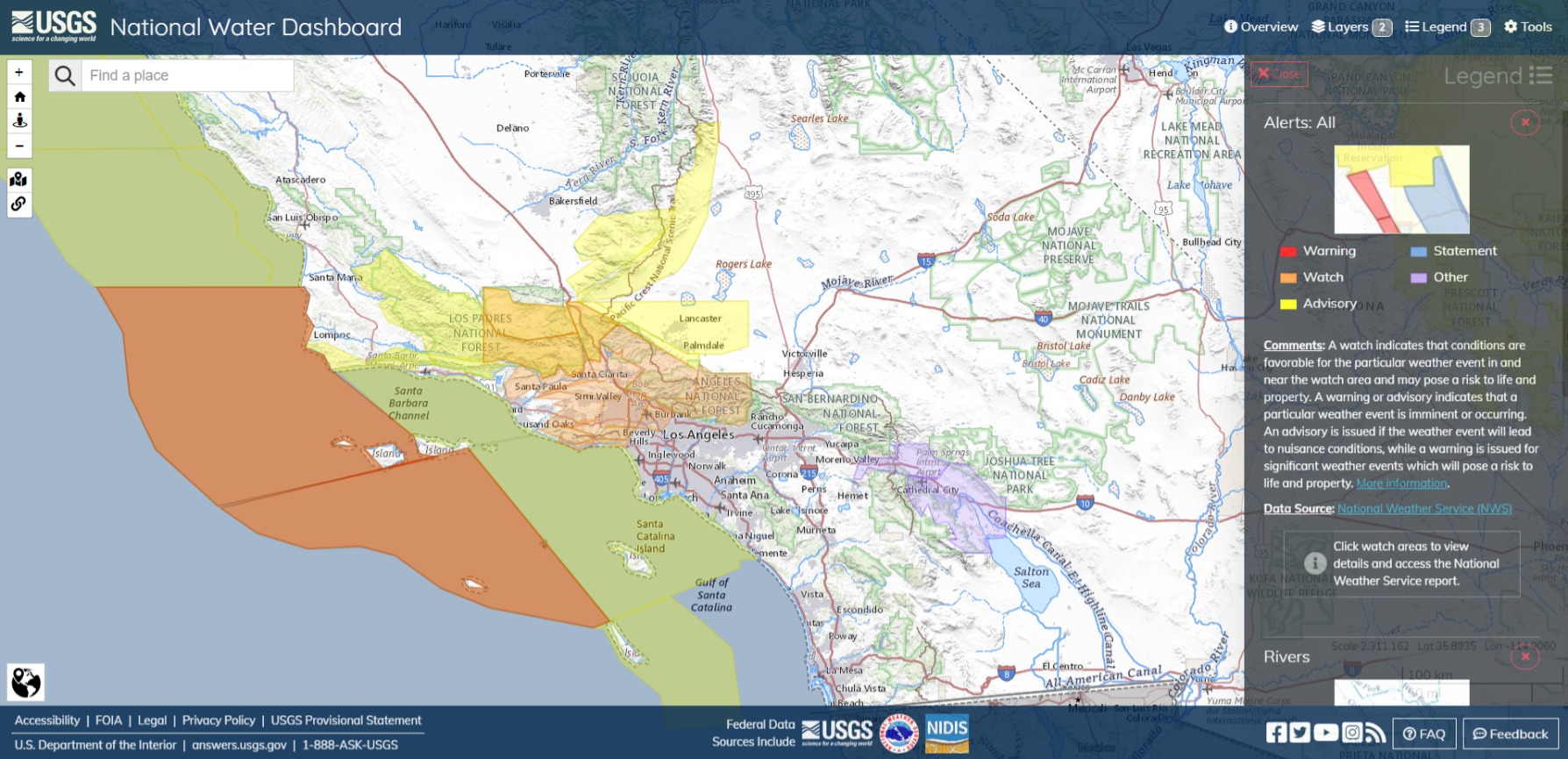
Fire Weather Watch issued November 6 at 2:50PM PST until November 9 at 6:00PM PST by NWS Los Angeles/Oxnard CA
WINDS…North to northeast winds 15 to 30 mph with gusts 30 to 40 mph.
RELATIVE HUMIDITY…Falling to 10 to 20 percent by Wednesday afternoon and evening, and 8 to 15 percent by Thursday.
Impacts…If fire ignition occurs there could be rapid spread of wildfire that would lead to a threat to life and property.
Instructions
A Fire Weather Watch means that critical fire weather conditions are likely to occur in the coming days. Residents near wildland interfaces should prepare now on what to do if a wildfire breaks out. See readyforwildfire.org and wildfirerisk.org for information…
Sender: NWS Los Angeles/Oxnard CA
Sent: 11/6/2023 14:50 PSTUpdates: urn:oid:2.49.0.1.840.0.48b359774881cccf2d08f590bb86aa7f0cc3a315.002.1
Santa Clarita Valley; Central Ventura County Valleys; Malibu Coast; Western San Fernando Valley; Eastern San Fernando Valley; Southeastern Ventura County Valleys
(I would not be surprised to see this extended westward through the Santa Ynez Mountains to Lake Cachuma by tomorrow afternoon.)
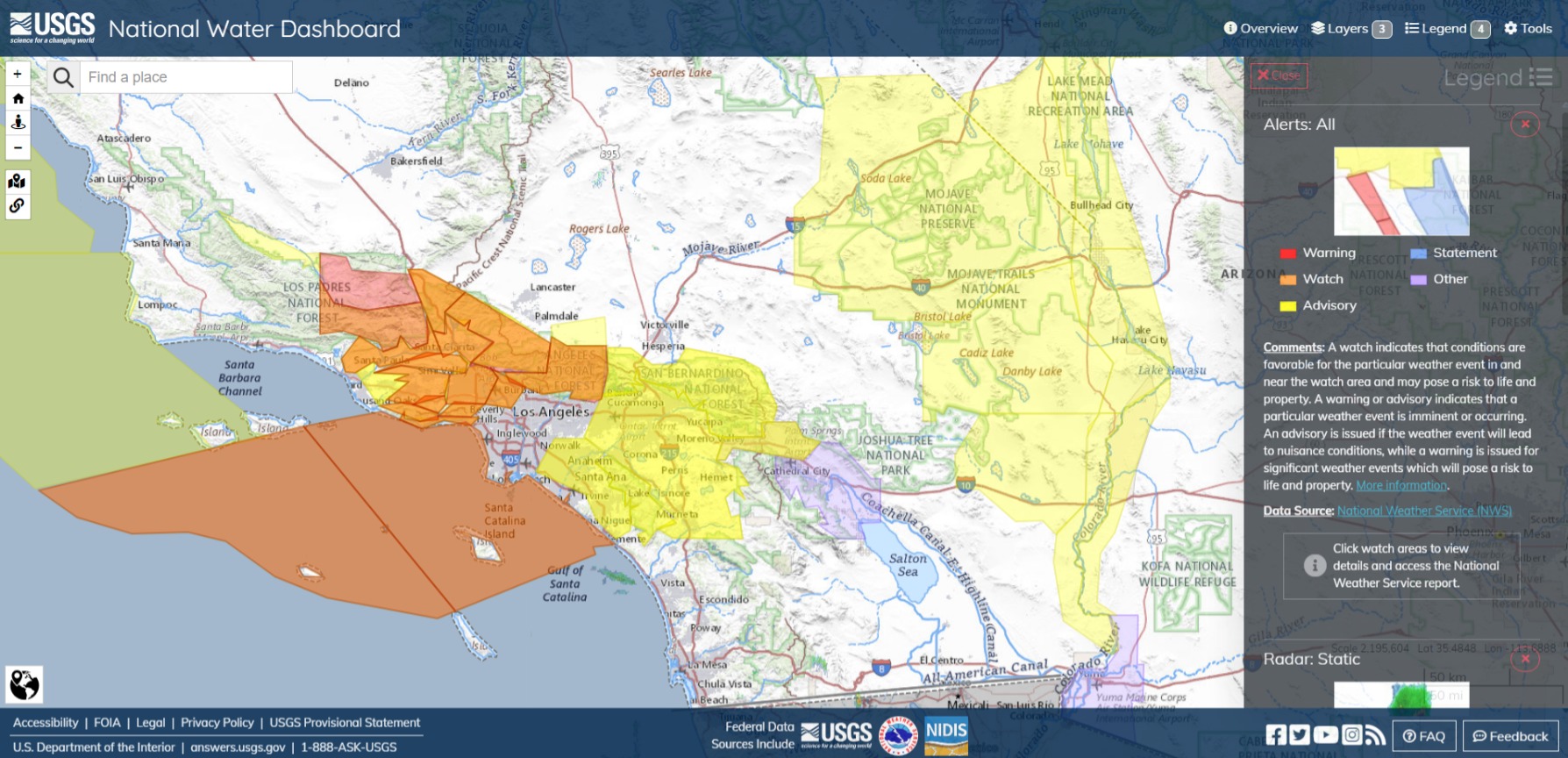
Wind Advisories added for LPNF, Santa Barbara south coast and Lancaster. Dense Fog and light precip southeast of Bakersfield to the Tehachapi Mountains.

3/8 of an inch last night at my casa. 40 out when I took the pics. RH off the chart, no wind.
Fire season in the Sonora area, stick a fork in it. Unless we get some very strong north/east winds not much is going to happen. Grass is starting to really show itself and leaf litter having a harder time drying out with these shorter days. Different story for you folks south of the Tehachapi’s.
Sun pic looking S/W of Sonora.
Fog bank looking towards Columbia AAB.
Ventusky HRRR for TUE Nov 7 8pm.
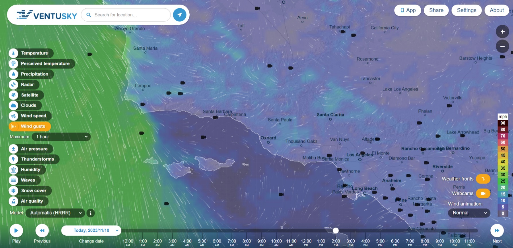
Ventusky HRRR for WED Nov 8 10am.
Mostly the same forecast as yesterday. Sundowners tonight for Santa Barbara south coast and the south exposures of the Tehachapi Mountains.
Ventura and LA, blowing pretty hard over the Gabriels overnight and in the morning, actually, and focus shifting to the eastern Transverse (Angeles and Bernadino) through midday and weakening by tomorrow evening.
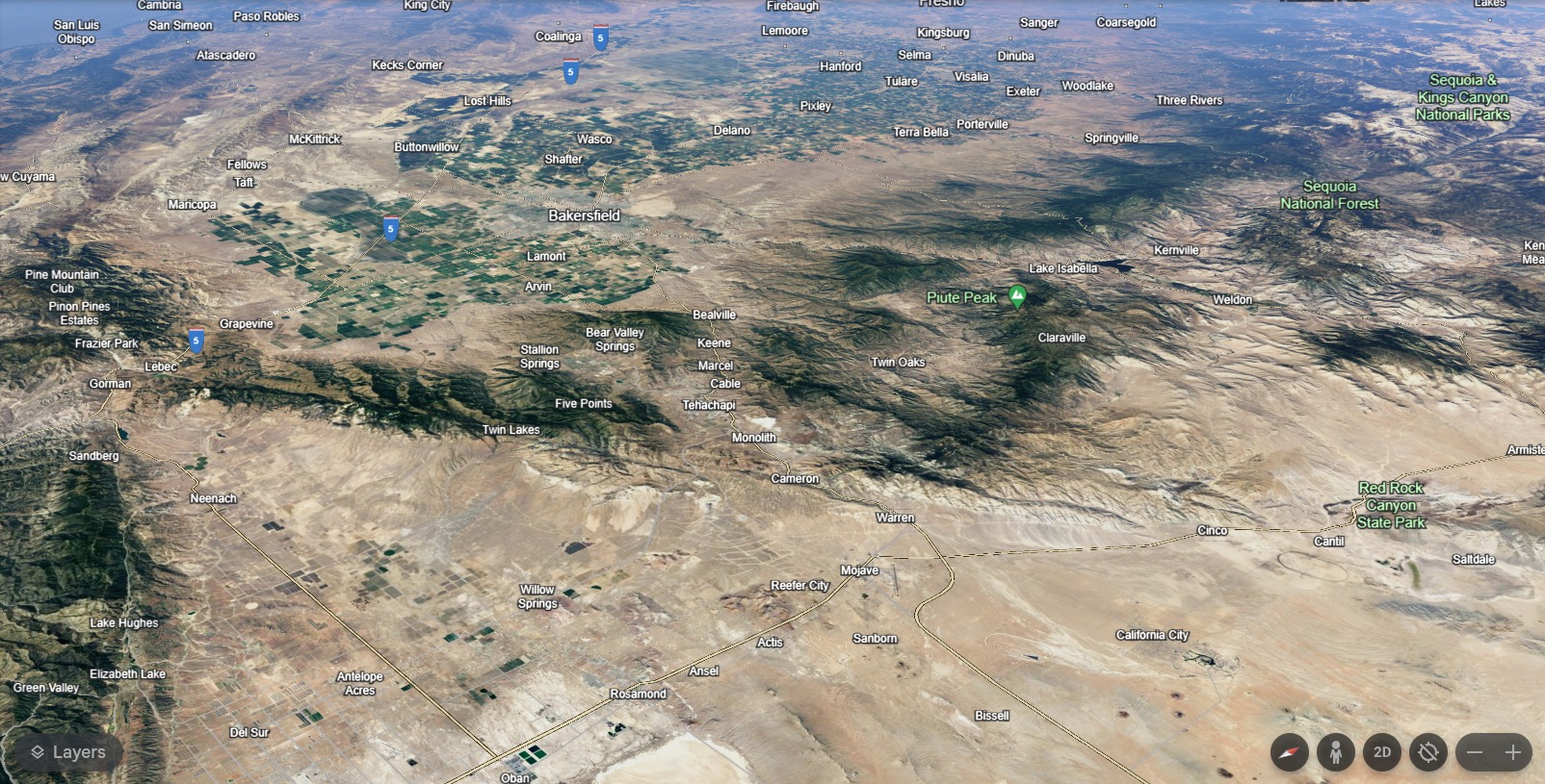
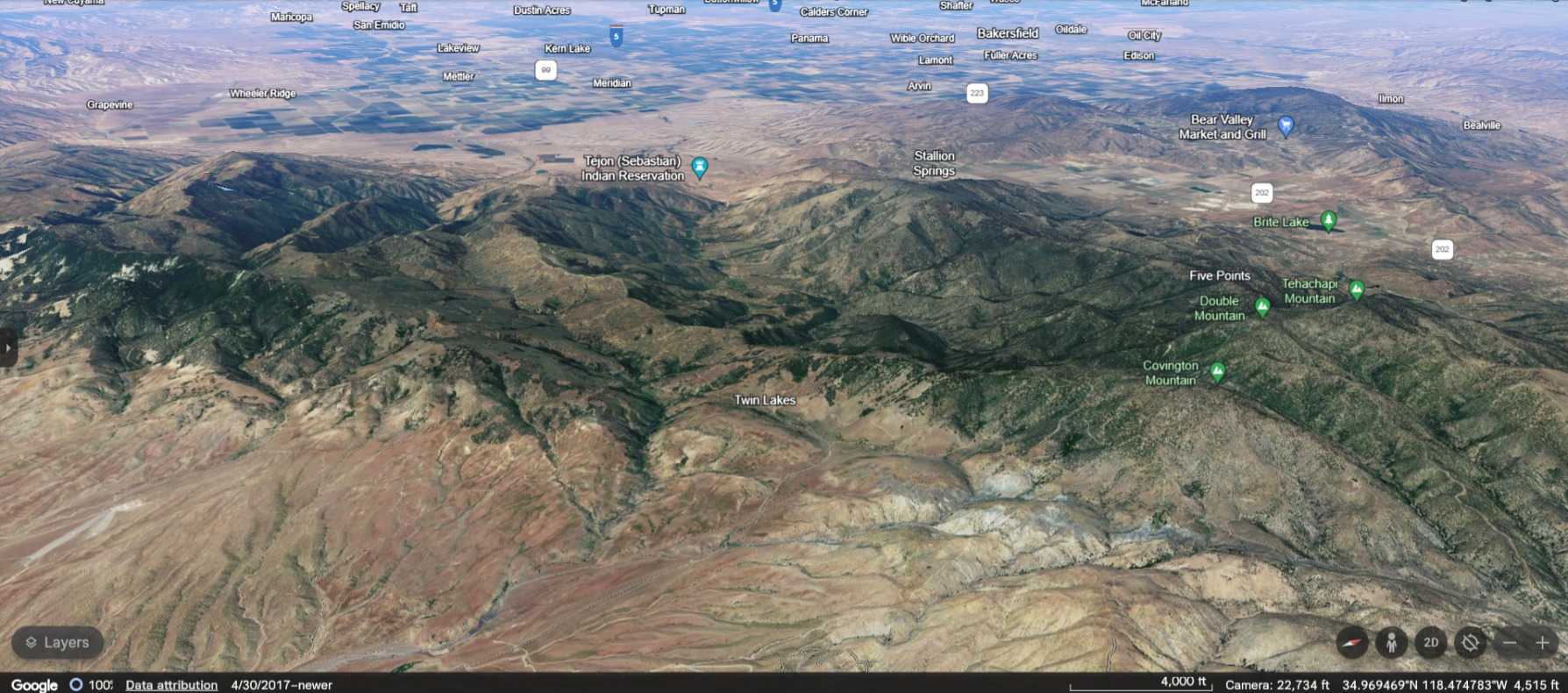
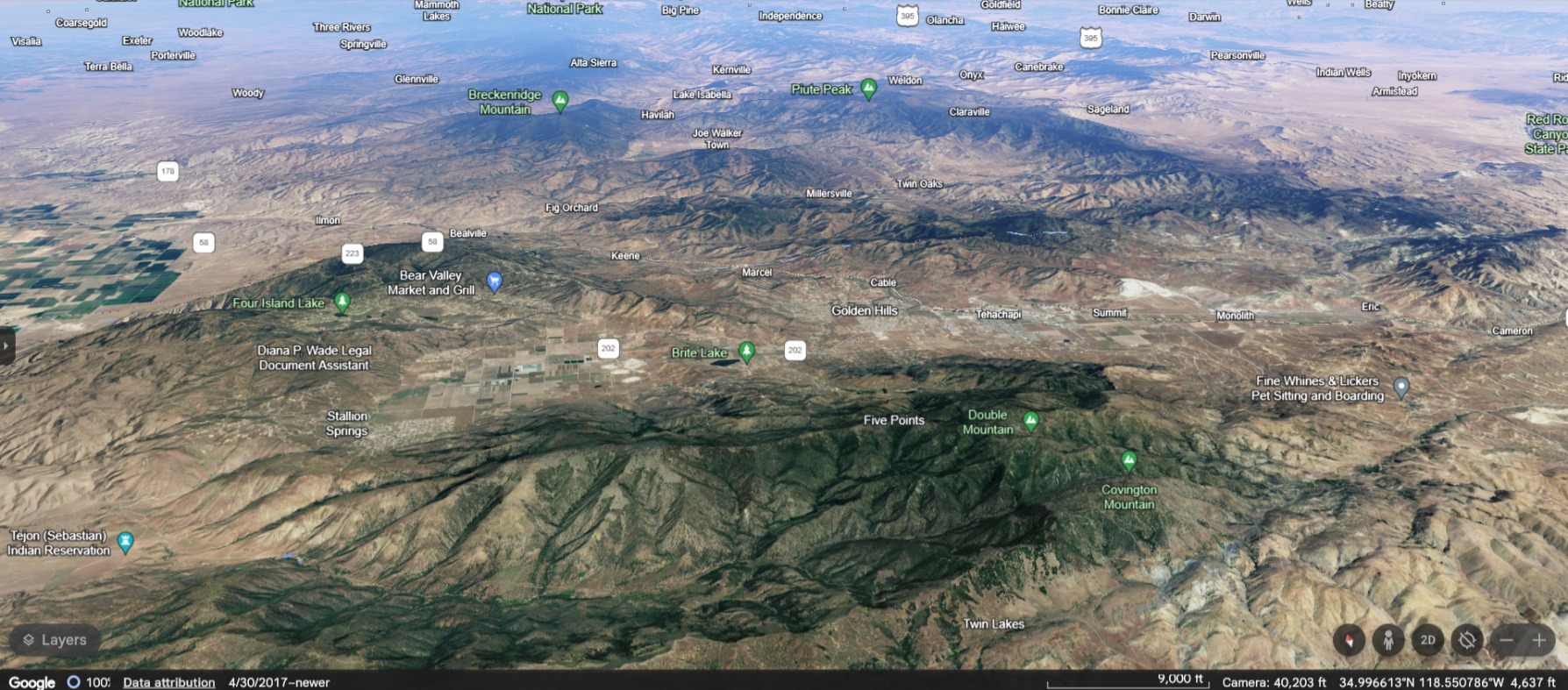
The Tehachapi Mountains, looking northwest. Mark the transition between the Central Valley and the Mojave. Rugged chapparal, grasslands, oak woodlands and savannah.
Showing alignment on Tuesday. Winds from the north. Grapevine to Tehachapi Mountain.
By Wednesday afternoon, northeast winds are blowing across the ridgelines.
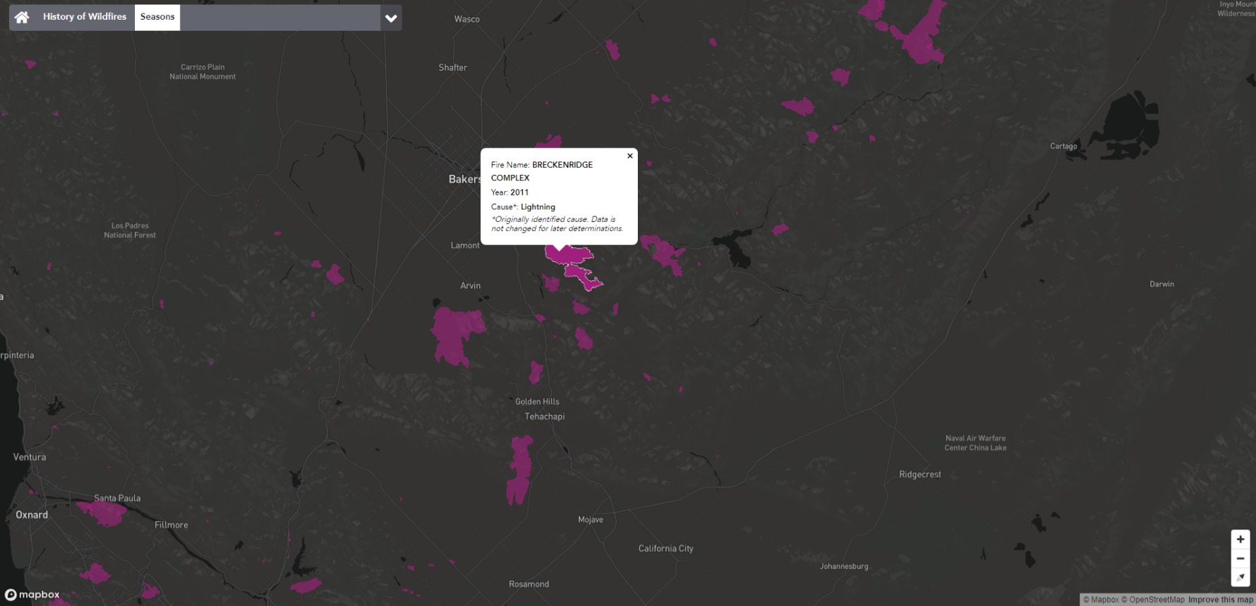
Not much recent fire history. Lightning burned a lot of acres in the fall of 2011.
Chins in the wind. 
At this time, all models bring a season ending rainfall event next week. There is a slight chance the frontal boundary washes out before moving around Pt. Conception but atmospheric river ensembles show a pretty good chance of AR making it south. The lack of fire activity across South Ops the last three seasons is pretty exceptional.
Continued blocking pattern over Canada and the Pacific NW with an enhanced subtropical jet stream over Mexico rather than the desert SW this winter could favor more cold continental airmass intrusions from the NE in a Modoki El Nino like pattern.
Variable is right. The HRRR model was predicting this to be mostly over by tonight, but instead the winds have sustained, rH took a nosedive and the Fire Watches have been escalated to Red Flags through tomorrow morning.
If it’s any consolation for surfer helo, while light to moderate offshore winds help the waves to stand up, a hard blow just makes a mess of it all.
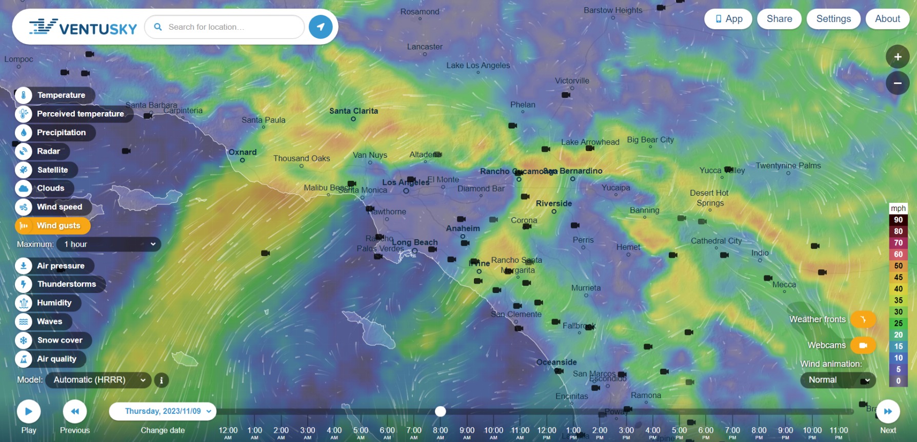
Ventusky HRRR for THU Nov 9 8am.
These winds don’t look as strong as during the 2021 Alisal Fire, but one of the issues of fires near the water is when wind directions change abruptly near the waterline because of the way the Pacific is like to rip sideways through the channel, disrupting normal orbital patterns.
The Catalina Eddy is mostly reestablished in the channel and there will be an onshore flow in Ventura County today, with some northeasterly gusting to 25mph in the Angeles and San Bernadino Mountains.
Sun Fire may see a bit of northwesterlies to 20mph in nearby Honda Canyon and the Santa Ynez ridges in the late afternoon. Crews that are still on the fire grounds tomorrow may get to see a Falcon 9 launch from Vandenberg around 11am.