Hey all pretty big enhancement to the Feature Layer Plugin, DART and FireGuard
Hey all pretty big enhancement to the Feature Layer Plugin, DART and FireGuard
New plugin that is all hazards weather. For the folks that have been around a minute brought in the fire snooper data layer in the weather station.
Want to run ATAK on your Mac or Windows machine? This is a purpose built Android emulator installation that gives you all the bells and whistles of ATAK right on your computer. This is a beta project but I am very impressed so far. I have it running on my macbook with really good results. If you run into any issues DM me.
New layers brought into the Atmosphere plugin.
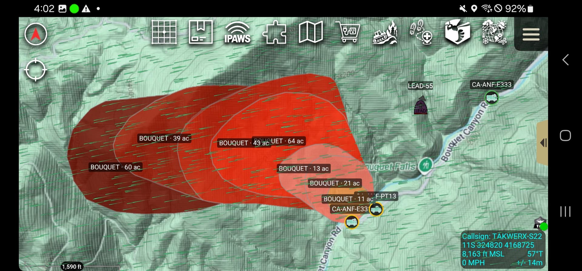
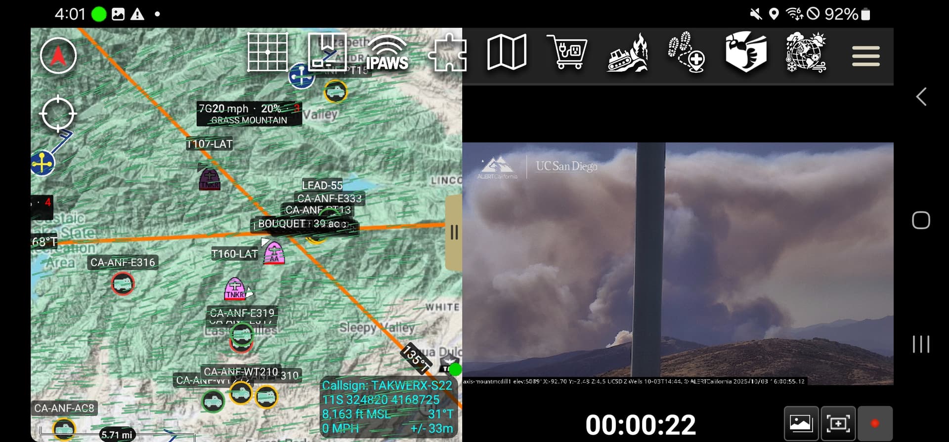
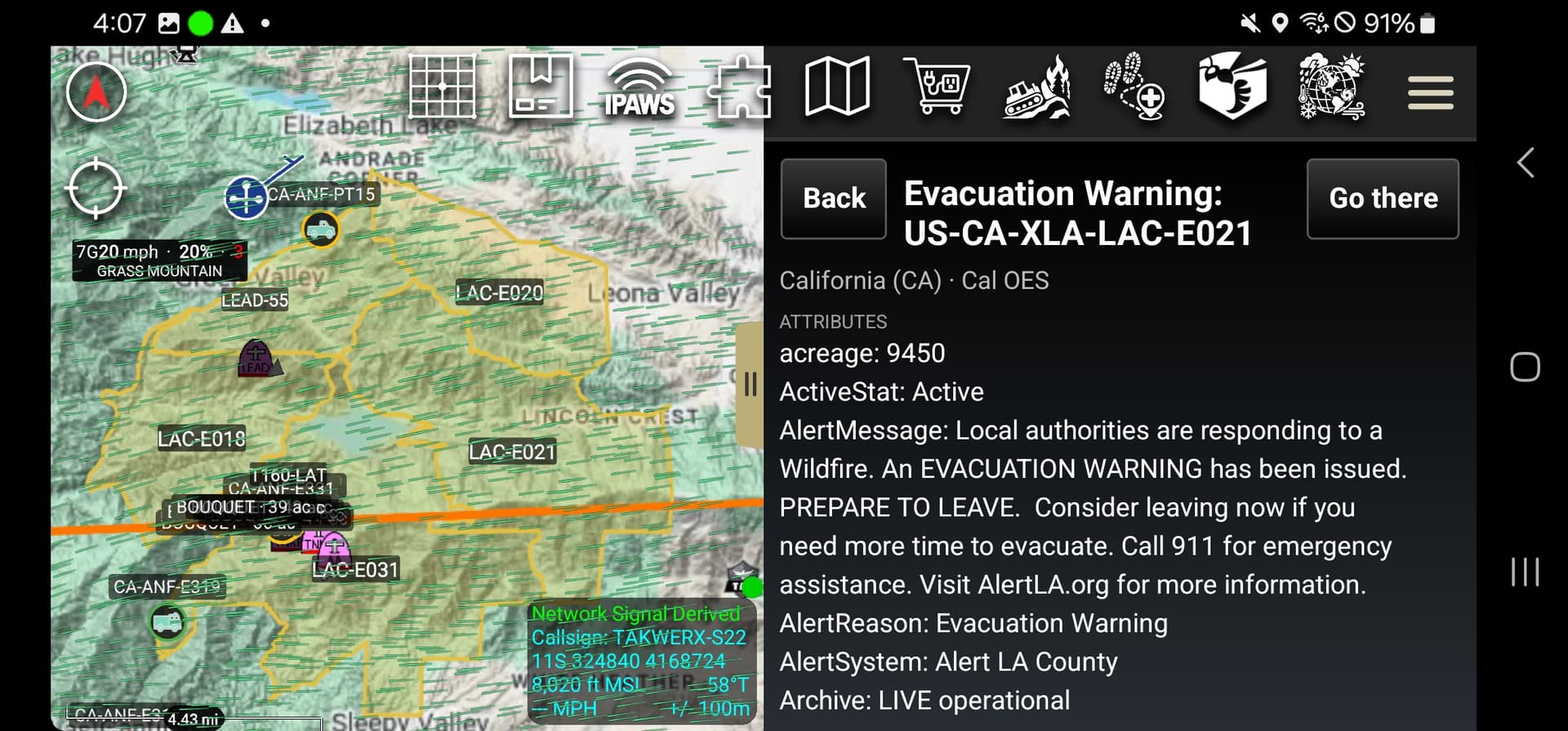
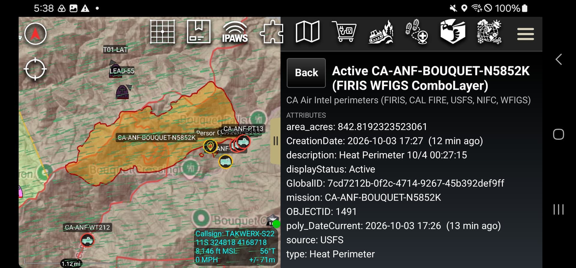
Have a fire to look at recent plugins- CA-ANF-BOUQUET
Cam Depot [cams triangulating]
Atmosphere [wind, weather station]
Feature Layer [USFS AVL, FireGuard]
Evac Zone [Evac Zones from Genasys]
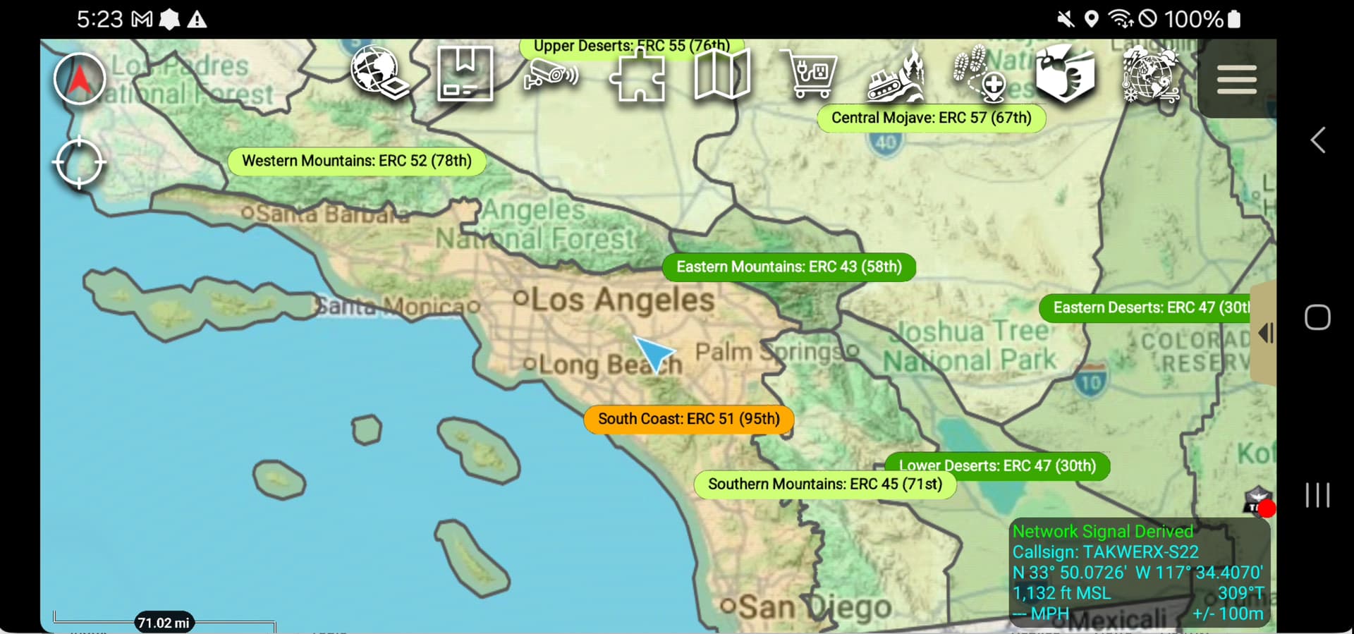
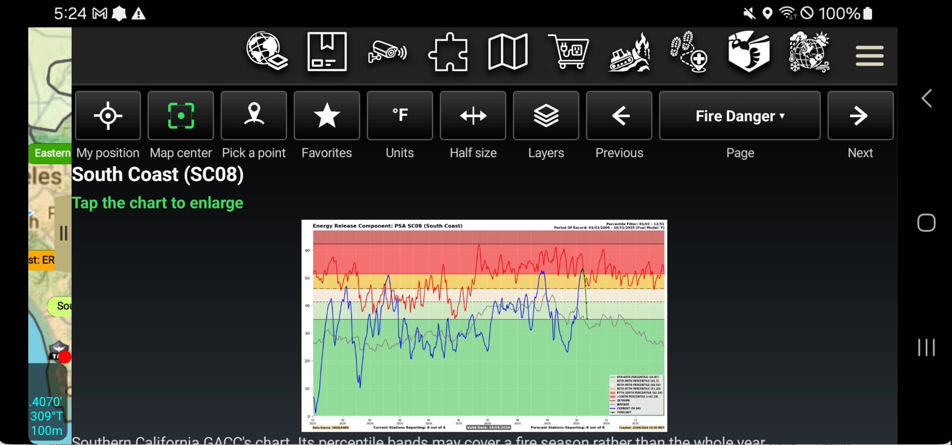
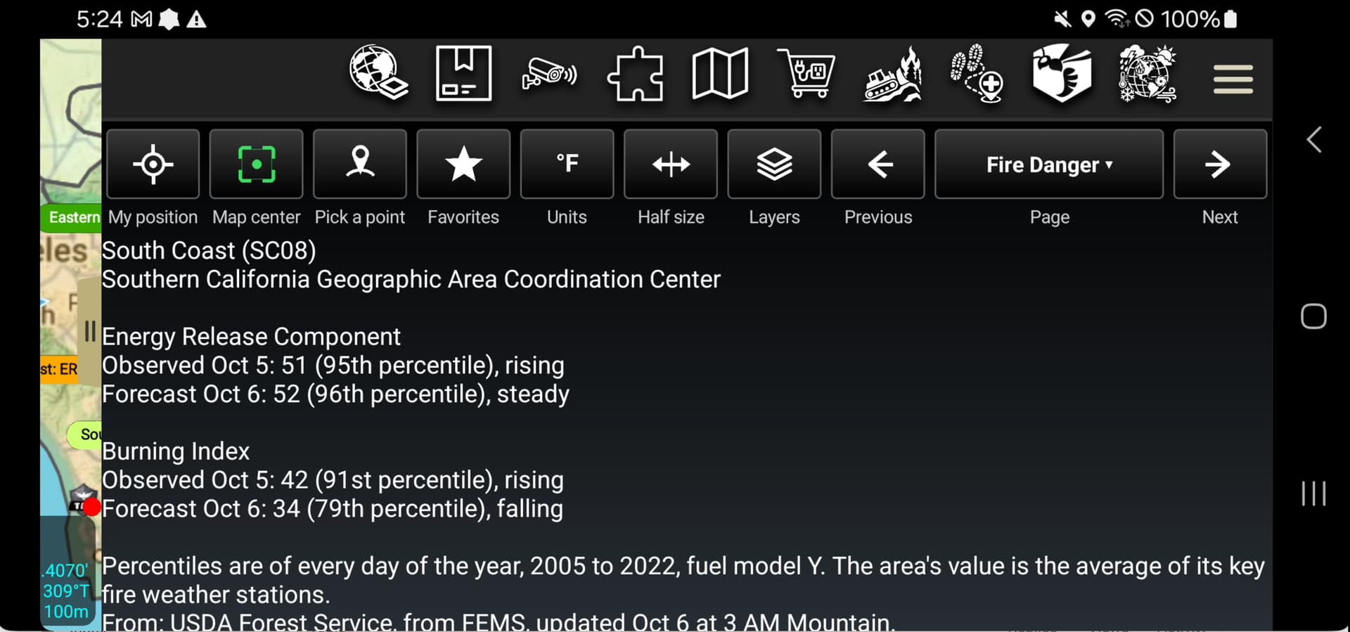
New version of Atmopshere it out. Here are some pics. All the info in the release notes but what I love the most is ERC as a map layer. Then click it and get the forecast.
Feature Layer plugin with some new updates.
Fire History with the ability to isolate certain fires that are relevant to your current incident. So bring up layers by decade, find the fire(s) you care about, make them on a fav list for the new/emerging incident. Clear all the other history off the map.
Added NIFC wildfire feed and rx feed for both new starts and on going incidents. This does included state and local gov who feed into IRWIN.
User guide with pictures on the link.
Had a request for UAS Flight planning. In the end the plugin became way more than that and is calledd AIR-AWARE
Here is the conop - user is on wildfire, Air Attack says this is your ceiling. How do you know what ground you can cover with a 400 ft max height above terrain (or less). The user saw the Dozer Country plugin and said can you do this. So built it. And expanded. If you know the area you want then it will give you the ceiling to ask from the air attack. You can do all this because ATAK can have the terrain data on it, you can download it from map depot.
So took that and then added FAA obstructions, TFRs in 3D even turn it into a geofence so with adsb in you would know if someone broke the TFR., METARS, FAA Airsoace in 3D, UAS celing for controlled airspace, ability to link to a LAANCE app like Aloft, and file a NOTAM.
NOTAMS coming soon once API is approved. Enjoy. Pics and all that in the link
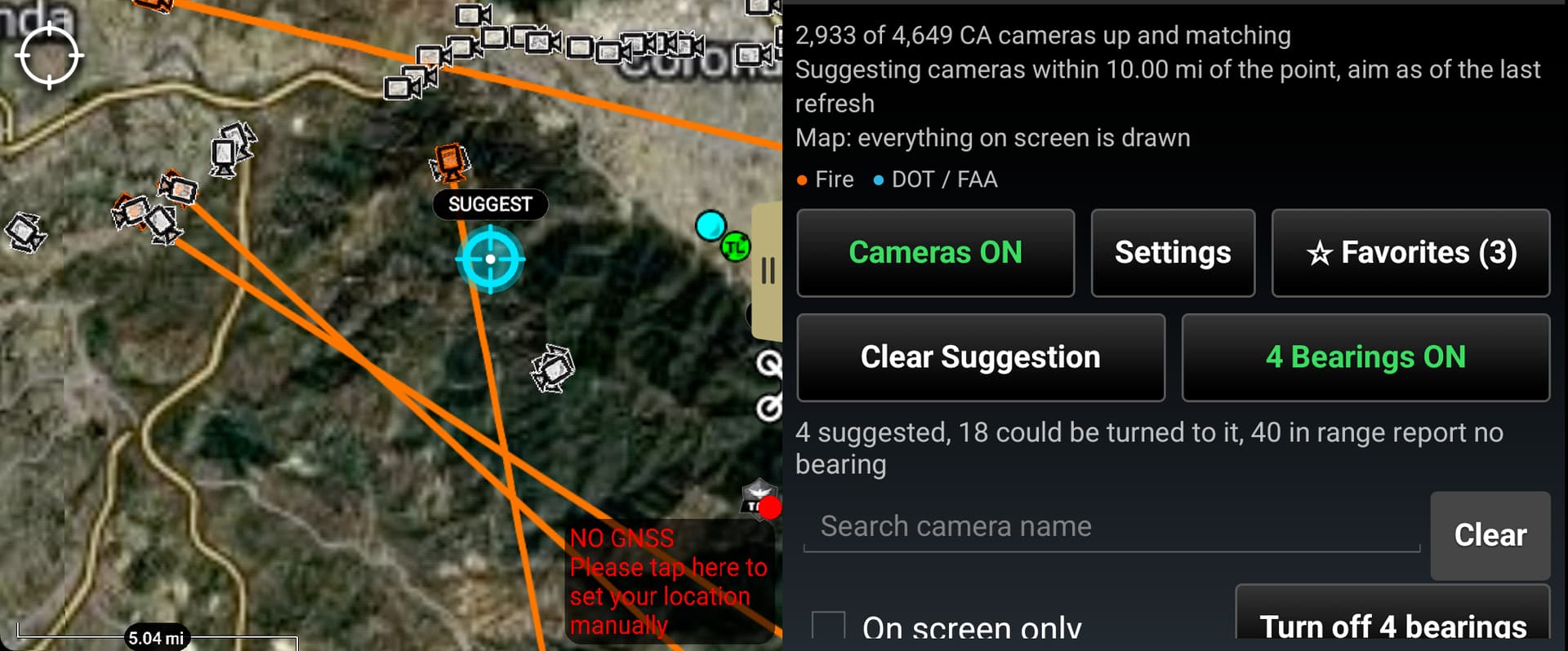
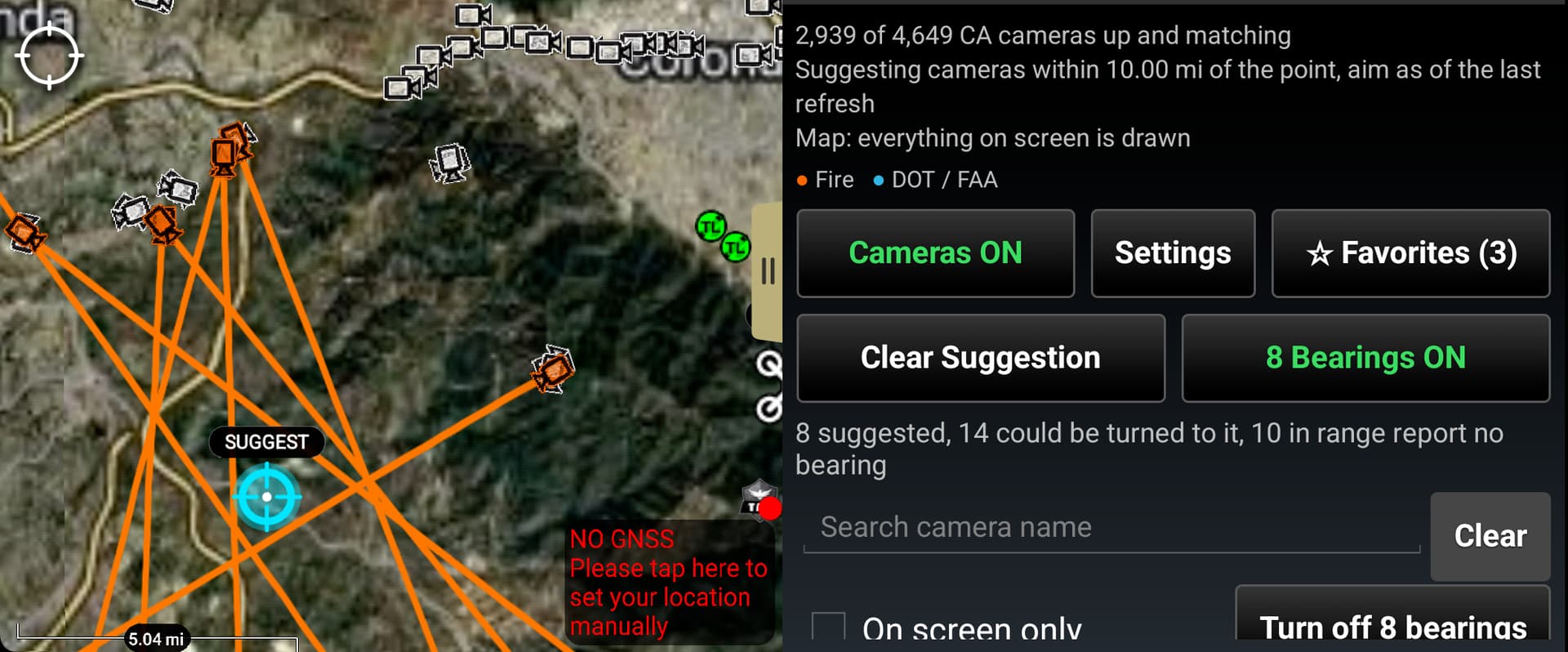
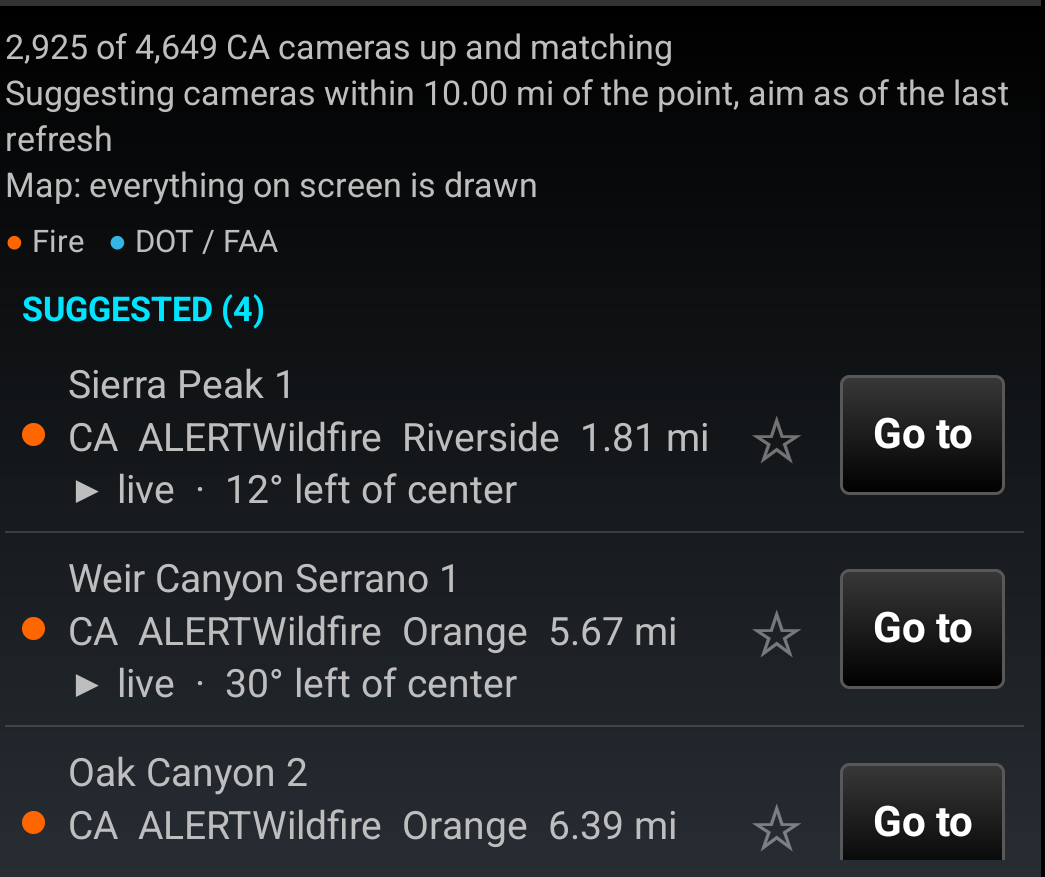
New update to CAM-DEPOT plugin. Problem to solve was I have a fire in the area with lots of cameras and I did not want to turn on all 1000 lines of bearings on all the alert cameras.
So now you can drop a point on the map and it will 1. Give you a “Suggested” list of the cameras that are pointed in that area. 2. with one button click turn on the lines of bearing so you know what camera most likely is the best to turn on. It aint perfect by any means but a great start. You can also drag it around with the bearings on and it will just keep updating the list and turn on LOBs.
Another release today for MAP DEPOT
This gets you Aerial Disaster imagery. I have it gated for the past two years. So if Vantor/Maxar or Civil Air Patrol or FEMA release imagery its on the list for you to download. Palisades is on there right now. Also expanded a new overlay so you can put google streets and points of interest right on top of the imagery so you arent guessing where that is. Pics in the link, click on the user manual.
New features added to Atmosphere Plugin.
Wind Heat Map, Live and Dead Fuel moisture on the map, More Storms data, tornados etc, Rain gauges, debri sflow post fire, earthquakes.
Pics from the user guide here.