DNR is responding to #CowCanyonFire, 12 miles SW of Ellensburg. Approximately 200 acres, structures threatened.
3 Likes
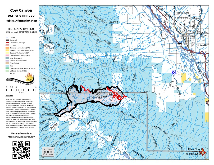
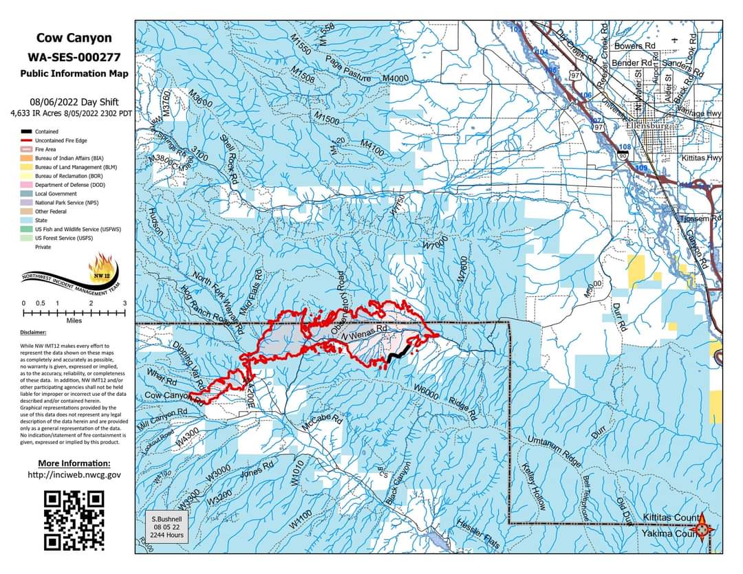
#CowCanyonFire SW of Ellensburg, WA. 4,009 acres per infrared flight 8:51pm yesterday. This is a much smaller burn area than shown by a guesstimate map posted yesterday on the NIFC server. #WAfire #WAwx
Open #GISsurfer map: bit.ly/3BKq0Jo
2 Likes
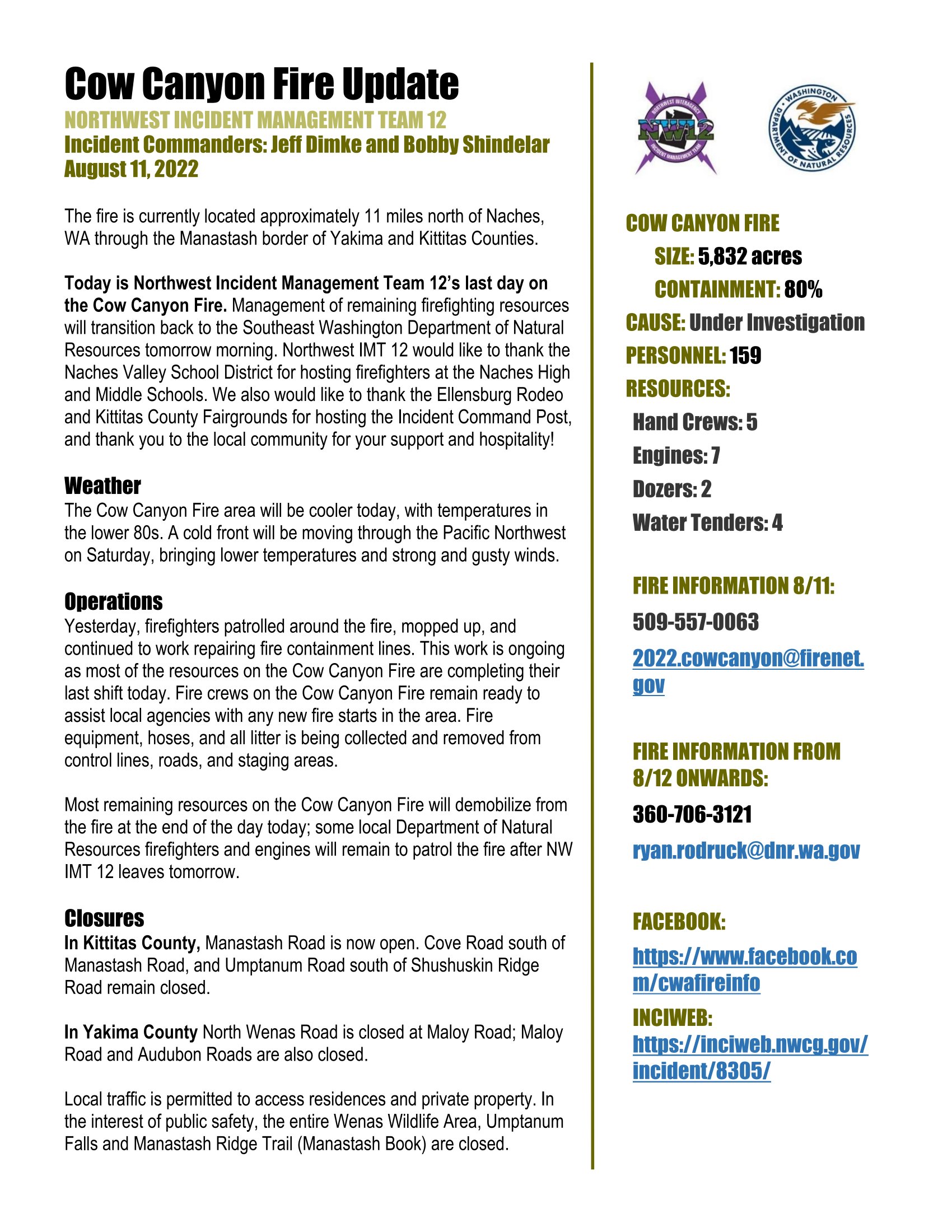
#CowCanyonFire Update
NORTHWEST INCIDENT MANAGEMENT TEAM 12
Incident Commanders: Jeff Dimke and Bobby Shindelar
August 6, 2022
FIRE INFORMATION:
509-557-0063
2022.cowcanyon@firenet.gov
Facebook: Redirecting...
INCIWEB:
Cow Canyon Information - InciWeb the Incident Information System
SIZE: 4,633 acres (Fire acreage updated due to more accurate mapping)
CONTAINMENT: 15%
CAUSE: Under Investigation
RESOURCES:
Hand Crews: 6
Engines: 6
Dozers: 6
Water Tenders: 2
Helicopter: 1
There will be a virtual community meeting today at 5 PM on the Central Washington Fire Information Facebook page.
The fire is currently burning approximately 11 miles north of Naches, WA through the Manastash border of Yakima and Kittitas Counties. The Incident Command Post at the Kittitas Fairgrounds in Ellensburg is closed to all but essential personnel to help ensure the health and safety of community members and firefighters.
Weather
A warming and drying trend is moving through the area with temperatures in the lower 80s today.
Operations
There was increased fire activity yesterday on the north and west flanks of the fire as winds from the east moved the fire down the North Fork Wenas drainage. Firefighters located and quickly extinguished a few spot fires midday, while both helicopters and fixed wing aircraft were used for water and retardant drops on northwest portion of the fire throughout the day. Dozer line was constructed on the northwest side of the fire near Mud Flat Road. Fire crews worked along Audubon Road, improving the road to use as a fireline. Firefighters also assessed and prepped structures in the Manastash Creek area. Late in the evening, fire crews completed a burn out operation to remove fuels on the northwest flank between the head of the fire and the dozer line. Firefighters worked through the night to locate and suppress any spot fires.
Today, fire crews will continue to secure the northwest flank of the fire as well as watch for spot fires or flare ups that may emerge as the temperatures warm through the day. Firefighters will be scouting for spot fires to further secure the perimeter. Multiple aircraft are available today for water bucket drops and retardant as needed.
Closures and Evacuations
The entirety of the Wenas Wildlife Area is temporarily closed for human safety due to the Cow Canyon Fire.
Level 2 and 3 evacuations are in place on the Cow Canyon Fire in both Yakima and Kittitas Counties. Evacuation details for Yakima County are located at Redirecting... and Kittitas County are at https://tinyurl.com/2225ruhs.
TEMPORARY FLIGHT RESTRICTION
A Temporary Flight Restriction is in place over the Cow Canyon Fire. Please consult the Notice to Airman for specifics. Wildfires are a No Drone Zone.
1 Like
5,832 Acres
Contained: 40%
1 Like