#NakiaCreekFire update: Crews will continue to engage the fire throughout the day utilizing both ground and air resources. An acreage update will be provided after aerial survey.
No evacuation orders are in place at this time. The public is asked to remain clear of the area.
Last night it was reported 70 acres
The #NakiaCreekFire is visible on two Alert Wildfire cams in Oregon, one from the Brightwood cam, and then from the West Hills 1 cam
#NakiaCreekFire update: The fire is estimated at 150 acres with active fire behavior. A Type 3 Incident Management Team has been assigned. Ground and air resources continue to engage and establish control lines. Updates as available.
All access between the L-1600 Road at the Jones Creek ORV Trailhead and the L-1500 Road at Four Corners is currently closed due to the #NakiaCreekFire. This includes all motorized trails in the Jones Creek and Hagen Creek systems, as well as the Larch Mountain Trailhead.
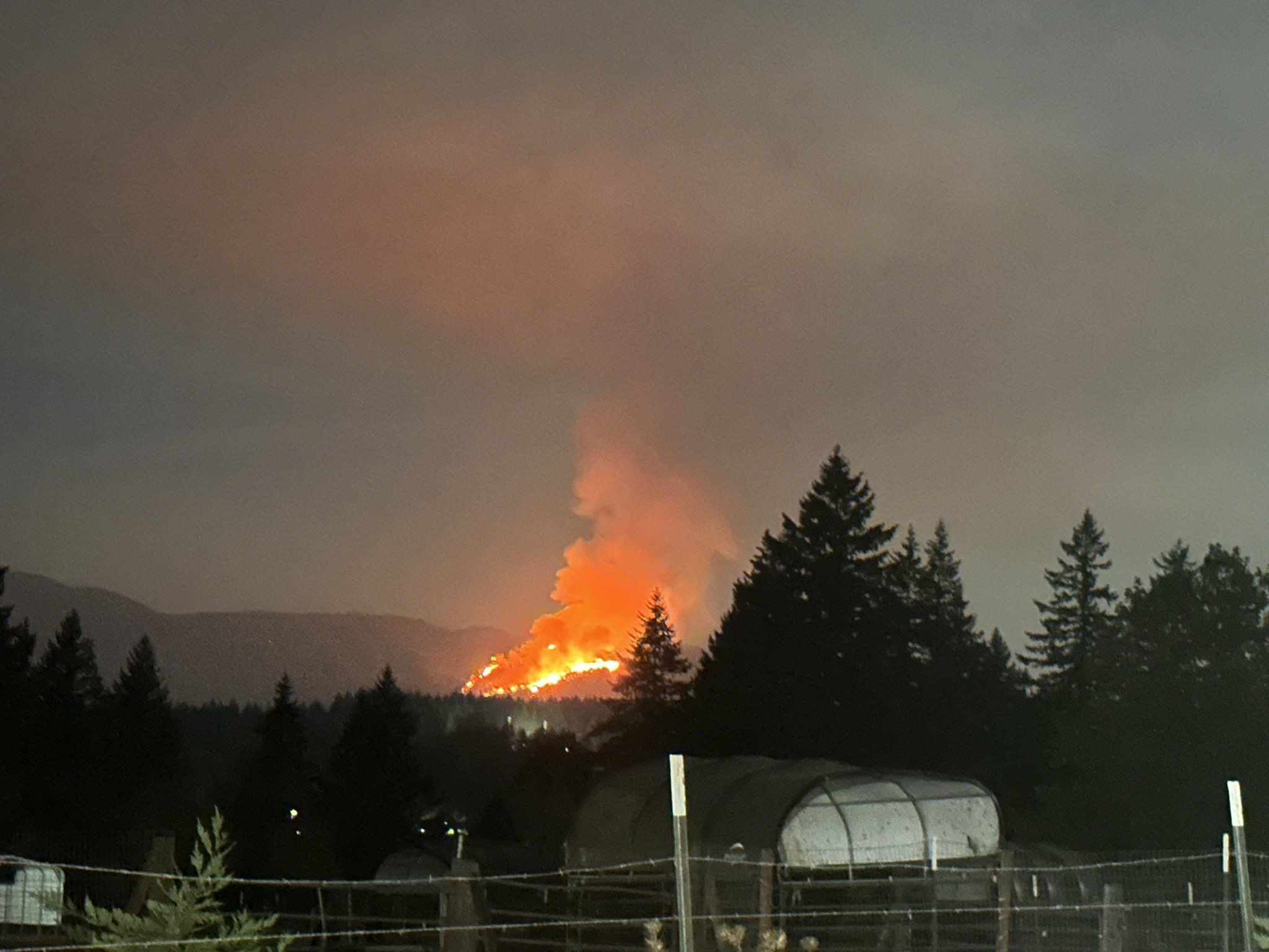
The Nakia Fire was reported on the evening of 10/9/22 on Larch Mountain, Washington DNR Land. The fire was worked during the evening and into Monday by local fire crews and State Land using aviation tools due to location and terrain. Last estimates, the fire had burned about 250 acres. The Fire showed some extreme fire behavior on Monday, but crews were making good progress on handlines in the steep, rocky terrain. Please avoid the fire area, and pay attention to all closure signs.
Road Closures:
All access between the L-1600 Road at the Jones Creek ORV Trailhead and the L-1500 Road at Four Corners is currently closed. This includes all motorized trails in the Jones Creek and Hagen Creek systems, as well as the Larch Mountain Trailhead.
Evacuation Notices:
Clark Regional Emergency Services Agency (CRESA911) Emergency Management sent out notifications to homes within the 3 different levels Monday Evening.
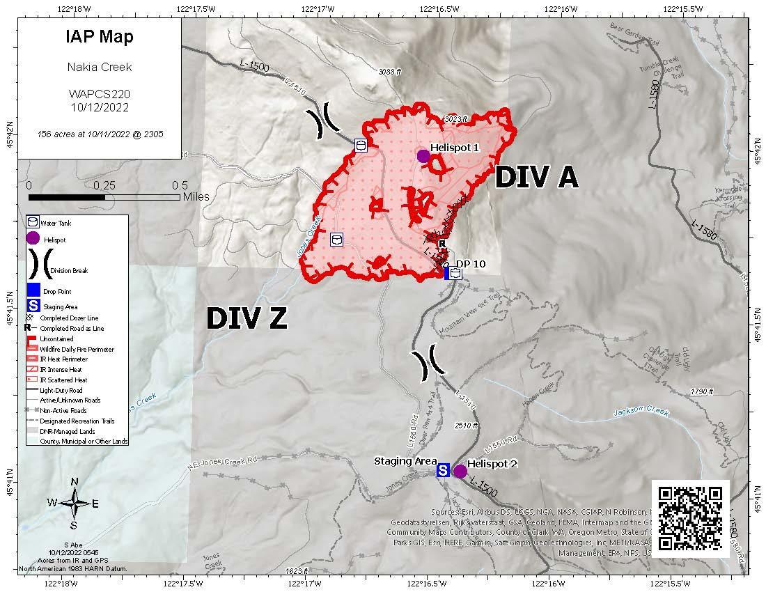
Below is the interactive map of the fire and notice areas.
Monday evening, Washington State DNR requested CRESA to assist in sending out Notification notices to homes who may need to evacuate. Below is a map of the different zones.
Fire has jumped the line today, putting up a decent smoke show. Was hoping somebody had some freqs or even an IAP. Not sure if thats possible with DNR fires. Thanks
Nakia Creek Fire has broken containment lines and the go now evacuation zone has increased in size. Fire is aggressively moving West/Southwest. Please check CRESA Nakia Fire Blog for most current info. CRESA has sent Notifications out. Deputies are in the area.