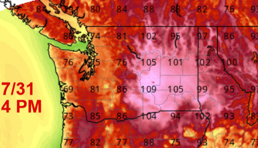
Surface temperatures in the 85-110 range today
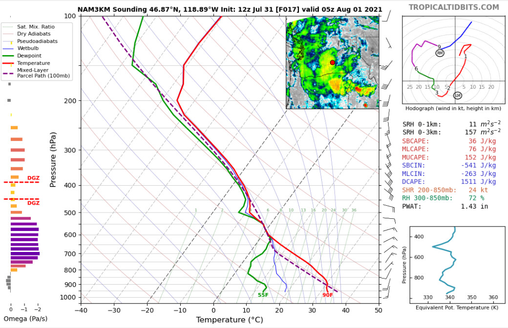
Strong inverted V profile despite PWV above 1", there is a sub cloud dry layer especially at 850 mb… its a recipe for dry lightning today

Surface temperatures in the 85-110 range today
Strong inverted V profile despite PWV above 1", there is a sub cloud dry layer especially at 850 mb… its a recipe for dry lightning today
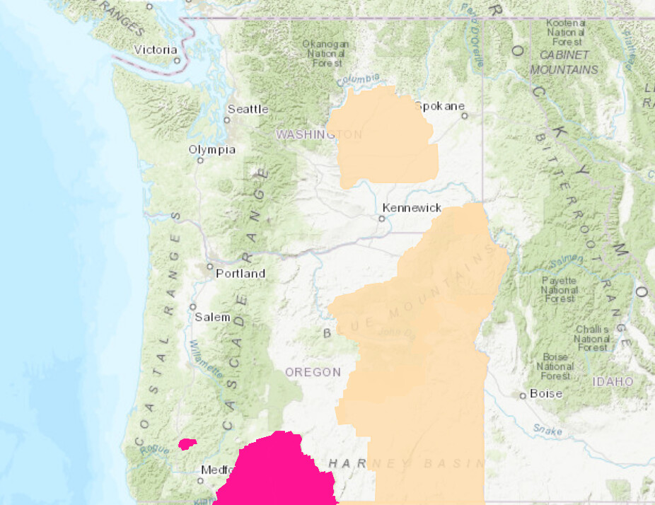
The northern Cascades eastward got hammered by lightning today. Precipitation has fallen. On Thursday a potent shortwave moves into the area with a lot of instability. Thunderstorms will be very widespread.
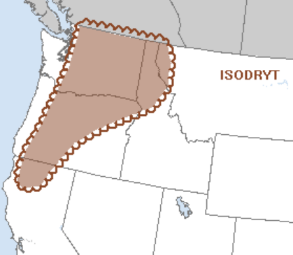
A fire weather watch is in effect for dry lightning on Thursday.
Forecast models are in unanimous agreement. This discussion pertains to Oregon as well.
A potent trough will drop out of Canada along the Cascades Saturday into Sunday. This will significantly increase winds along the lee of the Cascades and other mountain ranges. Several timber fires and new fires from lightning strikes could see explosive growth. The inhibiting factor is RH above 20%. Nonetheless, expect significant fire behavior.
As this trough digs in the primordial flow across the upper midwest a strong upper level high pressure system noses in off the Pacific Tuesday into Wednesday. Heights approach 597 DM and temperatures will warm considerably! To go along with this, surface high pressure across Idaho and Alberta will turn gradients offshore, compounding the drying and heating adiabatic process.
Fuels will dry out very quickly, with extremely hot temperatures lasting into early next week. The ECMWF forecast model has temperatures reaching up to 110 east of the Cascades. Seattle proper reaches the lower 90’s.
While this will likely not reach the upper maximum temperatures of the historic heatwave in June/July by 1-4 degrees, the Pacific NW will be trading those couple degrees for a much longer heat episode.