Wildfire Intel
Where do you feel the NOPS / SOPS GACC divide be?
California & Hawaii Hotlist
Questions and Discussion
ghost7
July 19, 2023, 2:31am
21
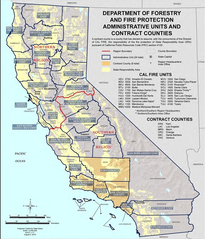
Web capture_18-7-2023_19313_efaidnbmnnnibpcajpcglclefindmkaj
714×831 215 KB
Man, where has this been?
1 Like
show post in topic