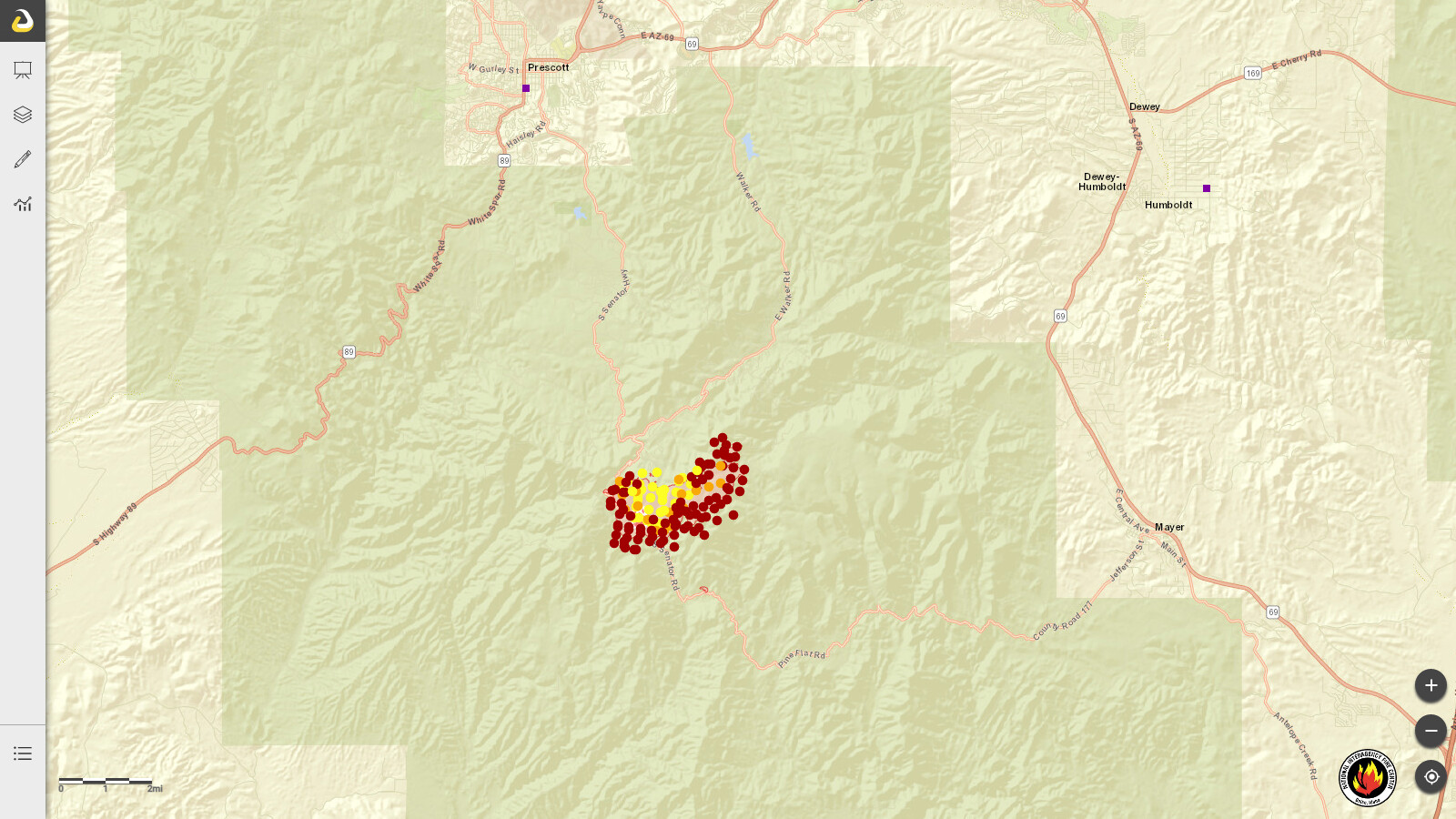
Does anyone have more information on this? South of Prescott, AZ. Some evacuations and road closures, and it sounds like it had LATs and VLATs working it yesterday. Not to be confused with the Crooks Peak fire in NM.
Crooks, Prescott NF, USFS. IMT 1 (CA Team 4) mobilizing. Eleven miles south of Prescott, AZ. Timber and chaparral. Active fire behavior with group torching, flanking and spotting. Communication infrastructure threatened. Evacuations and road closures in effect.
Fairly quiet in the local PNF freqs. No movement of local resources from North of Mingus (Verde Valley) that I have heard. I’m sure once the team transitions, more resources will be ordered.
This particular area has had some RX activity some 20+ years ago. I will say though…lol. is a wee bit early for this kind of activity. And, if you head north to the Greater Flagstaff Region (GFR), you will find some RX burns actively burning.
And to make matters worse in Yavapai County, extended red flag conditions until tomorrow (so far) winds at my house is 15, gusts to 32 last hour and dry lightning between Cottonwood and Sedona…and it’s only April
Pretty dry over there for this time of the year, was over that way in the Prescott area a few weeks ago and was commenting to my folks on how dry it was for this early in the year. Be safe
Government fire is located in Belmont (LG-Ponderosa Fire District), 10 miles west of Flag, north of I-40 across from Camp Navajo. Fire is in the MTZ of Kiabab NF. Last I heard, holding at 5 acres.
OH - Tunnel apparently is getting a FED Type 1 Team from CA - I guess it should get’s its own thread…I am just busy now though if someone else wants to do it.