Air Attack-230 on scene of a couple acres with a rapid rate of spread. smoke showing on a few Cams here. Highway 193 and Greenwood near Georgetown. Evacs taking place at this time, Tankers are doing structure defense. Cam link here http://www.alertwildfire.org/tahoe/index.html
Added correct Cam link. Coon hollow showing the Column.
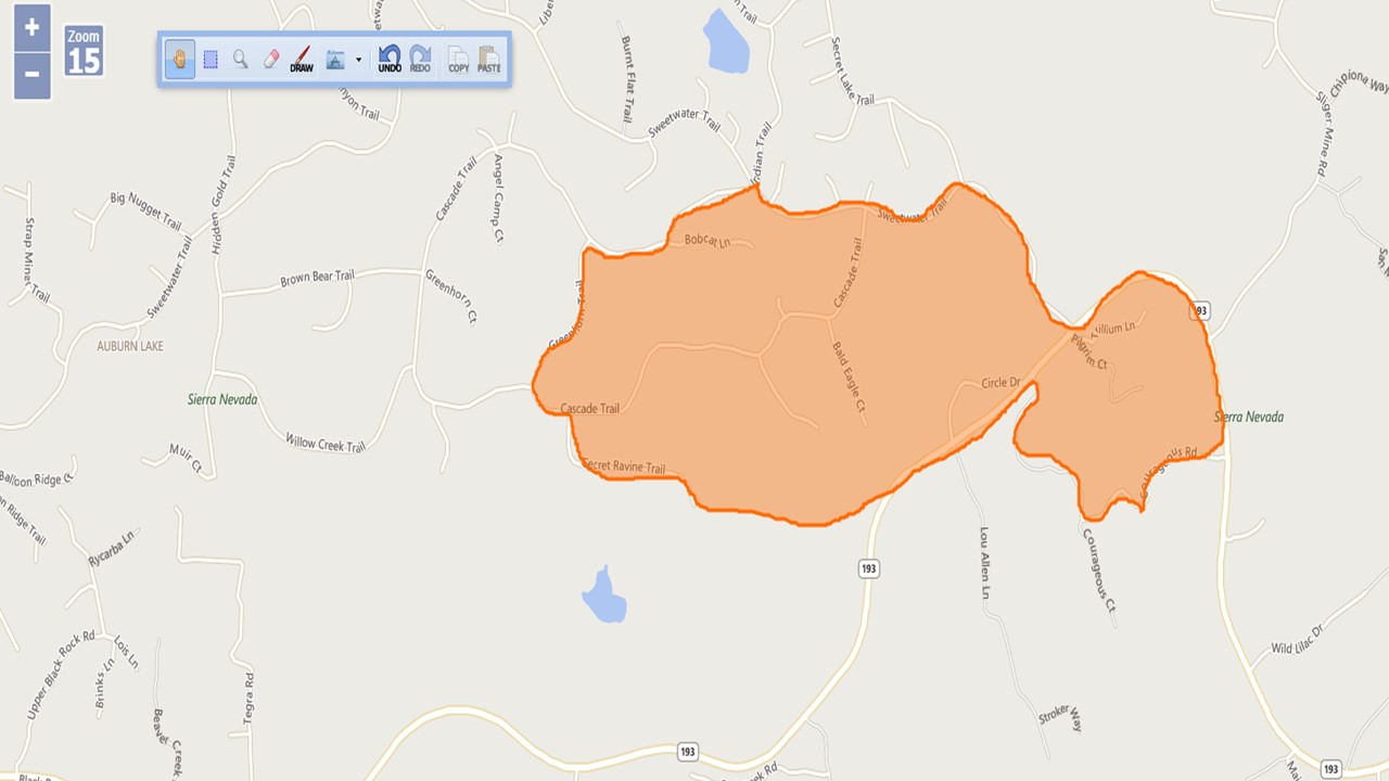
The fire is throwing spots across the Canyon threatening structures, AA wants evacs of Bald Eagle Ct, Cascade Trail + Stoney Hill Ct. 5 additional type 3 engines started.
Got a big column on it. Heard AA arrive and state it was at least 10-12 acres and heading into the timber with no signs of slowing down. Sounds like multiple structures in the area.
State ID: CA
3 letter designator: AEU
Fire name: Country
Location: Hwy 193/country hills ln cool, ca
Reported acres: 10+
Rate of spread: Rapid
Report on Conditions: Structure fire into vegetation, fire running now
Structure threat: Immediate
Resources: 5 additional engines, additional tankers, and LAT from McClellan
Hazards:
Weather:
Radio channels: CDF Tac 9
Scanner link:
Webcam link: http://www.alertwildfire.org/tahoe/index.html
Agency Website:
#CountryFire (#Cool, El Dorado Co) - AA placing a load & hold on both LATs (T134, T137) + releasing T82 back to Columbia loaded. Sounds like good progress being made, little smoke left on cam. https://t.co/u43Exi2Dp0