State ID: CA
3 letter designator: ANF/BDU
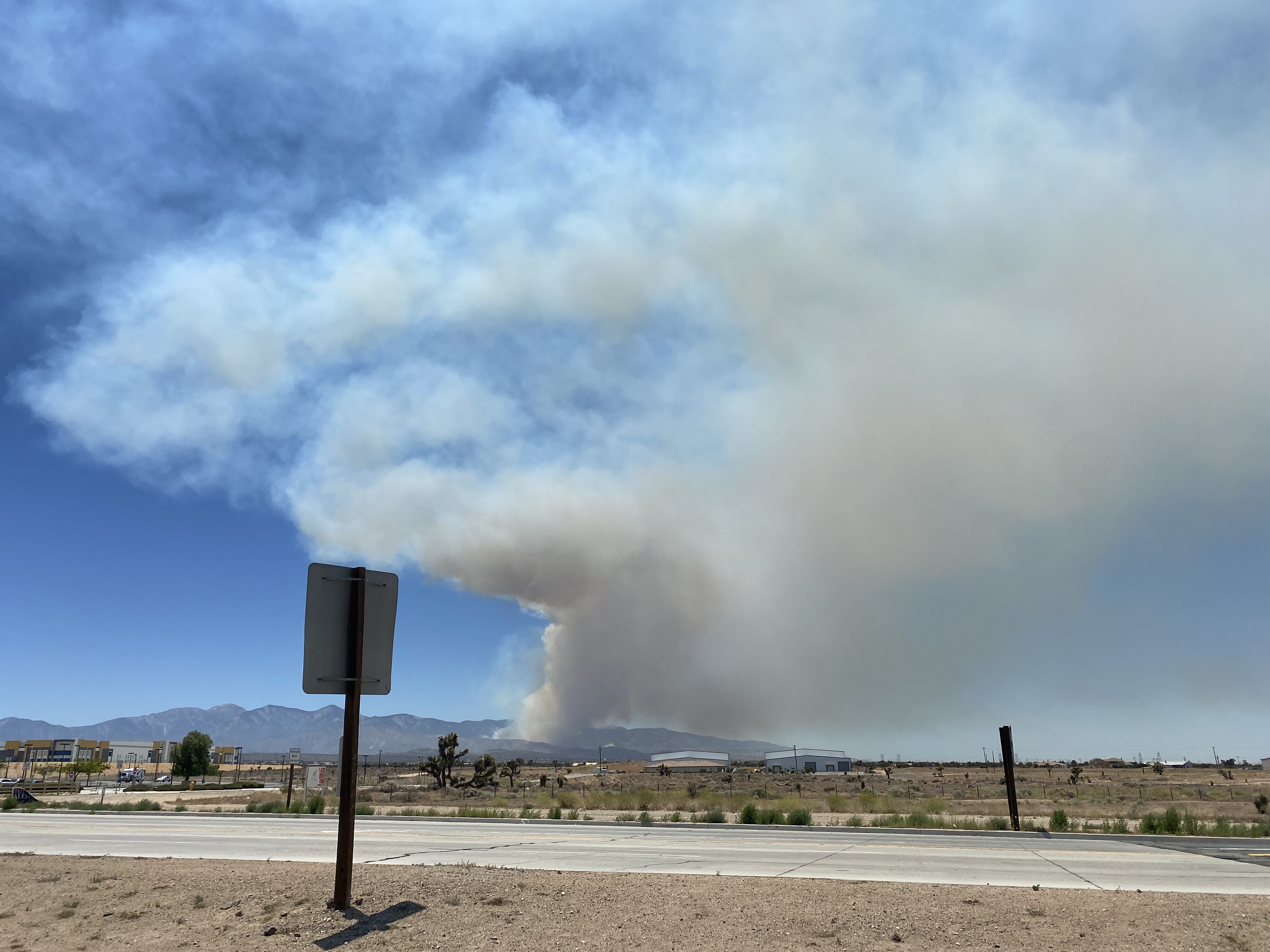
Fire name: Sheep
Location: North of Hwy 2 at Sheep Creek Dr in Wrightwood
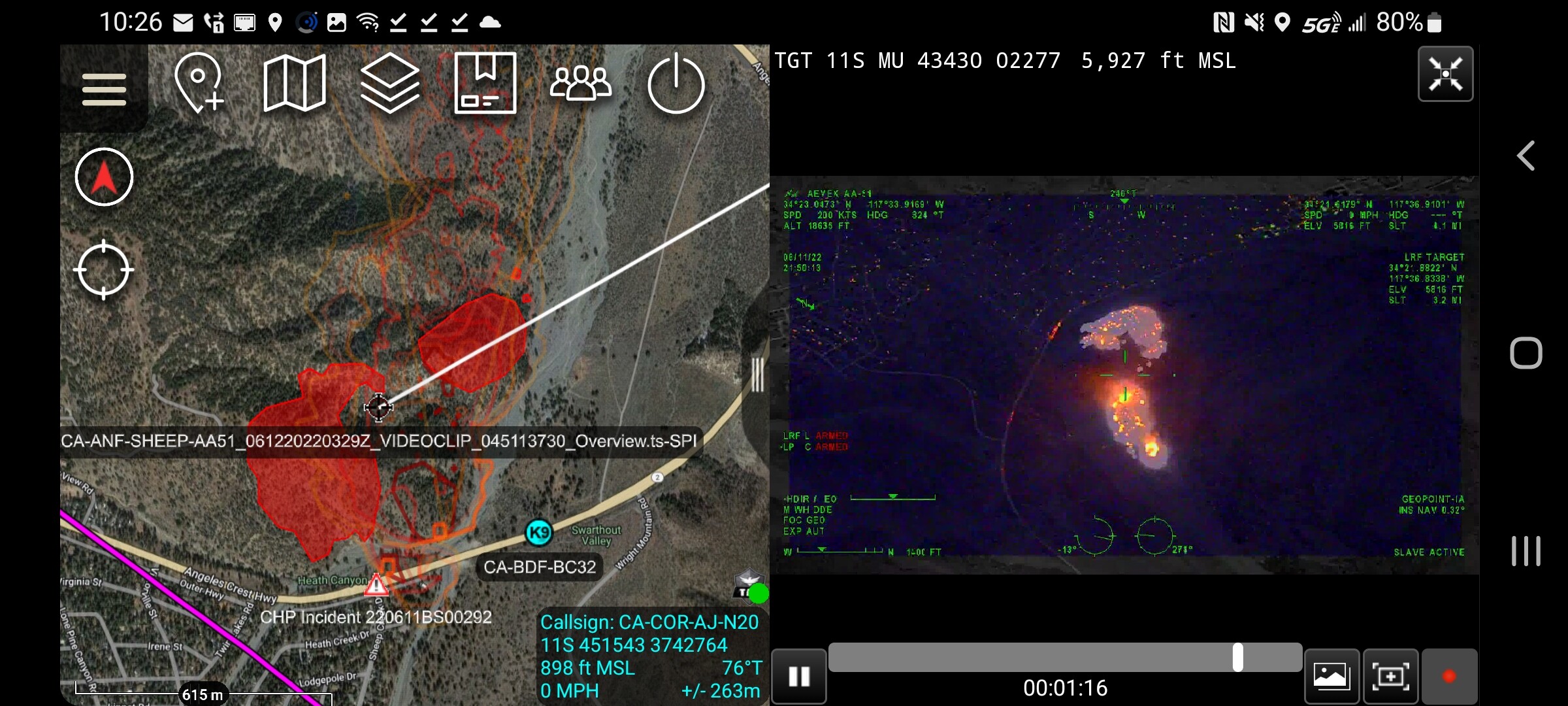
Reported acres: 1/4 acre, now estimated 3-5 burning on a south facing slope.
Rate of spread:
Report on Conditions: Mid slope spotting on right flank
Structure threat:
Resources:
Hazards:
Weather:
Radio channels:
Scanner link:
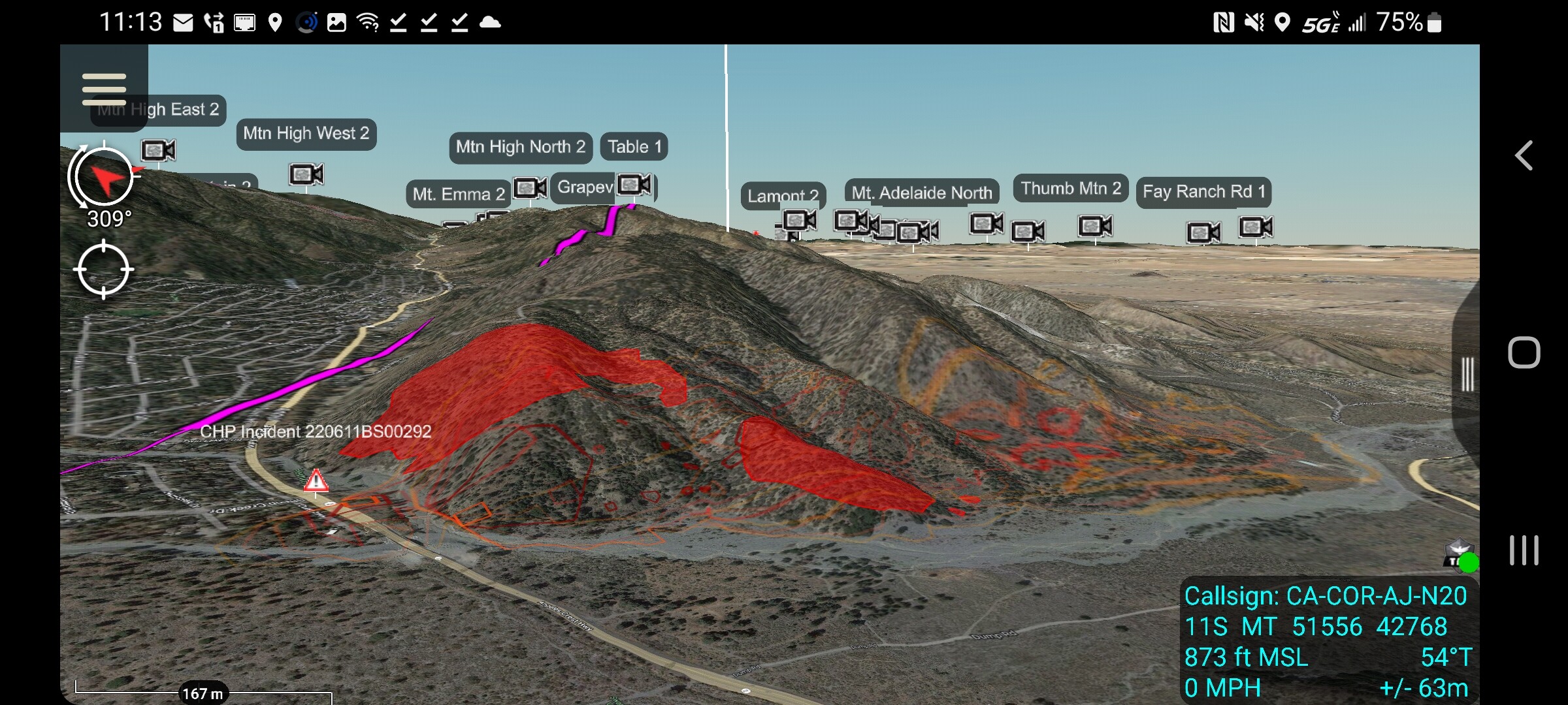
Webcam link: ALERT Wildfire
Agency Website: Video from Twitter https://twitter.com/conannbcla/status/1535818199131770880?s=21&t=i4JUvekrBCFz_5d_an__zw
3 Likes
A couple photos from twitter.
From Lone Pine CYN rd and sheep creek wash #SheepFire pic.twitter.com/5jnd9bNk3U
— Jim Emery (@_JimEmery) June 12, 2022
7 Likes
AA requesting 1 AA, 2 AT. 2 type 1 and 1 type 2 helos. over fire for 0800 hrs. tomorrow
forgot to add IC requested 2 LAC copters for tonight. also AA told him that one night ship out of fox was on order and I missed the other resource
4 Likes
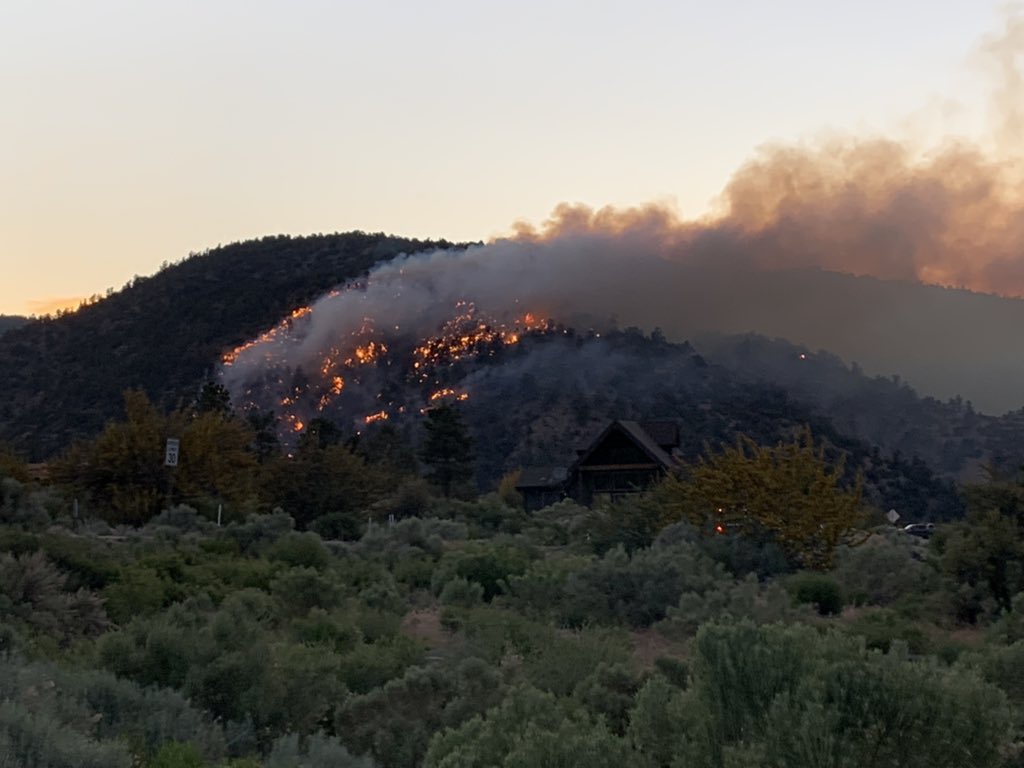
New video showing a few spots out in front and one of them growing pretty well.
5 Likes
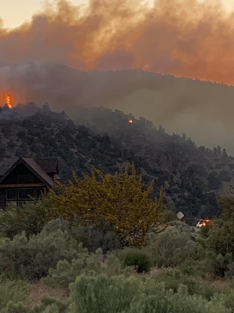
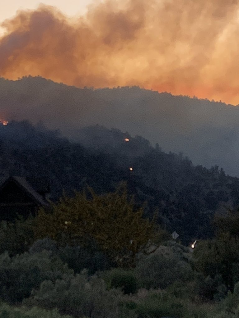
Per ANF AA-51 advising 30 acres with spotting. Main priority is to keep the head from pushing downhill into the community.
5 Likes
Per AA the fire is continuing to spot ahead with 2 new spots taking off. H-531 the night ship is working the spot fire in the flats.
CHP is closing HWY 2 and SBSO has been requested to assist with Evacuations in the Desert Front area.
The main fire is 24 acres and the spot is 11 acres.
6 Likes
INTEL-24 currently mapping the incident.
I saw the AA earlier and a couple helos working that area earlier but kept checking for a post on here.
6 Likes
Updated video courtesy
@_JimEmery
1 Like
another scanner id to listen to:
1 Like
From Inciweb: As of Sunday, June 12, at 8 a.m. - The Sheep Fire is still estimated at approximately 35 acres in size with 5% containment at this time. The fire is still burning away from the town of Wrightwood, CA. Road closures have been updated by Caltrans and can be found at https://roads.dot.ca.gov/. The fire is being co-managed under unified command by both the Angeles National Forest and Cal Fire BDU (San Bernardino Unit). San Bernardino County Fire is assisting on the fire.
CHP log shows Angeles Crest, Hwy 2, closed between the 138 and Wrightwood. Will be reevaluated at 1800 today.
5 Likes
iBooks like the fire is getting legs.
https://www.alertwildfire.org/region/orangecoca/?camera=Axis-Table2
4 Likes
The 15 minute time lapse shows quite a difference in activity
4 Likes
A view from a bit of distance makes clear that the fire is moving.
https://www.alertwildfire.org/region/orangecoca/?camera=Axis-MtnHighEast1
3 Likes
2 additional immediate need type 3 ST’s have been requested. Aircraft are also being requested.
H-3AC, and H-95B are the Helitankers responding.
3 Likes
Can’t seem to find a good scanner feed.
1 Like