5 Likes
Lots of good updates, video and stills via Twitter, https://twitter.com/hashtag/SheepFire?src=hashtag_click
4 Likes
The fire has spotted to the East of HWY-2. Recommending Evacuations of Desert Front.
6 Likes
Reports of fire spotting across Hwy 2 to the east and evacuation warnings for the Desert Front Rd area. A lot of the east side of the 2 right in that area is part of the Blue Cut Fire burn scar in 2016.
3 Likes
3 Likes
AA released the LEAD plane back to San Bernardino plane due to no airtankers flying over the fire, from the turbulence.
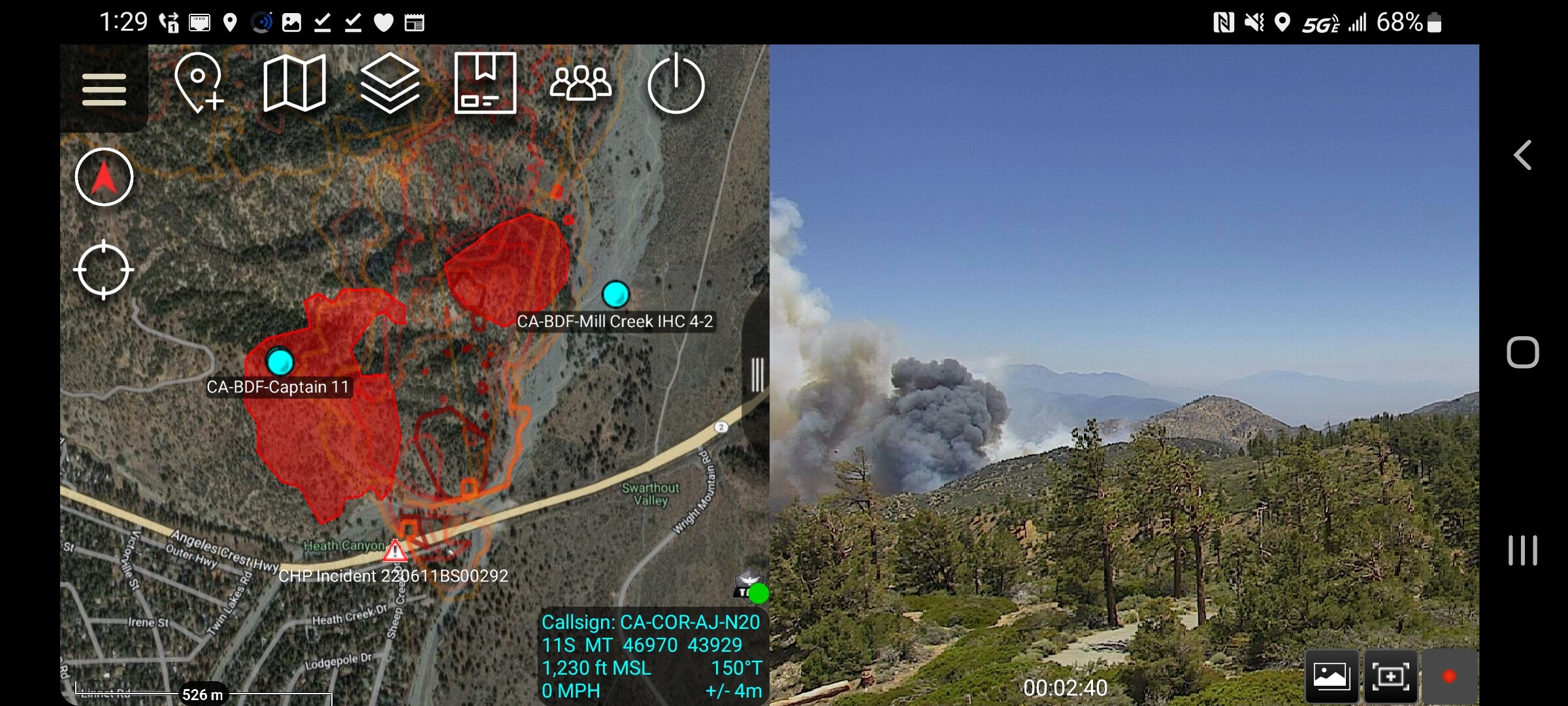
The fire is 150 acres, MROS. Wildhorse Canyon is under a mandatory evacuation now.
6 Likes
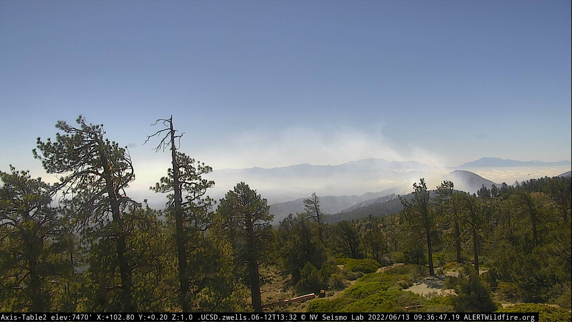
More video of fire behavior and spread along Hwy 2 as the fire pushes out towards the desert.
1 Like
FIRIS Intel 12 en route. Will have updated validation mapping soon. The 1330 update of the Inciweb page stated 45 acres. Anvilhead reporting 150 acres at 1350 stating 150 acres. Winds must be cranking.
2 Likes
15 additional engines any type requested for a State Mission doing structure defense on the BDC side.
Per some live video the fire is down in the flats and bumping Desert Front Rd with some pretty good activity.
1 Like
2 posts were merged into an existing topic: CA-ANF/BDU-Sheep??
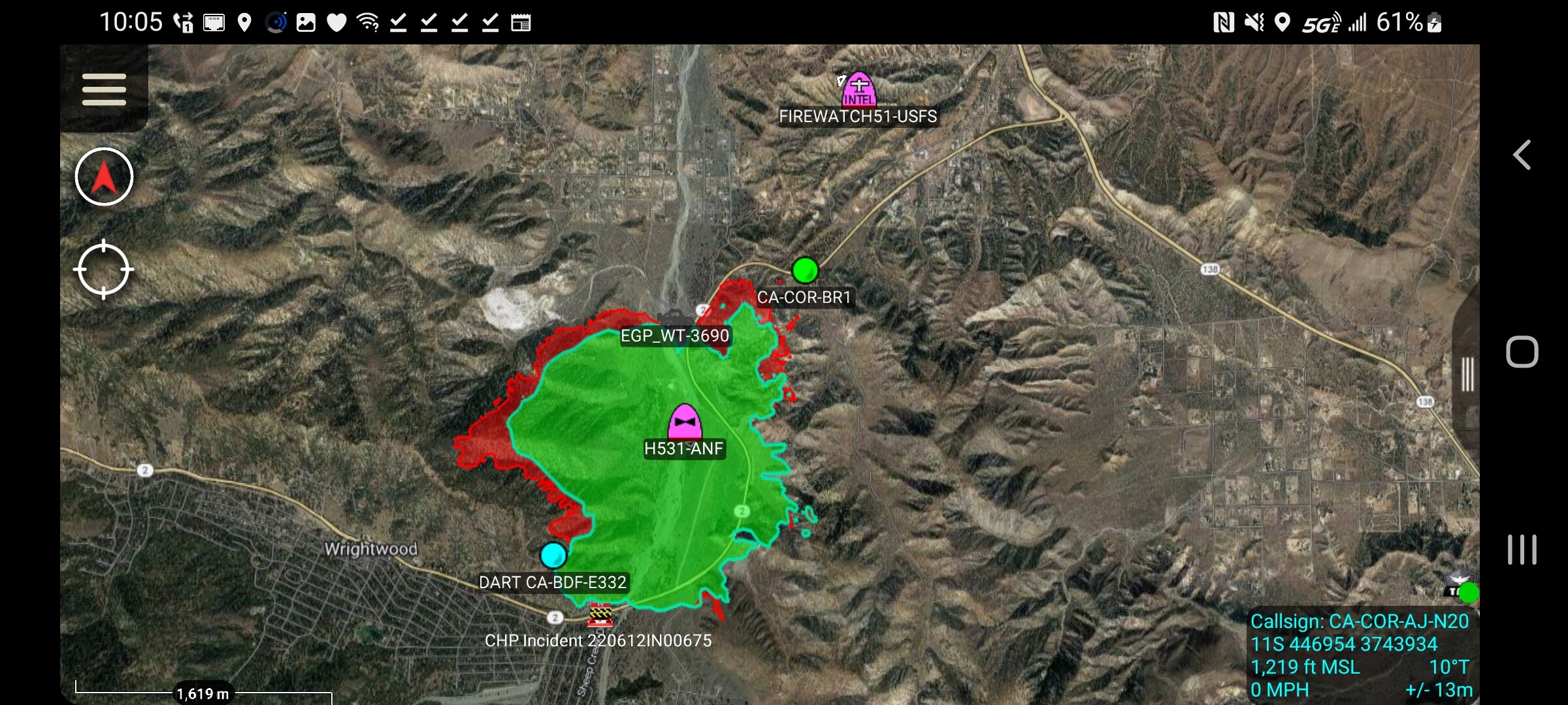
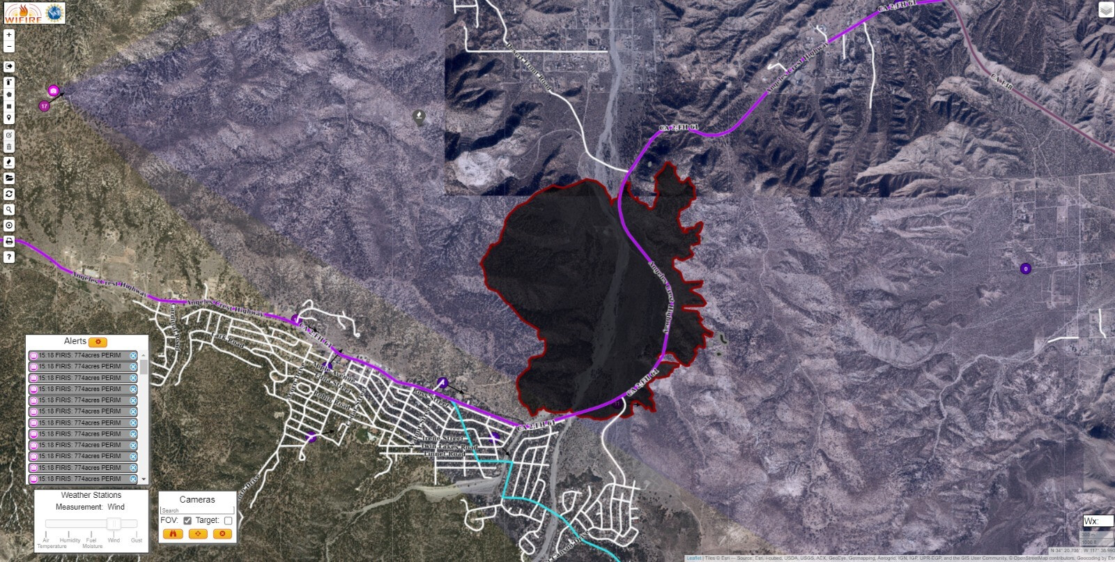
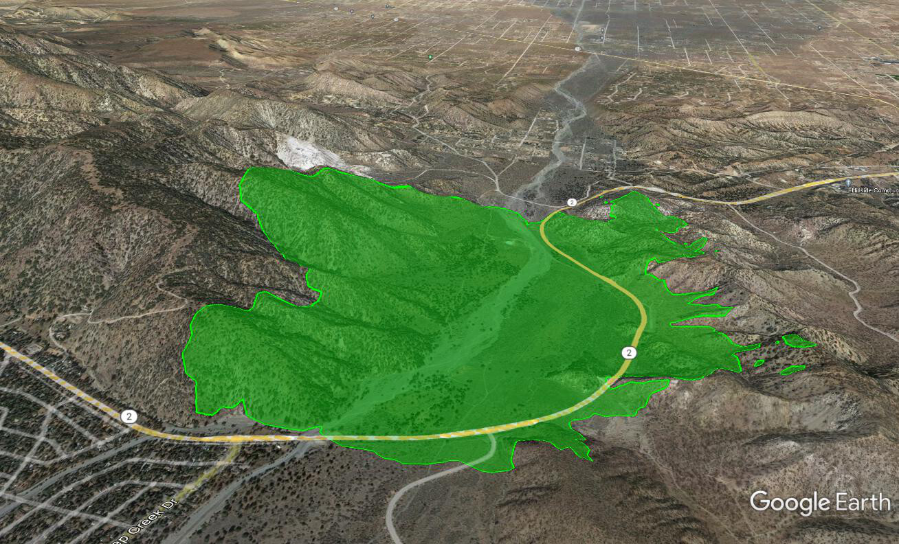
Intel has the Sheep Fire at 774 acres.
7 Likes
Per @Angeles_NF Twitter
#SheepFire There is a mandatory evacuation order for Desert Front Road and Wild Horse Canyon near Wrightwood, CA. Wrightwood is under an evacuation warning. There is a road closure from Hwy 138 to Lone Pine (State Route 2).
Evac shelter: Serrano High School, 9292 Sheep Creek Rd in Phelan.
4 Likes
OES 6808C Enroute
3 Likes
ABC7 over the fire
2 Likes
Incident update as of 1950
As of Sunday, June 12, at 7:50 p.m., NEW EVACUATION ORDER: Hwy 2 south to Lone Pine Canyon Rd, Wright Mountain Road to Sheep Creek Drive. For the quickest evacuation updates, follow the San Bernardino County Sheriff’s Twitter site @sbcountysheriff.
As of Sunday, June 12 (afternoon) - The Sheep Fire has grown to 775 acres and is 5% contained. It is burning toward Desert Front Road. Law enforcement is going door-to-door with a mandatory evacuation for Desert Front Road and Wild Horse Canyon. Wrightwood is under an evacuation warning. There is a road closure from Hwy 138 to Lone Pine (Highway 2). A portion of State Route 2 is closed.
1 Like
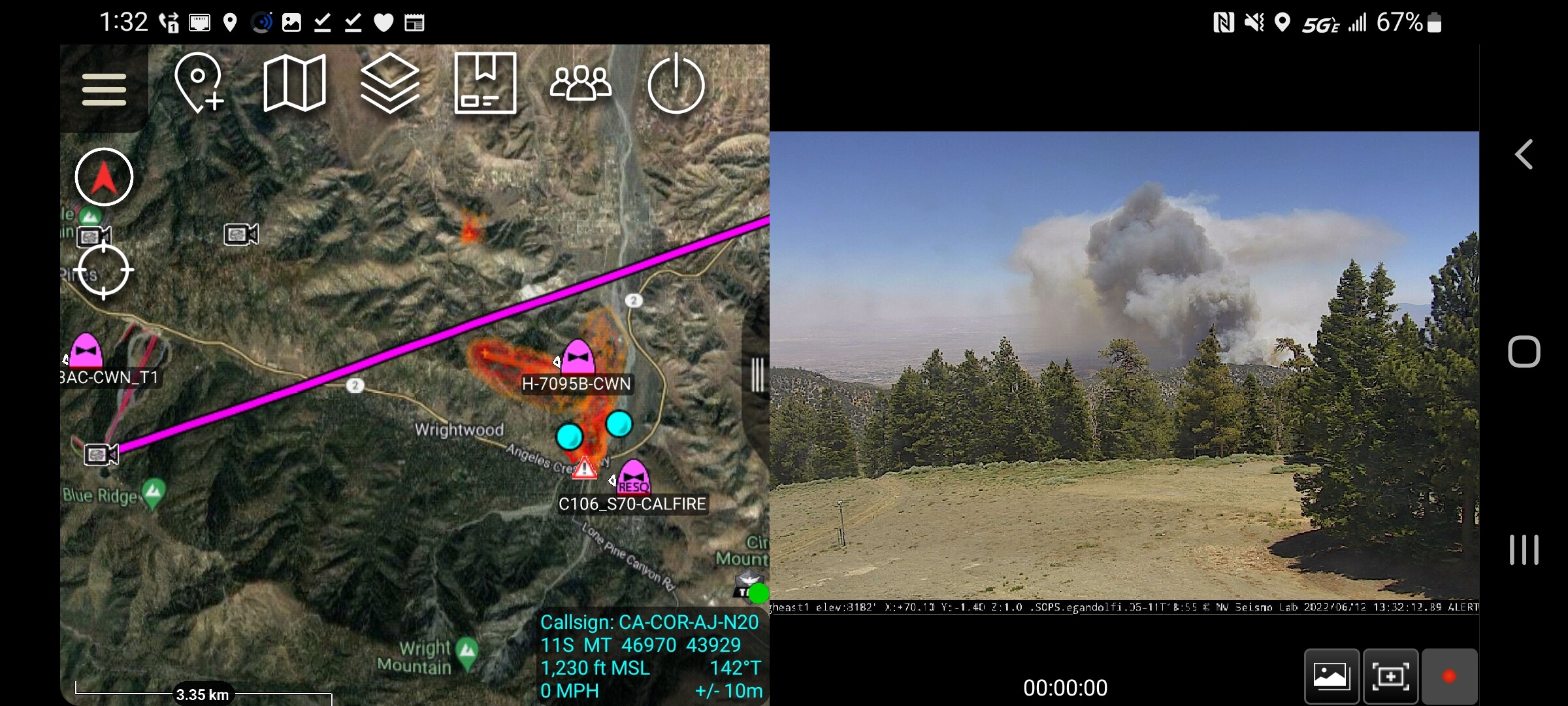
Ground personnel on the #SheepFire will have air support throughout the night from Air Attack 51, providing aerial supervision, mapping and IR information. They will be joined by ANF night water dropping Helicopter 531 in the next 10 minutes.
 James Reeder https://twitter.com/SocalAirOps/status/1536189106945789953/photo/1
6 Likes