State ID: CA
3 letter designator: ANF
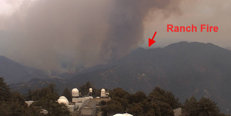
Fire name: Bobcat
Location: Devils Canyon Dam Truck Trail x Cogswell Reservoir, E/O Bradbury, CA
Reported acres: 5
Rate of spread: rapid
Report on Conditions: large header showing, fire burning uphill rapidly on both sides of West Fork
Structure threat: structures were not initially threatened at IA. Extended attack led to large structure threat with multiple destroyed.
Resources: ANF, LAC, BDF
Hazards: hikers in area, high tension powerlines, extremely steep terrain, some parts of the fire have 60+ year old fuels
Weather: excessive heat warning 9/6, Santa Ana winds 9/8-9/9
Fire weather snooper: https://www.weather.gov/lox/fwmV3?wfo=lox
Radio channels:
Scanner link: https://www.broadcastify.com/webPlayer/25757
Webcam link:
LA Basin side:
http://www.alertwildfire.org/orangecoca/index.html?camera=Axis-WilsonEast&v=81e004f
http://www.alertwildfire.org/orangecoca/index.html?camera=Axis-WilsonWest&v=81e003f
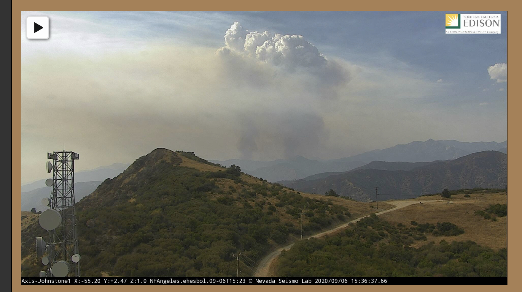
http://www.alertwildfire.org/orangecoca/index.html?camera=Axis-Johnstone1&v=81e004f
http://www.alertwildfire.org/orangecoca/index.html?camera=Axis-Sunset2&v=81e003f
http://hpwren.ucsd.edu/cameras/I/wilson-e-mobo-c.html
http://www.alertwildfire.org/orangecoca/index.html?camera=Axis-VerdugoPeak2&v=81e003f
http://www.alertwildfire.org/orangecoca/index.html?camera=Axis-Lukens1&v=81e003f
Desert Side:
http://www.alertwildfire.org/orangecoca/index.html?camera=Axis-MtnHighEast2&v=81e003f
http://www.alertwildfire.org/orangecoca/index.html?camera=Axis-Table1&v=81e003f
http://www.alertwildfire.org/orangecoca/index.html?camera=Axis-MtEmma2&v=81e003f
http://www.alertwildfire.org/orangecoca/index.html?camera=Axis-Hauser1&v=81e003f
Live video:
Mountain High Resort: https://www.mthigh.com/site/trails-and-conditions/conditions/livecams/chisholm/index.html/
Agency Website: https://inciweb.nwcg.gov/incident/7152/
Map: https://napsg.maps.arcgis.com/apps/webappviewer/index.html?id=6dc469279760492d802c7ba6db45ff0e&extent=-13176157.5386%2C4027575.163%2C-13076483.6537%2C4098050.1031%2C102100
Fire already spotted across the canyon to the east.
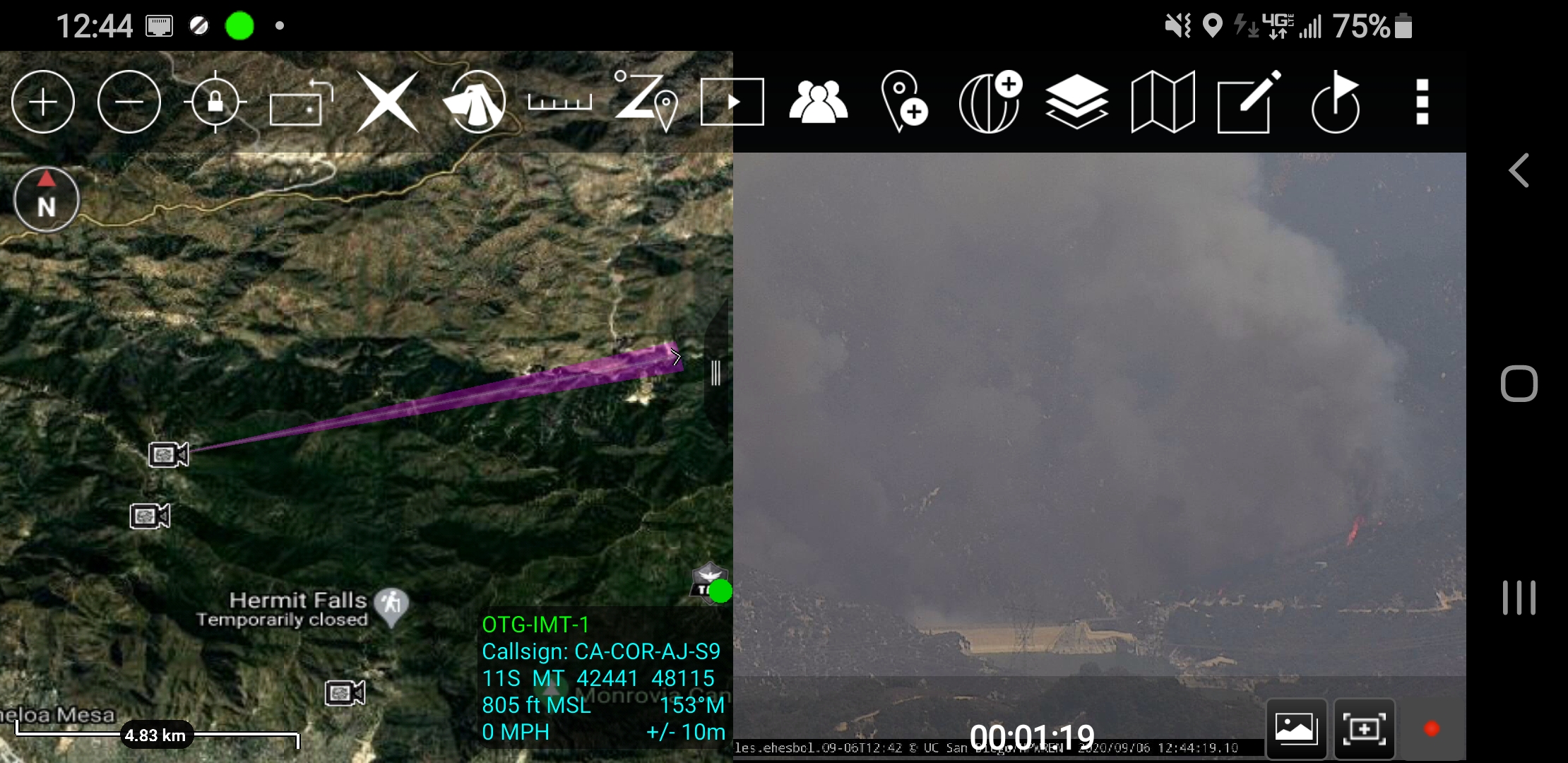
100+ acres medium to heavy brush rapid ROS, both sides of the canyon.
That is an 11yr old fuel bed
Last burned in the ANF-Station Fire
LCES Everyone!
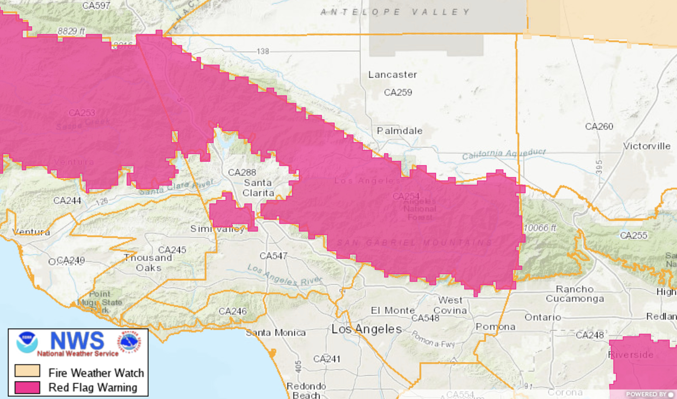
NWS Los Angeles/Oxnard CA
952 AM Sun Sep 6 2020
…RED FLAG WARNING IN EFFECT FROM 6 PM THIS EVENING THROUGH 10 PM MONDAY EVENING FOR THE LOS ANGELES AND VENTURA COUNTY MOUNTAINS DUE TO GUSTY NORTH WINDS, LOW RELATIVE HUMIDITY, AND VERY HOT
TEMPERATURES…
Actually Ehoss, Chileno and Devil did not burn in the Station. Everything on the left flank of the Bobcat did burn in the Station and it changed the fuel model. The current run up Chileno/Devil has not burned since 1924.
 correct! Was stopped west of and at Cogswell.
According to traffic and Forest Net between AA and ANF, 5 Type I helos and 6 Type I fixed wing requested. ANF requested the Quebecs and were denied due to a new start in Malibu/Topanga.
Edit at 1337 hrs, both Q1 and Q2 will be responding to add to the attack.
This may go down as the Labor Day weekend fire storm,looking at the goes imagery it wouldn’t surprise me.
400-500 acres per AA
1,000 + acres, 0%, still rapid rate of spread.
Looks like fire is now on Monrovia Peak above the cities of Monrovia, Arcadia and Bradbury. Red Flag Warning in effect brings potential for this to push down into lots of WUI. 4800 acres and 0% contained.
time lapse of Bobcat:

Fire visible in the communities below. AA just got over the fire and saying not looking real good compared to yesterday.
Edit: AA released back to Hemet to preserve flight time.
It’s probably time to just put retardant laterally between the fire and communities
No aircraft on the fire right now.