I would guess that they have or will soon preposition ST’s soon. It gets real ugly when the monster gets pushed by NE winds projected
1 Like
I do believe the S2’s are going to be last resort do to there ability to help out during IA fires.
2 Likes
Santa Ana’s just started blowing here in Ventura County about 20 mins ago
2 Likes
That’s going to depend on available resources. Right now most units and even some local government are at max draw down. I live on the SQF and the nearest staffed engine to us is an hour out. Resources are flat stripped. Of course local gov in so cal should still have a lot of resources…
2 Likes
Pre-positioning happening now. LAC has STENS and Area C STEN 1205A pre-positioning apparatus. LAC has aircraft staged at 44C.
3 Likes
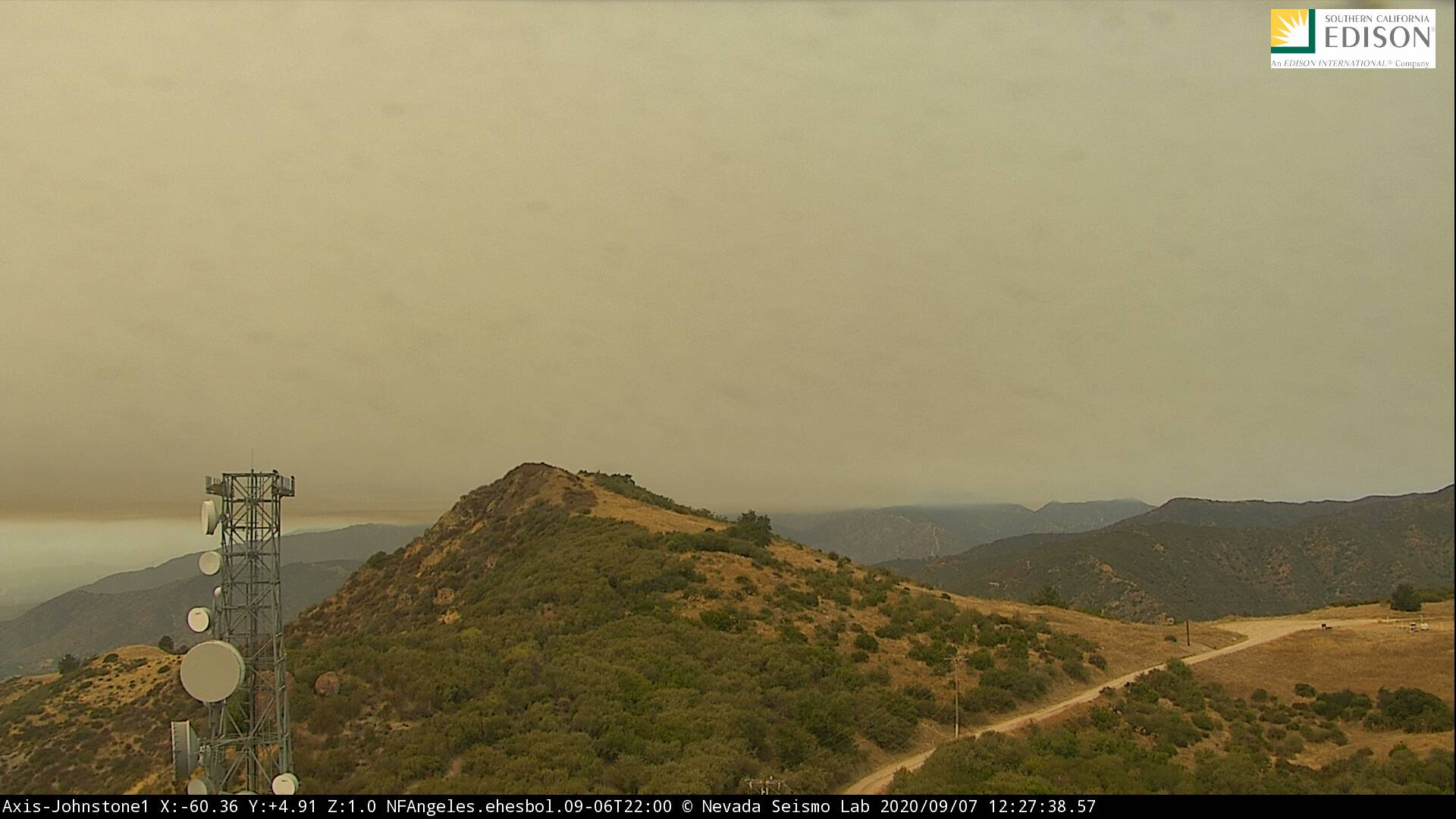
I’d imagine this is all due to visibility issues as well. Everything south of Fresno is socked in with smoke especially into this area with the San Gabriels
3 Likes
Everything north of Fresno as well…
Be interested to see how this wind event plays out regards to moving all the smoke around
4 Likes

FBA has advised that relative humidity has dropped below 70% above 2,500’. Expecting the NE winds to surface now.
They have started in So Cal. Light, less than 5, but some gusts are into the teens in LA and SD counties.
1 Like
Still no real winds on it. The flow aloft is offshore, but the winds do not seem to be making it down to the 4500 foot level. Fire continues to creep along the ridge, westward towards Mt Wilson, now into the Station scar on the backside (north), but punking on the south side.
Sounds like a local Type I Team is possibly taking over and sending the Type 2 team back to the east.
Plenty of preposition Type I resources positioned along the front country. ANF resources tying in good dozer line on the east end, off of Van Tassel, and near the Fish Fire scar.
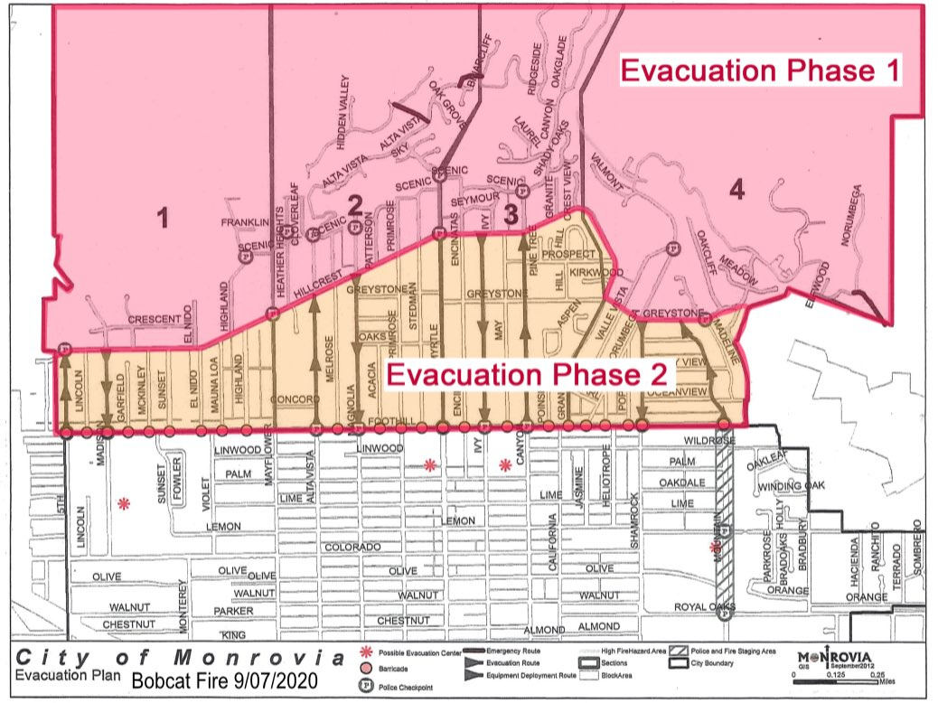
There is no real place to put line in between Monrovia city limits and Monrovia Peak, which means fire is backing down into Monrovia Canyon Park, which has not seen fire since the 1950’s.
http://articles.adsabs.harvard.edu//full/1954PASP...66...52A/0000052.000.html
5 Likes
51 was to map fire today. I believe 51 is 15 min out but did not catch all the traffic. was just up at just below 7000 ft level and that was where the wind was at. more than likely coming down.
2 Likes
The fire spotted across Highway 39, trying to pick up with hoseline.
2 Likes
I do not know the direction it is going…but it is building big time
http://www.alertwildfire.org/orangecoca/index.html?camera=Axis-Johnstone2&v=7a7f1a5
not hearing much on LAC or ANF freqs
Based on Sunset Cam (http://www.alertwildfire.org/orangecoca/index.html?camera=Axis-Sunset2&v=81e004f) it is burning east towards Hwy 39. Add to that anvilheads comment above.
2 Likes
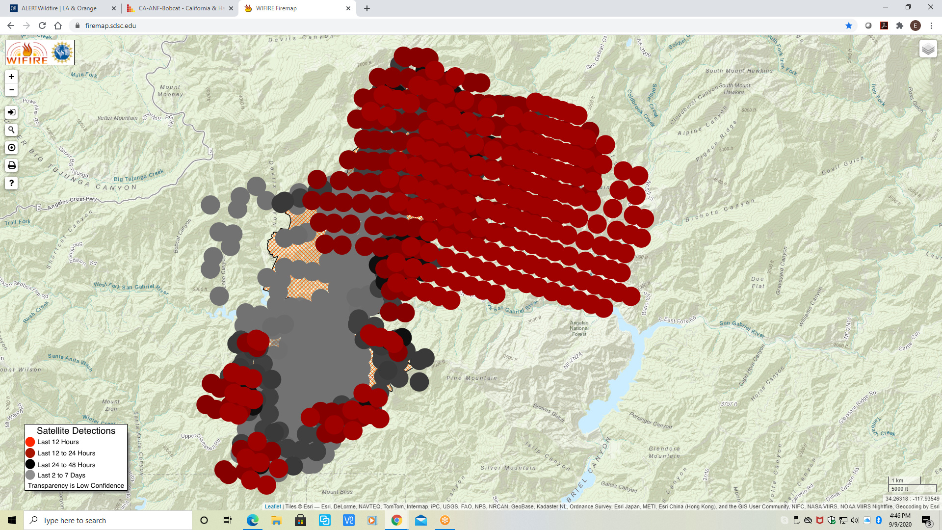
Looking at this latest progression, I am thinking it will run up Bear Canyon, and may make it to the Crest, and Crystal Lake if no resources committed to the north. And the north is essentially unstaffed. No resource commitment there today.
1 Like
if it gets into next cyn to the east it will follow the narrows burn (1997) to the Crest also. Hope not…live in Wrightwood
2 Likes