All Aircraft off the fire Drone spotted
2 Likes
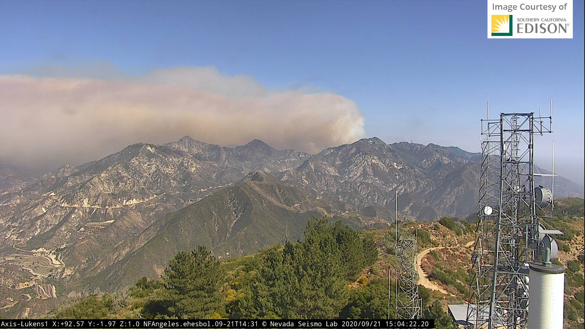
Big Tujunga Reservoir
2 Likes
It appears to be well established in the drainage just North of Mt Wilson
http://www.alertwildfire.org/orangecoca/index.html?camera=Axis-WilsonWest&v=7a7f1a5
2 Likes
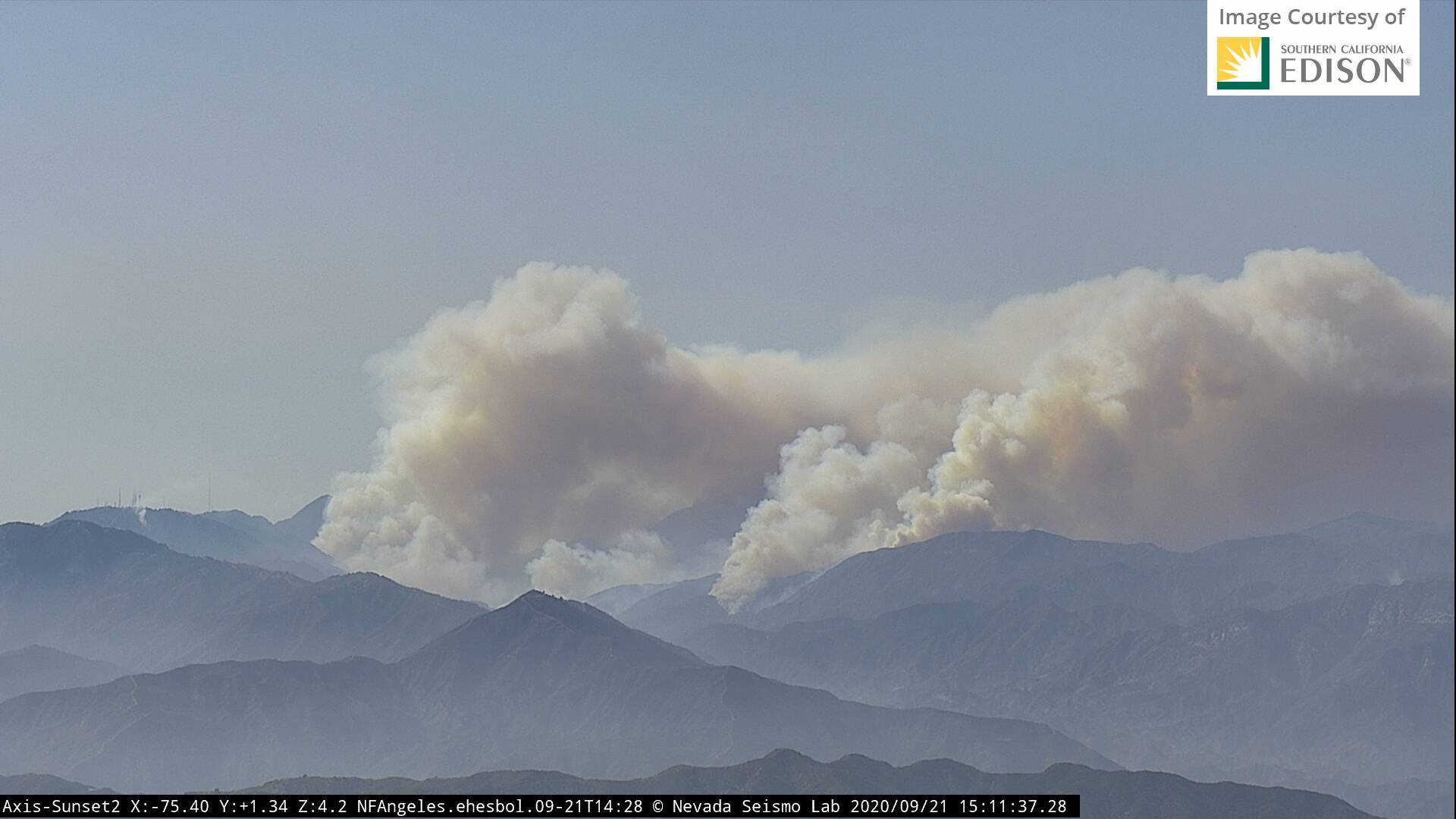
Uh oh, big pyro cum building. Heads up for a big assed run when that bad boy collapses.
3 Likes
My Lukens cam should show the spotting distance pretty well
The fire jumped the Crest between Red Box and Shortcut Saddle. getting direct info from boots on the ground. Best guess with the size of the Pyrocum that Valley Forge Canyon is gone too. It is not in the Big Tujunga watershed, and is nowhere near the Big T reservoir yet. yet. It will impact Strawberry again (done in the Station in '09) and Barley Flats, home of Air Rescue 5. Map of where it crossed: https://goo.gl/maps/WtUEWr3J3aJfVSJo7
The peaks in the background in the smoke are Josephine on the left and Strawberry on the right. You can see Mt Wilson towers on the far right, then Disapoint, then Strawberry, then Josephine from R to L. The Big T Reservoir/Dam is in the bottom left of this pic
1 Like
On the KTLA live shot it looks like a spot just below MT. Willson
1 Like
Is the maybe a burn op to secure and tie into other control points?
Nope. Crews were supposed be off their 24 at 0800 this morning and were held on the line at Red Box due to anticipated activity. They were at the 2 and east of Red Box. They had 50 feet or pre fire black below the highway and it freight trained across them.
4 Likes
ANF Twitter did post they were firing near Wilson.
Yes. That was to tie in around Wilson. The header you see on the cams is unanticipated new growth and well establish back into the footprint of the Station scar.
3 Likes
Including that little spot near the towers that bootylvr I think was referencing?
Towers should all be good. Wind direction has been pushing onshore from the SE. No push towards Wilson. They painted the entire back side of Wilson all day on Friday (it is very very red), then did a firing op to tie it all in. Anything directly around Wilson has 3 Type I STEN on it.
2 Likes
Station fire was in 2009 FYI
2 Likes
Oops. It was indeed. Ought nine.
3 Likes
And now, once again, nothing is sacred. This fire has no boundaries. Big change. Now on the backside, where I was last week where PhosChek made the whole side of the hill red is now threatened.
https://abc7.com/bobcat-fire-threatening-mount-wilson/6491069/
2 Likes
106,169 acres & 13% contained.
Fire showing well on the Mtn High live video stream: https://www.mthigh.com/site/trails-and-conditions/conditions/livecams/chisholm/index.html/
2 Likes