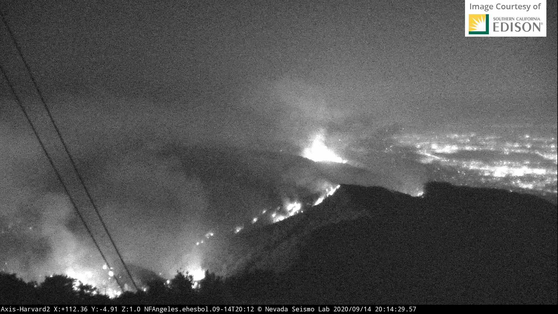
That is the slop over I was speaking of. Top of Little Santa Anita. Just finished chatting with my engine crew who is at the Mt Wilson Pavillion lot now. FS Type 3 and LAC Type I, LAC AC2 Inman, plus XLC Type I in there. ANF crews did prep all round today, but I know it won’t match what @ffviking Cal Fire Team did in 11. But they have local crews in there and have a plan. Fingers crossed. Pic looking east from Harvard
6 Likes

9 Likes

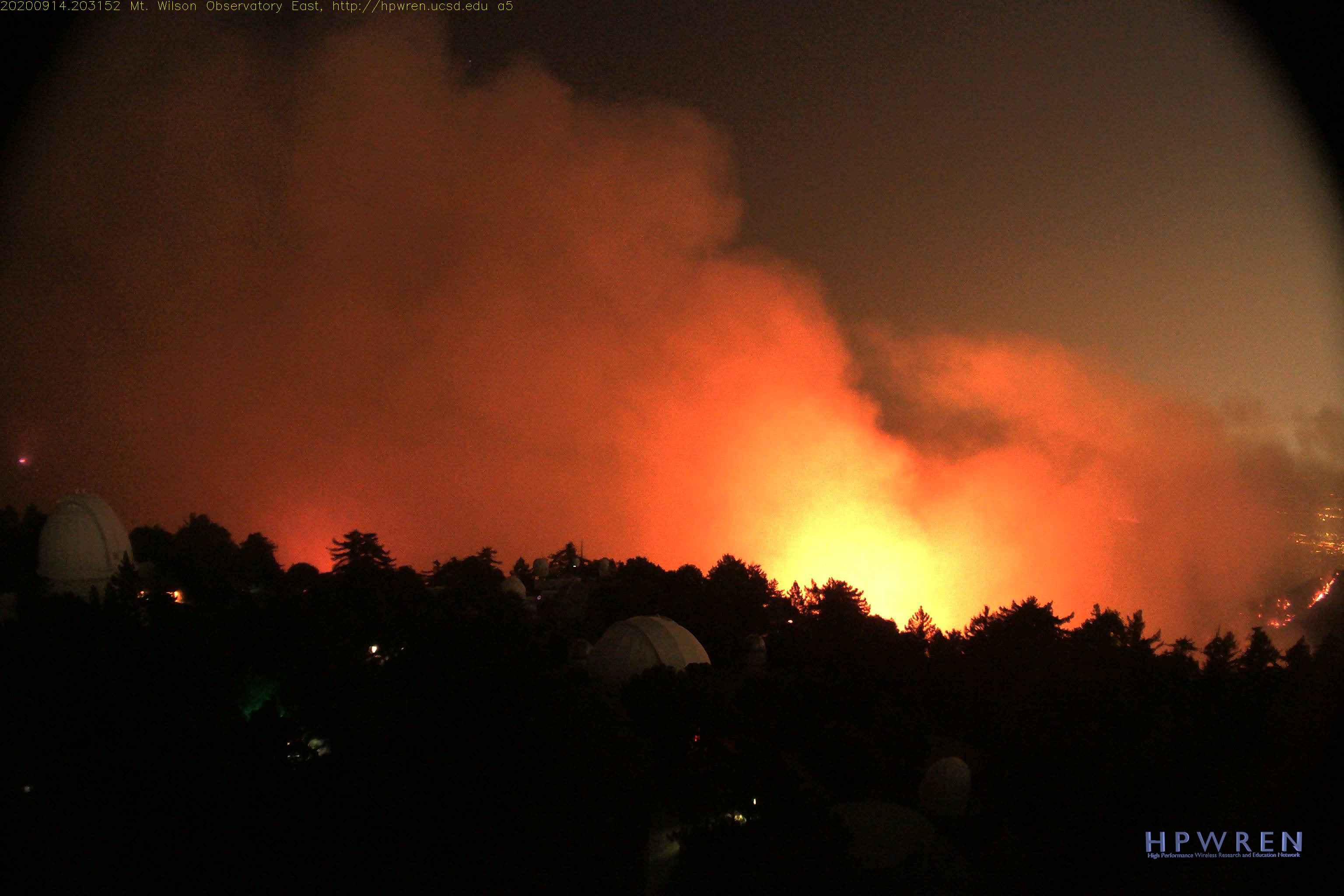
Despite the initial issue with AA relief yesterday afternoon, they were able to paint the backside of Mt Wilson all day with tankers and VLATS. Per the mapping flight at @ 1951 hours last night, good retardant lines held for the most part across the tops of the ridges to the east of Wilson and on the north side of Wilson. Alert Cams show things looking good there for now.
6 Likes
41,231 acres & 3% contained.
Today is expected to be the warmest day over the fire for the next week.
3 Likes
AA just requested 8 tankers, any type, VLATs included. Sounds like threat up in the high country. Crest Hwy is impacted and holding Alpha STEN at Upper Big T due to fire on the crest.
Based on this traffic and knowledge of the area Chilao, Newcombs Ranch, Waterman, Three Points would be areas of concern. They stopped the Station Fire at Devils Canyon and adjacent to Chilao from moving east into Twin Peaks and Waterman, but sounds like fire involved at the 5000 foot level on the Crest Hwy may be causing some issues up there. https://goo.gl/maps/2xssEy5Ku59wA1kCA
3 Likes
Fire now close to impacting Mt Wilson per Branch I. Asking for rotorwing.
2 Likes
Fire has crossed the Crest Hwy up near the 5000 foot level, east of Shortcut Saddle. https://goo.gl/maps/NfVt6gF7RRWBYheK7
Dozers now going to work off of Mt Vetter https://goo.gl/maps/veshE5Df1nCLDZVbA
That means fire now working in modified fuels from the Station Fire in Upper Big T.
3 Likes
Reported 500-1000 acre slop over Highway 2 in Cooper Canyon area.
4 Likes
3 Likes
Morning, Any chance todays radio freqs. for the Bobcat are available? its trying to come into my “backyard”
Some equipment is on R5 frequencies. I do not have the aircraft. But ANF Forest Net 172.375 is Cmd. LA County Structure Grp is LAC V4 Cmd 152.57, VFire 24, 25 and 26 are front country tacticals from east to west.
copy that I’m in Juniper Hills the northside 67yr. old fuel from Hwy 2 to JH last burnt in 1953 (32K ac.)
hearing aircraft on 168.400 and 156.330
1 Like
Best coverage is on:
https://m.broadcastify.com/listen/feed/25757
it only has air to ground and admin…but better than nothing
44,393 acres and 3% contained.
1 Like
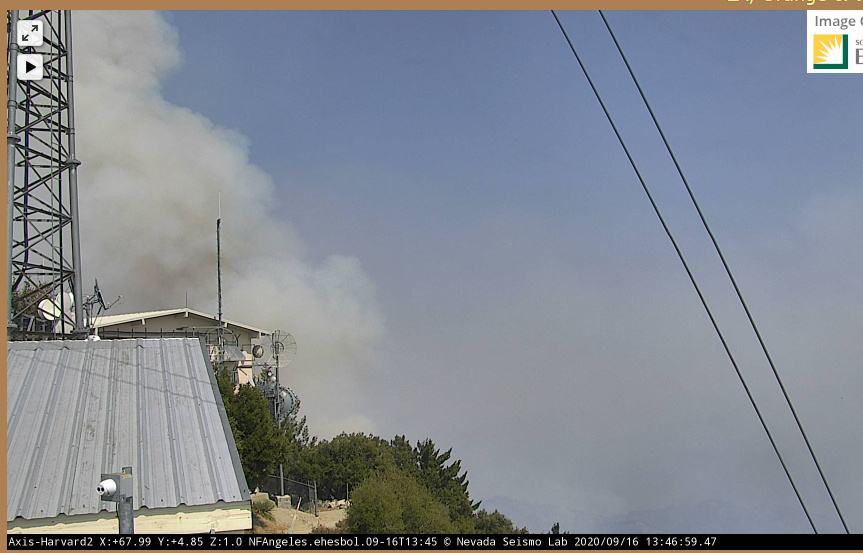
Some activity at Harvard 2…Does anyone know if this is possibly a burn op or is this lookout a concern?
http://www.alertwildfire.org/orangecoca/index.html?camera=Axis-Harvard2&v=81e002f
Visibility is better today. Looks like we have good air assets on hand. Watched T 914 just fly across the front country of the ANF from Berdoo. T107, T137, T101 and T15 in the fight.
4 Likes
