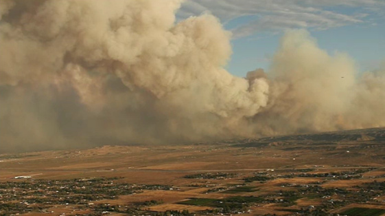
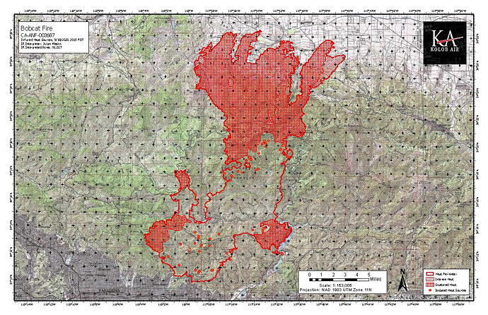
It is burning into SRA on the desert side, but LACO is direct protection. Considering what has been happening on this fire it is very possible, but don’t have first hand knowledge.
I think that is very, very conservative call

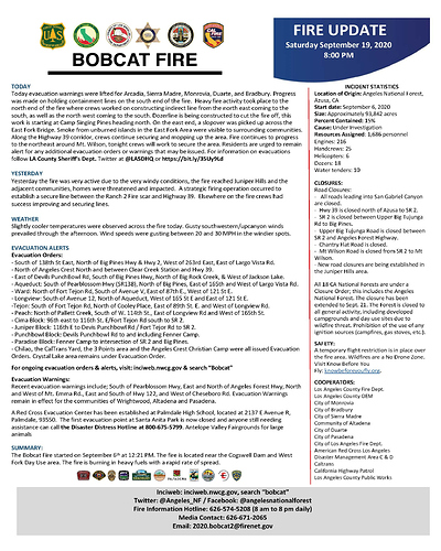
UPDATE (18:27) New expanded evacuation WARNING:
- South of 138th Street East, north of Big Pine Highway and Highway 2, west of 263rd Street East, and east of Largo Vista Road.
72,000 acres and 15% contained.
Live briefing: https://abc7.com/bobcat-fire-update-from-firefighters---live/6437178/
http://www.alertwildfire.org/orangecoca/index.html?camera=Axis-MtnHighWest1&v=7a7f1a5
looks like activity on Mt High slopes…could be setting up their guns for defense
Thats been going on for a few hours…
Div TT was up there earlier today but had to leave to go back down. great to hear that they got an early start in the defense of Wrightwood.
Mt High West has been running snow making machines most of the afternoon. On for a few hours then off for a few hours keeping the vegetation moist.
does Mt High have anything on the North side of 2???
Mt. High North is a tubing park, but I’m not aware of any snow making machines on that side.
Coulson was also using the large parking lot at that location as a staging area. The JPL Table Mountain Observatory is just uphill from Mt High North as well.
09/19/2020 IAP
Plan is to keep the fire west of Largo Vista Rd. Fire is backing down toward Largo Vista with the wind starting to push it East.
The fire is about to cross Largo Vista to the east. Expanding evacuations all the way to the county line.
Wow!!
Live Video: https://ktla.com/news/local-news/homes-destroyed-after-winds-push-bobcat-fire-into-juniper-hills/
501 will be flying IR over fire tonight and on station for 3 hrs.
Defensive firing operations are about to begin on the North side of Mt. Wilson to mitigate the fire hooking around the NE corner of the mountain. This will tie it into existing retardant line. There is a good window of opportunity with favorable conditions.

