State ID: CA
3 letter designator: ANF
Fire name: Bridge
Location: 24700 East Fork Road x Glendora Mountain Road; NE of Glendora, CA
Reported acres: 75
Rate of spread: rapid
Report on Conditions: wind driven fire from thunderstorms in the area, burning up Cattle Canyon in medium to heavy fuels.
Structure threat: are threatened
Resources: ANF 2nd alarm; ENG-328, ENG-339, PAT-25, ED-12, CRW-63, ED-11, BC-23D, ENG-512, ED-15, ENG-332, PAT-22 Q, ENG-23, ENG-317, DOZ-10, ENG-311, CRW-2, ENG-310, WT-225, ENG-13, WT-234, DIV-2, 1-C-1, ENG-324
AA12, LEAD55, T12, T72, T74, T75, HC14, HC22, 5 additional large airtankers on order
Hazards: thunderstorm hazards including lightning and gusty winds
Weather: SCE San Gabriel River WX
Tanbark WX
Radio channels:
Scanner link: Angeles National Forest Fire Net Live Audio Feed
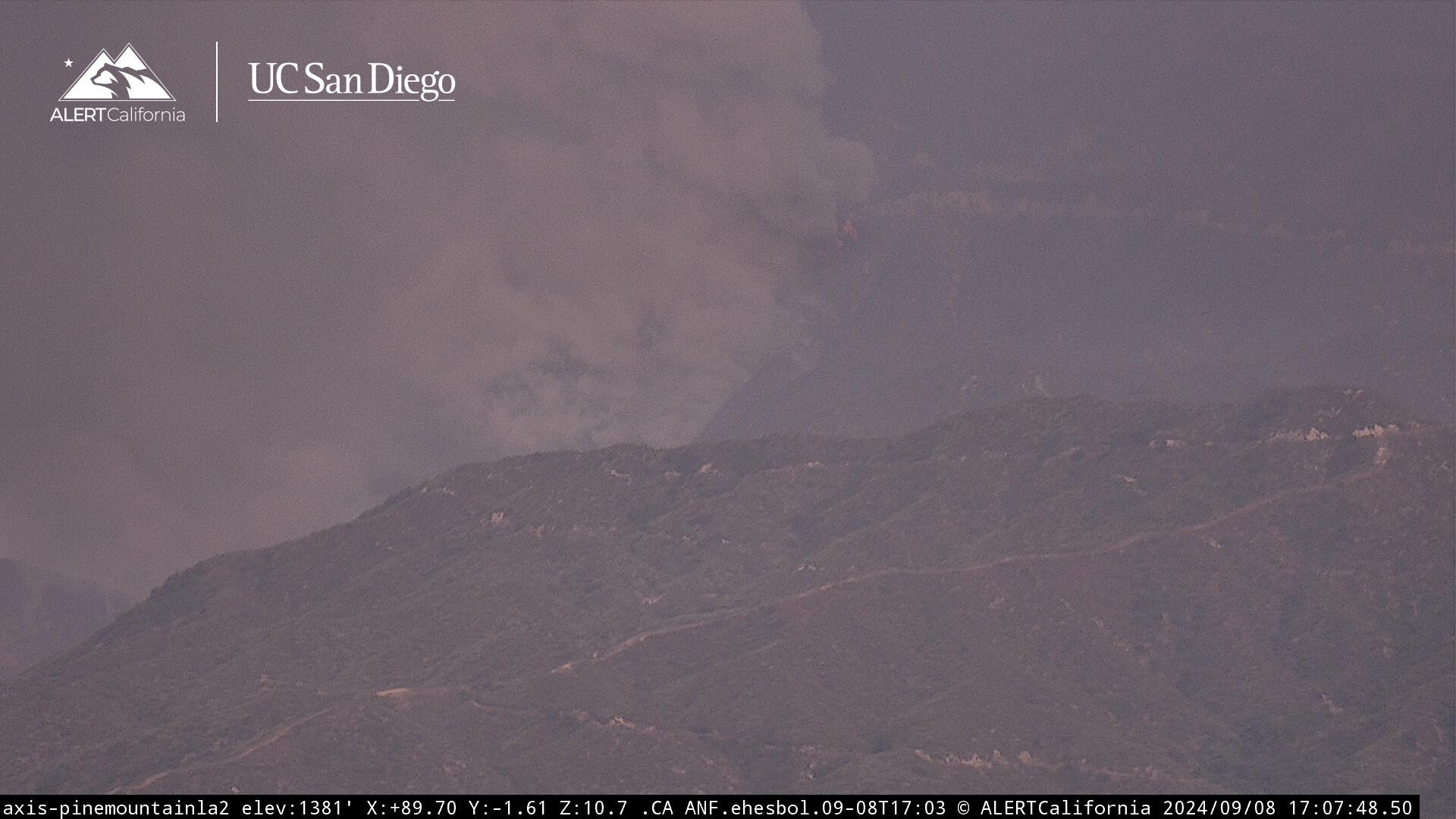
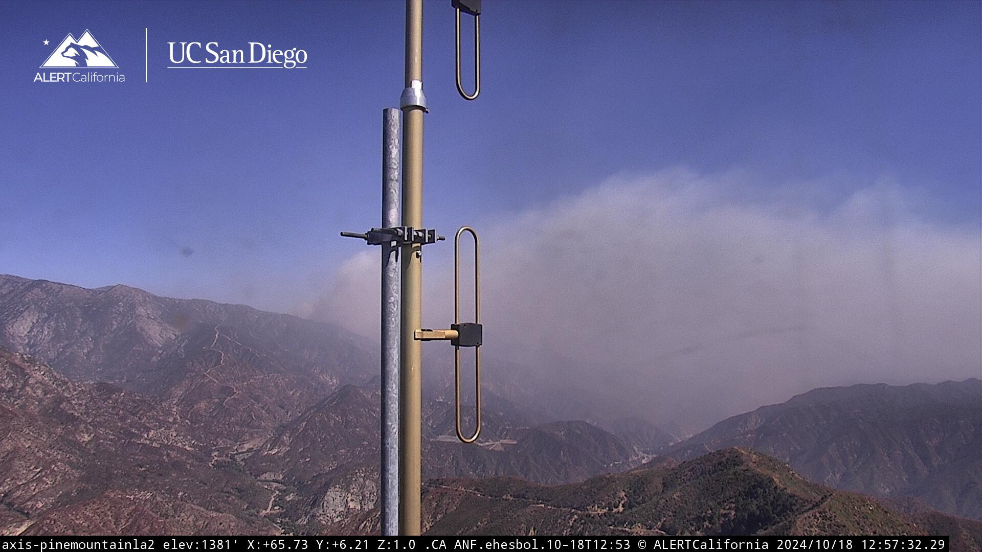
Webcam link: Pine Mountain LA 2
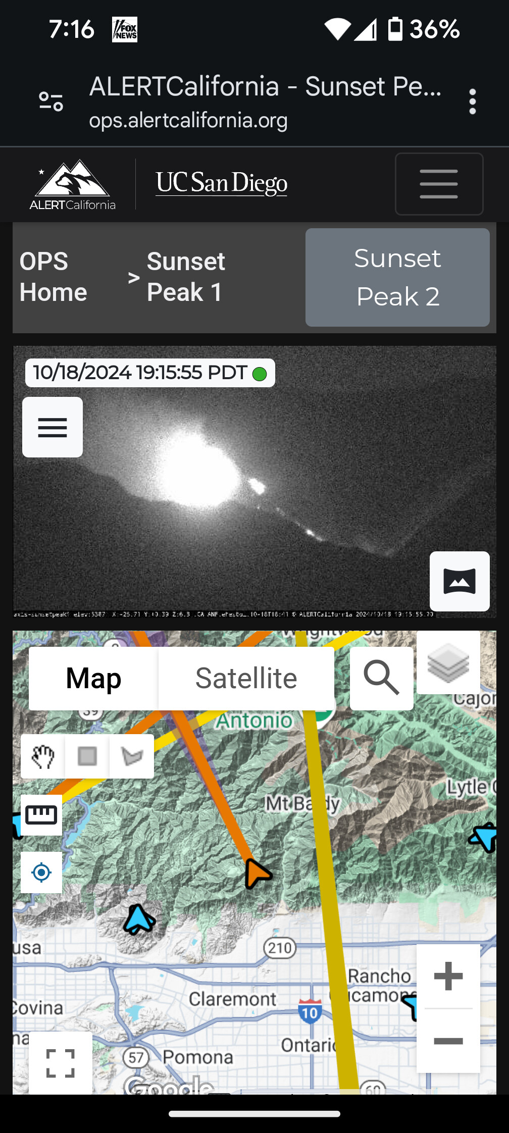
Sunset Peak 1
Agency Website:
Quebec 1 and Quebec 2 have been ordered back to the fire
If you look at the wide view of Pine Mountain LA #2, you can see both Bridge and Line Fires. Both with caps
QRF HT-61 out of VNC at fire for night operations. (Ht61 back up while HT40 OOS)
820 acres this morning and no containment per Inciweb.
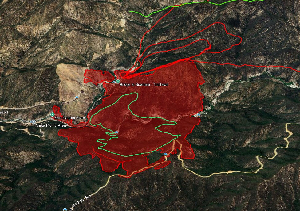
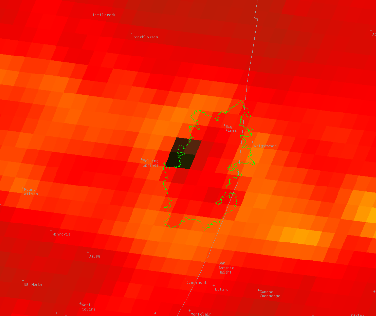
Couple good maps available on X.com. This one from Dave Toussaint:
She is up early this morning…capping at 845am
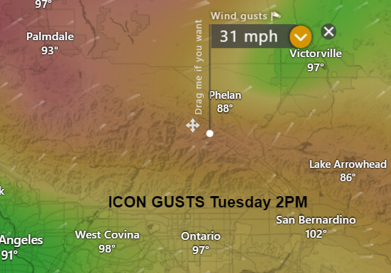
Ridge break down starting tonight through Wednesday. If the fire establishes itself further upslope today, gusty onshore winds could drive the fire towards the desert side Tuesday/Wednesday.
Agreed. Hoping this won’t do what the Bobcat did in 2020. Red Flag in effect till noon Wednesday.
From today’s conference call with NWS LOX:
- Wind:
- Increasing onshore winds (SW-W on Tue and W-NW on Wed)
- Onshore wind gusts 25-45 mph across interior valleys, mountains, deserts
- Strongest winds in San Gabriels and Antelope Valley (especially foothills) on Tue then I-5 corridor and Antelope Valley on Wed
- Assessment:
- Best overlap of gusty winds and low humidities in LA county mountains and Antelope Valley foothills Tuesday afternoon through Wednesday morning - resulting in Red Flag Warning
- While winds will remain gusty Wednesday afternoon into Wednesday night, anticipating some humidity recovery and cooler air, still expecting widespread elevated fire weather conditions across interior
View from the valley floor below (east San Gabriel Valley) and on cams is better this morning. Mapped at 2347 hours and 46,728 acres. As of that mapping mission it looks like much of Baldy Village, all of Icehouse Cyn, Baldy resort and Glacier Cabin Tract, as well as much of Wrightwood were spared (at time of mapping).

man that thing keeps going it wil be in Phelan by nightfall.
Per ongoing ANF press conference:
- 48,000 acres, 0% containment
- No significant injuries or deaths reported
- Approximately 20 homes destroyed in the Mount Baldy area
- Approximately 13 homes destroyed in the Wrightwood area
- Six cabins lost in the wilderness area
Better structure damage/destruction count coming at tonight’s press conference.
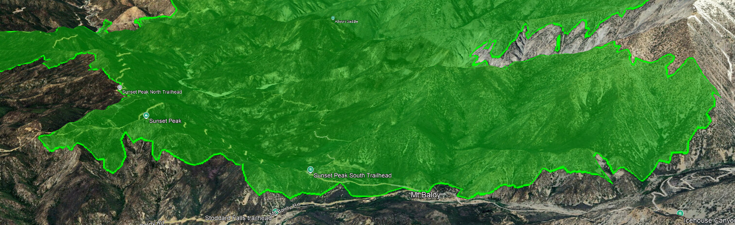
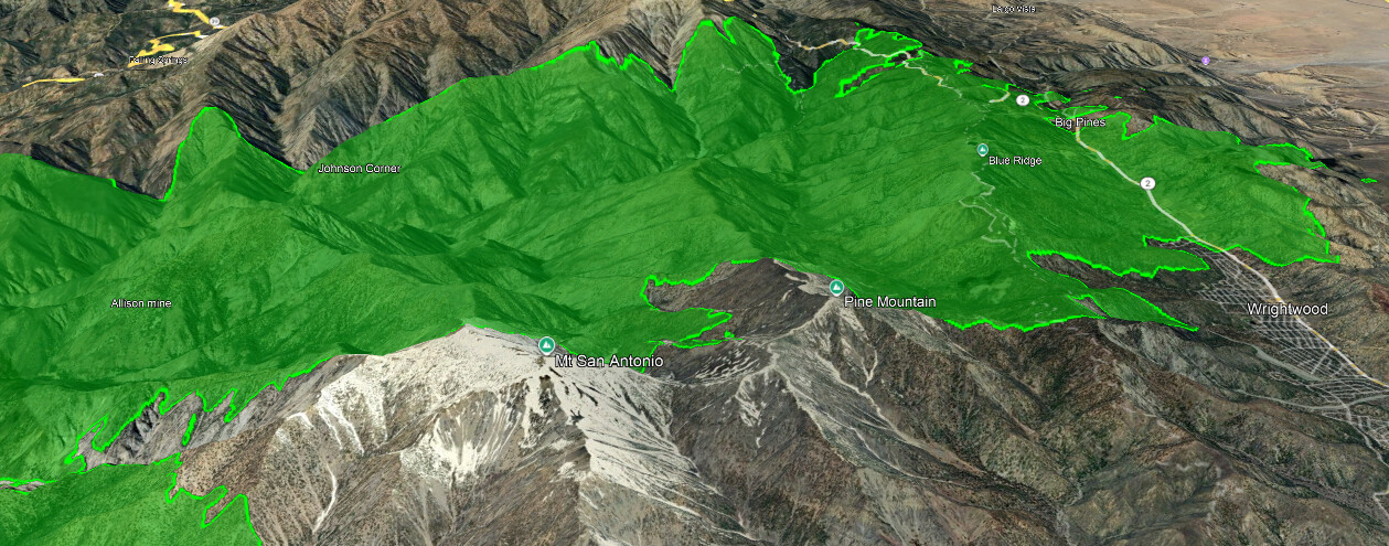
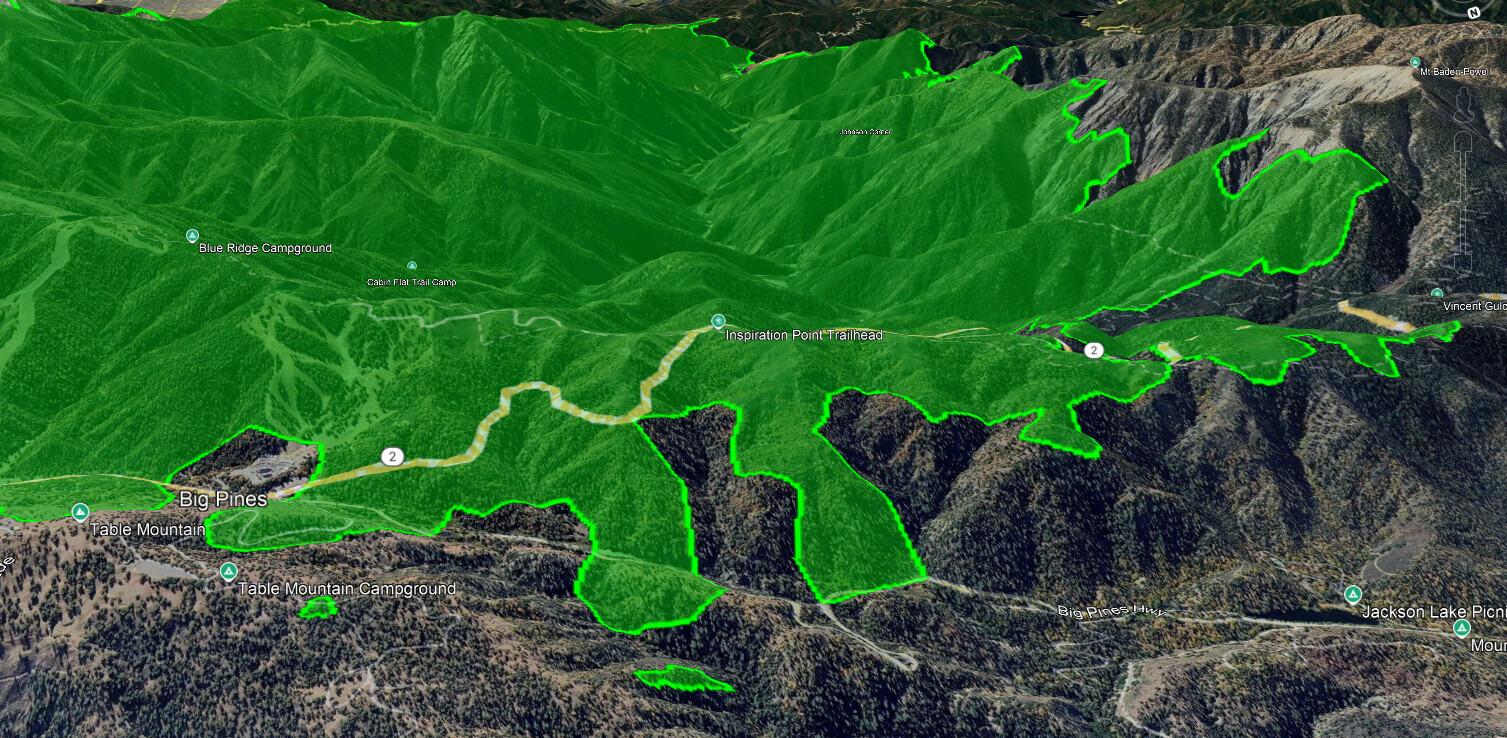
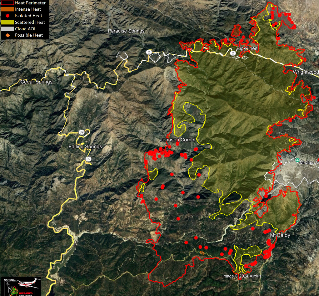
51,167 acres this morning. The fire grew to the north towards Pinion Hills. It held in the Mt Baldy Village area with lots of resources prepared to ensure the fire does not cross the canyon to the east, which would allow for significant runs up towards Ontario Peak. Lots of containment work in Wrightwood with some heat near Wright Mountain. Interior elements of the fire near the point of origin show isolated spots of heat with the perimeter and no growth south and west other than a pocket near Sunset Peak, north of the Sunset towers and cam.
The LA Basin woke to a decent marine layer and cooler temps
For some reason this IR KMZ shows the Vista fire and heat (upper right) which was cropped out for this post.
IG reel from Glendora Mtn Rd
I had the same thought, Looks to have some push under it.
There are a couple of good smokes popping up on this fire, there is another prominent smoke on the Wrightwood side that has been showing since early this morning.