State ID: CA
3 letter designator: ANF
Fire name: Gulch
Location: Hwy 39, San Gabriel Canyon, MM 21-23
Reported acres: 10-15 with 3 separate starts
Rate of spread: RROS
Report on Conditions: 3 spots, AA reporting 10-15 acres Rapid ROS. Requested 2 additional closest tankers.
Structure threat: No
Resources: LAC AC2 AC42 AC9 ANF BC10 BC16 BC2 BC46 BC64 BRU CC122 CC161 CC191 CC192 CC22 CC23 CC83 CC93 CDFCOPT CN12 COPT12, ANF 1-C-1 BC-21 CRW-4 DIV-2 DOZ-10 DOZ-12 ENG-20 ENG-321 ENG-322 ENG-325 ENG-326 ENG-327 ENG-521 HT-3AC PAT-22 PAT-25 TF-1605
Hazards: Power lines
Weather: Temp 82F Humidity 51 Winds W 8G14
Radio channels: LAC Blue 5/6 and ANF Forest Net
Scanner link:
Webcam link: ALERT Wildfire
Agency Website:
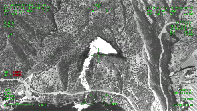
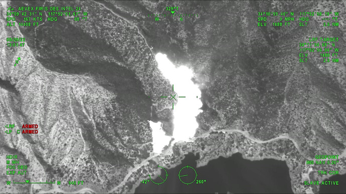
Image is Morris Fire (Gulch 1)
Looking at fire history, availiblity of local resources and the Intel 24 video and current weather, am not believing this will go too far. EDIT
Gulch 1 (Morris) is 16 acres, Gulch 2 is 4 acres. Image from Intel 24:
Now THIS is how you start an IA thread boys and girls.
Looks like it broke through the inversion layer and is taking off
VLAT and Type1 tanker on order
AA states there is a new spot 10 to 15 acres rapid rate of spread.
AA also said that there are 3 separate fires.
A post was merged into an existing topic: CA-ANF-Gulch??
A post was merged into an existing topic: CA-ANF-Gulch??
IC requested 2 ST type 3 to ICP at 1800
1st fire is 3 acres, forward progress stopped. 2nd fire is 100 acres w/ rapid ROS, 2 heads of fire & no containment, requesting an MRB + HT47 from OCFA.
LAC just dispatched DZ9 TRANS1 and CN16 to the fire.
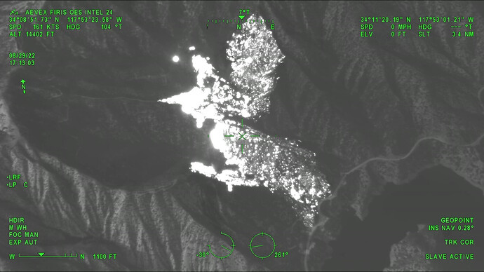
Night helicopter flights are now in progress. CH-47 and S-70i.
Very little smoke production on Sunset 2 cam this morning, pointed right at the fire ALERT Wildfire. No updates on Inciweb since last night. Nothing else on social media. Looks like LAC resources committed were scaled back to 2 hand crews and a supervisor.
What’s a “CN”? I’ve seen those on here and PulsePoint and couldn’t figure it out.
“Construction”. LACo uses that for their heavy equipment supervision positions


