
Looks to be barreling straight into 2022 Route fire scar, hopefully that could slow it up. But with FMs and the grasses in this area it won’t be as much help as a scar in norcal.
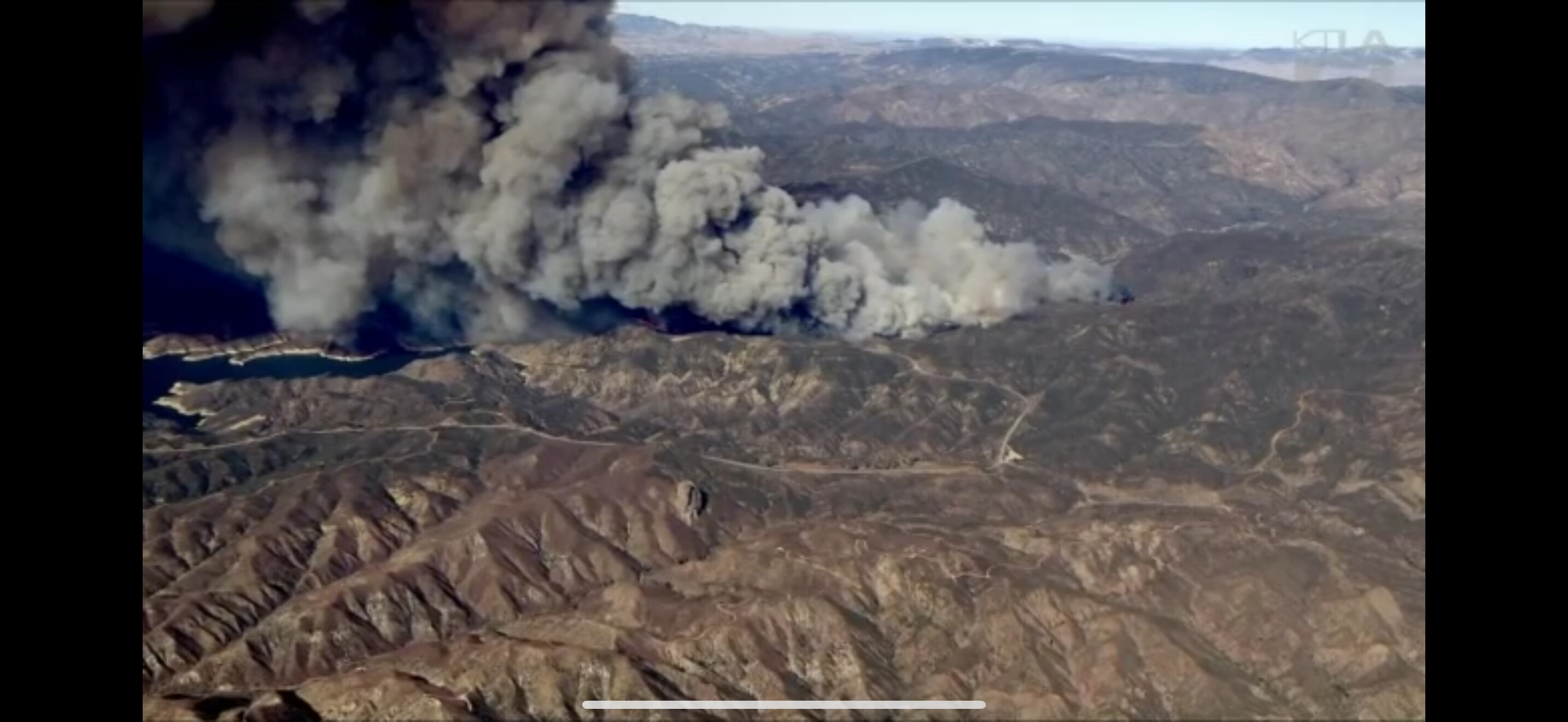
Ktla copter view showing spots pretty far out in front north of Castaic lake. Looks like it will impact the 5 in not too long
Calling spot out at Ridge Route Rd, Helc looking for it
Grasses and other flashy fuel regrowth has already been established after the wetting rains of 2023 and 24. Can easily carry spotfires.
We need to consider the very real possibility that if this crosses both Lake Castaic AND the 5, this may becoming a very longlasting ordeal for the Ventura area as well.
I think I found a scanner link
Current accumulated rainfall since October 1 for Warm Springs in the fire area is only.48 inches for the season according the CA DWR on CDEC. Grass Mountain east of the fire shows only .35 inches of rain so far. Seems low, but if it is accurate things are dry.
Use this for audio stream, coverage from Santa Clarita, if you use winamp to stream it, you can see alpha tags for what each channel is assigned to.
https://www.broadcastify.com/listen/feed/829
Unfortunately I Agree…
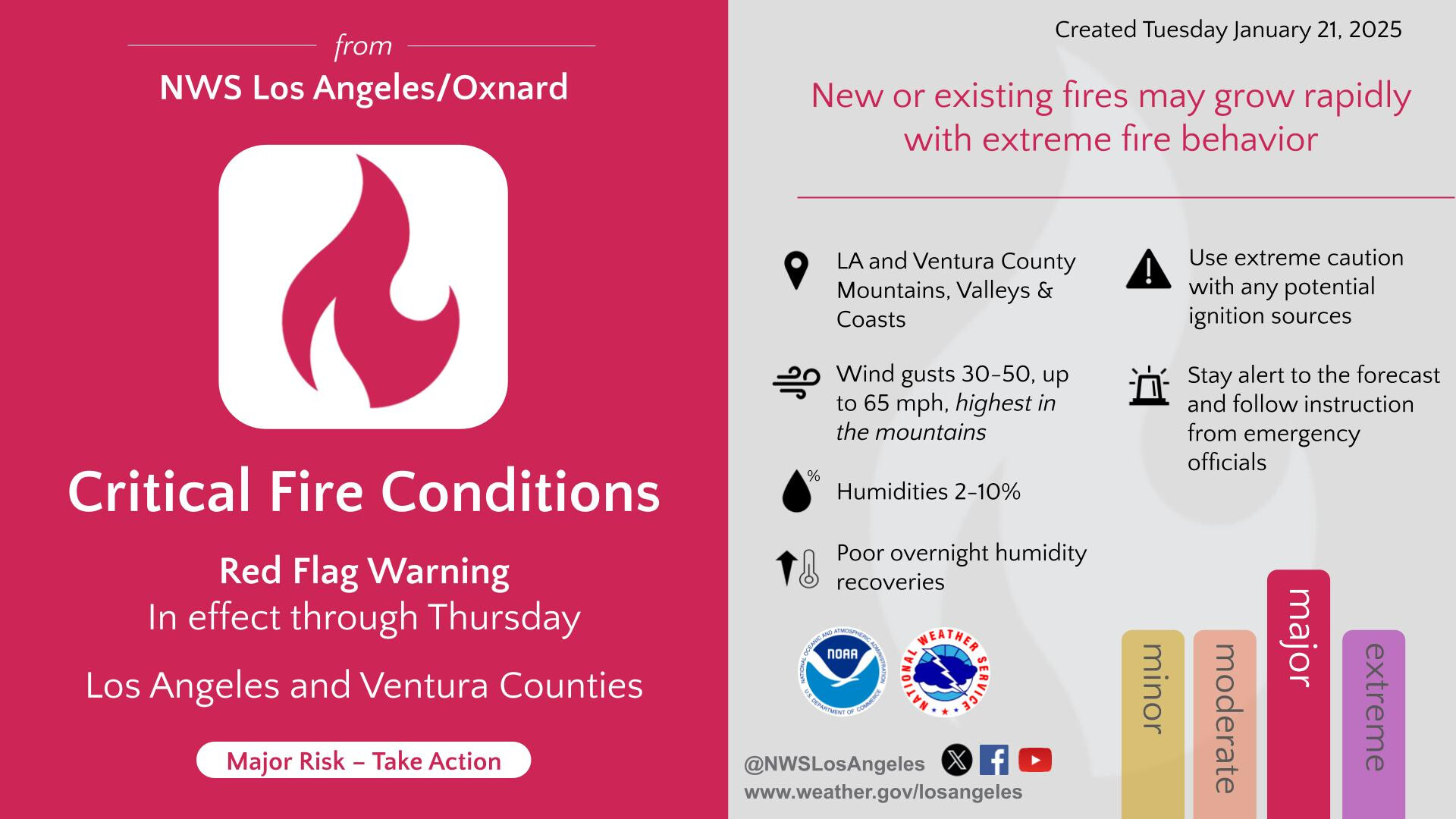
It’s all gonna be defendant on the wind…
4 dozer strike teams any type ordered
1 type 1 strike team
2 VLATS and 2 Quebecs out of van nuys
Looks like chp has already closed the 5.
My mistake cal trans says one thing and chp has something different. Just the off ramps in the area are closed.
I5 still open
From the copter, there is flowing traffic on Hwy 5…no backup.
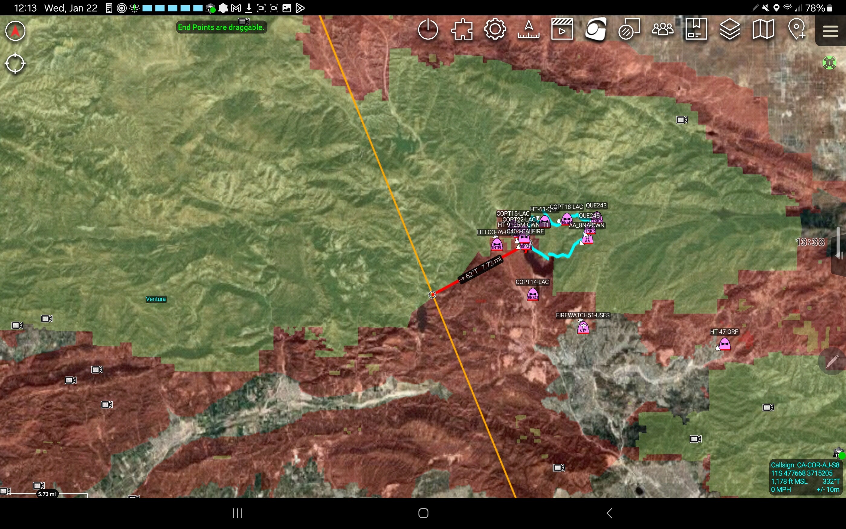
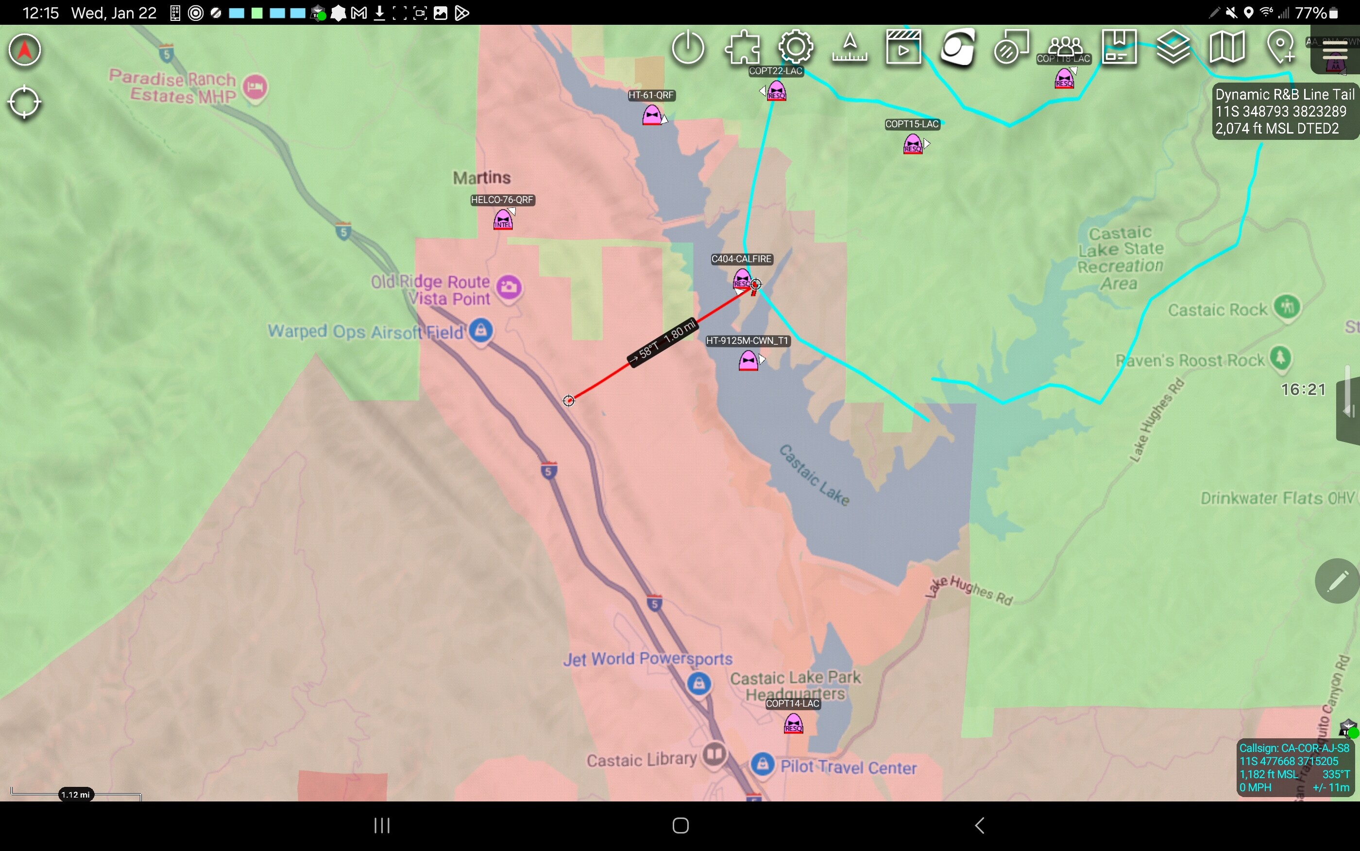
Honestly watching the copter cam, it’s looking decently good. If it stops at the lake…… Big if
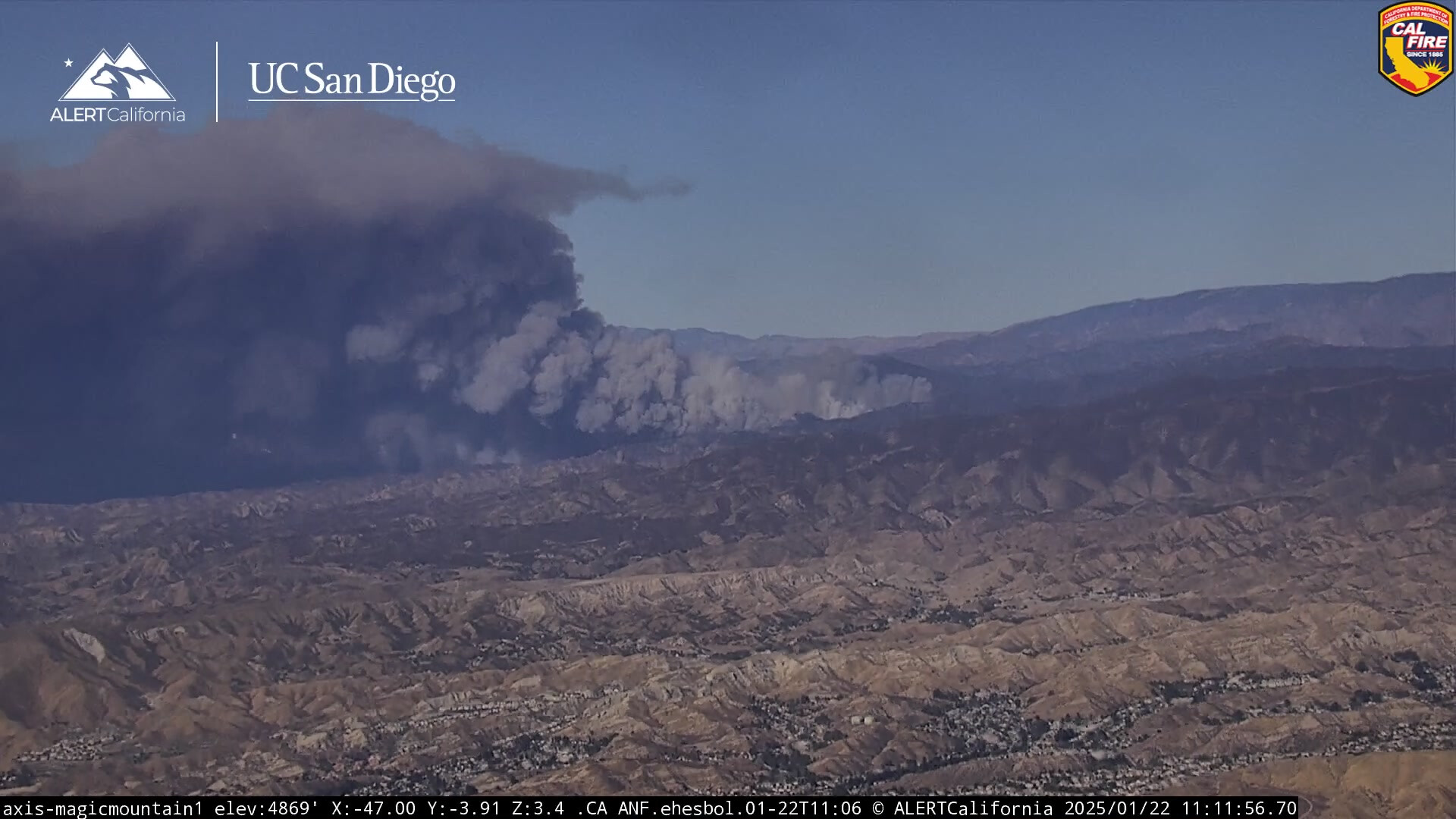
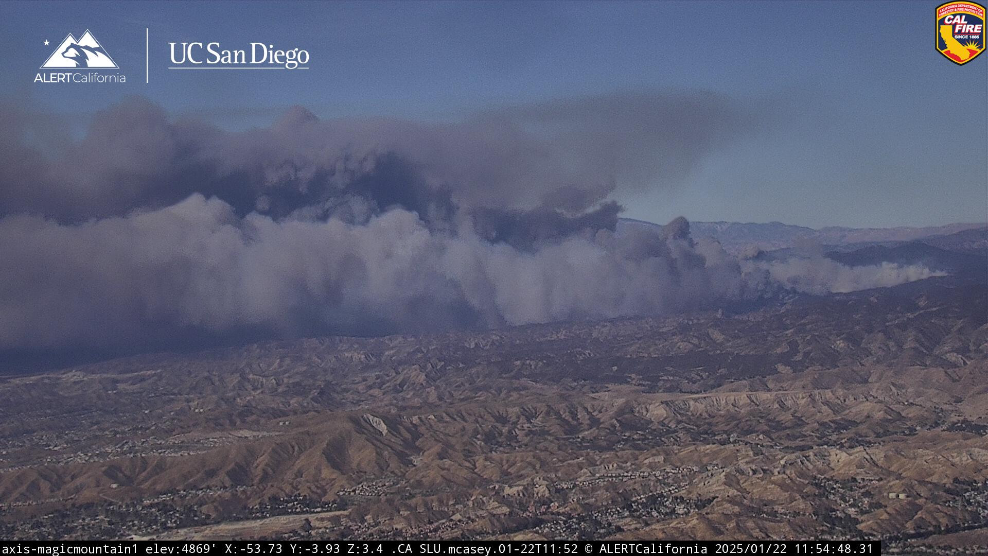
3,400 acres update
Has not spotted over the lake yet.