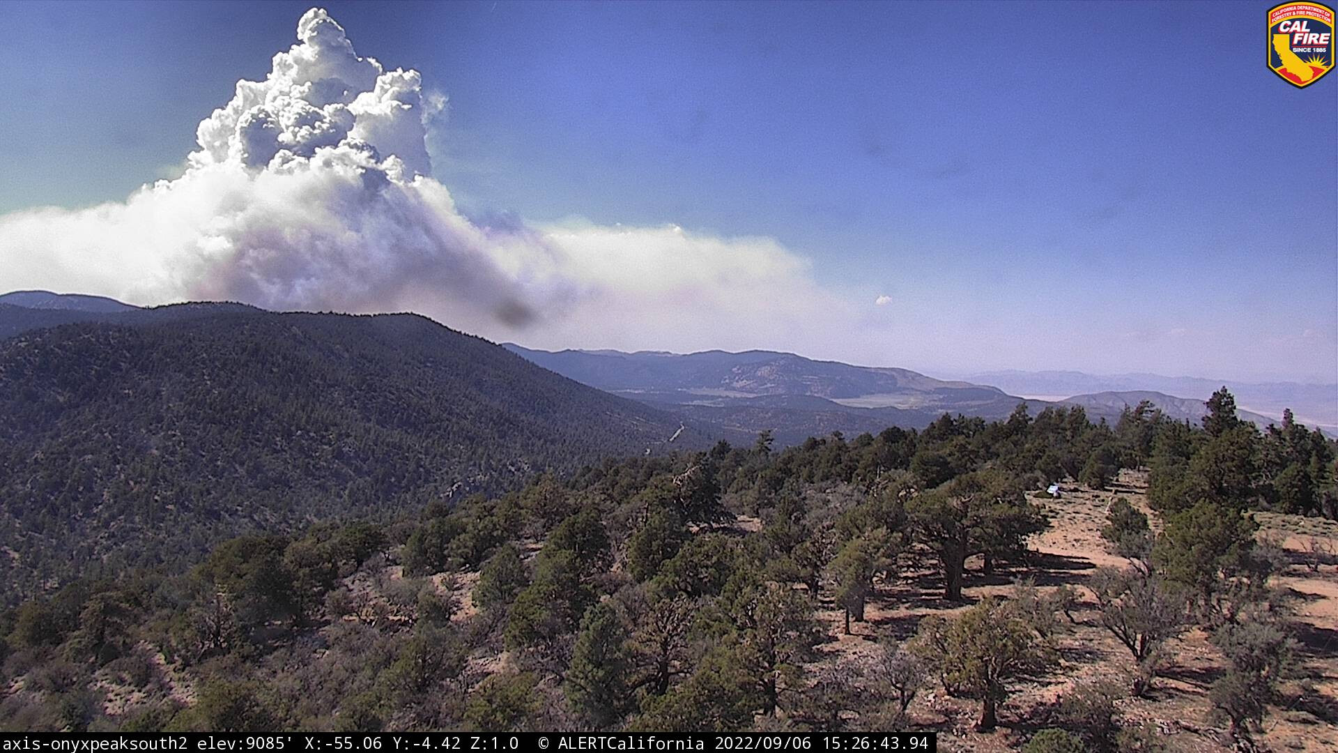
It’s definitely pushing up out of that draw now. It’s going to be a very dynamic day.
3 Likes
SBCo Sheriff just issued and evacuation order for the western edge. Essentially from the areas south of the Village to areas south of Boulder Bay. https://twitter.com/BigBearSheriff/status/1567214685707010048?s=20&t=Go-W0sQDHjN_X77qQHPODA
5 Likes
Smoke production overall, and especially in the west seems less. Perhaps all of the monsoon moisture over this area for the last few weeks is moderating things a bit. Sounds like crews working on backfiring down off Radford Truck Trail. Excellent air support all day.
Edit: Or did I miss something. This angle seems a bit more fired up.
2N10 and Sugarloaf, between Summit and Bear ski areas picking up: https://twitter.com/SoCalFirePhoto/status/1567268354892898306?s=20&t=BkHY5fv_JP4gD7wloSp0dw
3 Likes
A new evacuation ordered as fire approached Moonridge area.
“An evacuation order is now in effect for Summit Blvd East to Club View and Evergreen Dr South. Evacuation orders previously established remain in place.”
3 Likes
all fixed wing aircraft off fire except AA…smoked out
2 Likes
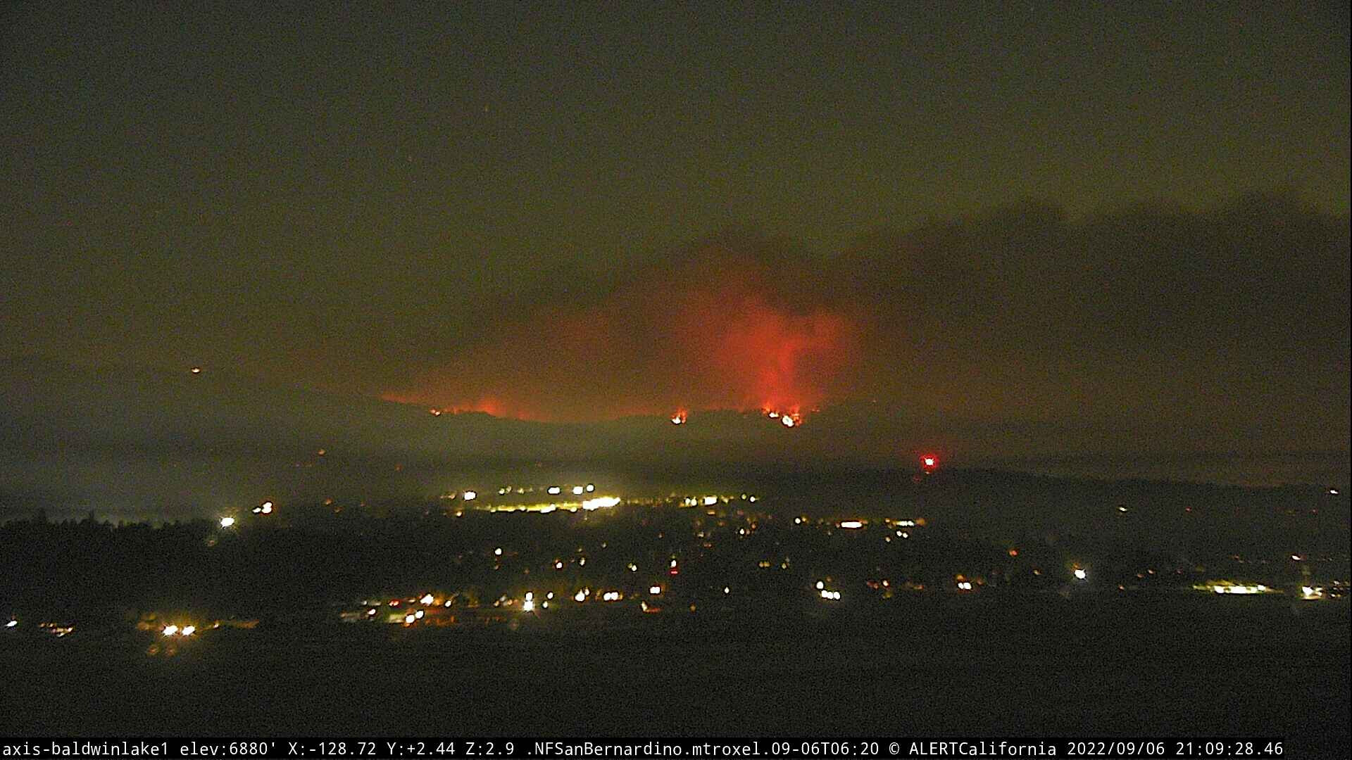
The overall flow has changed too. Everything seems to be leaning toward Big Bear Lake community.
2 Likes


Looks like the fire is coming over the ridge into Big Bear proper, as seen on the Deadman camera.
1 Like
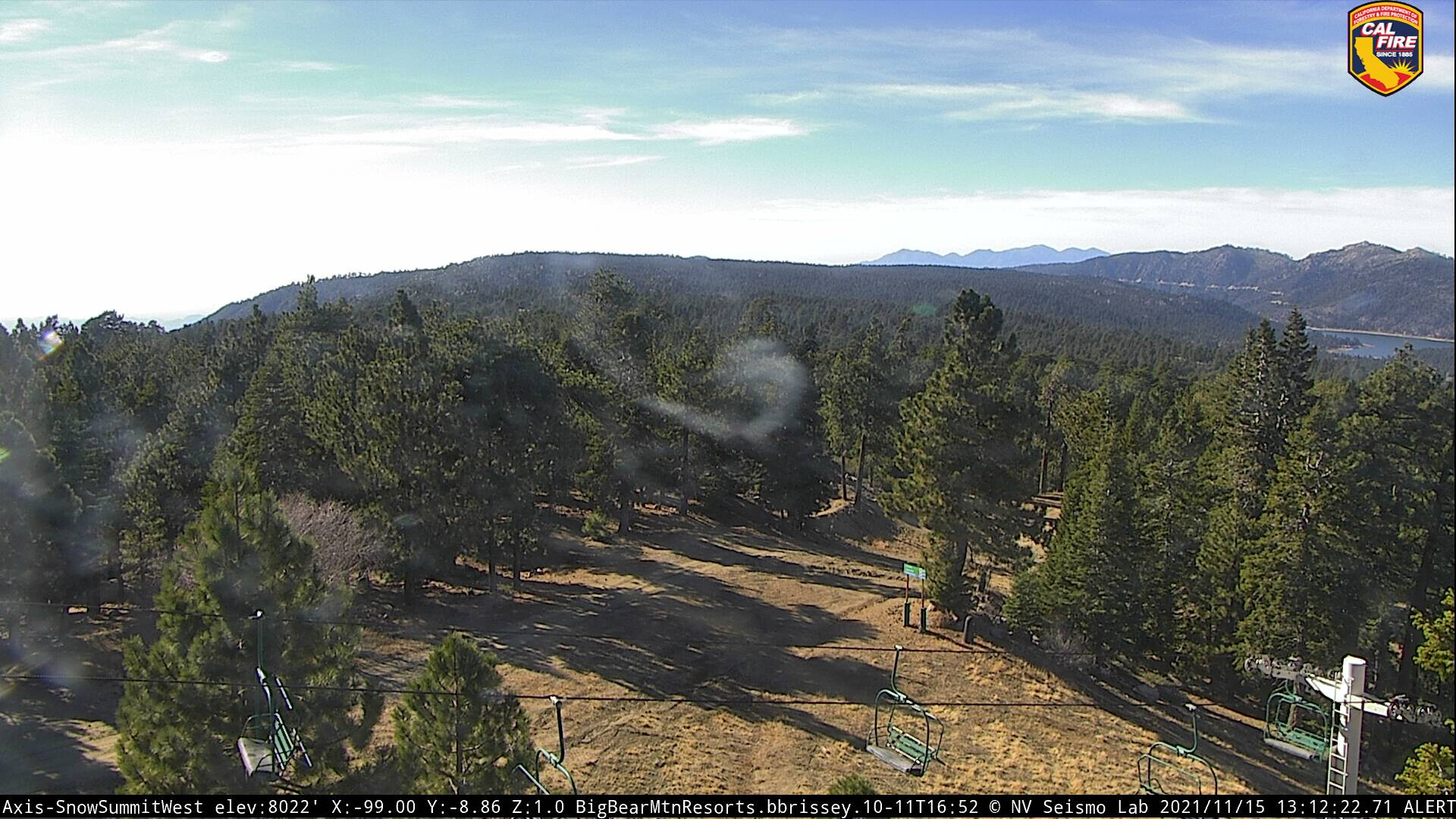
Based on what I am seeing on the Bear North Cam, I believe the fire is moving down into Snow Summit in the timber. Not what I had hoped for.

Edit. here is a before shot, not likely to see the same again:
Worse yet, odd, seems no fire on the south side, it is all in the timber on the Big Bear side, from Keller Peak:

4 Likes
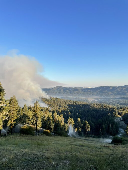
Looks like the sno guns (sprinklers) did their job overnight. Ski areas look okay. Fire moving downslope through timber beteeen Moonridge subdivision and Summit, upslope from Pineknot camground.
2 Likes
Addl victor assigned 126.275
Addl A/G assigned 168.325
2 Likes
@GonzoNick I was aware of the picture not being 'today." It was to be used as a before and after if the sno blowers did not handle the progression.
3 Likes
The fire backing down from Bear Mountain, east side of fire, into Moonridge subdivision. Courtesy of SFamiano, an employee working at Bear Mtn.
8 Likes