Just pulled resources out from Div M near Mtn Home, to this outflow and push into populated areas of Alpha.
Looks like fire blown south of Carter.
2 Likes
Structures are burning off of Ivy Street.
Live video: https://t.co/45HiSaCGKY?amp=1
4 Likes
RRU has sent 10 type 1s in the last couple of hours.
2 Likes
Santa Barbara County fire (SBC) type 3
Strike team Left CZU this morning for this fire.
2 Likes
Evacuation area expanded, west side of Bryant all the way south to Yucaipa Blvd.
2 Likes
Steady down hill push above oak glen camp
1 Like
My guys on the line saying fire moved into Oak Glen over night. Non stop structure defense fight on the Yucaipa Bench. Structures lost. Had to pull resources out of Zulu and then reinsert due to winds. Possibly asking for an additional 15 Type I ST.
3 Likes
Cause determined to be from a pyrotechnic device during a gender reveal party.
2 Likes
Santa Ana wind event predicted tomorrow evening through Wednesday.
2 Likes
10,574 Acres w/ 16% Containment
2 Likes
Ran all the way over to the Apple fire burn. Still open line on Yucaipa Ridge backing down into Forest Falls/Mountain Home.
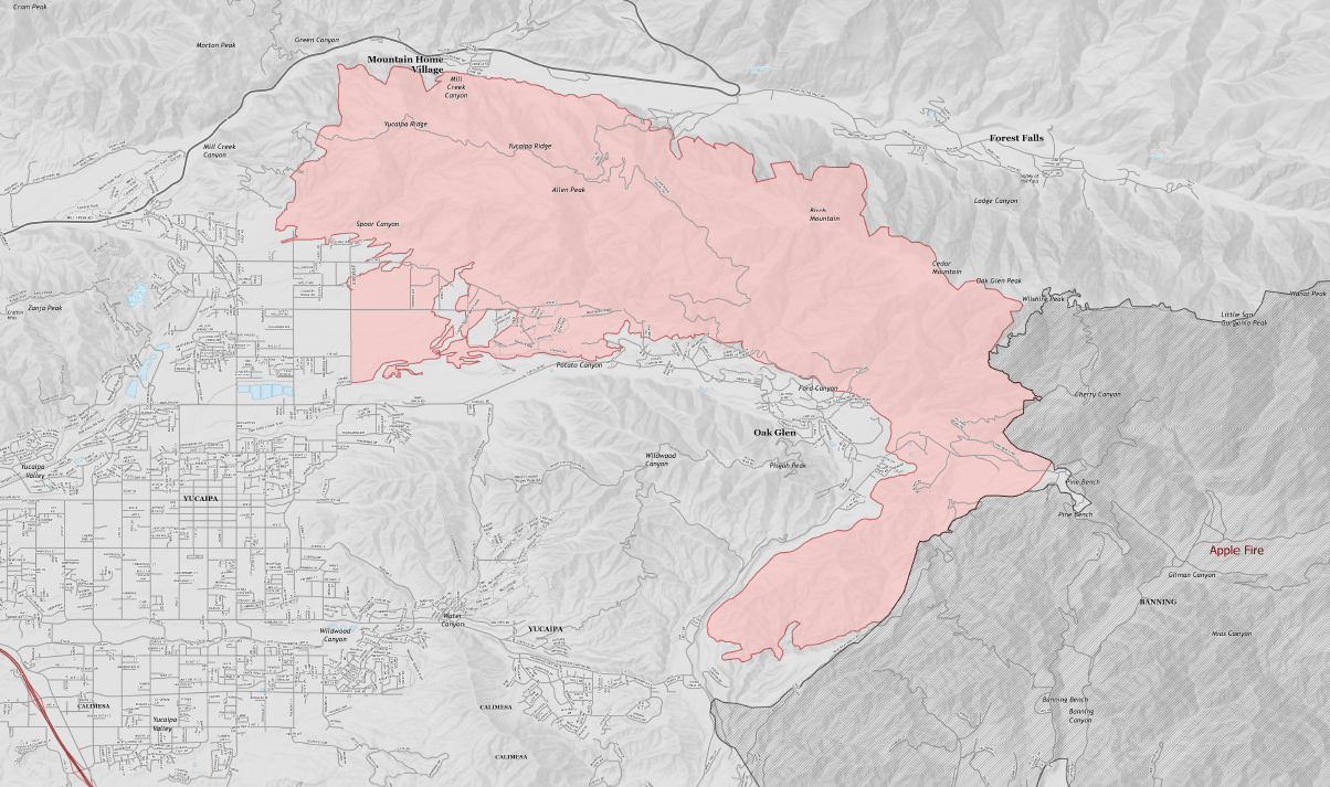
6 Likes
From the camera in San Timoteo canyon looks like thats on the Forest Falls side of Yucaipa ridge. They did a lot of prep work at the bottom, while it’s been creeping down the slope, hopefully this is cleanup in the burn.
2 Likes
Just moved Type I resources from Yucaipa Ridge into Mountain Home as a result. Surface winds across the LA Basin and into SB are westerly. Odd offshore event.
5 Likes
Oh boyyyy, its a whole new ball game now.
Angelus Oaks webcam: http://mtncare.com/web-cams/angelus-oaks-web-cam
1 Like
No lead plane available for the El Dorado. Bobcat is also getting aggressive today, so it will be a wait for fixed wing.
When you say ‘moving out’ which direction is that?
I think this shot gives it a better look:
http://www.alertwildfire.org/inlandempire/index.html?camera=Axis-BearPeakSouth&v=81e004f
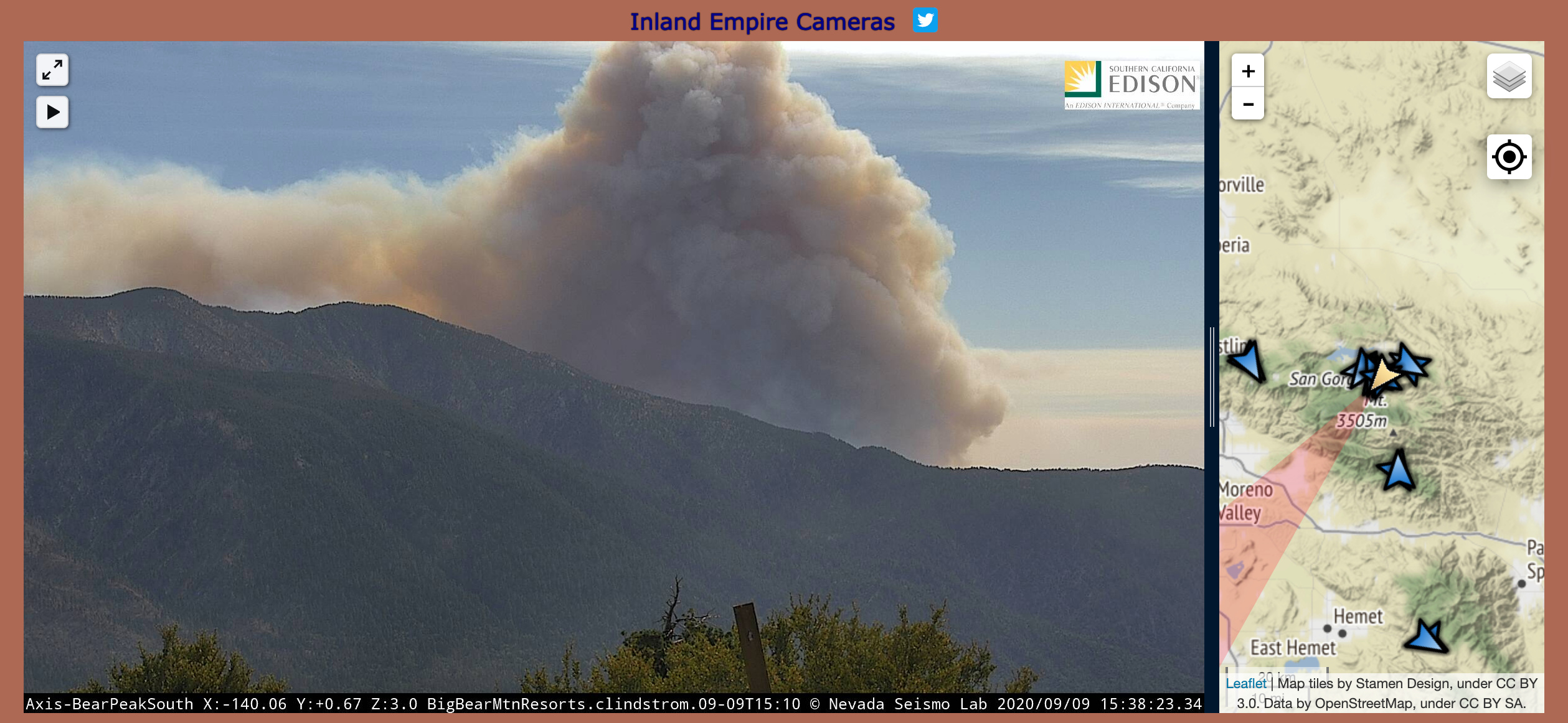
And @GonzoNick I’m assuming North since all the other directions are burned already…
4 Likes