data package for the Dixie is up at maps.takserver.us - no IR again today
Multiple large and small spots on div L and J. Largest spot being 100 acres, dangerous rate of spread per radio traffic.
AA just ordered 4 LATs for Div O & P, citing values at risk: Greenville.
They had spots in a big chip pile there by round valley reservoir yesterday and it looks like it is giving them problems.
Yes, fire is off to the races over Humboldt Road. The spot on the flats is across Humboldt Road just north of the Soldier Meadow Road. The run up the hill is burning up and over Ruffa Ridge, headed toward the NE shoulder of Butt Mtn.
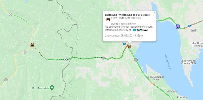
They just closed Hwy. 36 from the junction with 89 down to where it meets 32, about 16 miles or so of road. Not a positive sign for the northern front.
AA reporting multiple spots across the line and becoming established in the Lake Almanor area. Im not sure what Division.
That would be DIV M
So its kicking out on the east side also?!
My bad I thought the div break was at canyon dam.
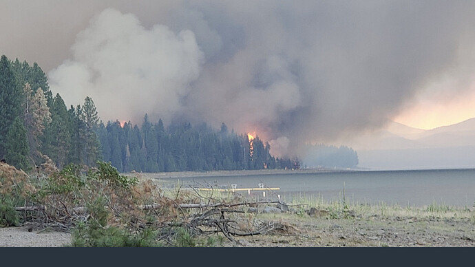
Fire has crossed the line near Round Valley Reservoir and is burning over the ridge toward Greenville. A mandatory evacuation has been issued for Greenville, saying leave immediately. Some of the spots are within 1 mile of Greenville.
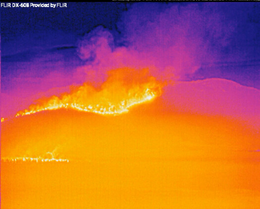
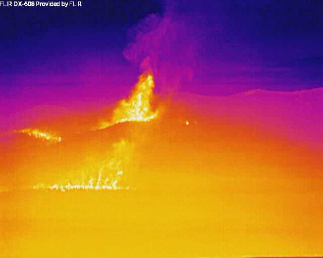
This is the fire front below Butt mountain
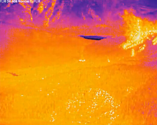
This is the fire front with spotting over the ridge above Greenville
Here are still FLIR images with where the camera is pointed:
Alert on TV. Immediate evacs for areas around Greenville. Sounded like the were saying don’t pack leave situation.
Prayers for All.
I got the Dixie - East Zone CMD, TAC and AIR frequencies added to Lassen County Fire & EMS - Coverage may be limited as receiver is quite a distance from the incident (~25 miles w/ terrain).
northern flare-up: ALERTWildfire
fire moving toward greenville: ALERTWildfire | Shasta Modoc
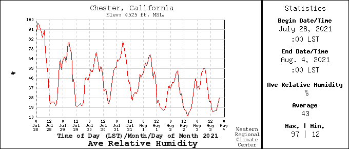
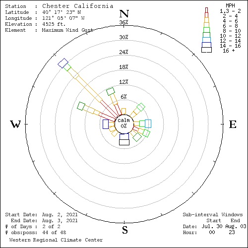
Weather RAWS station in Chester,
click on daily summary, set date in window and submit (detailed break down on the hour):
https://wrcc.dri.edu/cgi-bin/rawMAIN.pl?caCCHS
Had the site build a wind rose scale for winds over the last 44 hours and greatest winds are
out of NW between 12noon and 1700. This picture is for gusts in 2mph increments, peak 16mph NW:
Very poor humidity recovery the last 3 days which has kept the 10 hour fuel stick very dry 5-3%
Just RH picture for last 7 days here:
