Not accurate.
1 Like
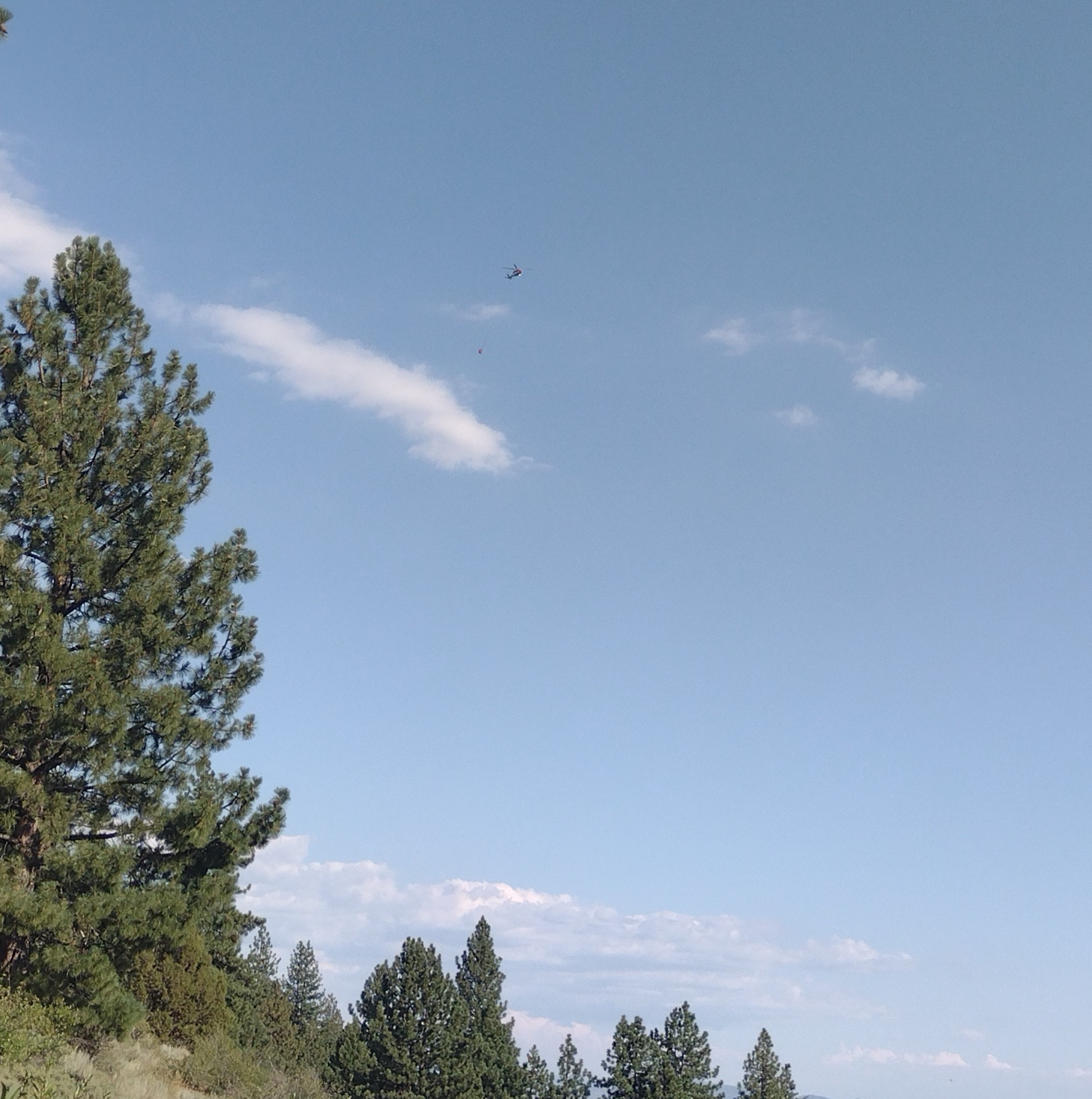
Just spotted this chopper heading back to the fight after a pit stop at Nervino. I feel like saying something out of a WWII news reel like: go get 'em.
Looks like the forecasted return to winds is happening. Winds are picking up. About 15mph now.
5 Likes
Zaca, Station, Day fires seemed to be exactly like your description. Thanks for the insight.
Butte County Federal/State Land Use Coordinating Committee-
West Shore Community Wildfire Protection ProjectAlmanor Ranger District, Lassen National ForestPlumas County, CaliforniaAugust 2019
Interesting read, with maps…
1 Like
Before we make this too complicated, a big part of the explanation is timing.
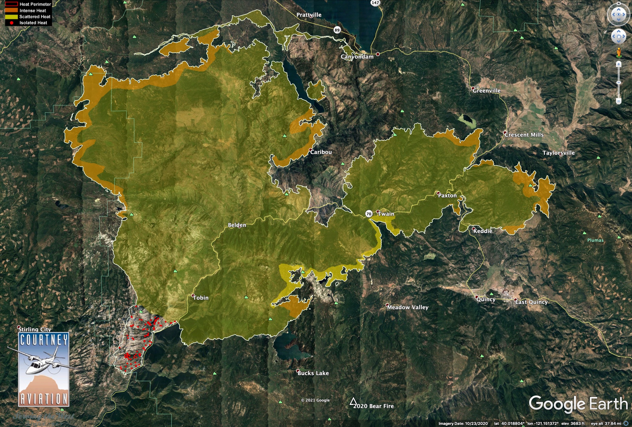
7/22/21 IR Map.
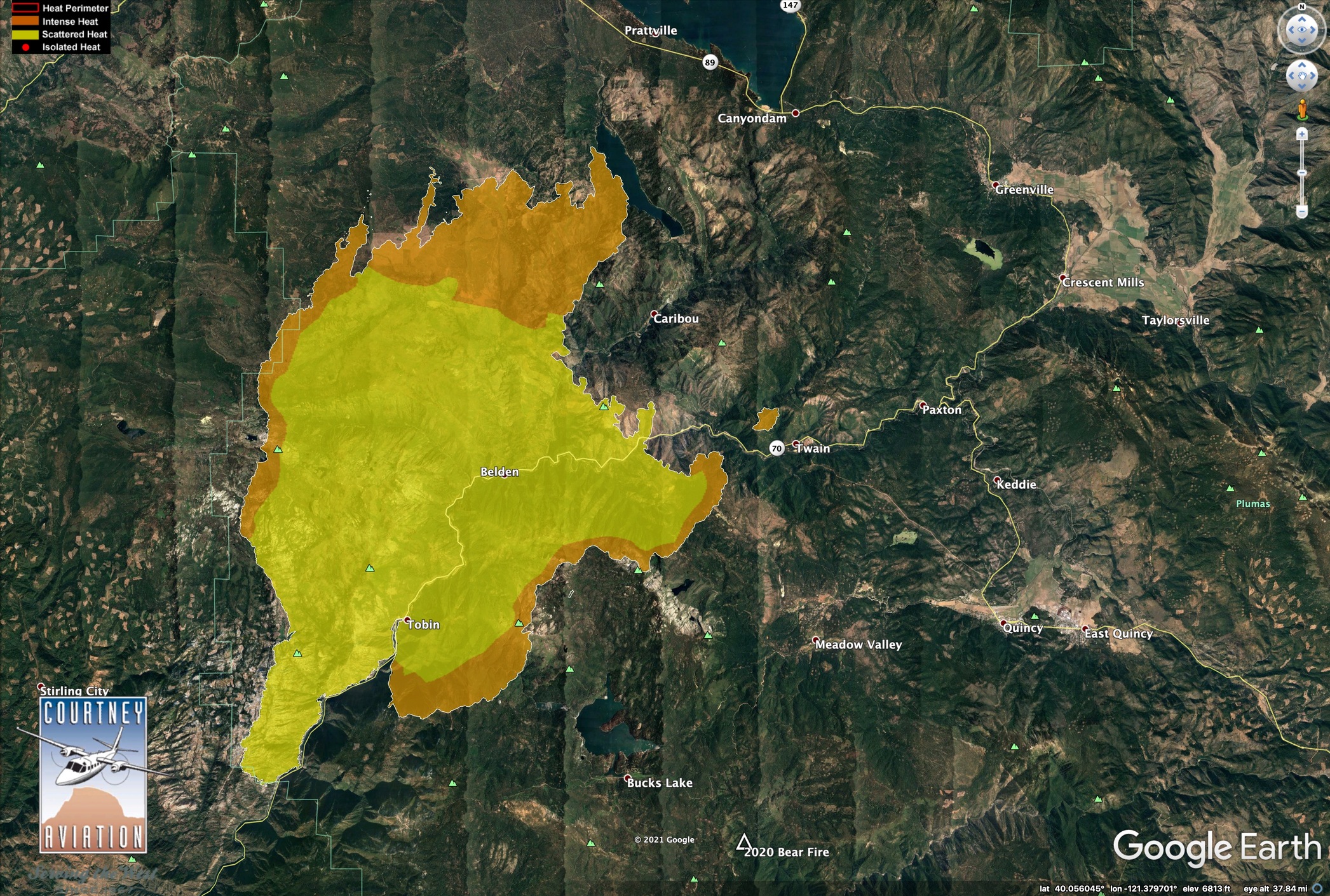
On 7/21, the big new run in Rush Creek and the Fly Fire hadn’t even started, but we were already firing along Highway 89 and building the contingency lines that ended up being the controlled edge of the main (western) part of the fire.
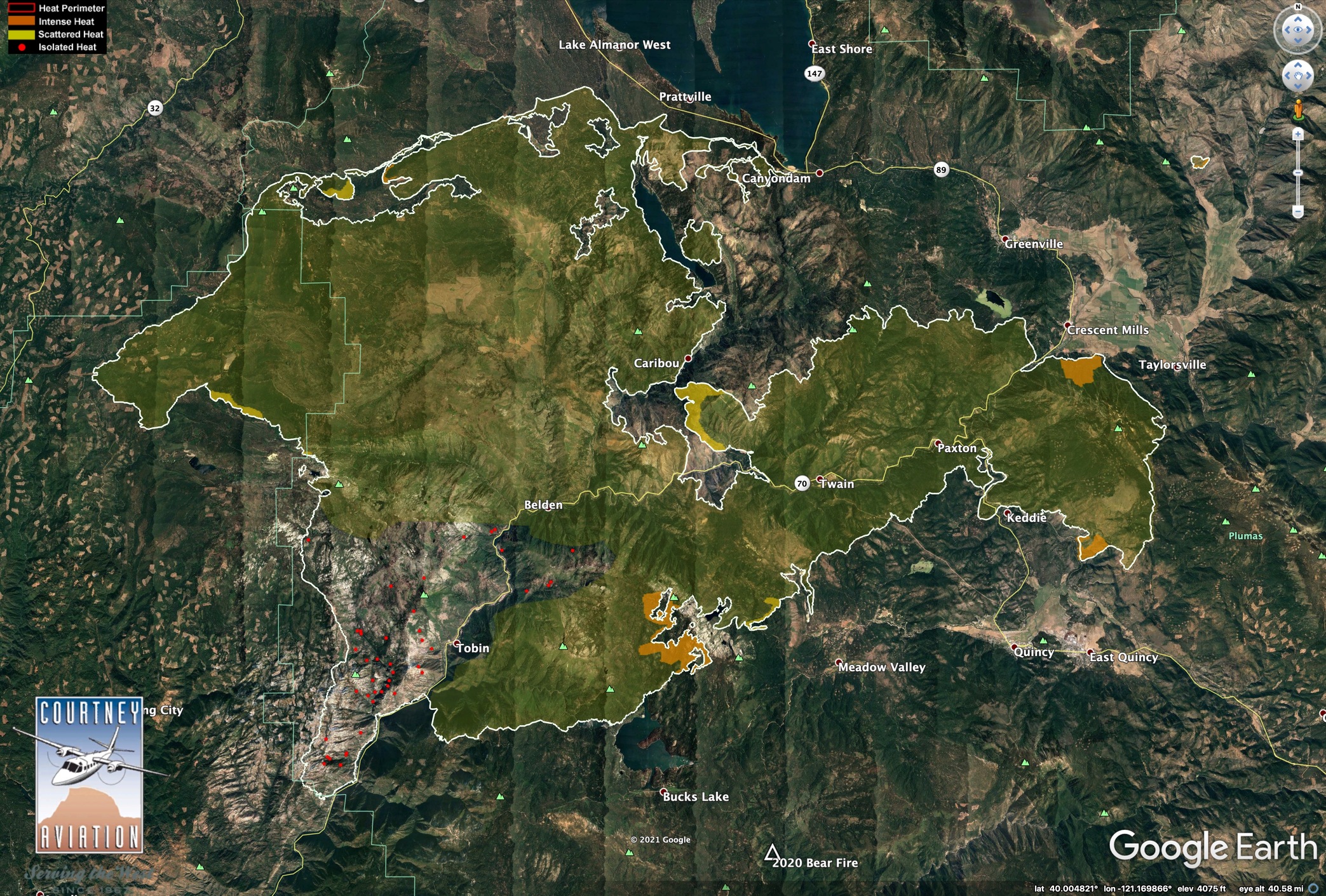
7/23/21 IR Map
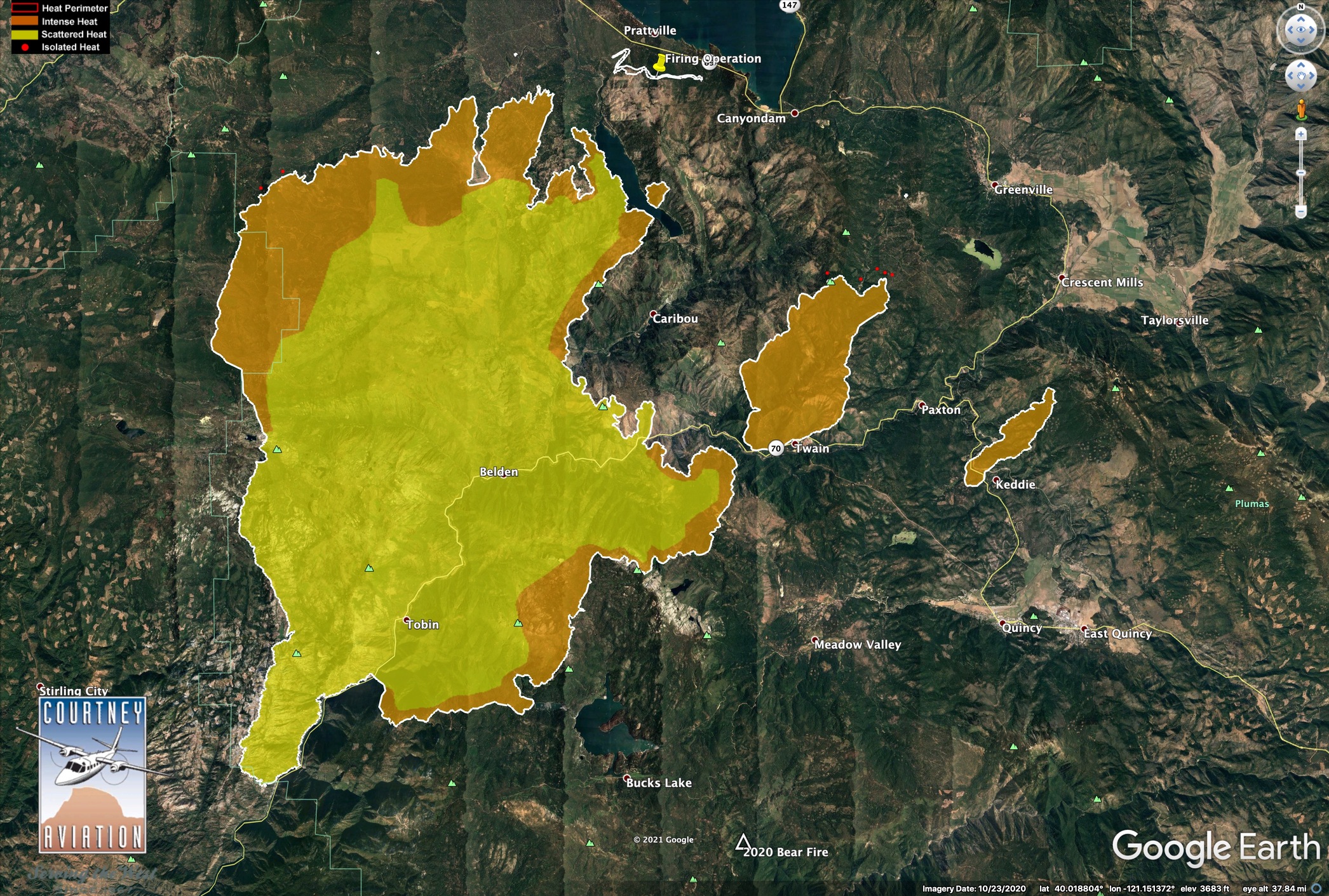
The Fly Fire and Rush Creek Fire took off on 7/22. We didn’t start to go direct on these fires until conditions moderated early last week. So a big part of the east zone really could be considered their own new fires which started days after the west zone was already going.
7/27/21 IR Map
We went indirect on Mt. Hough Road and at the base of Mt. Hough on Arlington Road. The fire took some time to get there, which helps explain these lines not turning black sooner.
7/31/21 IR Map
17 Likes
Not me but this may help.
https://m.box.com/shared_item/https%3A%2F%2Fcalfire.box.com%2Fv%2FCALFIREIMT1/browse/141385851968
1 Like
Due to some people being unable to be professional and mature, this thread will be locked for the night.
25 Likes
The winds are really starting to pick back up again from the SSW in a way they haven’t in more than a week.
6 Likes
They are putting alot of resources in place to catch anything that cross’s the line. There was a bit of concern about from Dennis burns this morning.
5 Likes
Can anyone confirm what Division has the spot fires? L, J, O, or R? Or all four?
2 Likes
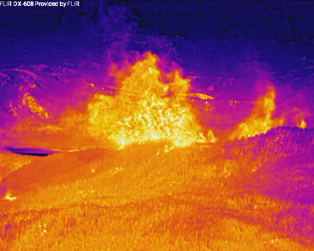
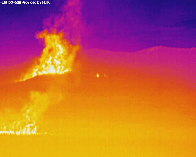
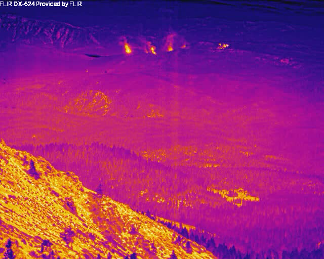
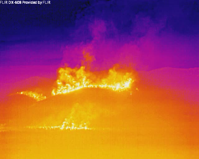
Well across the road in two spots in Div Lima. Don’t know about elsewhere. See Jim Higgins’ FLIR image in Dixie Q&D. This is a really big deal.
1 Like
Are any of the online scanners picking up the fire ?
1 Like
It is a bit messy w/ weather broadcasts & traffic from other areas but air traffic can be heard here: Lassen County Fire & EMS Live Audio Feed
1 Like