Another beautiful plantation up in smoke, somebody worked on that for many years.
2 Likes
Pretty to look at, but ill conceived. Tree farming hasn’t been panning out so well in dry California forests.
13 Likes
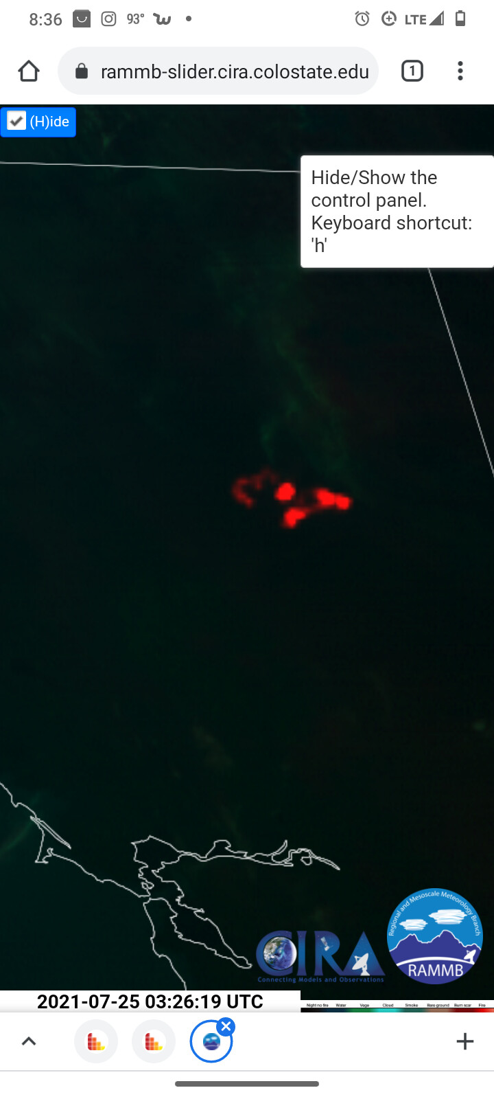
This is in the Dixie thread, but is it Dixie or Fly? “Image Courtesy of PG&E!”
Pretty sure it is Fly. Don’t think the two fires have merged.
Does your app track National Guard helicopters? I thought I’ve seen several NG helicopters working the fires via YouTube, though, at this point I can’t remember which fire, or even what state.
2 Likes
I have seen Guard copters working fires in previous years and they didn’t show on Flightradar24. Maybe they didn’t have ADS-B transponders installed yet or, If they had them, maybe they didn’t bother or remember to turn them on? Since then I have read that the FAA and defense agencies have had discussions about being able to turn it off when flying certain types of missions while still complying with the new requirement to have ADS-B installed. Firefighting wouldn’t fall under that, and I think… wait, instead of guessing, Mr Google to the rescue… yep Jan 1 2020 was the deadline to have it for commercial aircraft but the pentagon says it will be years before most military aircraft have it, source here: https://www.defensedaily.com/military-2936-aircraft-ads-b-jan-1-air-force-says/air-force/
1 Like
I have seen military helicopters on flightradar24 working the Dixie, but sporadically.
2 Likes
Military stuff used to never show up, but most of it has been showing up since the past year or so.
1 Like
I’ve been out of the loop for a bit. Last season being 2004. But late 90’s- 2000s there was always a lot of National Guard support. Was always extra cautious calling in drops from them and staying well out of the way compared to the state and federal aircraft.
1 Like
I meant that the military stuff shows up on Flight Radar 24 now, and it did not used to appear. Refueling tankers, T-38s, and Chinooks are now all over the place on the display and they never used to be.
2 Likes
Oh gotcha. My bad. Noticed the National Guard a lot but see a lot of kc10’s flying into Reno not showing up lately.
A lot of times the kc10s turn their ADS-B transponders off when coming in for landing for some reason and back on at 6000 after take off.
3 Likes
That makes total sense. I’ve seen a pair flying high on the app before, but when I see them approaching RNO, they are nowhere on Flightradar24
And now back to our regular scheduled program
16 Likes
Im sorry I can’t help but notice that section looks like a butt.

11 Likes
As of tonight the Dixie Fire is 181,289 acres, 20 percent contained and now has 5,022 personnel assigned.
“Threats and risks associated with this fire are very real,” said Commander Minton, adding later that “Taylorsville, Crescent Mills, and Greenville are our main concerns tomorrow. … If you occupy one of the mandatory evacuation areas, please leave.”
In addition to the threat to Taylorsville, firefighters dealt with a surge at the Greenville Wye and were forced to evacuate to safer areas. “The bulk of the activity today was at the Greenville Wye,” said John Goss, the operations section chief responsible for the East Zone of the fire.
Goss said that the area from the penstocks up to Bucks Lake is stable, and that from Bucks to Silver lake dozer line is going in. A mobile retardant base has been established at Bucks Lake. Plumas National Forest Supervisor Chris Carlton said that earlier in the day the forest had authorized bulldozer use in the Bucks Lake Wilderness. “We are going to do what we have to do to protect our communities, “ he said.
Operations Section Chief Mike Wink presented the update on the West Zone which runs up the west side of the Highway 70 corridor to Caribou and on to Lake Almanor. Wink said that the two zones are collaborating on the Highway 70 corridor.Wink said that the south edge, the bottom of the fire, continues to hold as it has for the past several days.
Toward the Philbrook area on the left flank, there was a slopover yesterday, but firefighters were able to contain it and it held today.
In the Butte Meadows/Jonesville areas the fire was active again today; yesterday it spread to the west, but was within containment lines. That activity put the area into evacuation yesterday. Efforts today were to reinforce the containment line.
Wink said that Teams 1 and 2 were collaborating on the Highway 89 corridor. Even though there are two teams responsible for different zones, they remain under one unified command , collaborating and share resources as one.
9 Likes
Thanks Chief Wink.
2 Likes